Integration von Reach RS4 mit Mergin Maps für iOS
Dieses Tutorial enthält eine Schritt-für-Schritt-Anleitung zur Integration Ihres Reach RS4 mit Mergin Maps für iOS.
Übersicht
Mergin Maps ist eine mobile App für iOS, mit der Sie vor Ort Geodaten erfassen, aktualisieren und teilen können. Dabei erfolgt eine Synchronisierung zwischen den Feldprojekten und QGIS, was die Zusammenarbeit im Team erleichtert.
Um Ihren Reach RS4 / RS4 Pro mit Mergin Maps zu verbinden, benötigen Sie Folgendes:
- Reach RS4/RS4 Pro
- Ein Gerät mit iOS
- Die Mergin-Maps-App, die auf Ihrem iOS-Gerät installiert ist
- Mergin Maps Konto
Sie können Reach RS4 / RS4 Pro auf zwei Arten mit Mergin Maps verbinden:
- Mit der TCP-Methode: Reach sendet NMEA-Daten über WLAN direkt an Mergin Maps. Bei dieser Methode muss der NMEA-Ausgang in Emlid Flow eingerichtet werden, dafür können Sie jedoch den Status der RTK-Lösung und die Genauigkeit, die direkt von Reach gemeldet werden, in Mergin Maps einsehen.
- Verwendung der internen GPS-Methode: Reach verbindet sich über Bluetooth Classic mit Ihrem iOS-Gerät, und Mergin Maps erhält seine Position über die iOS-Standortdienste. Bei dieser Methode ist keine Konfiguration eines NMEA-Datenstroms erforderlich, allerdings müssen Sie vor der Datenerfassung mithilfe von Emlid Flow den Status und die Genauigkeit der RTK-Lösung überprüfen.
Wählen Sie die Verbindungsmethode entsprechend der Art, wie Sie Reach verbinden und die RTK-Lösung überwachen möchten.
Arbeitsablauf
Um Ihr Reach RS4 / RS4 Pro mit Mergin Maps zu verbinden, befolgen Sie bitte die folgenden Schritte.
Emlid Flow vorkonfigurieren
Greifen Sie mit Emlid Flow auf Reach zu
Stellen Sie in Emlid Flow eine Verbindung zu Reach her, und zwar mit der Methode, die zu Ihrer Mergin-Maps-Konfiguration passt:
- Wenn Sie Ihr Reach-Gerät über Bluetooth (internes GPS) mit Mergin Maps verbinden, können Sie in Emlid Flow entweder über BLE oder über WLAN auf Reach zugreifen. BLE ist die empfohlene Option, insbesondere beim Empfang von Ntrip-Korrekturdaten über Ihr Mobilgerät.
- Wenn Sie Ihr Reach-Gerät über WLAN (TCP) mit Mergin Maps verbinden möchten, stellen Sie über WLAN eine Verbindung zu Reach her. Stellen Sie sicher, dass Ihr iOS-Gerät und Reach mit demselben WLAN verbunden sind.
Befolgen Sie die nachstehenden Anweisungen für die von Ihnen gewählte Verbindungsart:
- Bluetooth-Verbindung
- Hotspot-Verbindung
-
Aktivieren Sie Bluetooth auf Ihrem Smartphone oder Tablet.
-
Öffnen Sie Emlid Flow. Wenn Sie dazu aufgefordert werden, tippen Sie auf Configure access (Zugriff konfigurieren) und erlauben Sie Standortberechtigungen. Dies ist für die volle Funktionalität des Empfängers erforderlich.
Nachdem Sie die Berechtigungen erteilt haben, wird Ihr Empfänger in der Liste angezeigt. Die App verbindet sich dann automatisch mit ihm.
-
Gehen Sie auf Ihrem Gerät zu WLAN-Einstellungen (Wi-Fi settings).
-
Stellen Sie eine Verbindung zum Reach-Hotspot her. Sie erscheint als reach:XX:XX.
-
Geben Sie das Netzwerkpasswort ein. Das Standardpasswort lautet emlidreach. Falls Sie es zuvor geändert haben, geben Sie stattdessen Ihr individuelles Passwort ein.
hinweisUm das Standard-WLAN-Passwort emlidreach wiederherzustellen, müssen Sie den Empfänger neu flashen. Bitte beachten Sie, dass durch das erneute Flashen alle auf dem Empfänger gespeicherten Protokolle gelöscht und alle Einstellungen auf ihre Standardwerte zurückgesetzt werden.
-
Öffnen Sie Emlid Flow und stellen Sie eine Verbindung zu Ihrem Reach her.
Konfigurieren Sie Korrekturen in Emlid Flow
Lesen Sie die folgenden Anleitungen, um den Empfang von Korrekturen auf Ihrem Reach RS4 / RS4 Pro Rover zu konfigurieren:
- So richten Sie RTK über Emlid Corrections ein
- RTK über den Ntrip-Dienst einrichten
- Arbeiten mit einer Drittanbieter-Basis über UHF-Funkgerät
- RTK über das LoRa-Funkgerät einrichten
Aktivieren Sie Neigungskompensation
Reach RS4 / RS4 Pro unterstützt die IMU-basierte Neigungskompensation, so dass Sie Punkte auch dann erfassen und abstecken können, wenn der Vermessungsstab geneigt ist. Die Software berechnet den Neigungswinkel und die Entfernung, um die Position der Stapspitze auf dem Boden zu bestimmen. Um die Neigungskompensation zu aktivieren, folgen Sie der Anleitung Aktivierung der Neigungskompensation.
Konfigurieren Sie die Kommunikation zwischen Mergin Maps und Reach RS4 / RS4 Pro
Konfigurieren Sie die Kommunikation zwischen Mergin Maps und Reach RS4 / RS4 Pro mithilfe der von Ihnen gewählten Integrationsmethode.
Verwendung des internen GPS
Unter iOS können Sie Reach RS4 über die Option „Internes GPS“ als Standortquelle für Mergin Maps verwenden. Für diese Konfiguration ist keine zusätzliche Konfiguration des TCP- oder NMEA-Datenstroms erforderlich. Mergin Maps erhält Positionsdaten über die iOS-Standortdienste und nicht direkt von Reach.
Bei Verwendung der internen GPS-Methode werden die Positionsdaten von Reach über die iOS-Standortdienste weitergeleitet, bevor sie Mergin Maps erreichen. iOS kann die angezeigte Genauigkeit verändern, und Mergin Maps zeigt den Status der RTK-Lösung nicht an. Daher entspricht die in Mergin Maps angezeigte Genauigkeit möglicherweise nicht der Genauigkeit der RTK-Lösung. Verwenden Sie Emlid Flow, um den Lösungsstatus und die Genauigkeit des Empfängers zu überprüfen.
Um die Kommunikation zwischen Mergin Maps und Ihrem Empfänger über das integrierte GPS einzurichten, führen Sie die folgenden Schritte aus:
Bluetooth-Verbindung einrichten
Aktivieren Sie die Bluetooth-Erkennbarkeit, damit Ihr Gerät von anderen Geräten gefunden werden kann. Führen Sie dazu die folgenden Schritte aus:
-
Gehen Sie in Emlid Flow zu Settings (Einstellungen) und tippen Sie auf Bluetooth.
-
Tippen Sie auf Discoverability (Auffindbarkeit) und aktivieren Sie die Option Discoverability (Auffindbarkeit). Tippen Sie auf Save (Speichern), um die Änderungen zu übernehmen.
RS4 / RS4 Po und iOS-Gerät koppeln
Um den Reach RS4 / RS4 Pro mit Mergin Maps zu verwenden, müssen Sie zunächst den Empfänger mit Ihrem iOS-Gerät koppeln:
-
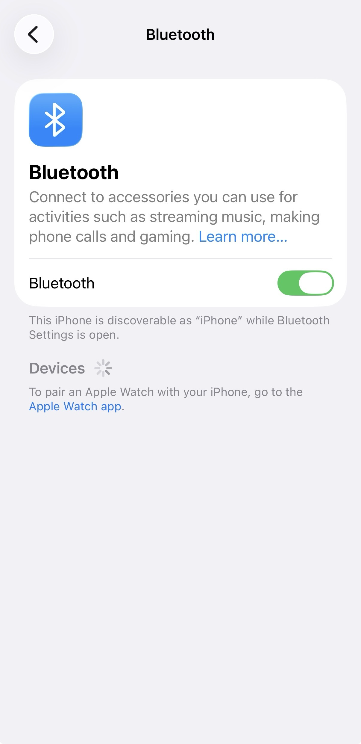
Navigieren Sie zum Konfigurationsbildschirm Bluetooth auf Ihrem iOS-Gerät und aktivieren Sie Bluetooth.
-
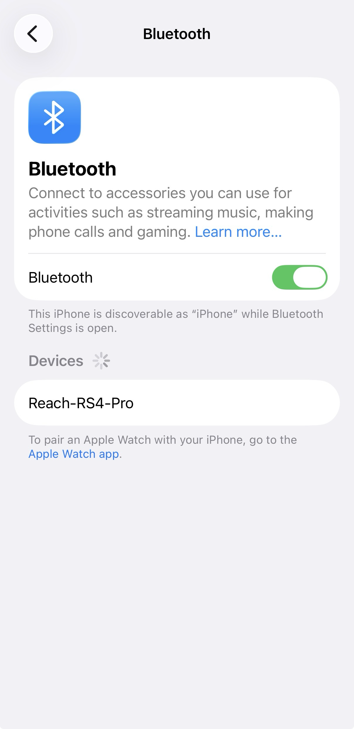
Warten Sie, bis Ihr Reach RS4 / RS4 Pro als verfügbares Gerät angezeigt wird.
hinweisHalten Sie den Reach nicht weiter als ein paar Meter von Ihrem Gerät entfernt.
-
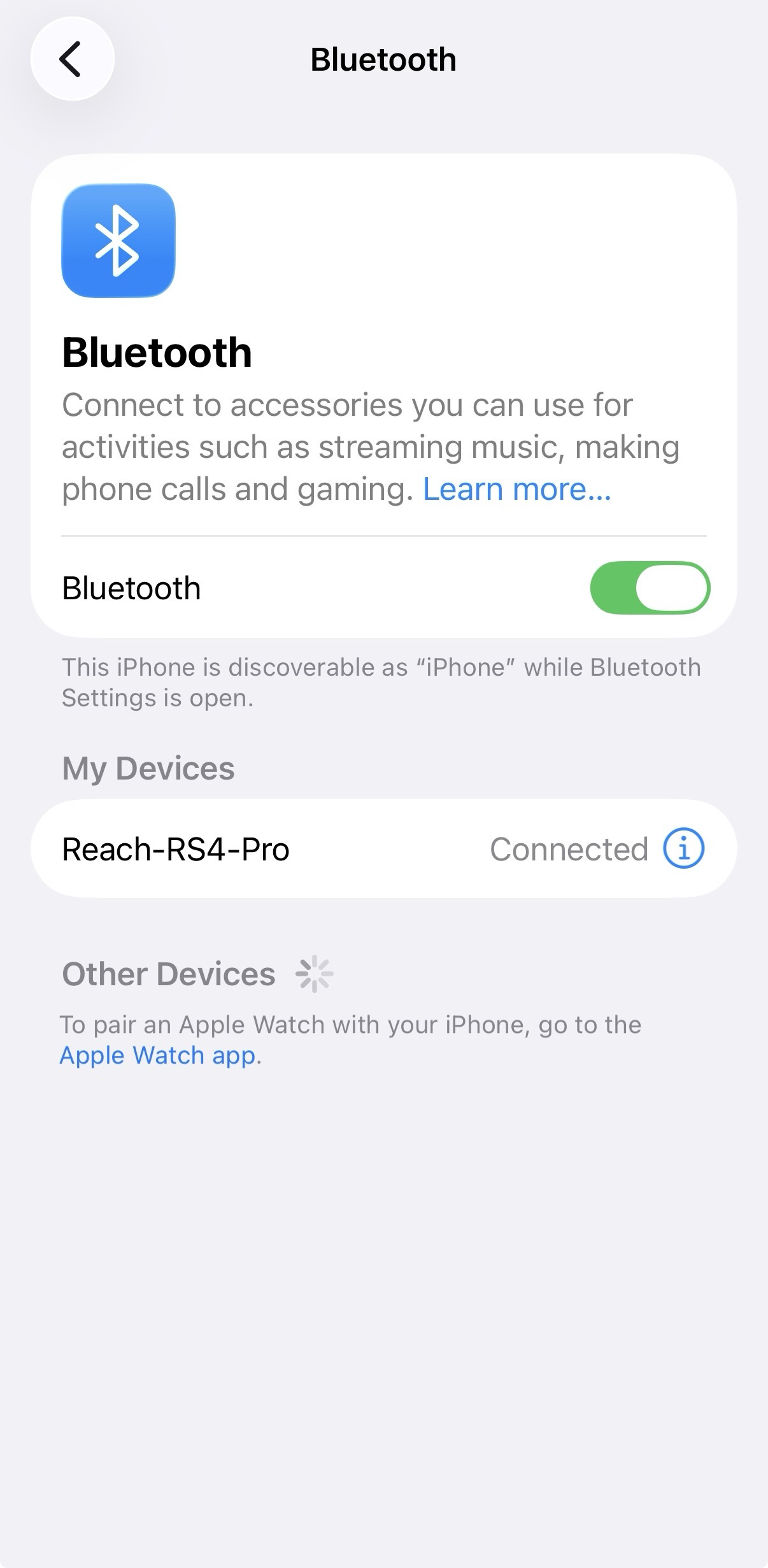
Tippen Sie auf den Namen Ihres Reach in der Liste der verfügbaren Geräte auf dem iOS-Gerät. Sie sollten den Hinweis „Verbunden“ sehen.
hinweisFalls für Ihr Gerät ein PIN-Code erforderlich ist, können Sie dies in Emlid Flow im Tab Bluetooth überprüfen.
Konfigurieren Sie die Kommunikation zwischen Mergin Maps und Reach RS4 / RS4 Pro
-
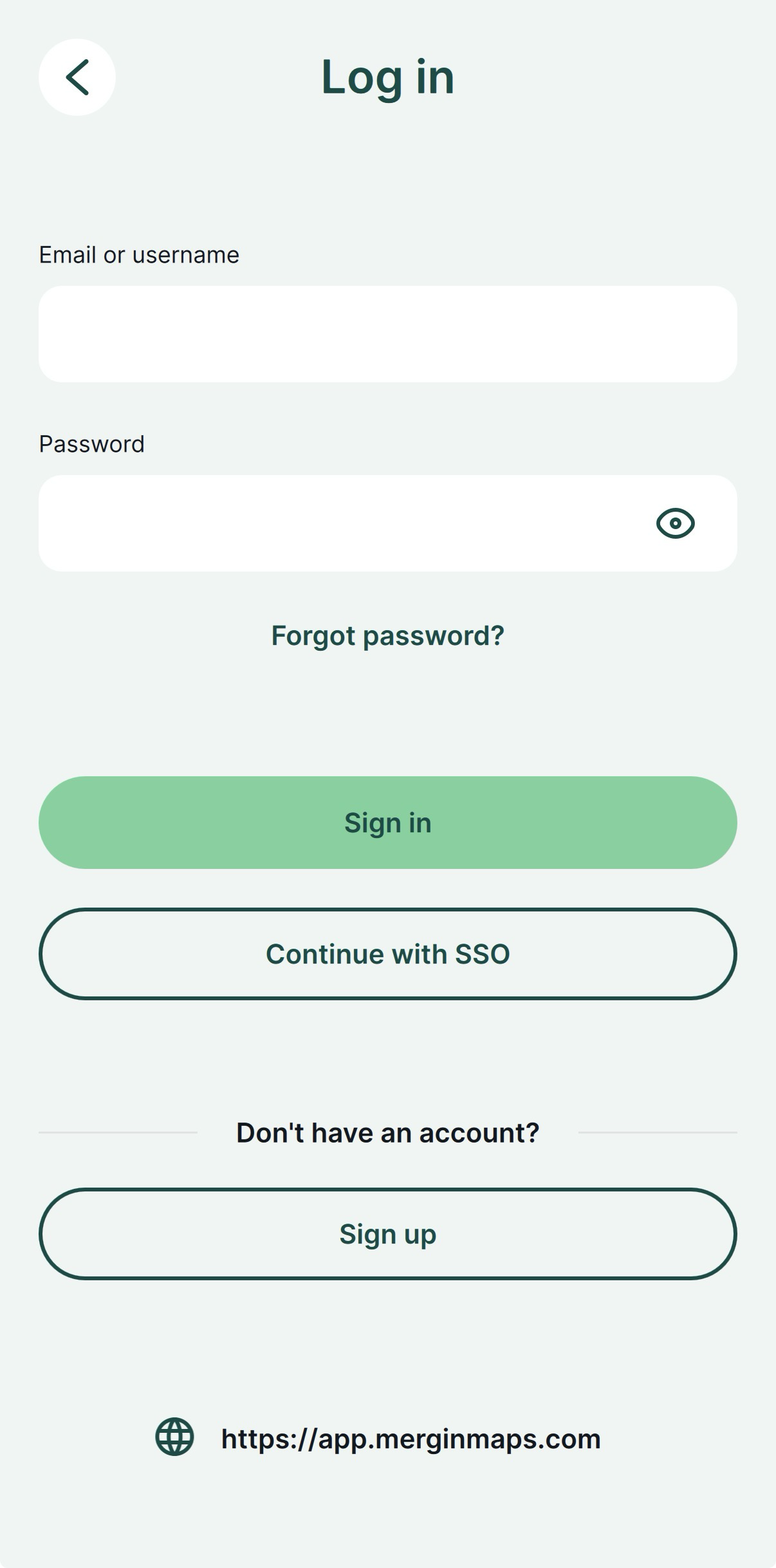
Öffnen Sie die Mergin Maps-App und erstellen Sie ein Konto, wenn Sie noch kein Konto haben, um auf die App zuzugreifen.
-
Öffnen oder erstellen Sie ein neues Projekt.
-
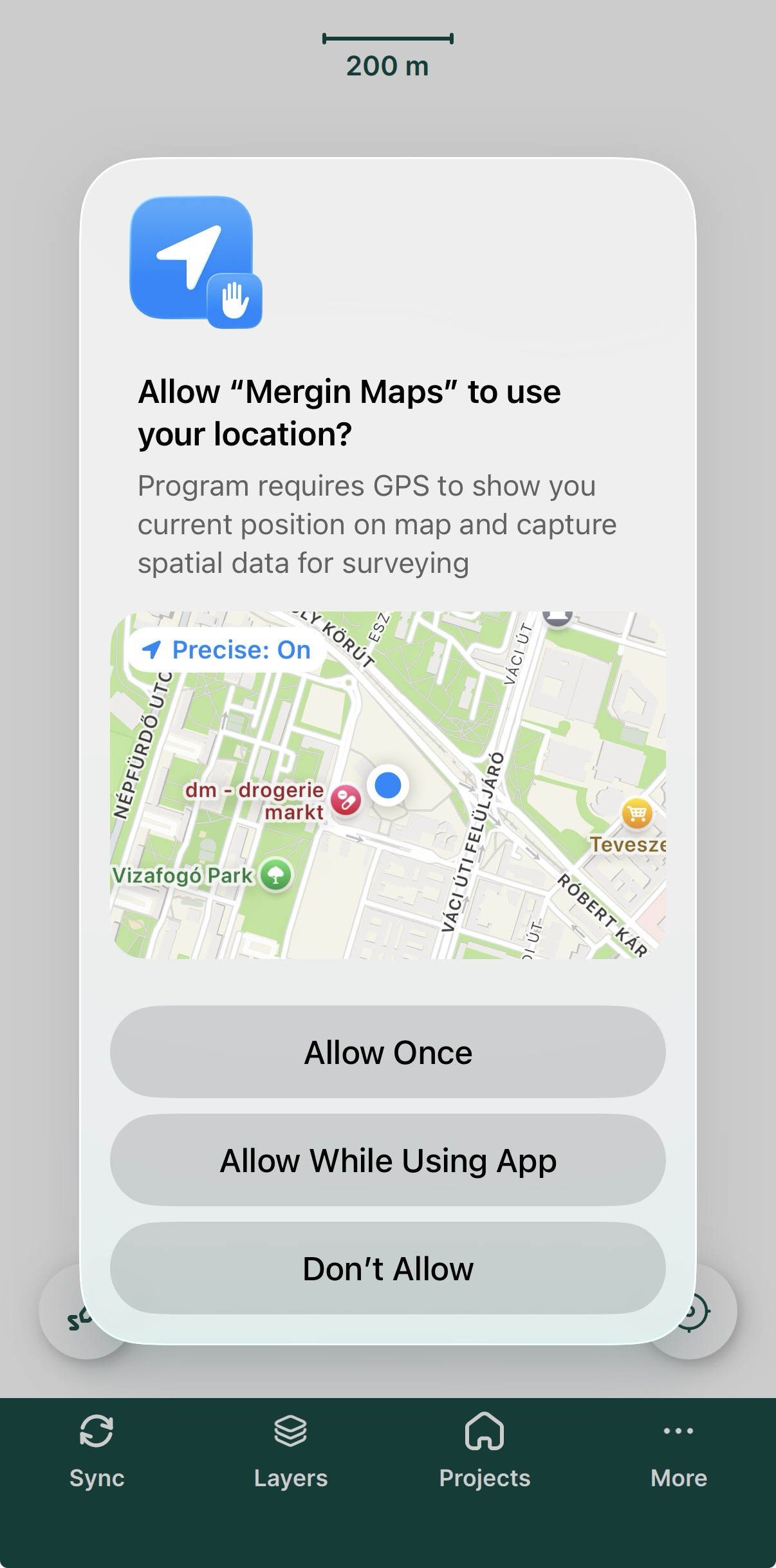
Wenn Sie dazu aufgefordert werden, erlauben Sie die Erfassung des genauen Standorts.
-
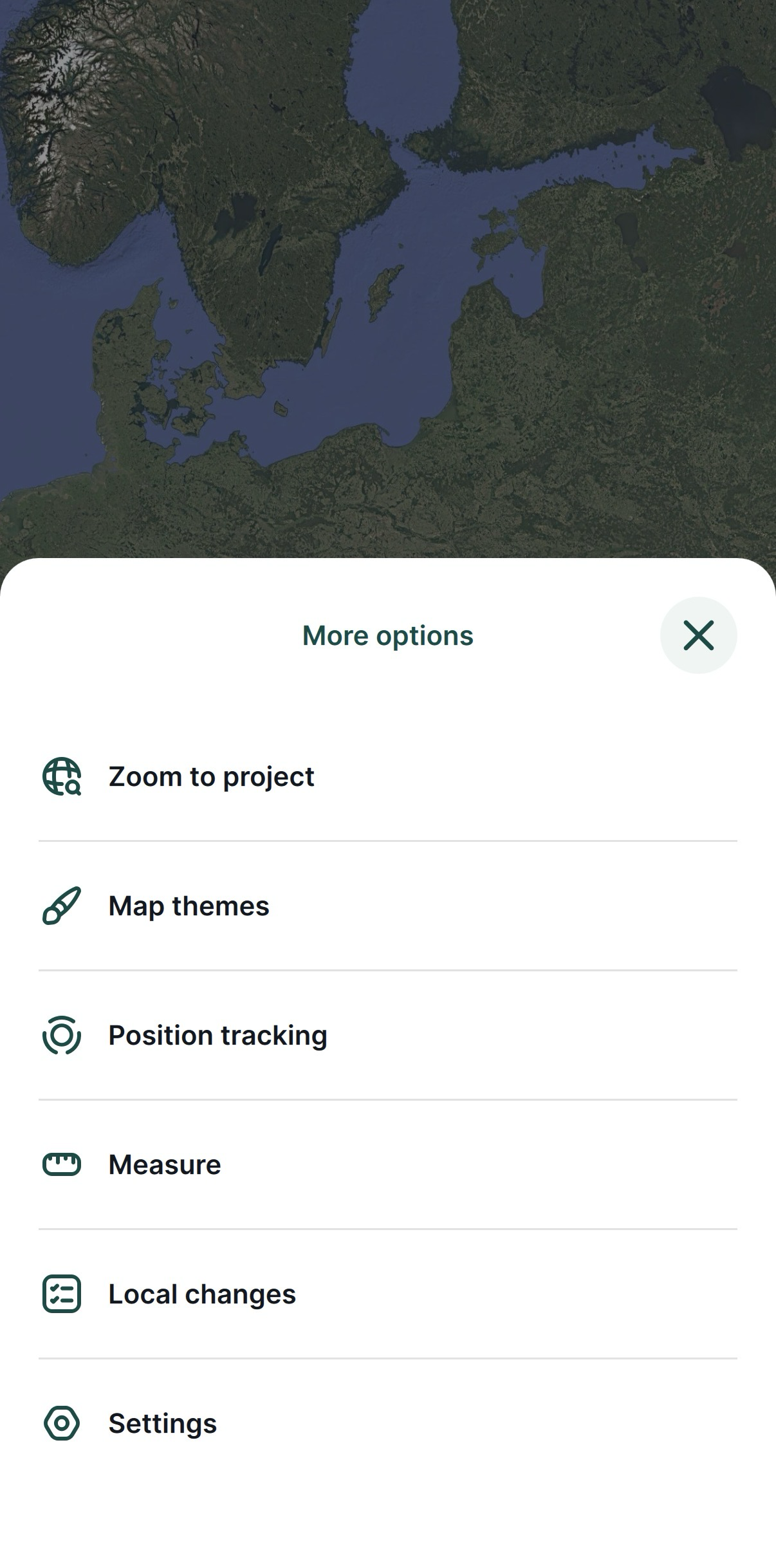
Tippen Sie auf dem geöffneten Bildschirm in der unteren rechten Ecke auf More (Mehr) und Settings (Einstellungen).
-
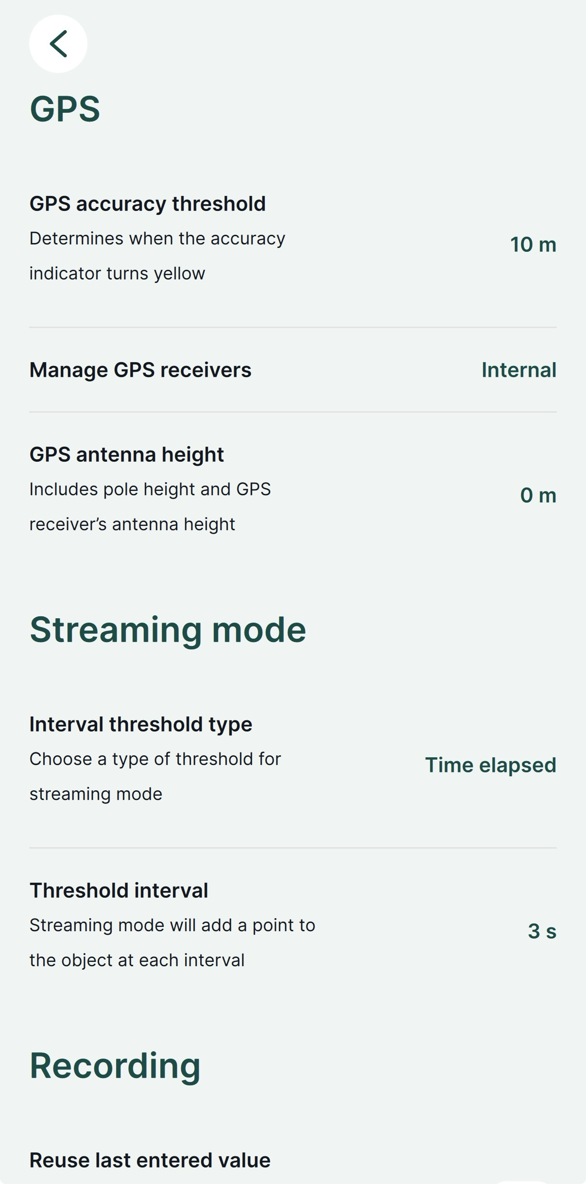
Tippen Sie unter Settings (Einstellungen) auf Select GPS receiver (GPS-Empfänger auswählen).
-
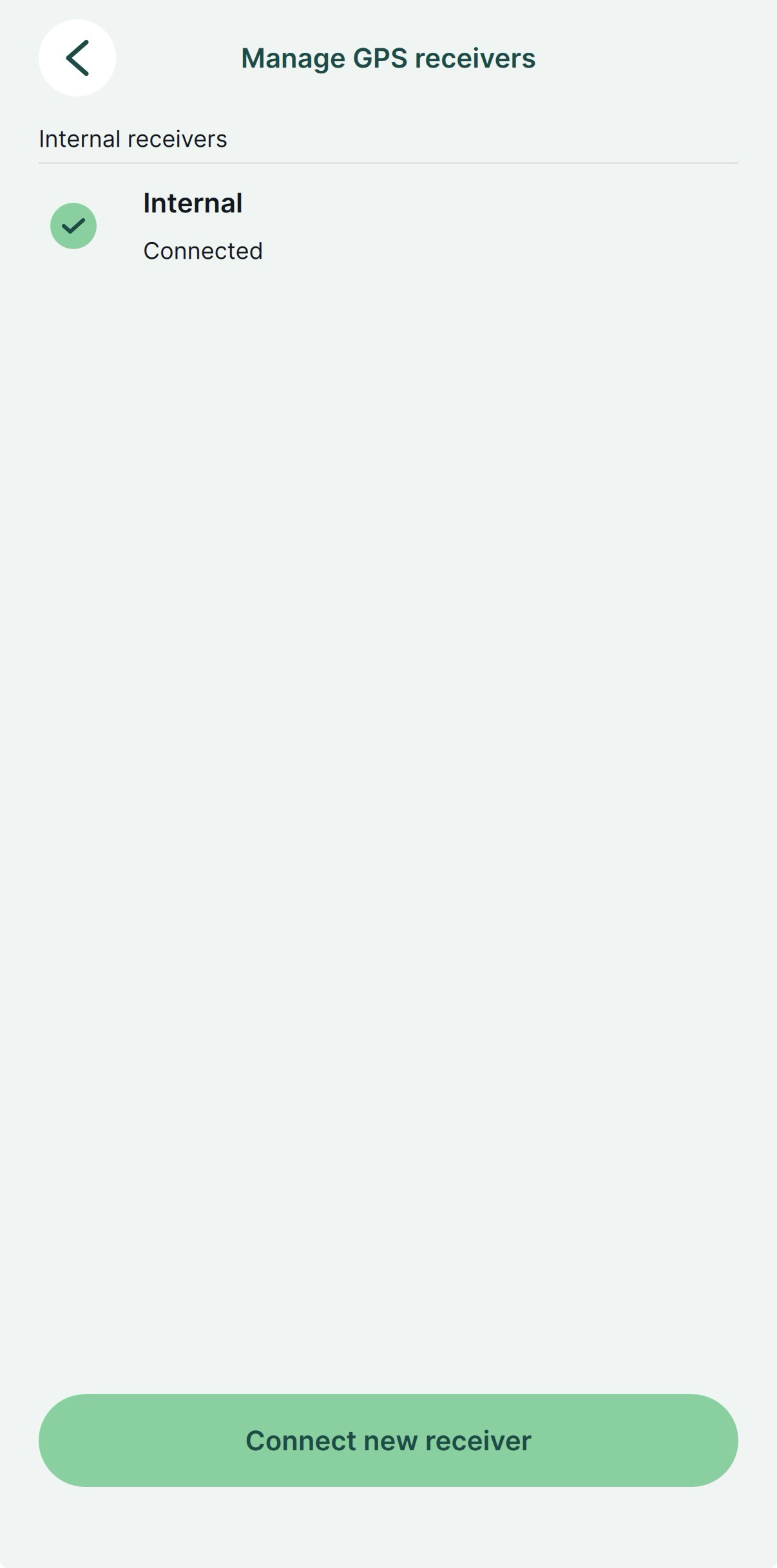
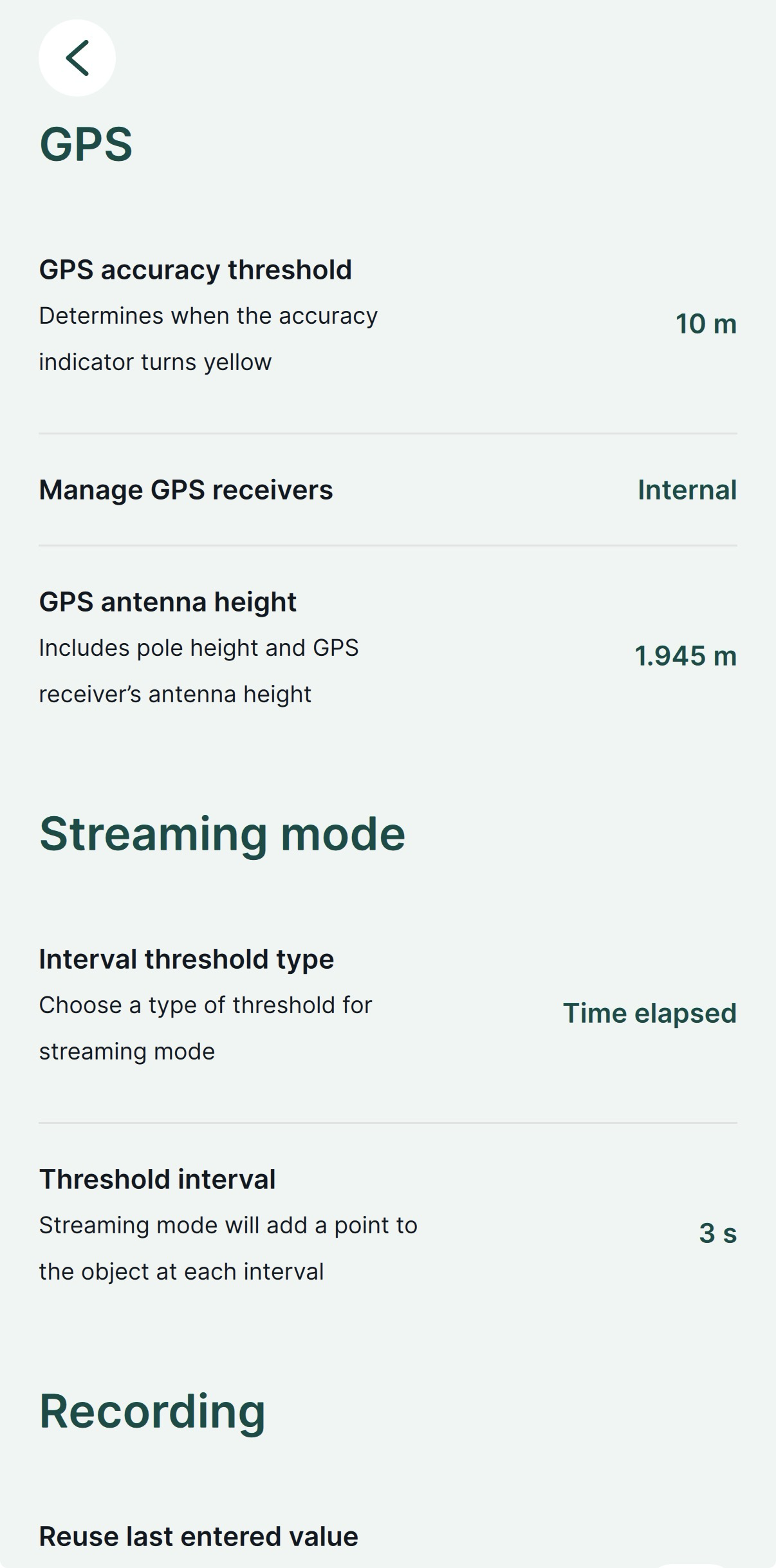
Wählen Sie Internal (Intern).
-
Gehen Sie zurück zu Settings (Einstellungen) und stellen Sie die Antennenhöhe ein. Bei Reach RS4 / RS4 Pro ist die Antennenhöhe der Abstand von der Markierung am Boden zum Mittelpunkt am Boden des Reach, dem Antennenreferenzpunkt (ARP), plus die Höhe des Empfängers zum Antennenphasenzentrum (APC), dem Antennenhöhenversatz. Der Versatz der Antennenhöhe beträgt 95 mm.
-
Wechseln Sie zum Tab GPS und überprüfen Sie den RTK-Status sowie die Genauigkeit auf der Karte. Um die detaillierten GPS-Daten einzusehen, rufen Sie Emlid Flow auf.
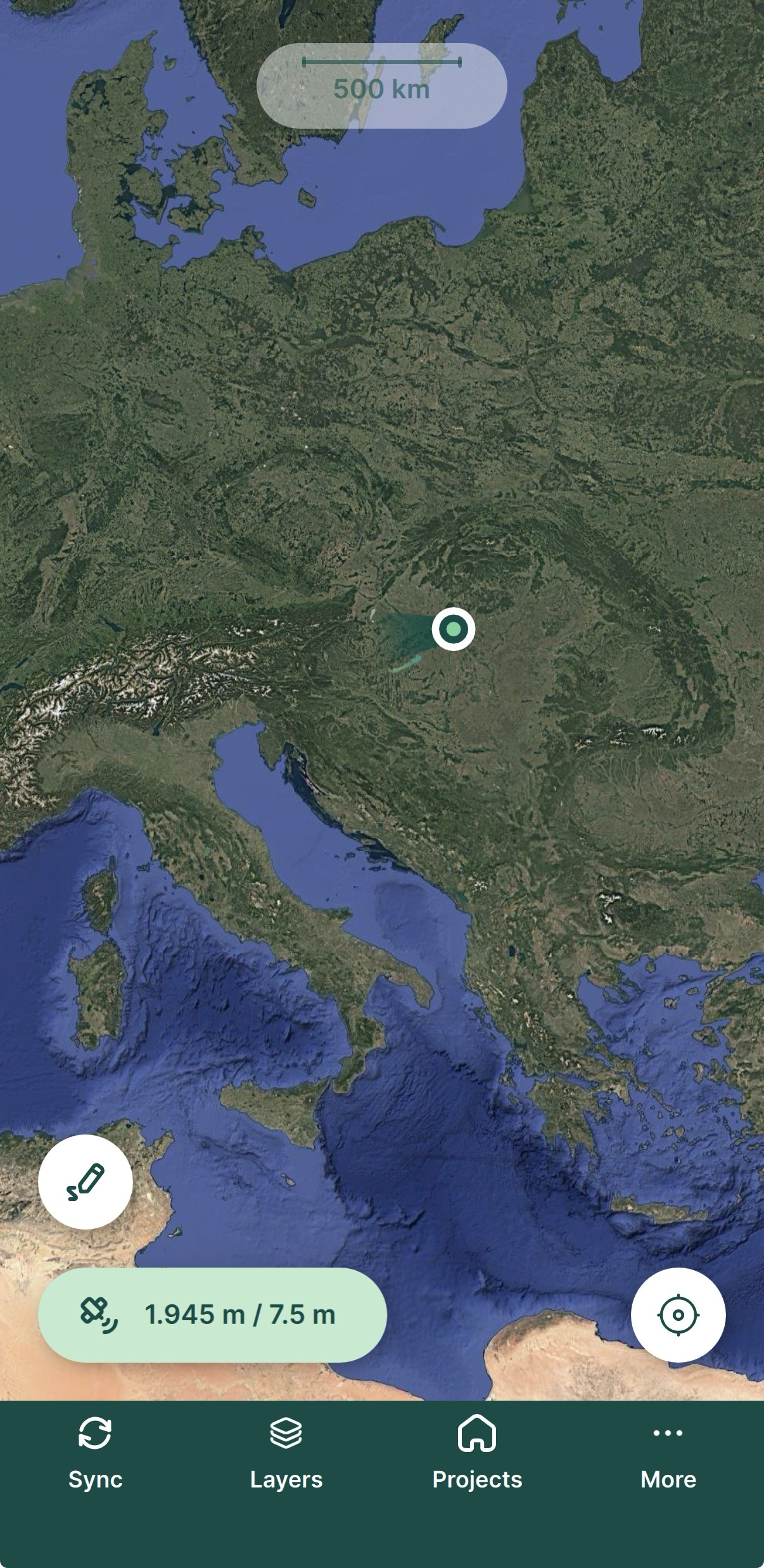
Jetzt können Sie mit der Datenerfassung beginnen!
Verwendung von TCP
Über TCP stellt Mergin Maps eine direkte Verbindung zu Reach her und empfängt Positionsdaten über einen NMEA-Datenstrom. Der Datenstrom liefert zudem den Status der RTK-Lösung und die vom Empfänger gemeldete Genauigkeit, sodass Sie diese Informationen während der Vermessung in Mergin Maps überprüfen können.
Um die TCP-Verbindung einzurichten, führen Sie die folgenden Schritte aus:
NMEA-Stream in Emlid Flow einrichten
Um Positionsdaten an externe Anwendungen zu senden, konfigurieren Sie das Positionsstreaming im NMEA-Format wie folgt:
-
Gehen Sie in Emlid Flow zu Settings (Einstellungen).
-
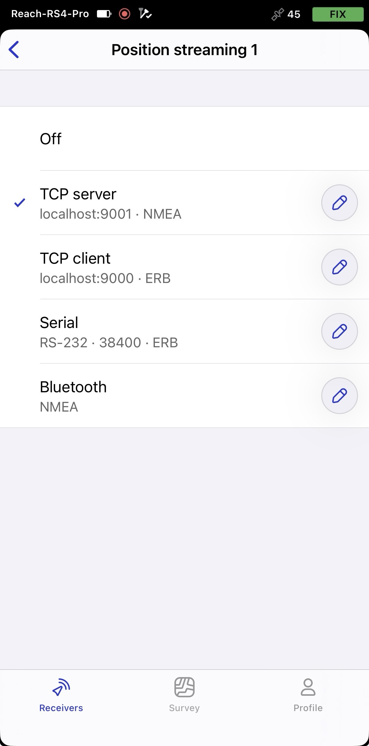
Tippen Sie auf Position Streaming 1 (Positionsstreaming 1) und wählen Sie TCP-Server aus.
-
Um das Positions-Streaming zu konfigurieren, tippen Sie in der Zelle TCP-Server auf die Schaltfläche Edit (Bearbeiten).
-
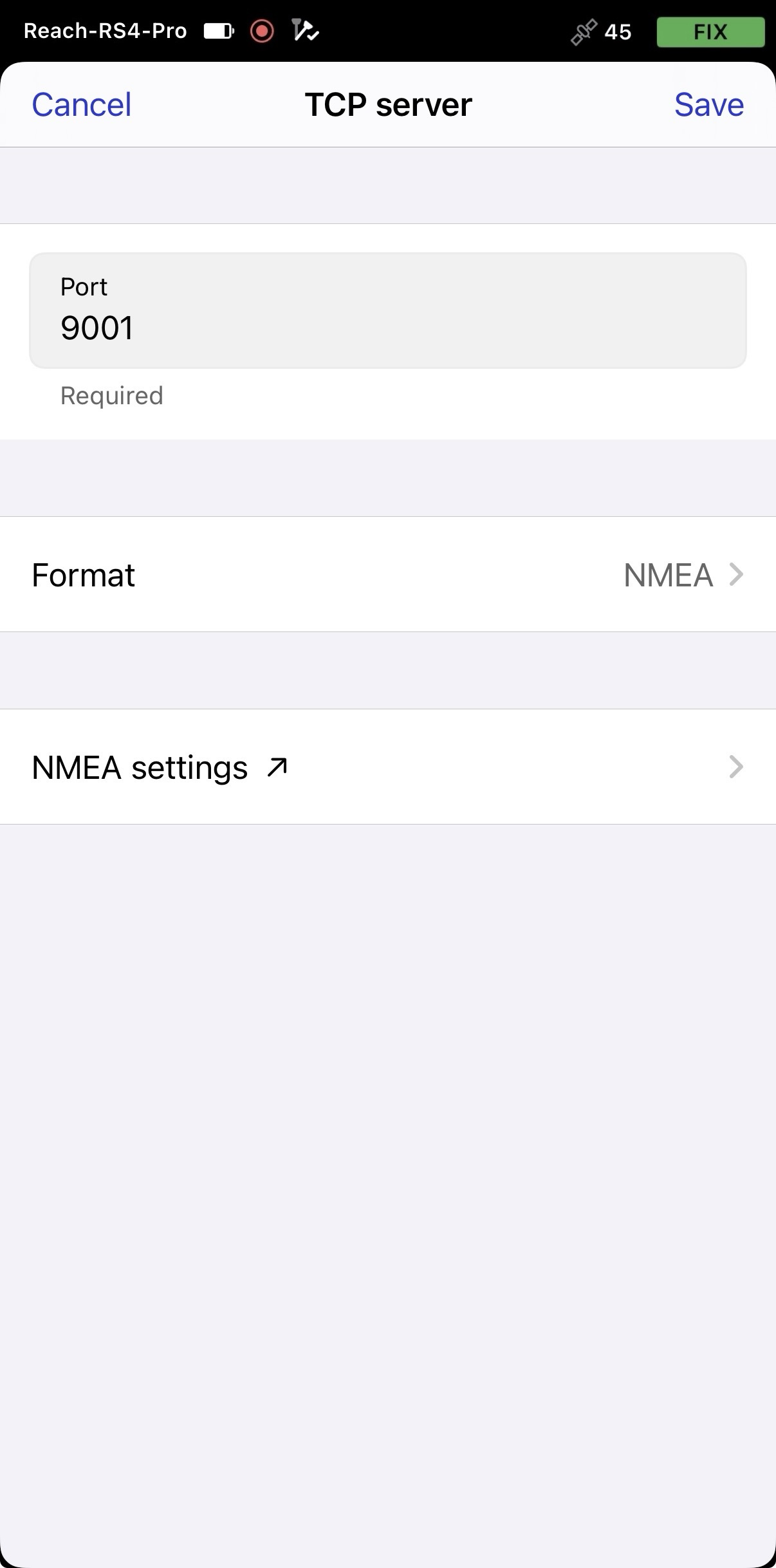
Tippen Sie auf Format und wählen Sie NMEA aus.
-
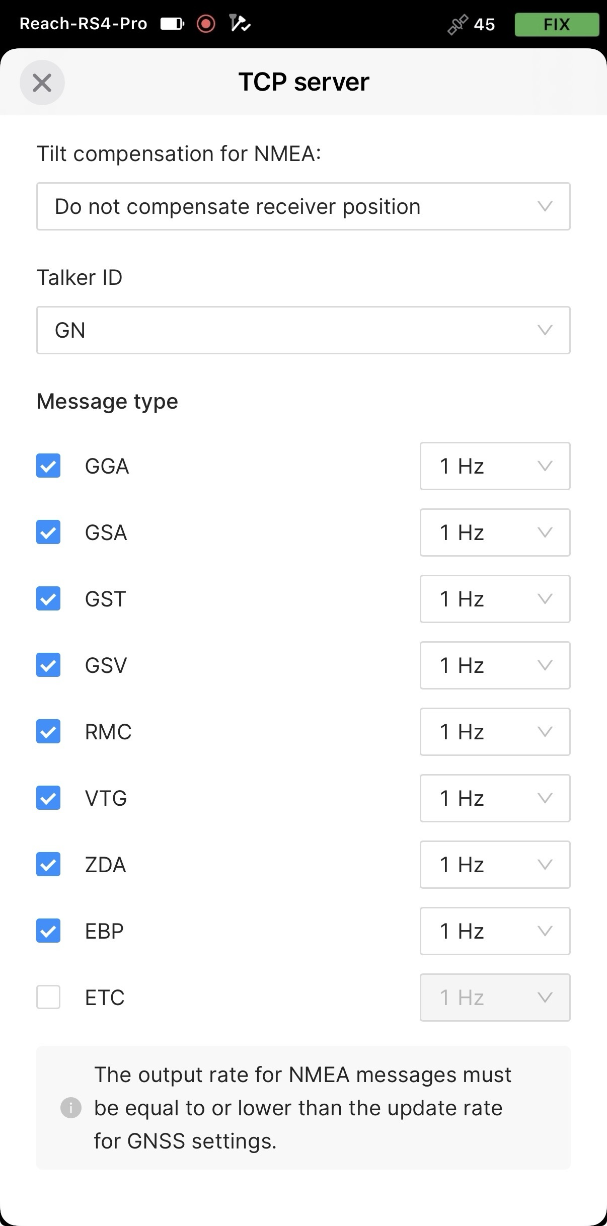
Wenn Sie die NMEA-Ausgabe anpassen möchten, tippen Sie auf NMEA settings (NMEA-Einstellungen) und nehmen Sie die erforderlichen Änderungen vor.
-
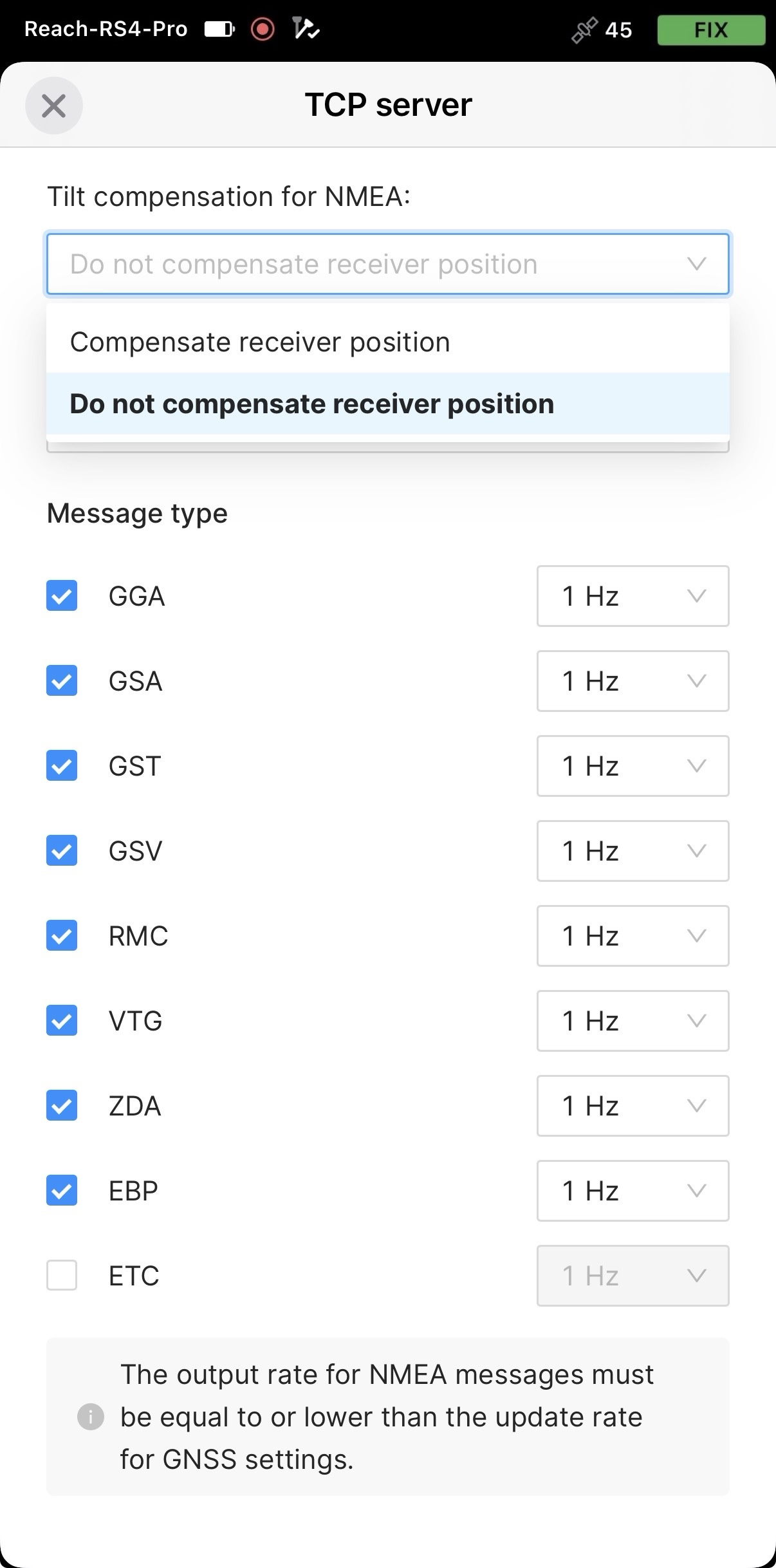
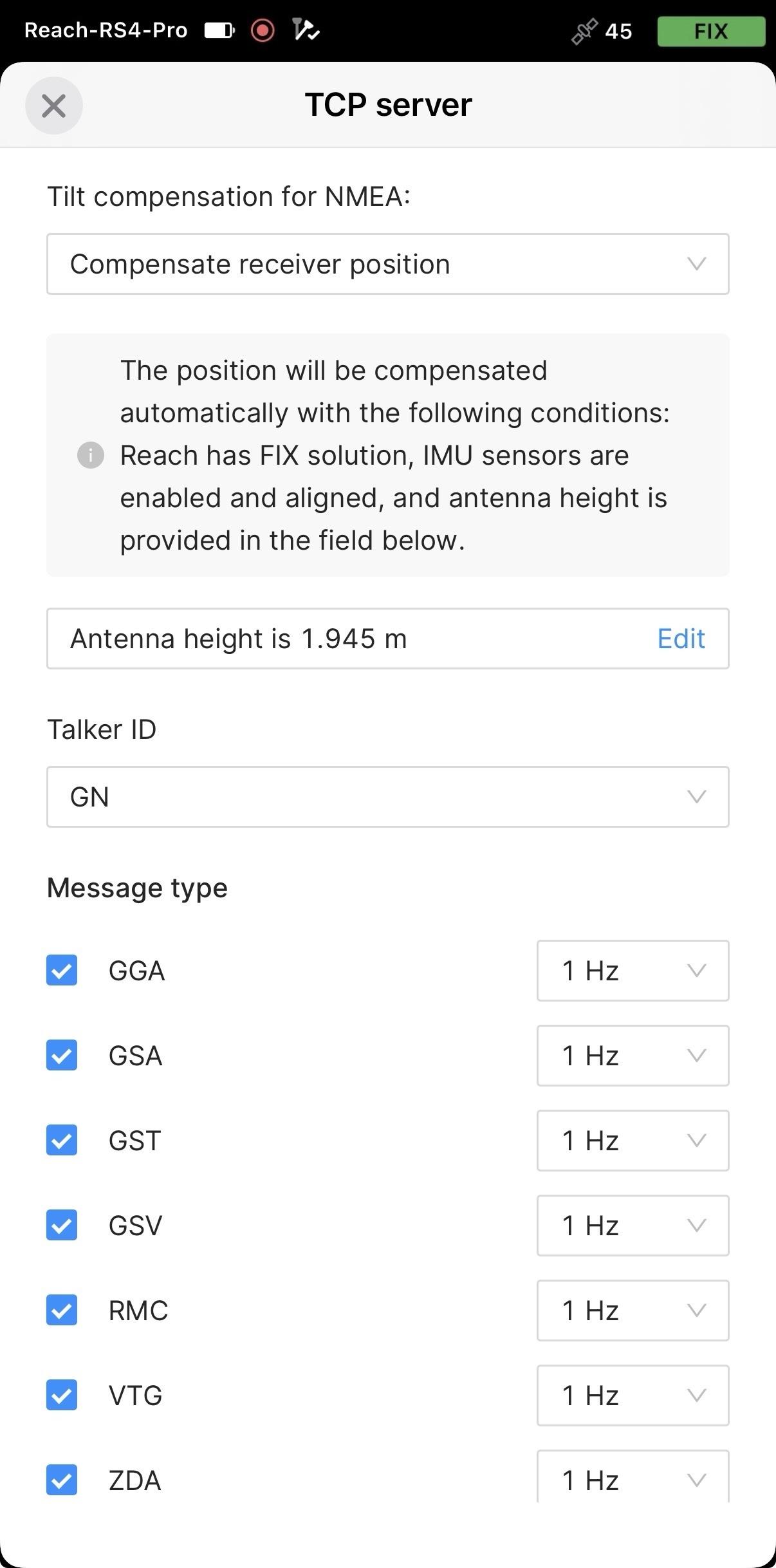
Um die neigungskompensierte Position in Mergin Maps zu nutzen, aktivieren Sie in Emlid Flow das Senden kompensierter NMEA-Meldungen.
-
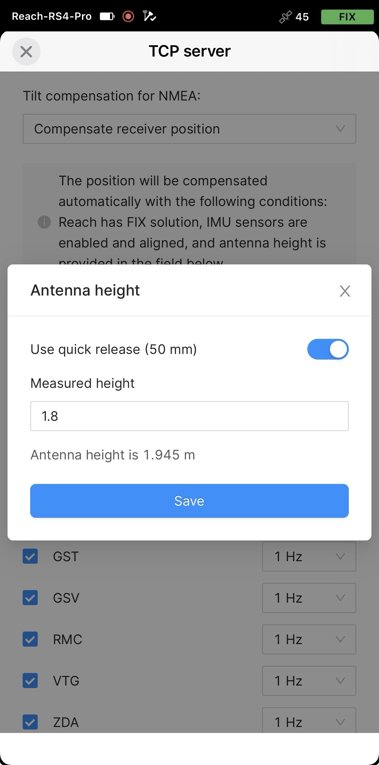
Stellen Sie die Antennenhöhe ein. Sie brauchen nur die Stabhöhe einzugeben. Emlid Flow wendet automatisch den Versatz des Antennenphasenzentrums an und passt die Messungen entsprechend an.
vorsichtWenn Sie kompensierte NMEA-Nachrichten senden, stellen Sie die Antennenhöhe nur in Emlid Flow ein. Auch die Einstellung in Anwendungen von Drittanbietern kann zu Unstimmigkeiten führen.
tippWenn Sie einen Schnellverschluss verwenden, schalten Sie den Kippschalter ein, um dessen Höhe bei der Berechnung der Antennenhöhe zu berücksichtigen.
Jetzt können Sie die korrigierte Position in einer GIS- oder Datenerfassungsanwendung eines Drittanbieters empfangen.
Konfigurieren Sie die Kommunikation zwischen Mergin Maps und Reach RS4 / RS4 Pro
-
Öffnen Sie die Mergin Maps-App und erstellen Sie ein Konto, wenn Sie noch kein Konto haben, um auf die App zuzugreifen.
-
Öffnen oder erstellen Sie ein neues Projekt.
-
Wenn Sie dazu aufgefordert werden, erlauben Sie die Erfassung des genauen Standorts.
-
Tippen Sie auf dem geöffneten Bildschirm in der unteren rechten Ecke auf More (Mehr) und Settings (Einstellungen).
-
Tippen Sie unter Settings (Einstellungen) auf Select GPS receiver (GPS-Empfänger auswählen).
-
Tippen Sie auf Connect new receiver (Neuen Empfänger verbinden).
-
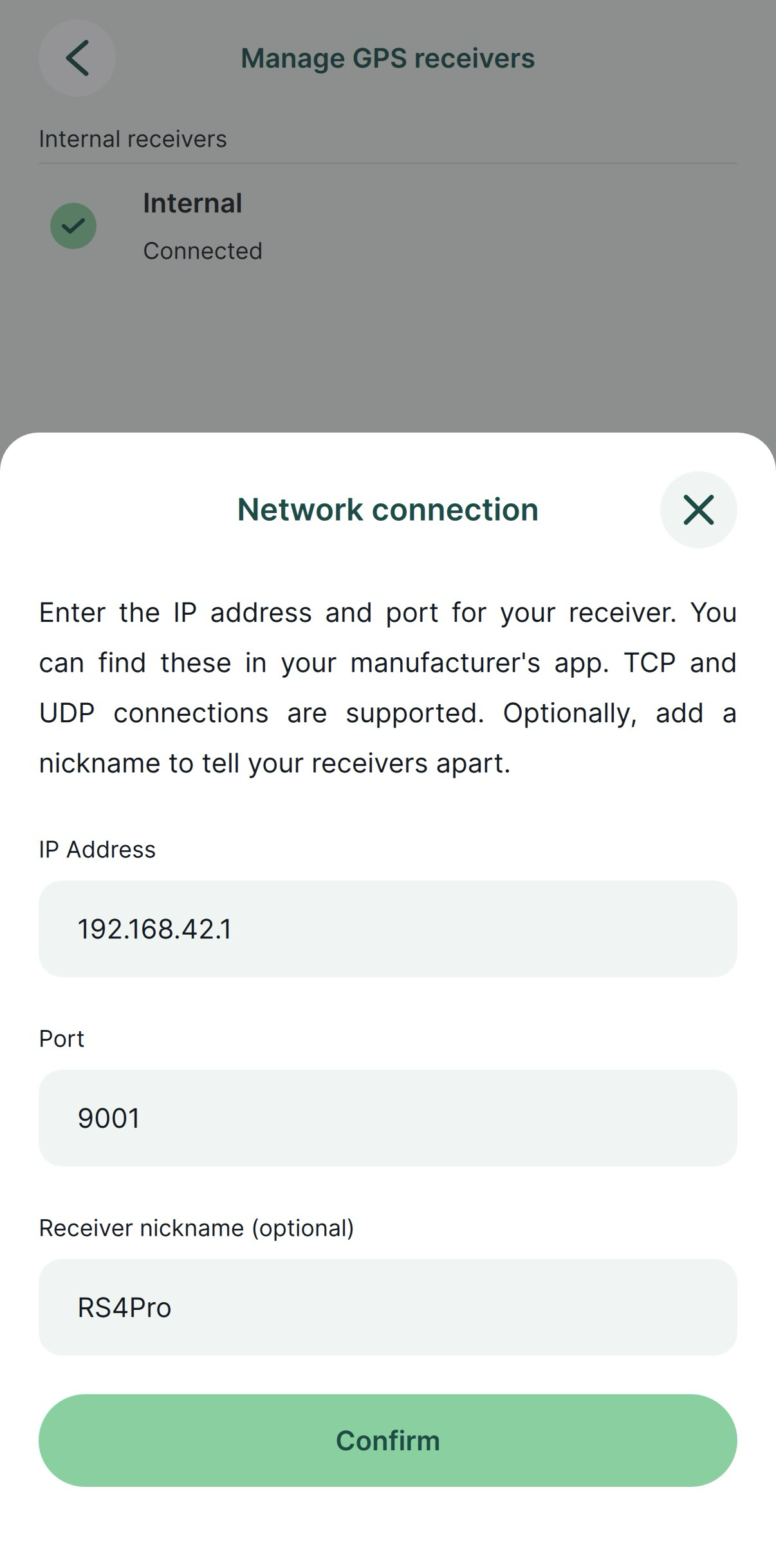
Geben Sie die TCP-Anmeldedaten Ihres Empfängers ein und tippen Sie anschließend auf Confirm (Bestätigen).
Sie müssen die folgenden Anmeldedaten hinzufügen:
- IP-Adresse
- Port
- Spitzname des Empfängers (optional)
-
Wenn Sie dazu aufgefordert werden, erteilen Sie der App die Berechtigung, nach Geräten in lokalen Netzwerken zu suchen.
-
Dieser Schritt ist nur erforderlich, wenn Sie keine kompensierte NMEA-Position streamen. Gehen Sie zurück zu Settings (Einstellungen) und stellen Sie die Antennenhöhe ein. Der Antennenversatz wird in Mergin Maps nicht automatisch hinzugefügt. Der Wert, den Sie eingeben, sollte die Summe aus der Stockhöhe und 95 mm sein, zuzüglich des Schnellverschlusses (50 mm), falls Sie ihn verwenden.
-
Gehen Sie auf den Tab GPS und überprüfen Sie den RTK-Status und die Genauigkeit auf der Karte. Um die detaillierten GPS-Informationen zu prüfen, tippen Sie noch einmal auf den Tab.
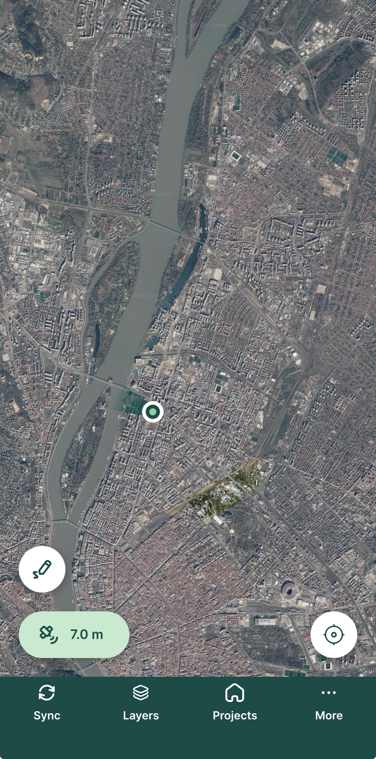
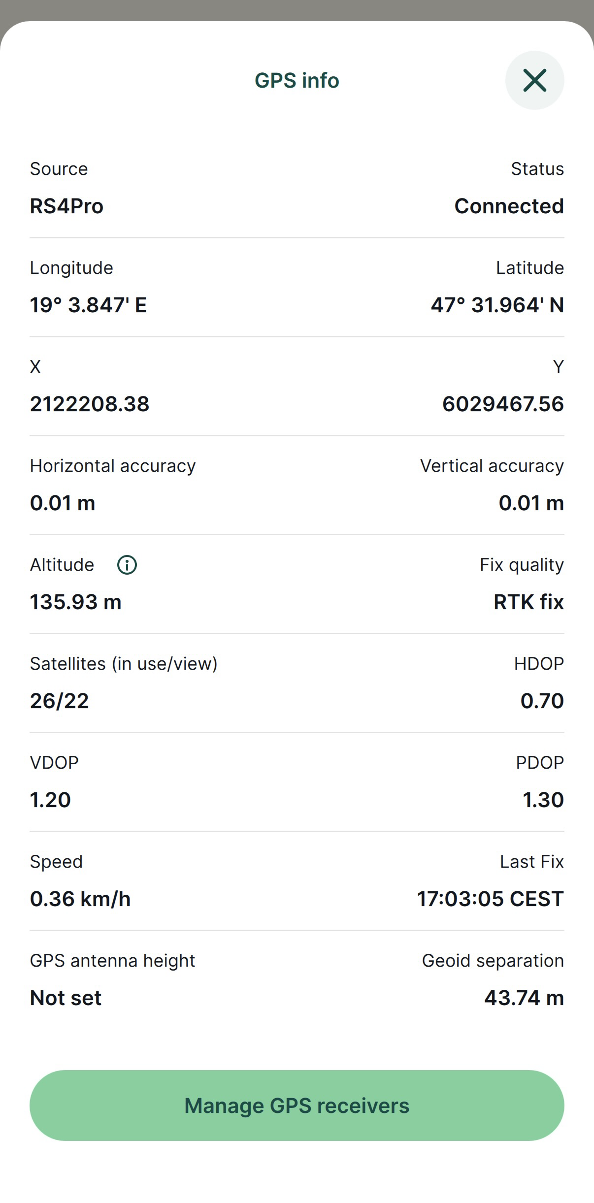
Sie haben Ihren Reach RS4 / RS4 Pro erfolgreich mit Mergin Maps eingerichtet. Sie können Reach nun für Vermessungen in Mergin Maps nutzen.