Integration of Reach RS4 with ArcGIS Field Maps for Android
This tutorial provides step-by-step instructions on how to integrate your Reach RS4 with ArcGIS Field Maps using a device on Android or WSA (Windows Subsystem for Android) via Bluetooth.
Overview
ArcGIS Field Maps is a mobile app that allows you to collect data in the field, view and edit maps, and share information with team members in real time.
To integrate your Reach RS4 with ArcGIS Field Maps via Bluetooth, you will need the following:
-
Reach RS4
noteMake sure your Reach receiver is running firmware version 34.4 or later to transmit compensated NMEA messages over Bluetooth.
-
A device on Android or WSA (Windows Subsystem for Android)
-
ArcGIS Field Maps mobile app installed on your Android device
-
ArcGIS account
Workflow
To integrate your Reach RS4 with ArcGIS Field Maps follow the steps below.
Access Reach using Emlid Flow
You can connect to your Reach in two ways:
- Using the BLE connection option. This is the recommended connection method. It is especially useful when working with corrections from an NTRIP provider. In this setup, the receiver uses your mobile device’s internet connection, so you only need to select the NTRIP over BLE option when configuring the receiver’s correction input.
- Using the Wi-Fi connection option. In this case, your device and Reach must be in the same Wi-Fi network.
To connect to your Reach, follow the steps below:
- Bluetooth connection
- Hotspot connection
-
Enable Bluetooth on your smartphone or tablet.
-
Open Emlid Flow. When prompted, tap Configure access and allow location permissions. This is required for full receiver functionality.
After granting permissions, your receiver will appear in the list. The app will connect to it automatically.
-
Go to Wi-Fi settings on your device.
-
Connect to the Reach hotspot. It appears as reach:XX:XX.
-
Enter the network password. The default password is emlidreach. If you changed it previously, enter your custom password instead.
noteTo restore the default Wi-Fi password, emlidreach, you need to reflash the receiver. Note that reflashing erases all logs stored on the receiver and restores all settings to their default values.
-
Open Emlid Flow and connect to your Reach.
For more information on connecting to your Reach device, refer to the Connecting to Reach guide. A Bluetooth connection is the recommended method.
The Reach name is displayed just above its MAC. In this guide, we used the unit named as Reach.
Configure corrections in Emlid Flow
Check the following guides to configure receiving corrections on your Reach RS4 / RS4 Pro rover:
- How to set up RTK over NTRIP service
- How to work with third-party base over UHF radio
- How to set up RTK over LoRa radio
Configure Bluetooth connection in Emlid Flow
Enable Bluetooth discoverability, so your device can be found by other devices. To do so, follow the steps below:
-
Go to Settings in Emlid Flow and tap Bluetooth.
-
Tap Discoverability and turn on the Discoverability option. Tap Save to apply changes.
Enable tilt compensation
Reach RS4 / RS4 Pro supports IMU-based tilt compensation, allowing you to collect and stake out points even when the survey pole is tilted. The software calculates the tilt angle and distance to determine the pole tip position on the ground. To enable tilt compensation, follow the How to enable tilt compensation guide.
Set up NMEA stream in Emlid Flow
To send position data to external applications, configure position streaming in NMEA format as follows:
-
In Emlid Flow, go to Settings.
-
Tap Position streaming 1 and select Bluetooth.
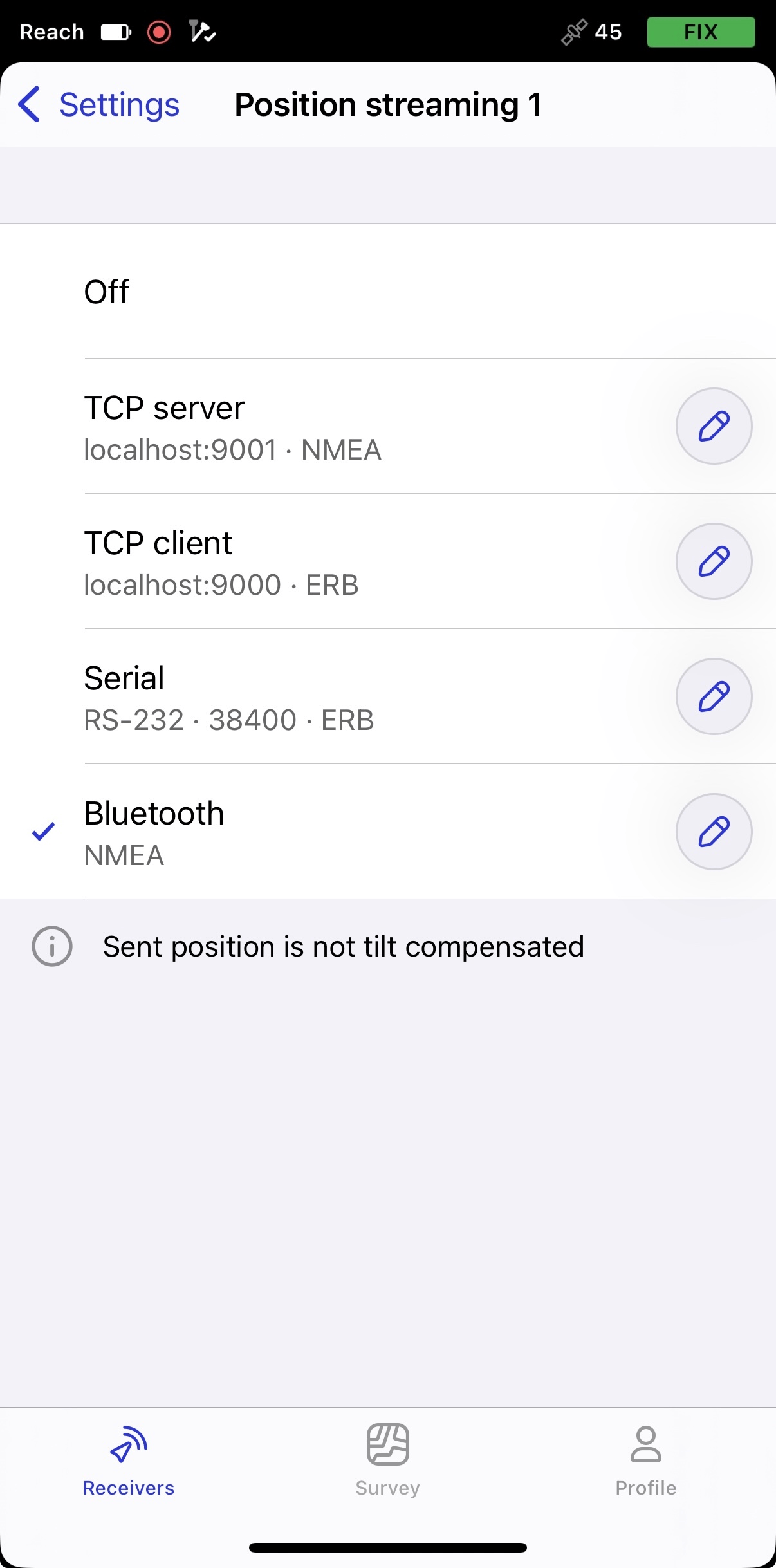
-
To configure position streaming, tap the Edit button in the Bluetooth cell.
noteWhen connected to your Reach via Bluetooth, Emlid Flow will prompt you to connect to the Reach hotspot to access the streaming configuration settings.
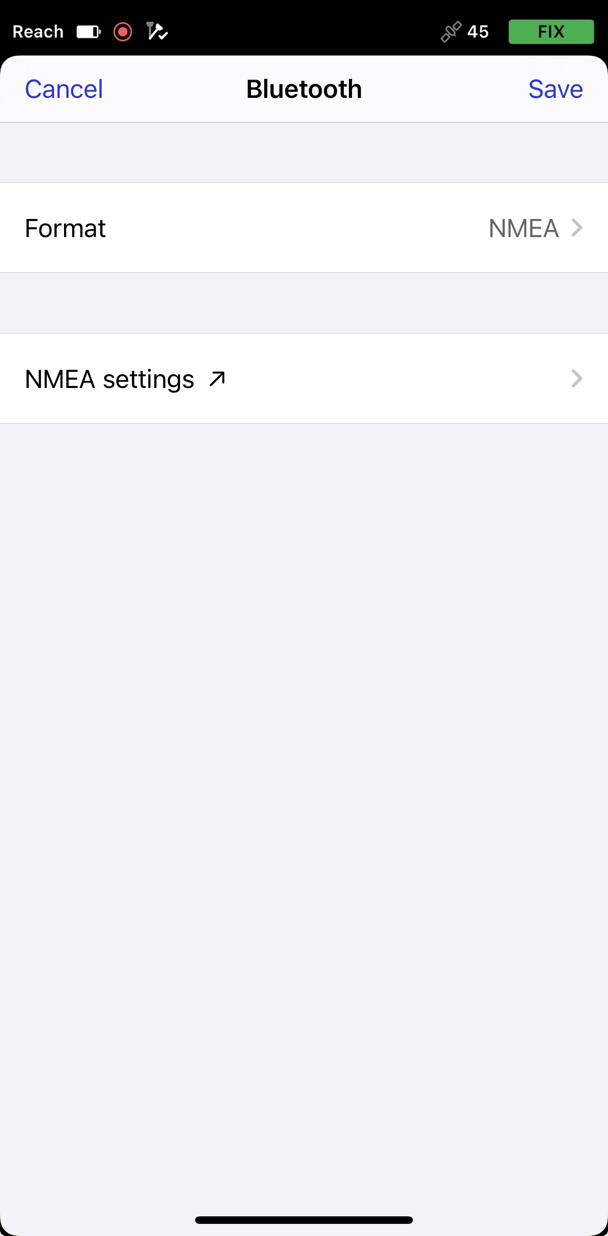
-
Tap Format and choose NMEA.
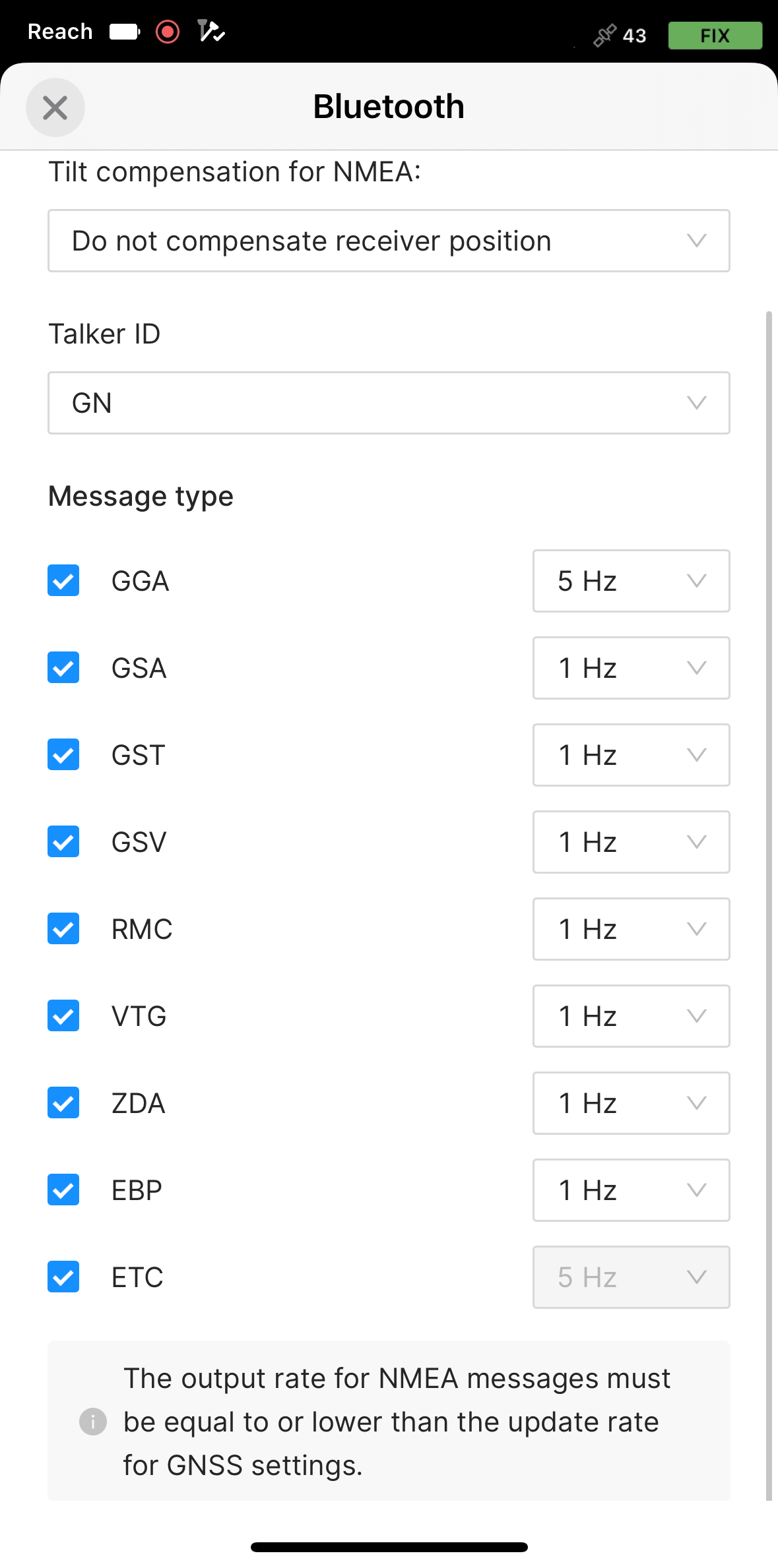
-
Apply the necessary changes.
-
To send compensated NMEA messages, you need to enable it in Emlid Flow.
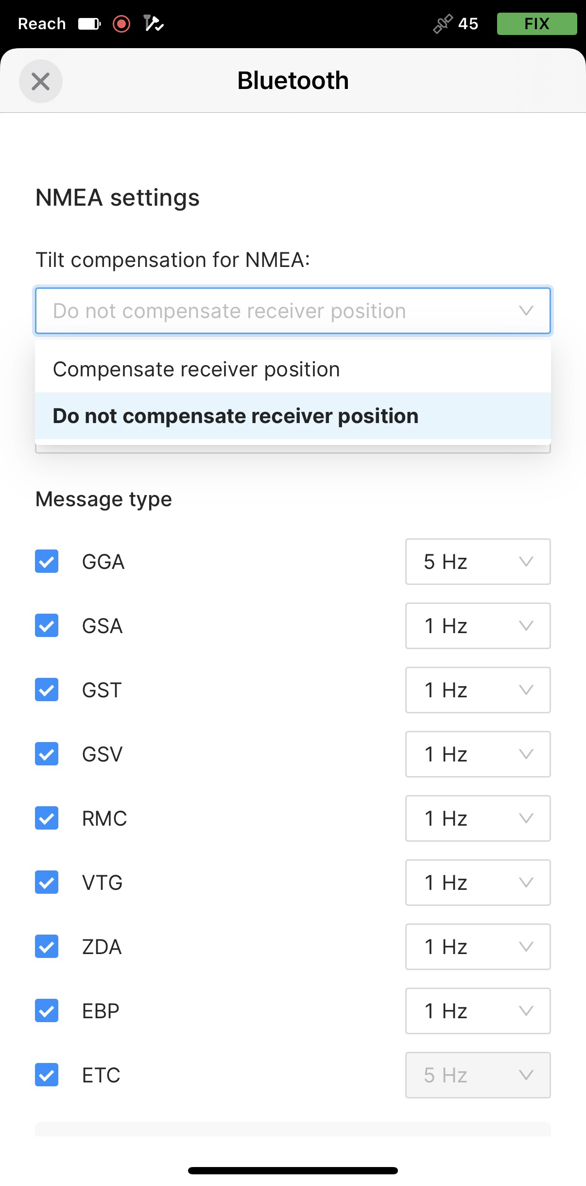
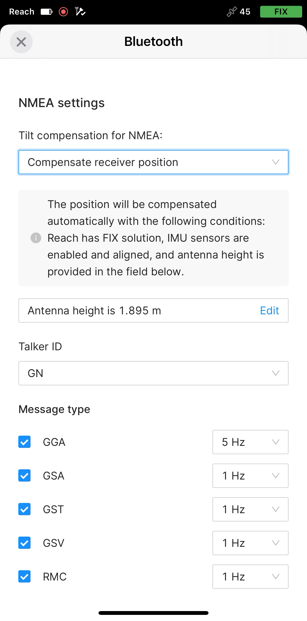
-
Set the antenna height. You only need to enter the pole height. Emlid Flow automatically applies the antenna phase center offset and adjusts the measurements accordingly.
cautionWhen sending compensated NMEA messages, set the antenna height only in Emlid Flow. Setting it in third-party apps as well may cause discrepancies.
tipIf you use a quick release, turn on the toggle to include its height in the antenna height calculation.
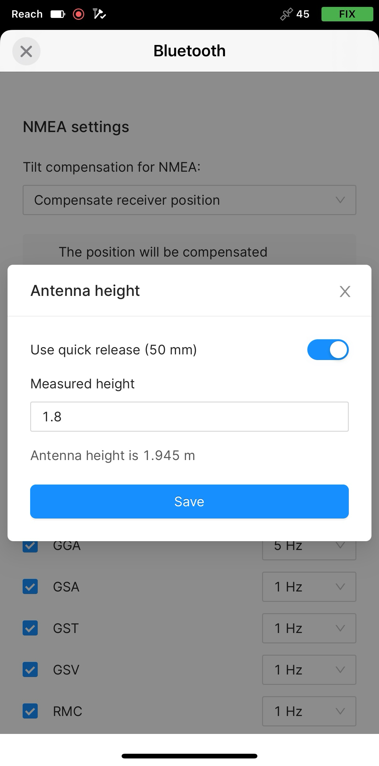
Now you can start receiving the corrected position in a third-party GIS or data collection application.
Pair Reach RS4/ RS4 Pro and Android device
To find your Reach RS4 or Reach RS4 Pro in the list of devices in Field Maps, you need to pair it with the Android device as follows:
-
Navigate to the Bluetooth configuration screen on your Android device and enable Bluetooth.
-
Wait for your Reach RS4 to be listed as an available device.
tipKeep Reach within a few meters from the device.
-
Tap the name of your Reach in the list of available devices on the Android device.
noteIf your device requires a PIN code, enter 123456.
-
Pair Reach with the Android device.
Configure communication between ArcGIS Field Maps and Reach RS4 / RS4 Pro
To set up communication between ArcGIS Field Maps and your receiver, follow the steps below:
-
Open the ArcGIS Field Maps app.
-
Tap the Profile icon in the upper-right corner to open the settings.
-
Tap Provider in the Location section.
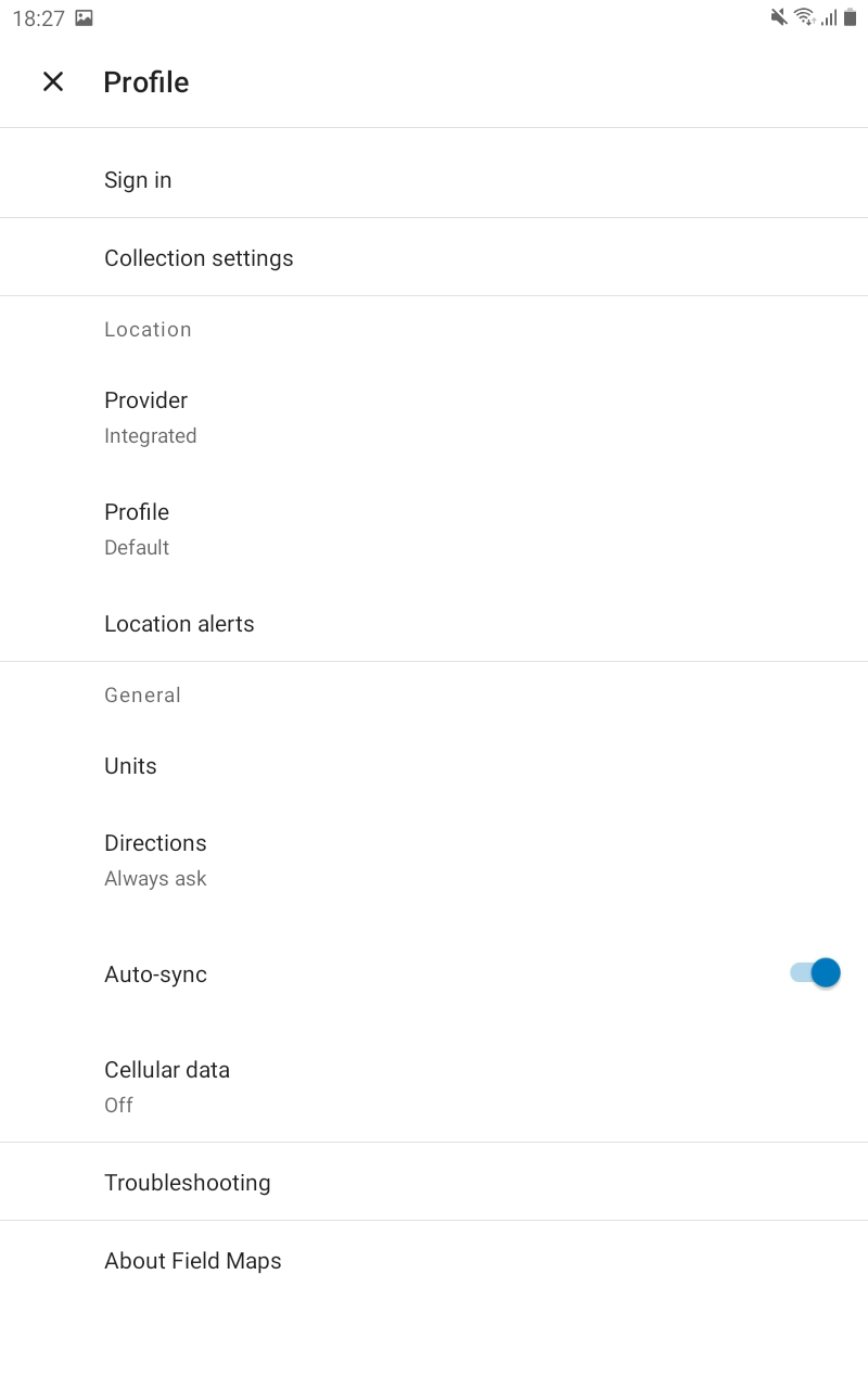
-
Tap the Plus button to add a provider.
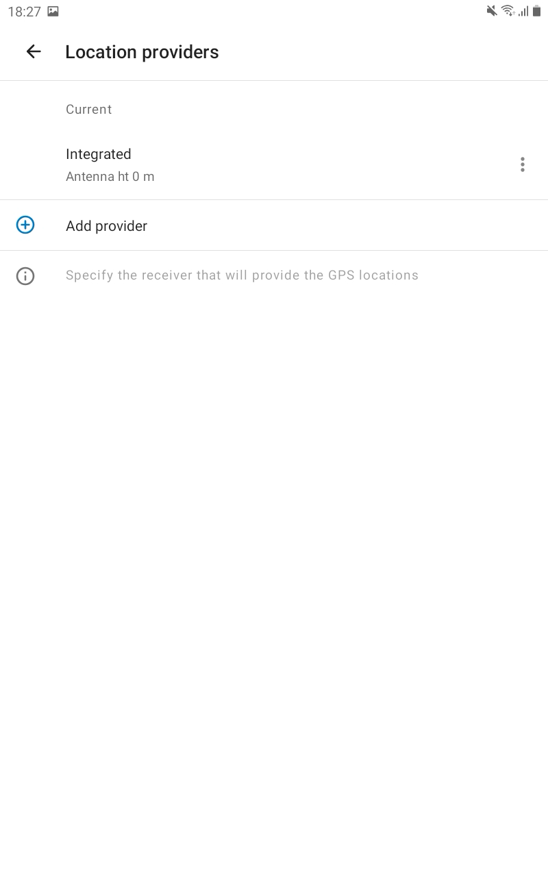
-
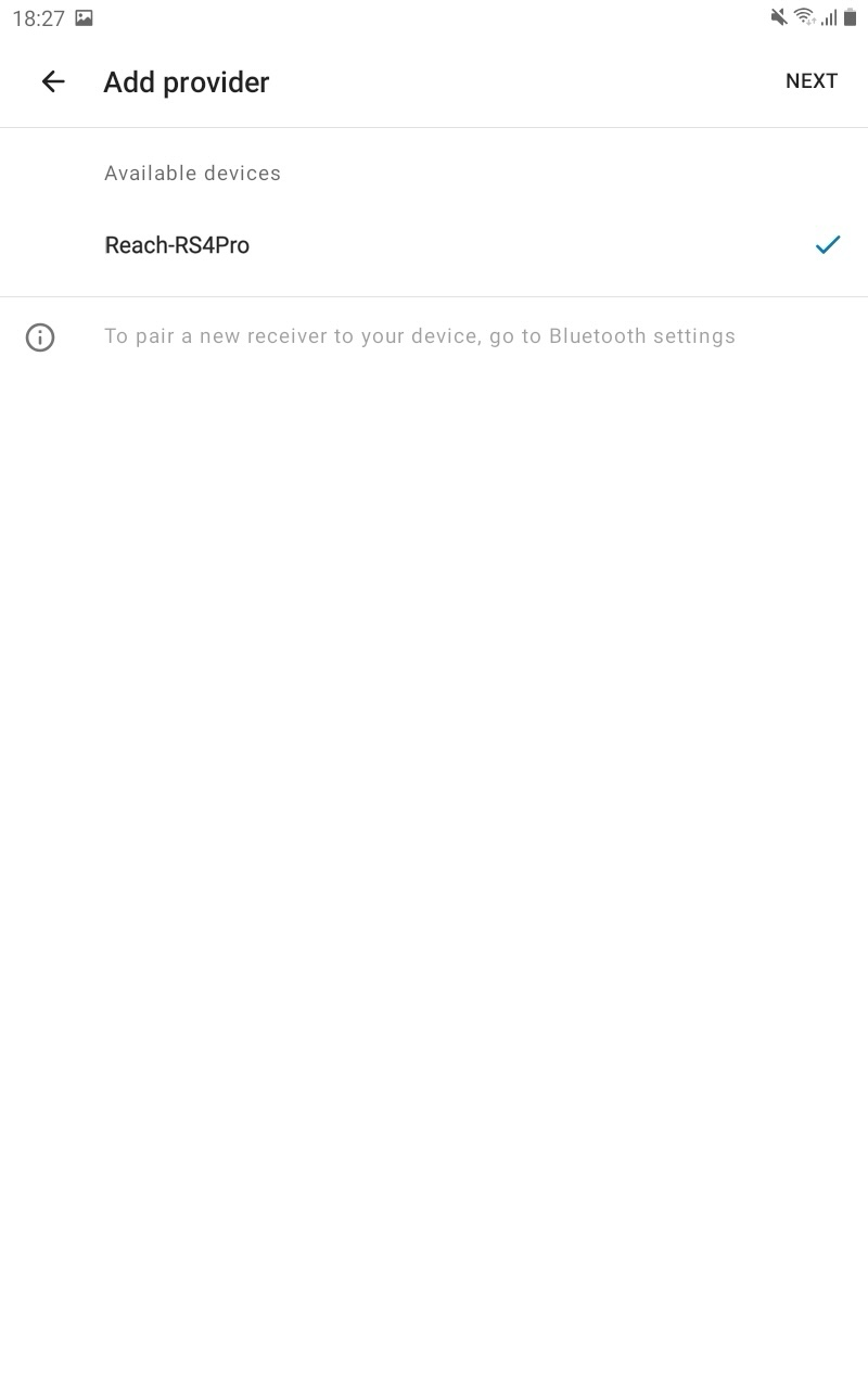
Select your Reach in the list of available devices. Tap NEXT.
-
This step is only required when you don’t stream compensated NMEA position. Set the antenna height and tap DONE. Antenna offset is not added automatically in the Field Maps. The value you enter should include the pole height, the antenna offset of 95 mm, and an additional 50 mm if you use a quick-release adapter.
-
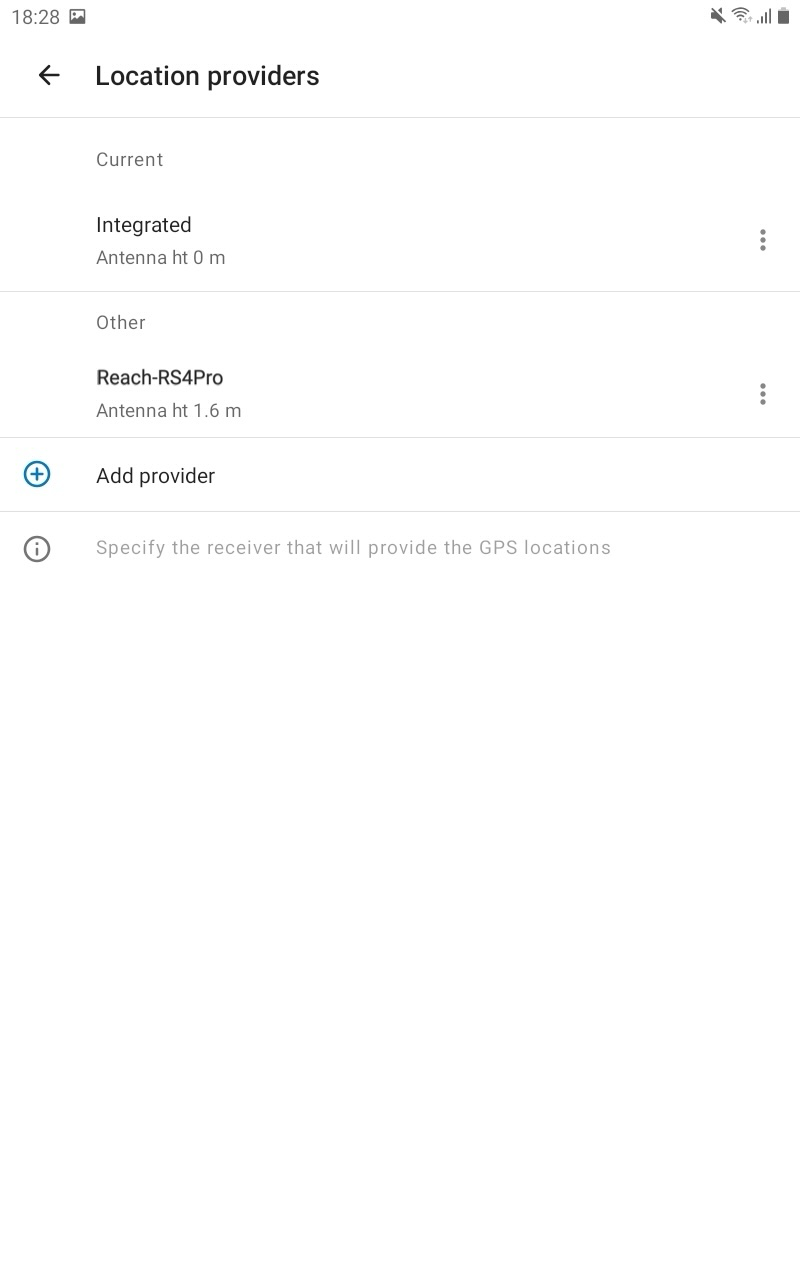
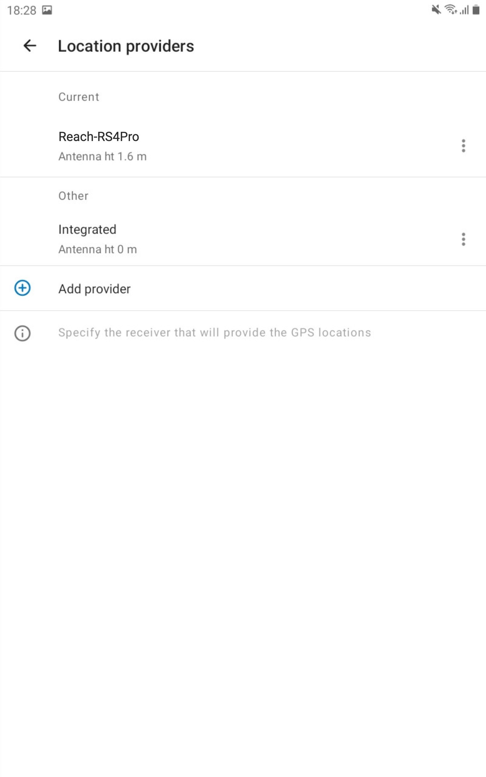
Tap Current. Tap on your Reach in the Other section. This Reach will be set as a current one.
-
Tap the back arrow to come back to your Profile settings.
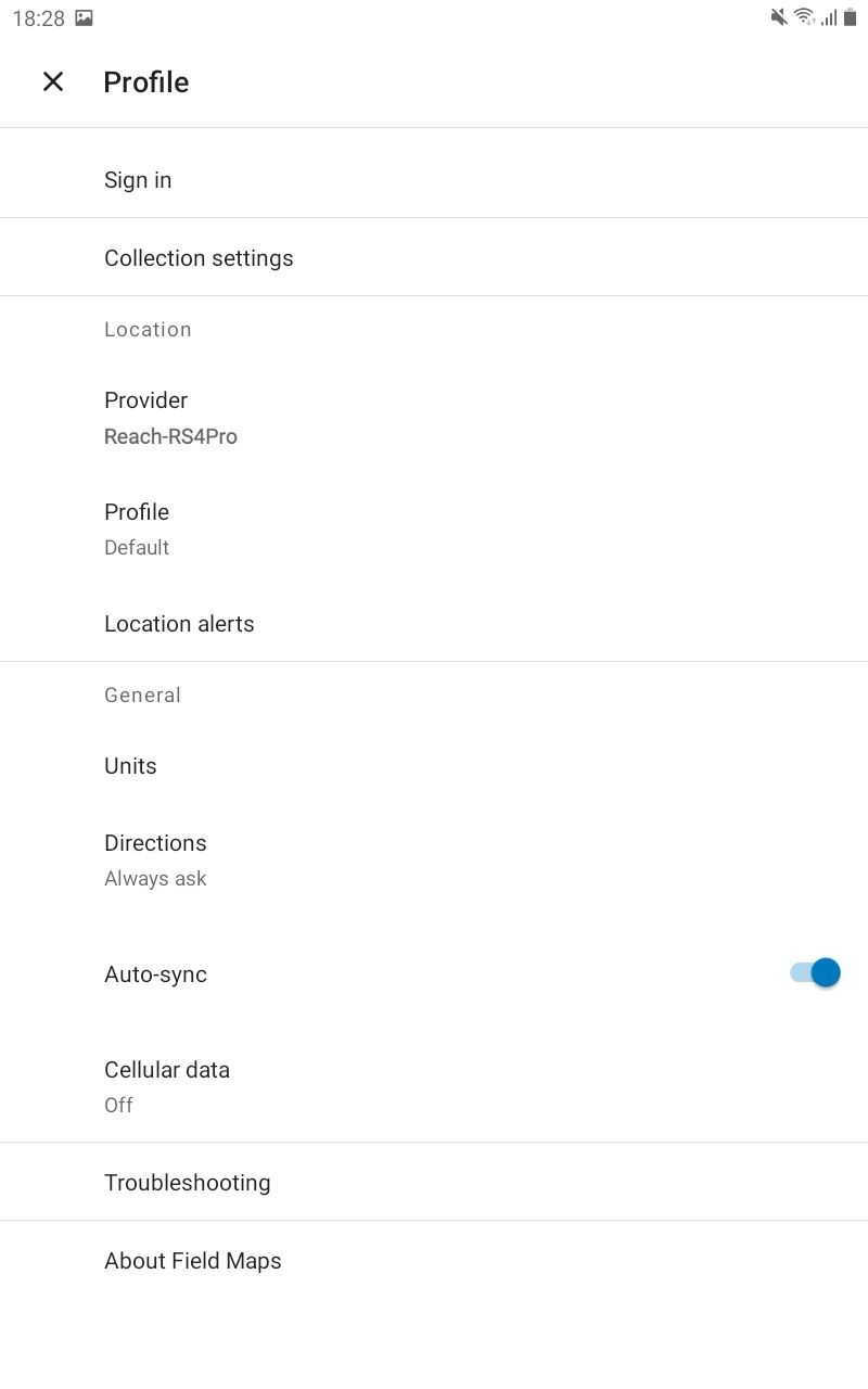
You are now ready to proceed with the measurement of the GNSS data!