Working with NTRIP service
This guide explains how to configure your Reach RS/RS+ to receive RTK corrections from an NTRIP service via the Internet.
Overview
An NTRIP service allows you to use RTK positioning with only one GNSS receiver acting as a rover. Using the NTRIP protocol, the service allows your rover to receive corrections from the nearest third-party base, a continuously operating reference station (CORS). This way, there is no need for you to have your own local base.
In order to access NTRIP services, you need to register and get a subscription. The cost and coverage area depend on your NTRIP service provider.
Workflow
To configure your Reach to receive RTK corrections from an NTRIP service via the internet, follow the steps below.
Set up internet connection
To receive corrections from an NTRIP provider, your Reach receiver needs internet access. The required internet connection method depends on how you connect to the receiver in Emlid Flow:
- Bluetooth connection
- Hotspot connection
The Bluetooth connection option is only available for Reach RS+.
When connected to Reach via Bluetooth in Emlid Flow, no additional setup is required. Emlid Flow automatically uses your phone or tablet’s internet connection to provide Reach with corrections. Make sure your mobile device has an active internet connection.
When connected to Reach via its hotspot, the receiver itself must have internet access. You can provide internet access using one of the following methods:
Configure GNSS settings
To set up your Reach as a rover for RTK mode with NTRIP, you need to configure GNSS settings and correction input in Emlid Flow. First, configure GNSS settings following the steps below:
-
Open Emlid Flow and connect to your receiver.
-
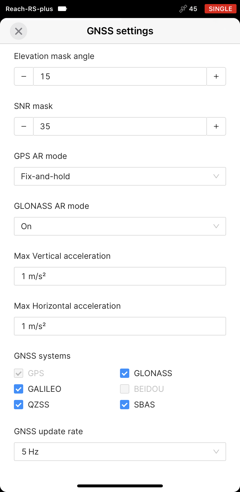
Go to Settings and tap GNSS settings. We recommend the following settings:
- The positioning mode is set to Kinematic.
- GPS Ambiguity resolution mode is set to Fix-and-hold.
- GLONASS Ambiguity resolution mode is set to ON.
- The elevation mask angle is set at 15 degrees.
- The SNR mask angle is set at 35 degrees.
- Each of the possible satellite systems is selected. Choose between GLONASS and BeiDou depending on your location. While GLONASS covers most of the world, BeiDou might be more efficient in the Asia-Pacific region.
- The GNSS update rate is set at 5 Hz.
-
Tap Apply.
Configure correction input
After configuring GNSS settings, set up the correction input as follows:
-
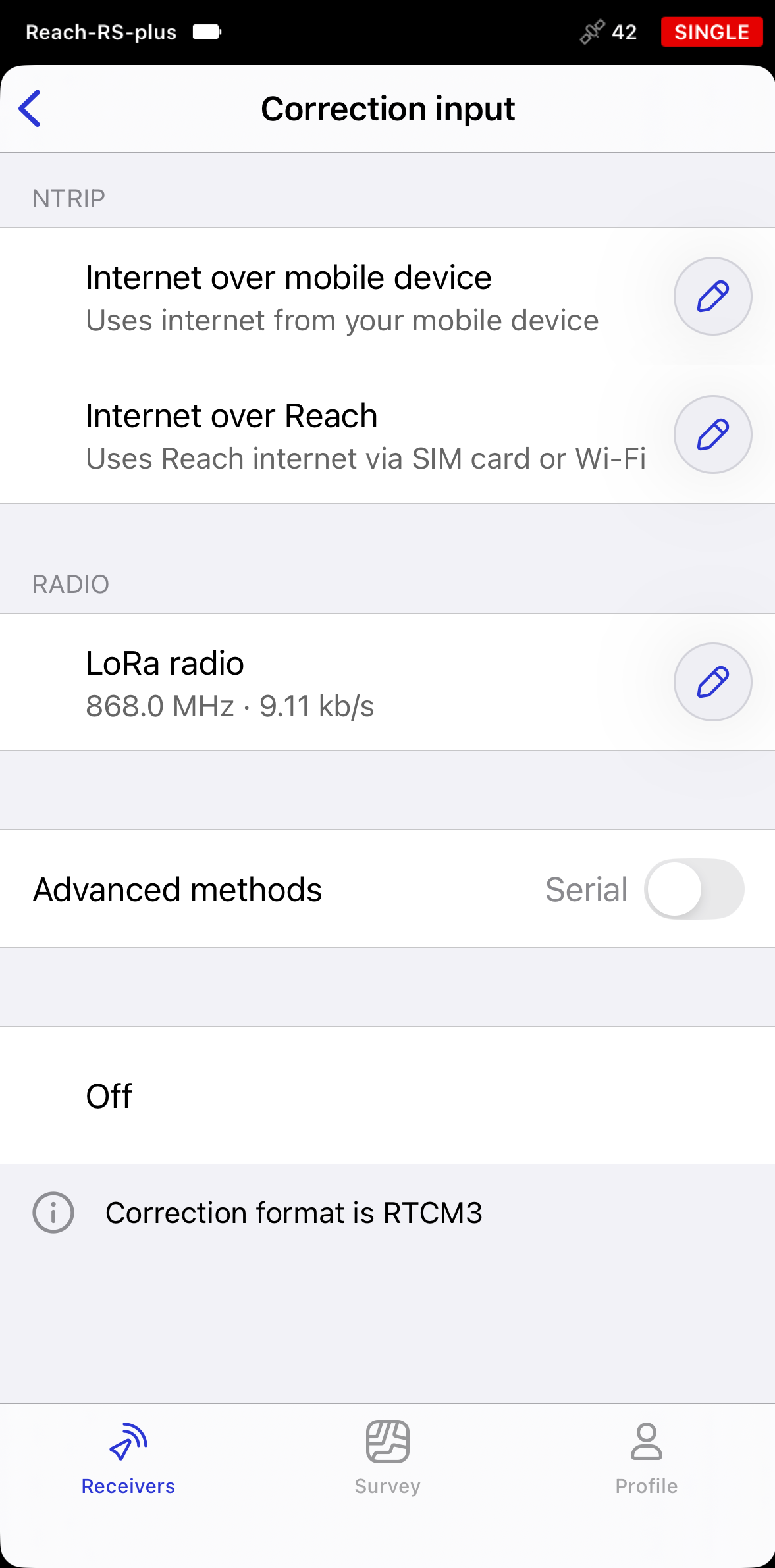
Go to the Correction input screen.
-
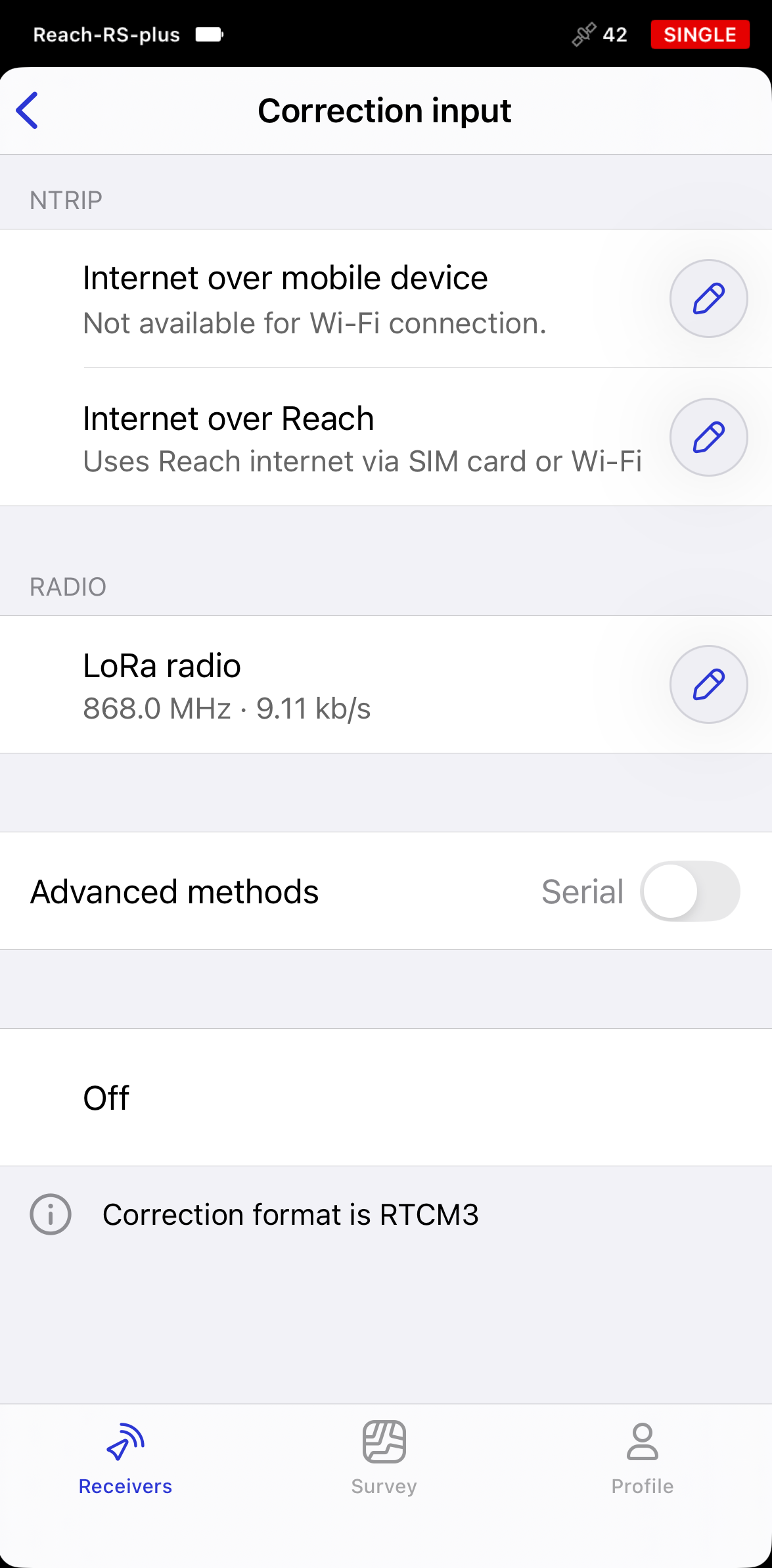
In the NTRIP section, select how the receiver will receive corrections from an NTRIP provider. The available options depend on how your mobile device is connected to the receiver.
- Bluetooth connection
- Hotspot connection
If you connected to the receiver via Bluetooth, you have two options:
-
Pick Internet over mobile's device to use your phone's or tablet's internet connection. This is a recommended method which requires no setup.
-
Pick Internet over Reach to use the receiver’s internet connection via a SIM card or Wi-Fi network. In this case, you can provide internet access using one of the following methods:
noteOn Android, the options have been renamed to NTRIP via mobile device and NTRIP via Reach. They now also include dynamic statuses with setup hints to help you configure the correction input. On iOS, these improvements will be available in upcoming releases.
If you connected to the receiver via its hotspot, you need to connect the receiver to the internet via an external Wi-Fi network or a SIM card using one of the following methods:
- Connecting Reach to internet via built-in modem
- Connecting Reach to internet via Wi-Fi
- Connecting Reach to internet via mobile hotspot
-
Tap Add profile and enter the credentials and connection details provided by your NTRIP service provider:
-
Address: The URL or IP address of the NTRIP caster.
-
Port: The port used to connect to the caster. The default value is usually 2101 unless your provider specifies a different port.
-
Username: The username used to authenticate with the NTRIP service. In some cases, it may be your name or email address.
-
Password: The password associated with the username.
-
Mount Point: The name of the correction stream provided by the NTRIP service.
tipTo find out which mount point suits you better, check the website of your NTRIP provider. In general, shorter distances to the reference station improve RTK performance.
ANDROID KEYBOARD TECH TIPOn some Android devices, default keyboards do not provide a minus sign. To access it, we recommend downloading Gboard, a virtual keyboard app, from the Google Play Store.
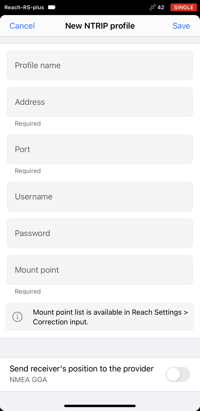
noteIf you use a VRS service, you need to enable Send receiver's position to the provider.
-
-
Tap Save. If everything is configured correctly, the Waiting for corrections notification will appear first. Once the receiver has a clear sky view and satellite visibility, corrections should start within a few seconds.
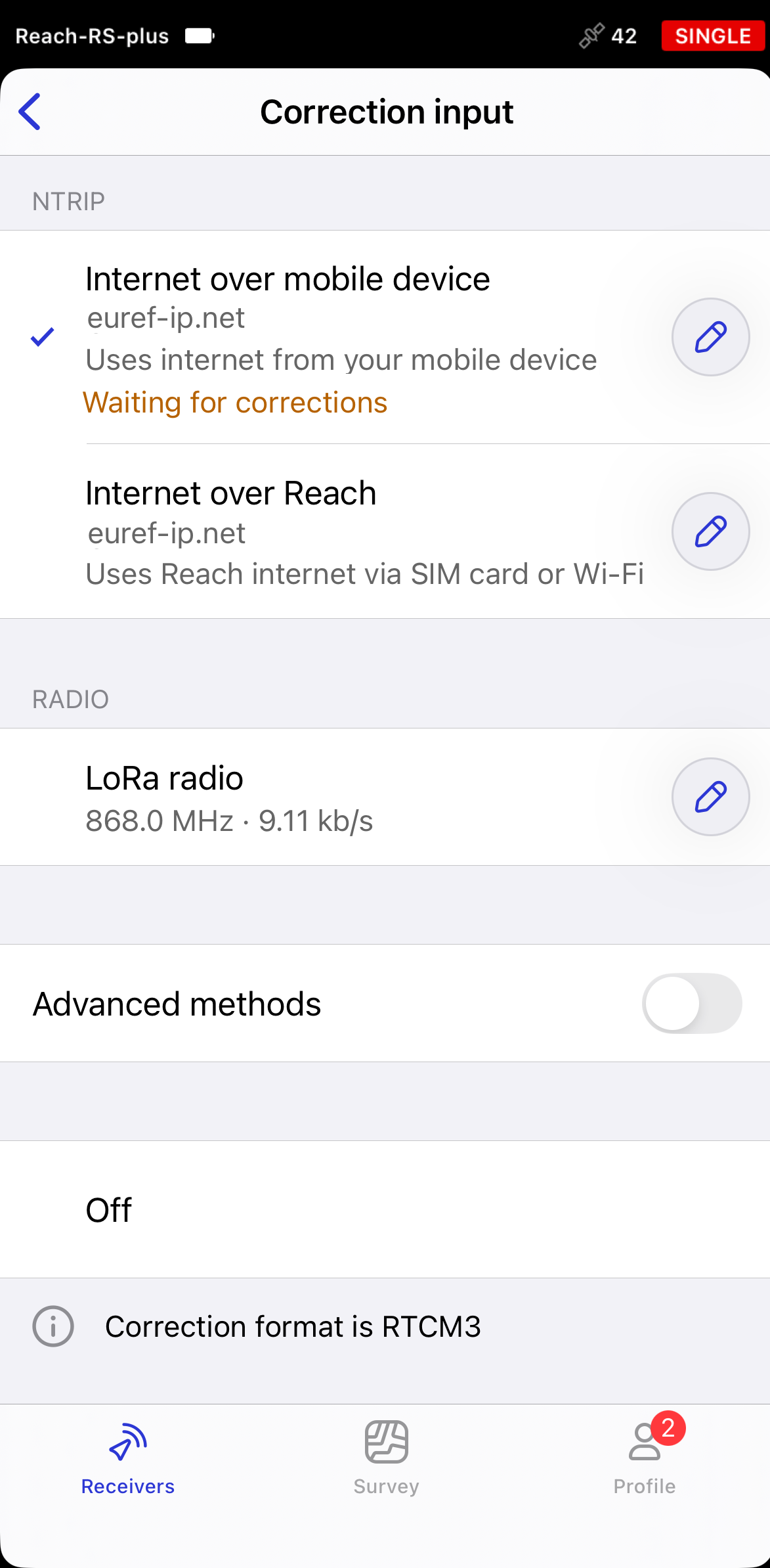
You can add a required number of NTRIP profiles and choose between them right on the Correction input screen later.
Provide Reach RS/RS+ with clear sky view
Before surveying, make sure your Reach has a clear sky view of at least 30 degrees above the horizon. There should be no obstacles that could block the view like buildings, trees, cars, people, laptops, etc.
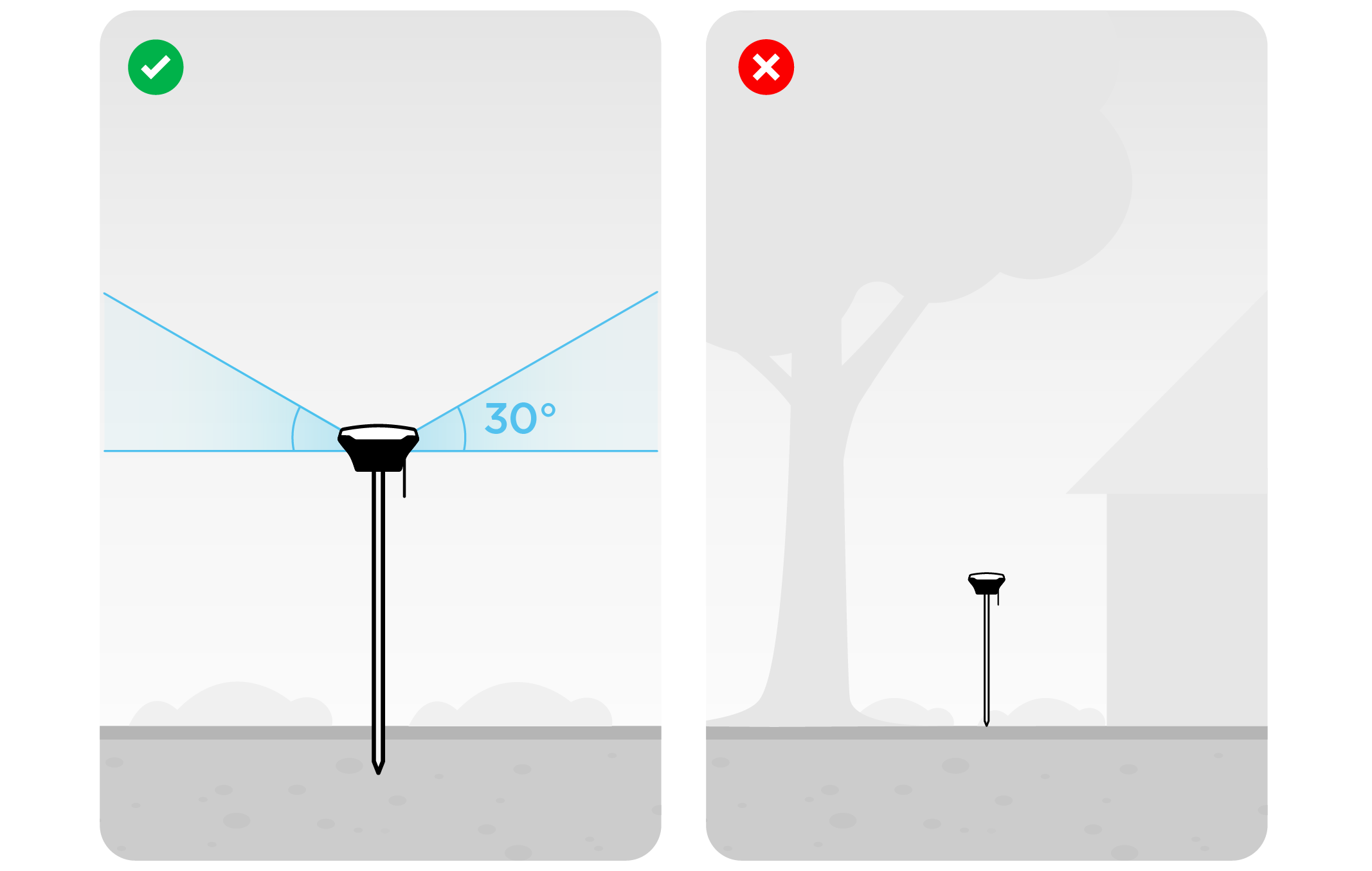
Learn more about Reach setup in the Placement guide.
Once the receiver has a clear sky view and satellite visibility, corrections will start within a few seconds.
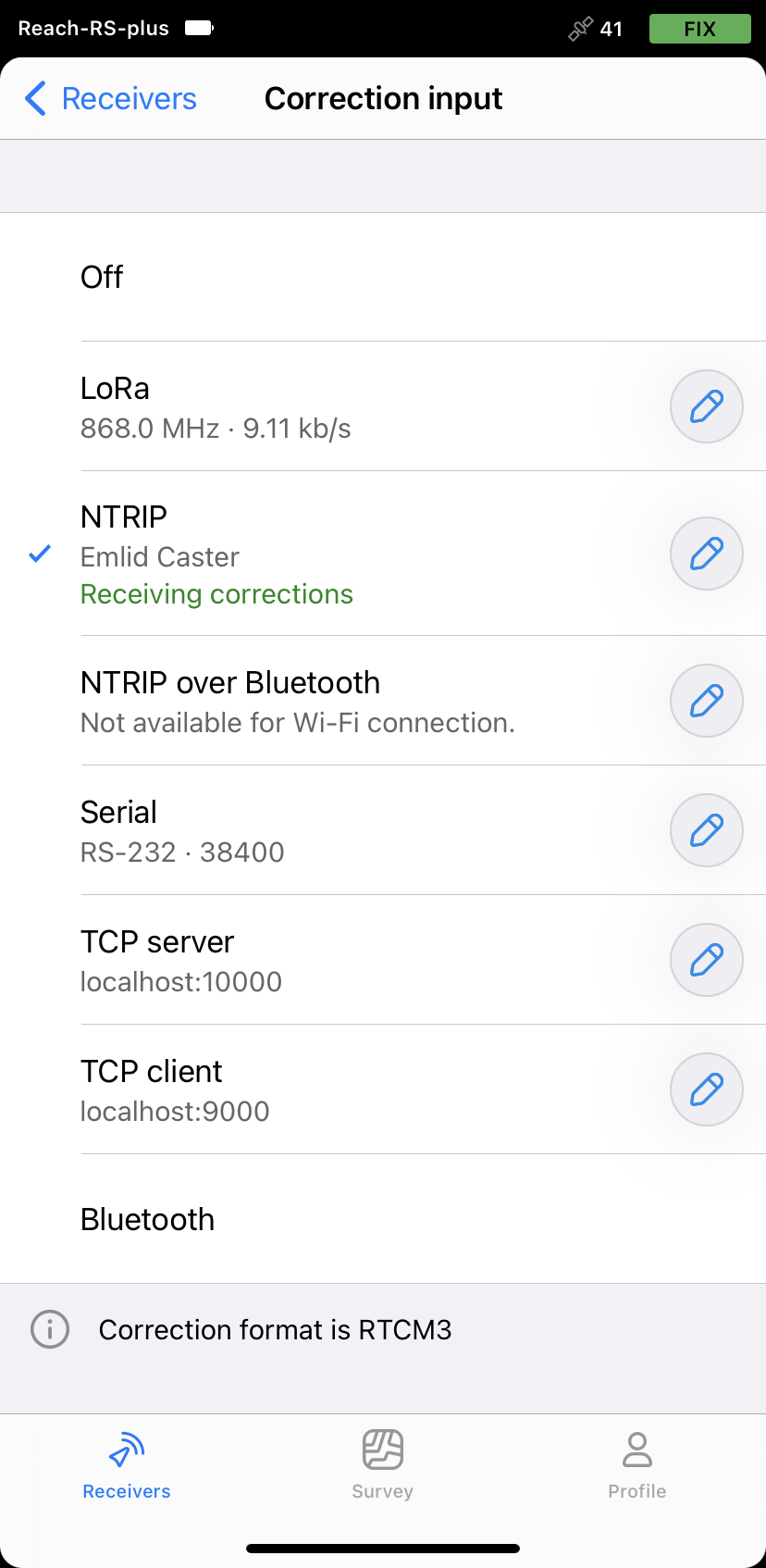
View solution status
When you complete your RTK setup over NTRIP, you can see the current solution status in the top-right corner of the Emlid Flow app:
SINGLE means that the rover has found a solution relying on its own receiver and reference station corrections are not applied. Precision in standalone mode is usually at the several-meter level.
FLOAT means that the rover receives corrections from the reference station but cannot resolve all ambiguities, and in this case, the precision is usually at the submeter-level.
FIX means that the rover using corrections from the reference station resolved the ambiguities in its positional calculation and achieved the solution with the centimeter-level precision
After a short period of time, the rover gets a fixed solution. In good environments, it will take a few seconds to get a fixed solution. In challenging environemnts, it may take a little longer. Once the rover gets FIX, you are all set for surveying.
You can also view the current solution status and your real-time position on the Status screen.