Averaging base position in FIX
This guide explains how to use the Average FIX coordinates entry method in the Emlid Flow app to obtain the coordinates of a known point and set up your base over it.
Overview
The Average FIX method allows you to determine the base’s coordinates with absolute centimeter accuracy. In this case, your base acts as a rover which receives the correction data from an NTRIP service via the internet.
You can find out how to get corrections from an NTRIP service in the Working with NTRIP service guide.
Workflow
Placing base in field
To place your base station in the field, follow the recommendations below.
Clear sky view without any obstacles
Reach base needs to have a clear sky view 30 degrees above the horizon. There should be no obstacles that could block the view like buildings, trees, cars, humans, laptops, etc.
Take a look at 2 pictures below. The left picture demonstrates desirable conditions for Reach location. The right one is an example of poor surrounding conditions such as the reduced view of the sky, possible obstructions or vegetation nearby.
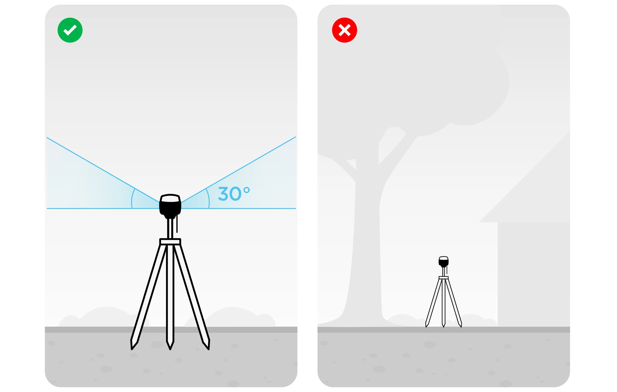
Examples of recommended environments for Reach placement:
- field
- top of the hill
- rooftop
Examples of poor environments for Reach placement:
- indoors
- urban area
- forestry area
No electronics nearby
Electronic devices may produce RF noise that could affect the reception of the GNSS signal. Keep all electronics as far as possible from Reach.
Measuring antenna height offset
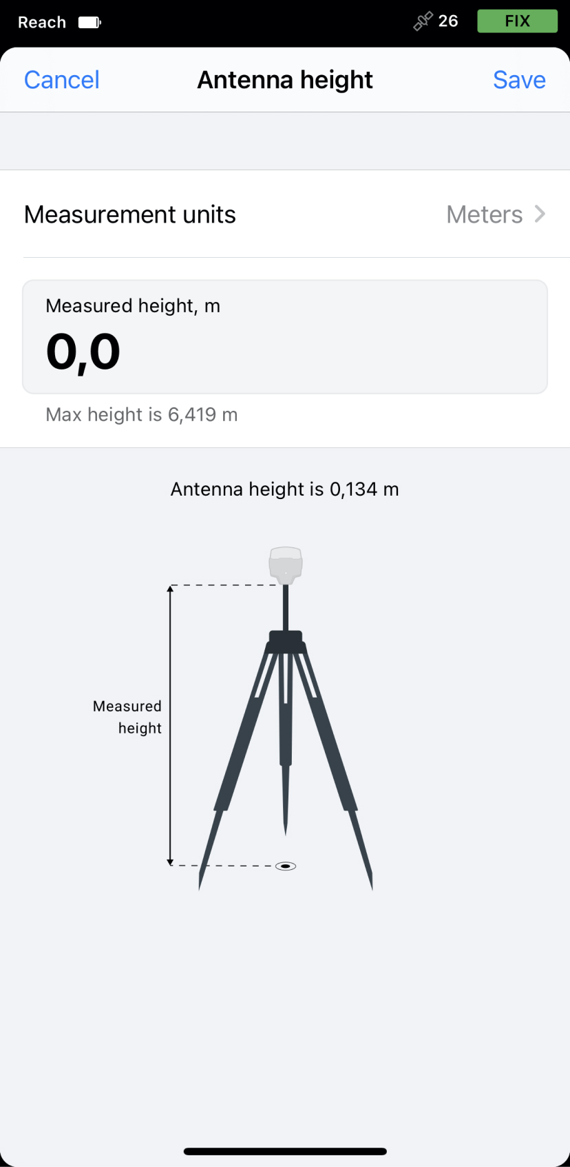
When placing your Reach in the field, make sure your Reach device is placed precisely above the marked point on the tripod and leveled. When you are setting up base coordinates manually, you need to measure the antenna height offset. Follow the steps below:
-
Measure the distance from the mark to the bottom of your Reach (h in Figure 1).
-
Specify the measured distance in Emlid Flow. It will automatically calculate the antenna height.
tipFor Reach RS3, the antenna height is the distance from the mark on the ground to the center point on the Reach’s bottom (h in Figure 1), antenna reference point (ARP), plus the height of the receiver to the antenna phase center (APC), antenna height offset. Emlid Flow automatically adds the antenna height offset, which is 134 mm.
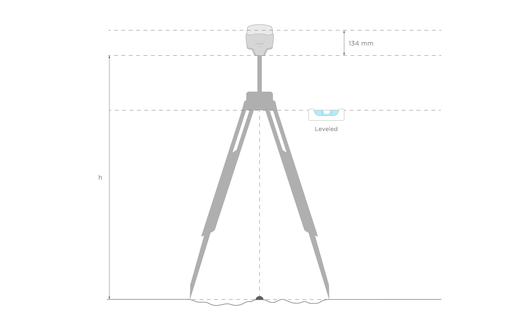 Figure 2. Antenna height
When you placed Reach over the mark and measured the antenna height, you are ready to set up the base position in the Emlid Flow app.
Setting up base’s coordinates in Emlid Flow
Once your base receives RTK corrections from the NTRIP service, follow these steps to get your base's coordinates in the Emlid Flow app:
-
Open the Emlid Flow app and connect to your Reach.
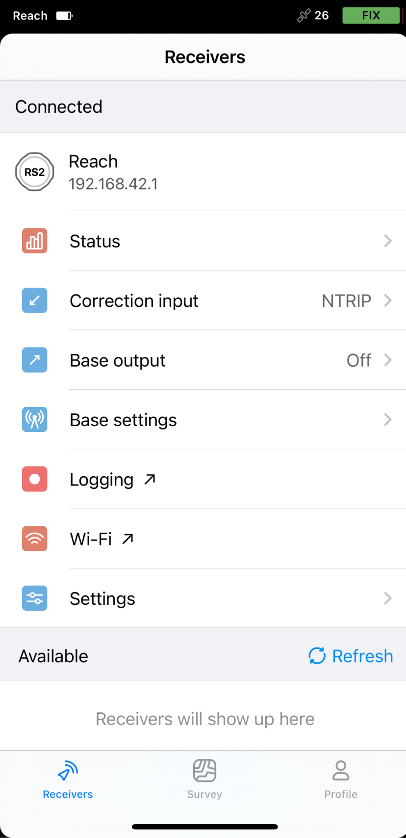
-
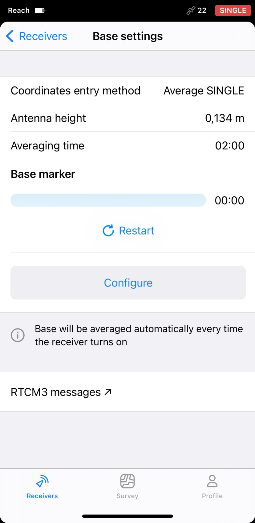
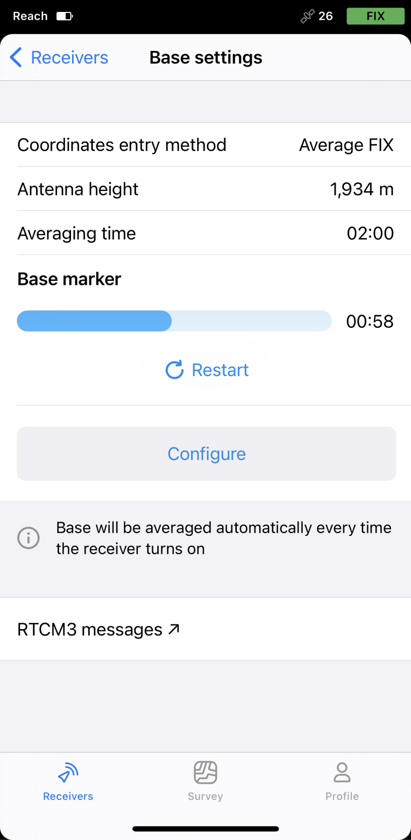
Go to Base settings and tap Configure.
-
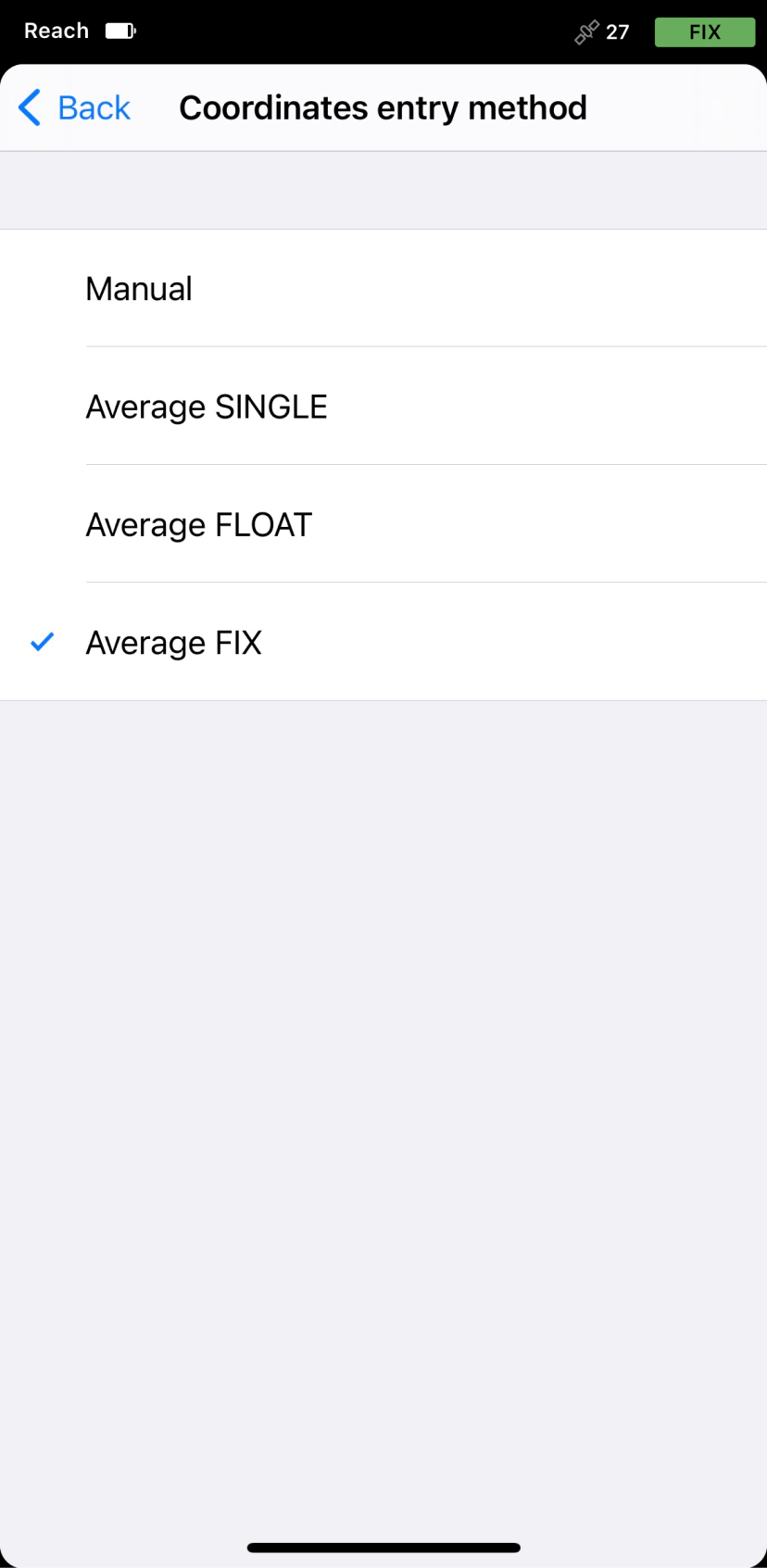
Tap Coordinates entry method and select Average FIX from the menu.
-
Tap Antenna height to set the antenna height and save it.
-
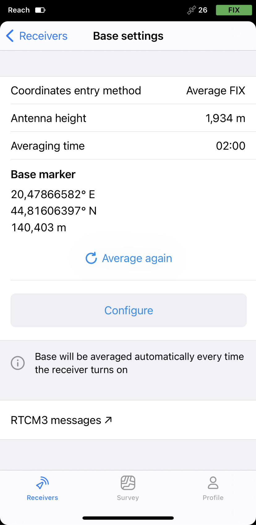
Set averaging time and tap Save. After accumulating the data, you will see averaged coordinates in the Base marker section.
 note
noteAfter setting up coordinate system for your project on the rover, make sure that your rover and base are in the same datum by checking the note in the project info.
Now your base’s coordinates are set, and you can continue setting up a project on your rover.