Calculate traverse
Upgrade your surveying experience with coding, linework, background maps, localization, and Traverse & Inverse tools
This guide explains how to use the Traverse tool in Emlid Flow and Emlid Flow 360 to create new geometry using the data from existing points.
Overview
The Traverse tool in Emlid Flow and Emlid Flow 360 allows you to create a new point using the known point data. All you need to create a new point is to specify its location relative to the known point by inputting distance,
Direction (azimuth) of a line AB, or from point A to B, is a horizontal angle in degrees, measured at point A clockwise between the direction to the north and the direction to point B.
The tool can assist you in such projects as:
- Transferring a survey plan to a real site: transferring a survey plan, such as coordinate geometry descriptions, to accurately recreate the features on the site.
- Fast design in the field: some designs can be imperfect and simply do not contain all the necessary points. If you are building a rectangular object, such as a swimming pool, you only need one corner coordinate and the other three points can be built in Emlid Flow 360.
- Calculating inaccessible or new points: You can use Traverse to get the coordinates of a point that you can't actually measure or want to add. For example, if something is placed over the point or something blocks the view of the sky there.
Depending on the
Coordinate system is a coordinate-based local, regional or global system used to locate geographical entities. A spatial reference system defines a specific map projection, as well as transformations between different spatial reference systems.
Direction (azimuth) of a line AB, or from point A to B, is a horizontal angle in degrees, measured at point A clockwise between the direction to the north and the direction to point B.
| CS type | Distance type | Azimuth type |
|---|---|---|
| Global CS | Ground distance Ground distance is the distance measured on the actual surface of the Earth, taking the mean elevation of the measured points into account. | True North azimuth True North azimuth is the angle ranging from 0 to 360 degrees measured clockwise between True North and the direction to a point of interest. |
| Local CS | Grid distance Grid distance is the distance measured on the projection flat plane. | Grid North azimuth Grid North azimuth is the angle measured clockwise between a line parallel to the central meridian, and the direction to a point of interest (a straight line between two points on the projection flat plane). |
See our Introduction to coordinate systems guide to learn more about distance and azimuth types in different CSs.
General workflow
- Emlid Flow
- Emlid Flow 360
To apply the Traverse tool in the Emlid Flow app, follow these steps:
-
Open Emlid Flow and either create a new project or access an existing one.
-
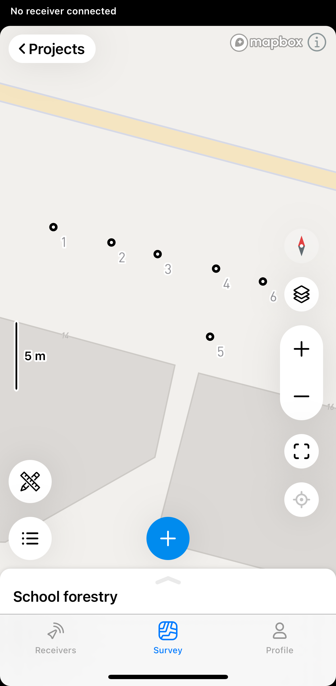
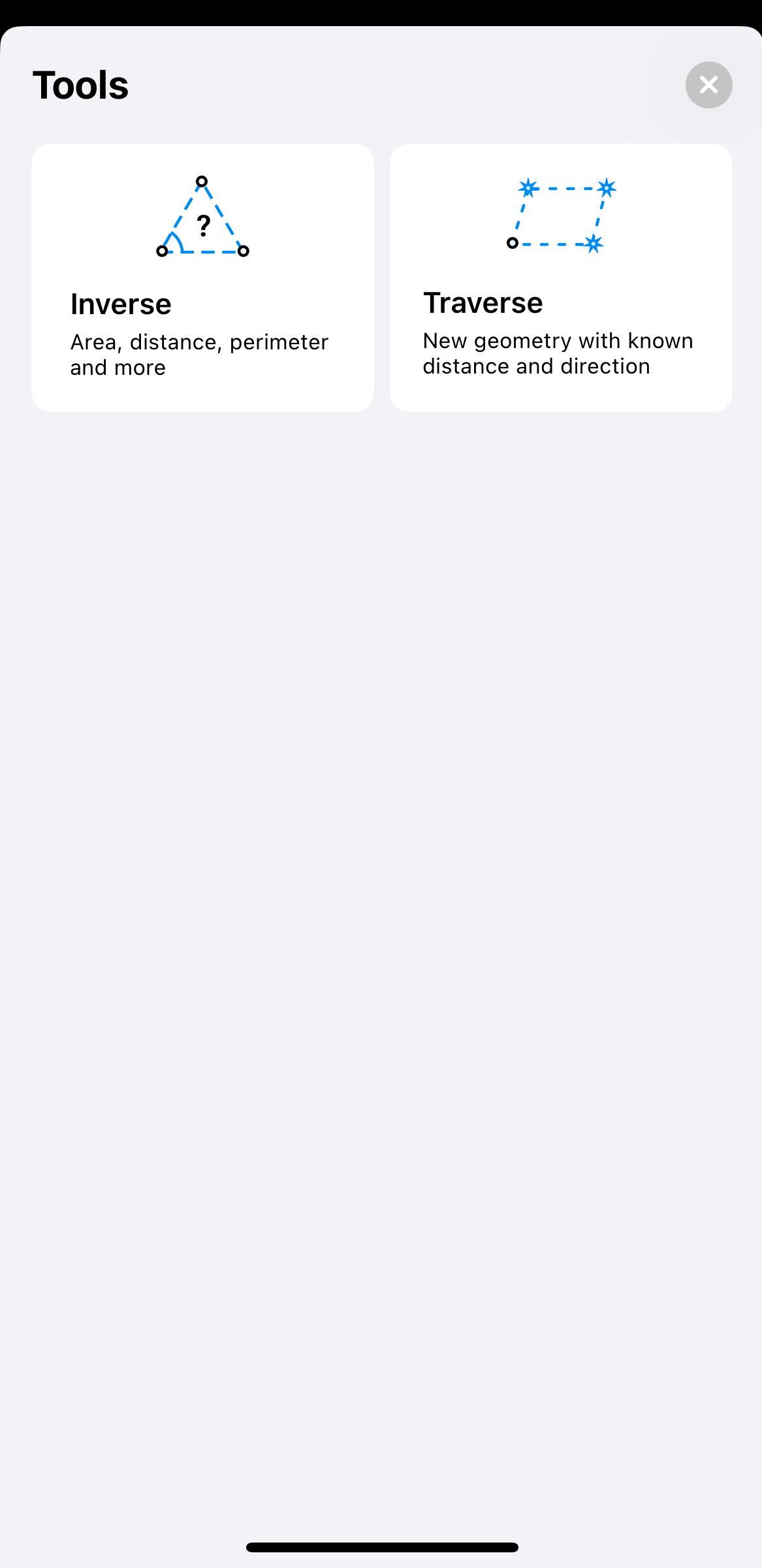
Tap the tools button at the bottom left corner of the screen.
-
Tap Traverse.
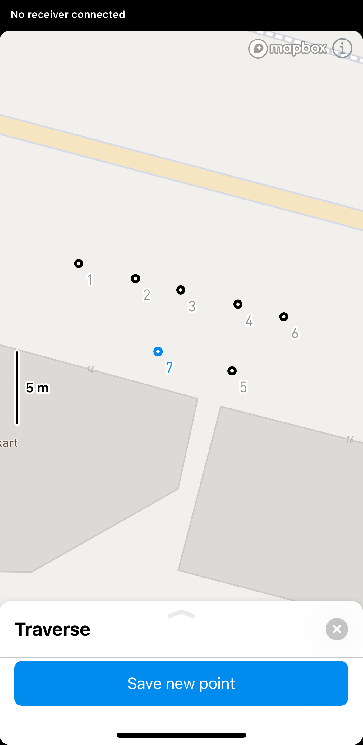
-
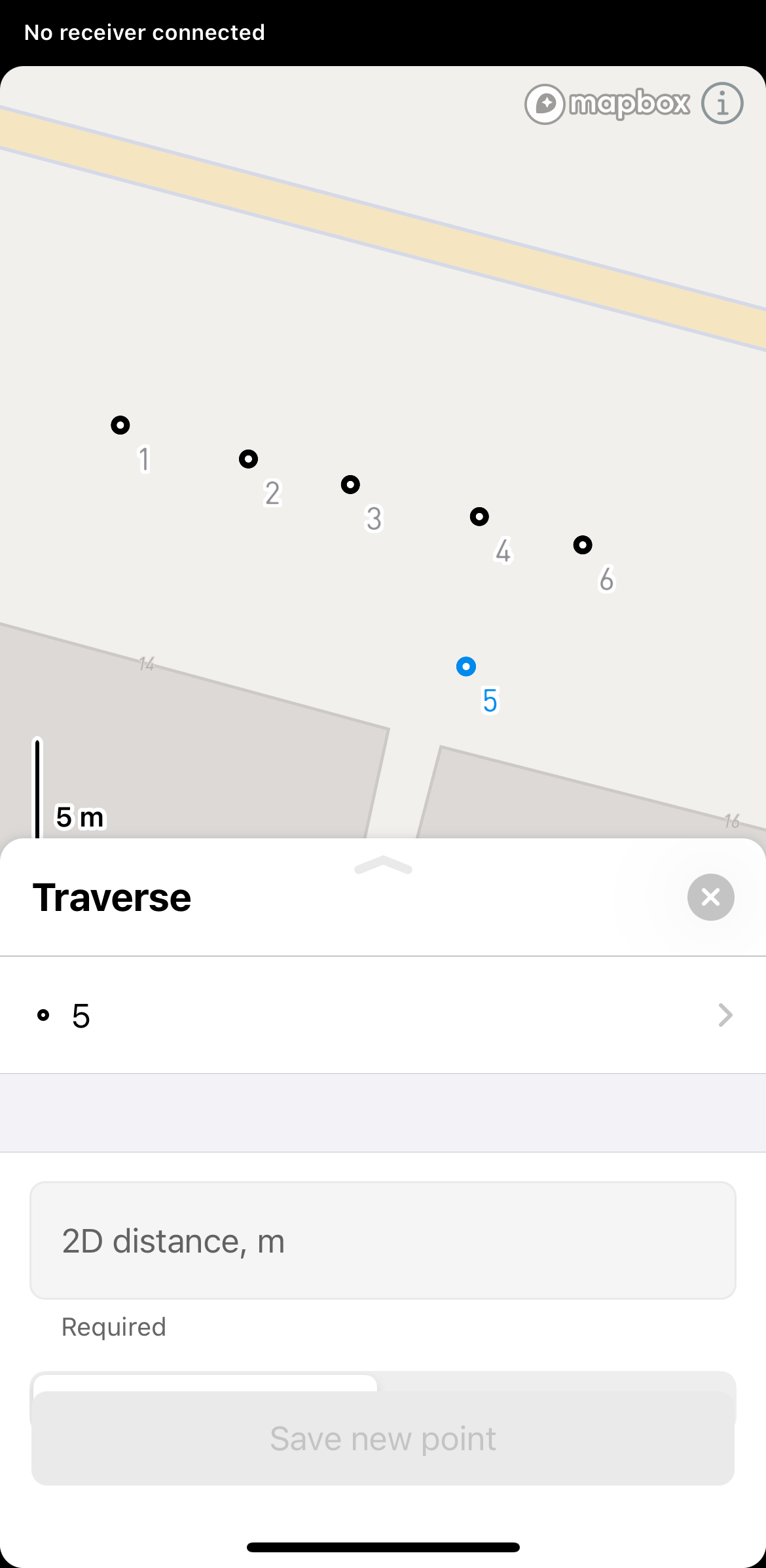
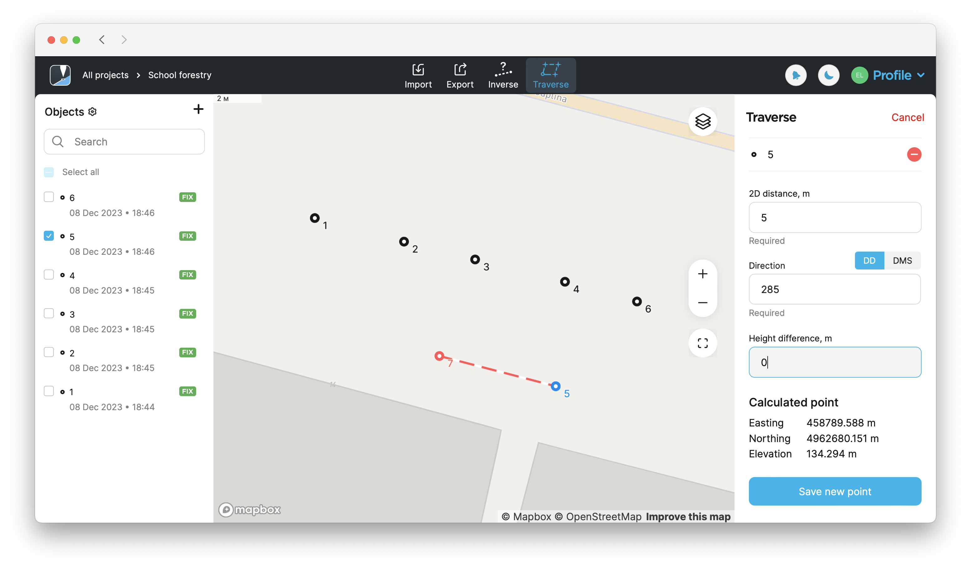
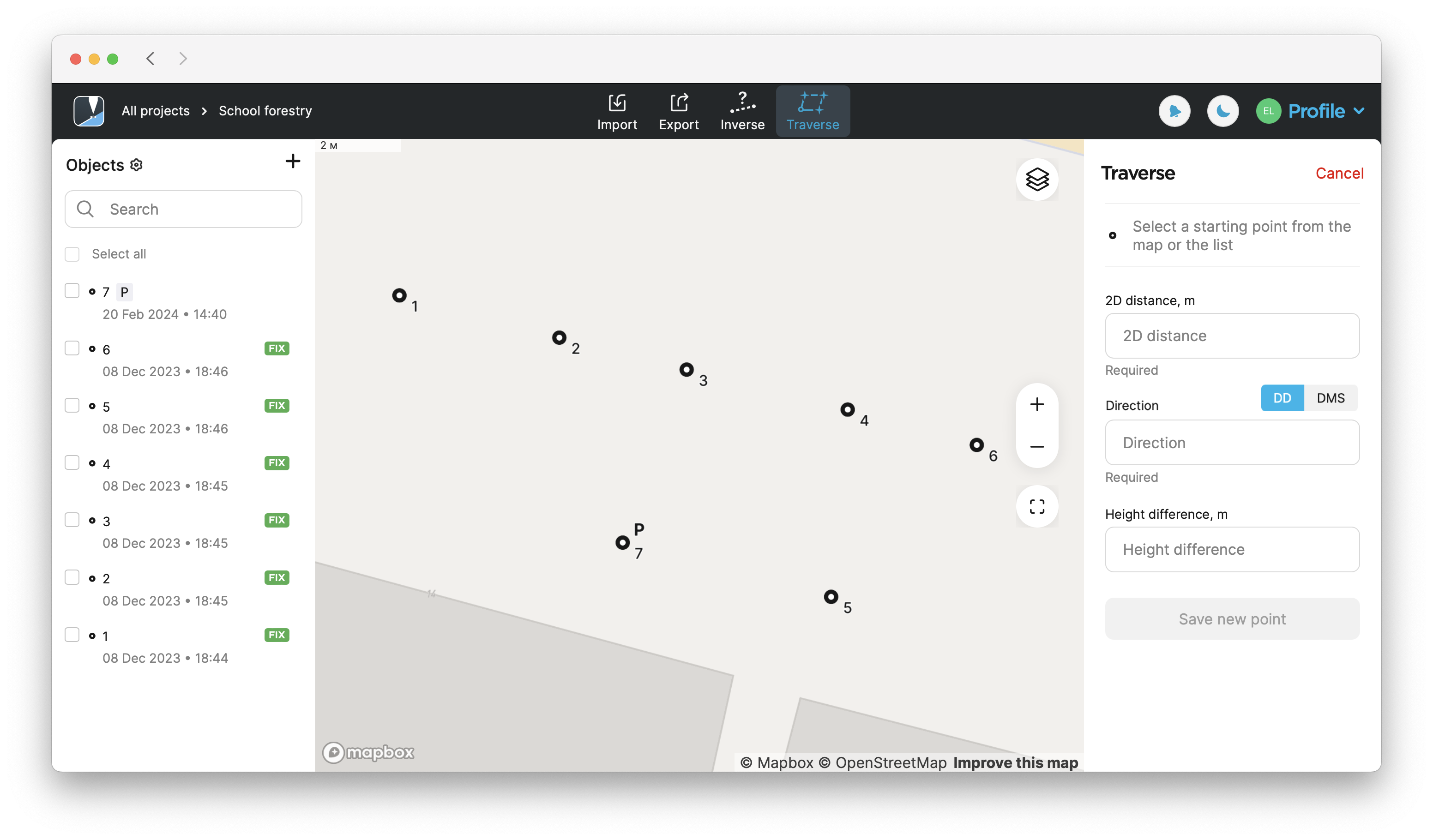
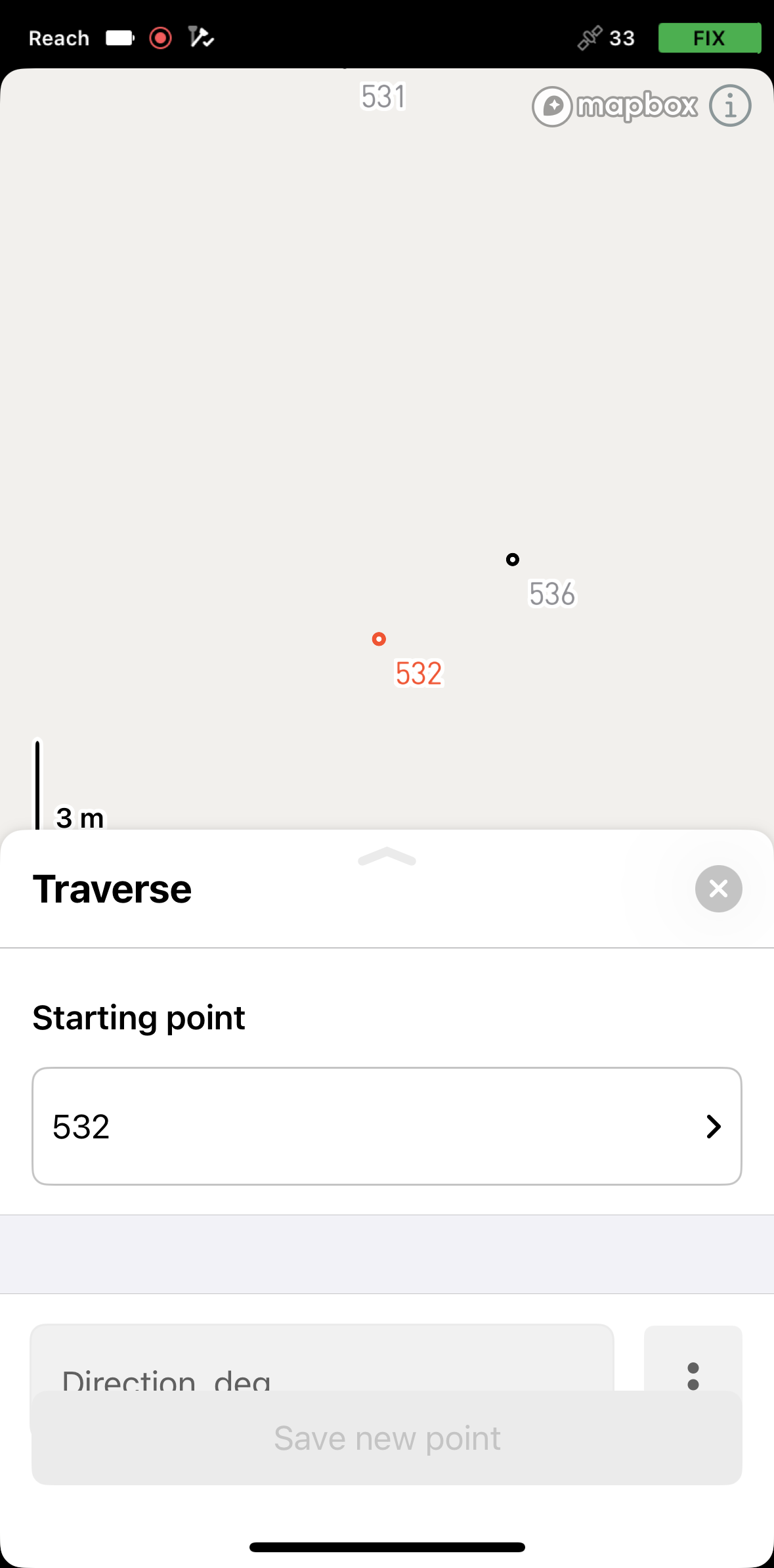
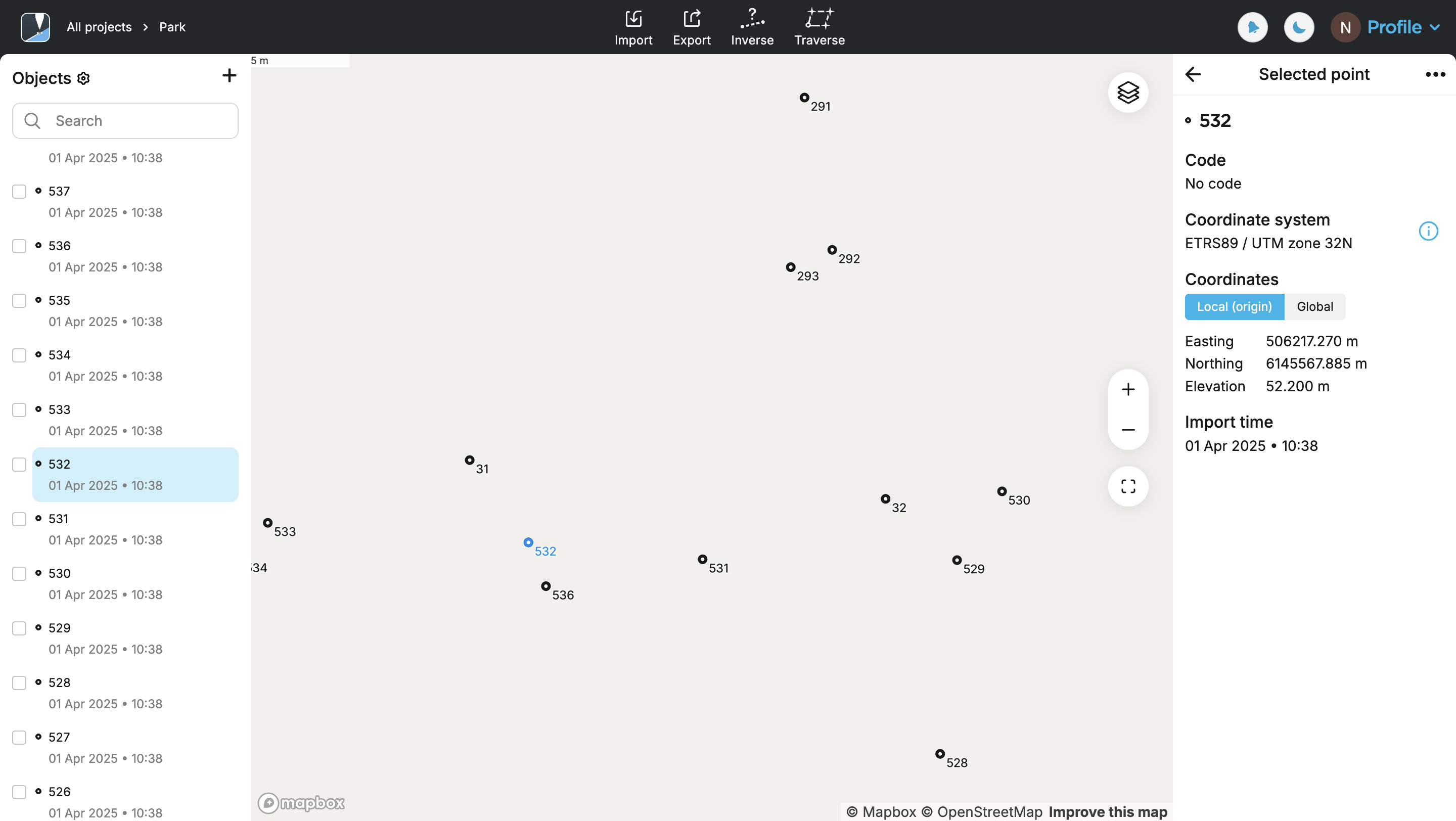
Select a start point from the map or the list.
-
Swipe the drawer up to enter the data for a new point.
-
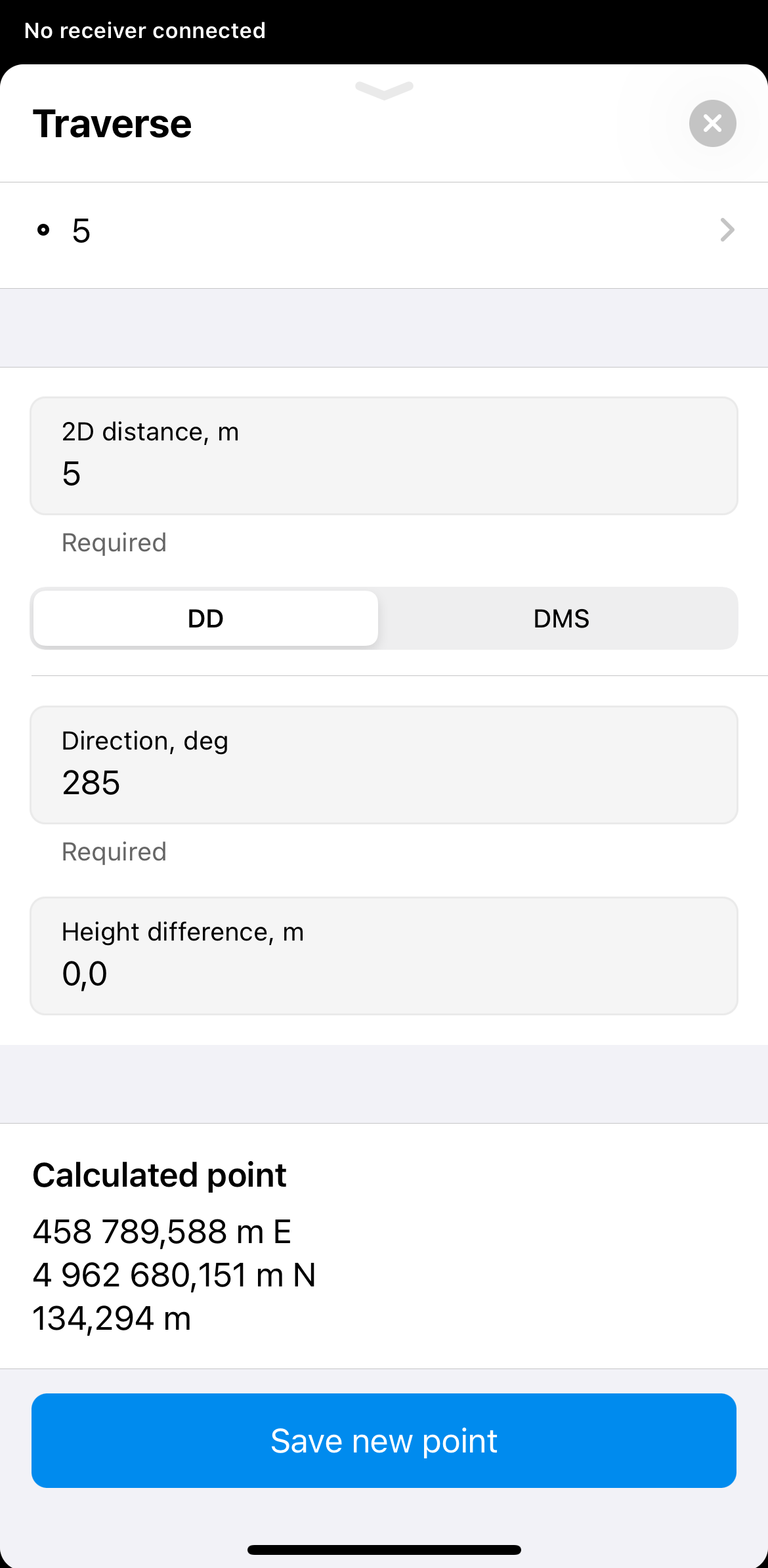
Enter the distance, direction (azimuth), and height difference from this point to create a new point.
noteDistance must start from 0.
Direction (azimuth)must be in the range 0-360 and can be in the DD or DMS format.Direction (azimuth) of a line AB, or from point A to B, is a horizontal angle in degrees, measured at point A clockwise between the direction to the north and the direction to point B.
 tip
tipTo create a fast design when the initial direction is known, you can simply add the needed angle in the next calculations. For example, your first point is calculated with the azimuth of 34; if you need to build a square, add 90 every time, so it will be 124, 214, and so on.
-
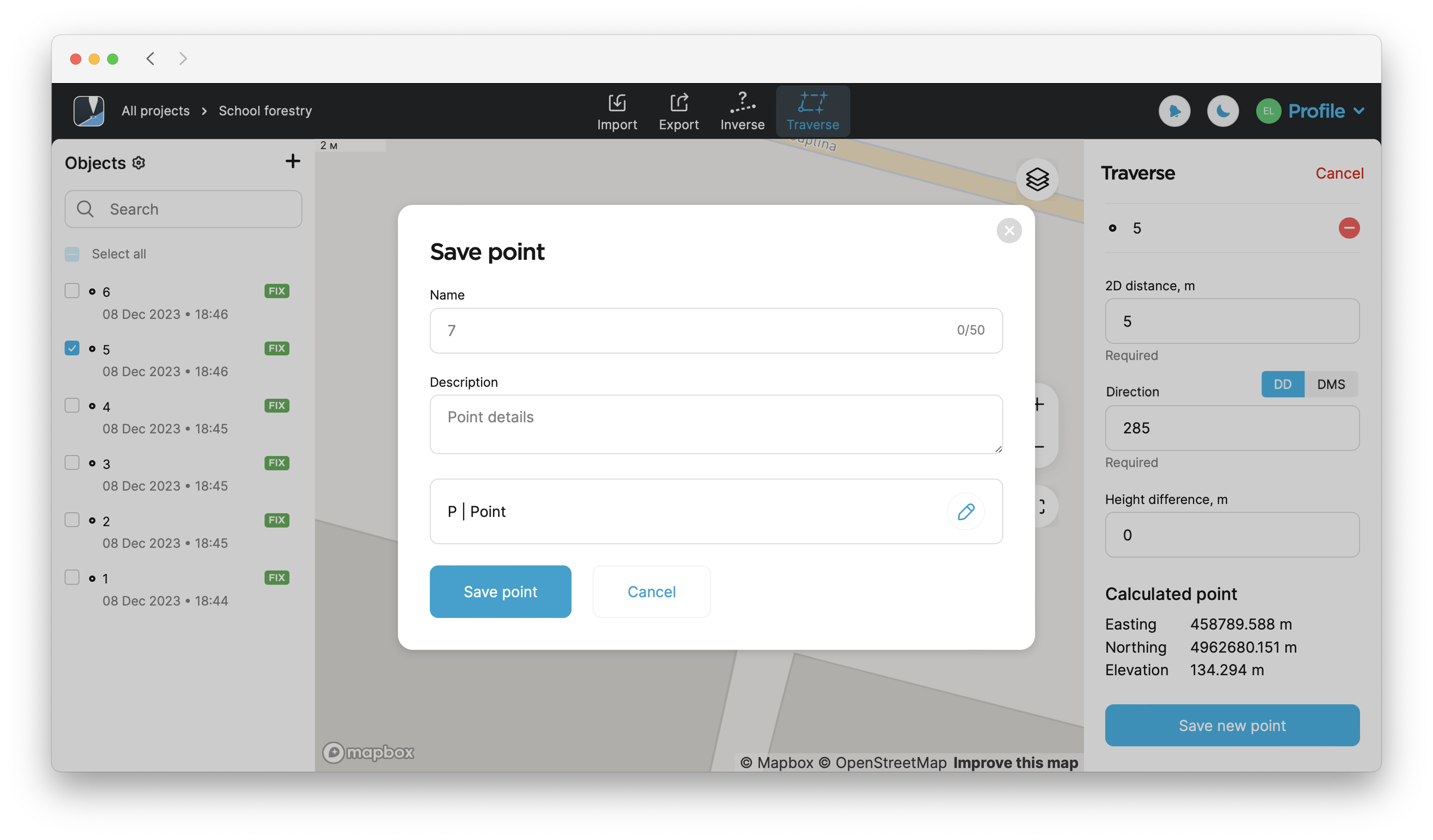
Tap Save new point.
-
Enter the name, fill in the description, and assign a code for your new point.
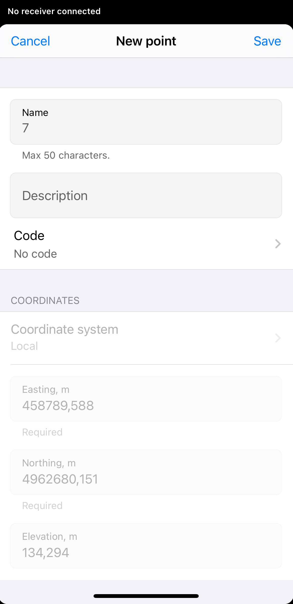 tip
tipIf you select a line as the survey code for your new points, you can then use the Create line feature to join them together into a line.
-
Tap Save in the upper-right corner. Now, your new point has been saved into your project.
-
To exit the Traverse calculation mode, tap Cancel in the upper-right corner of the drawer.
To apply the Traverse tool in the Emlid Flow 360 app, follow these steps:
-
Access Emlid Flow 360 and either create a new project or access an existing one.
-
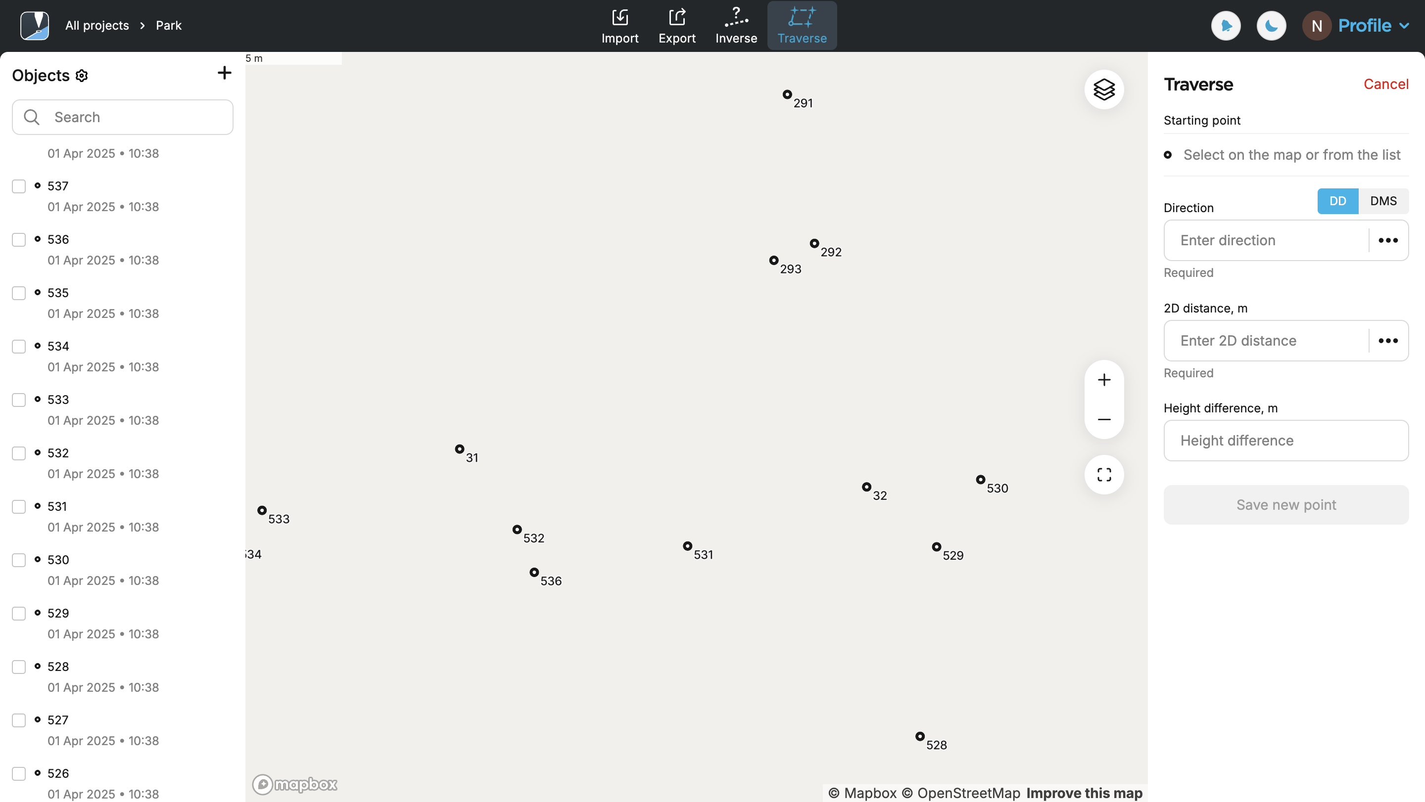
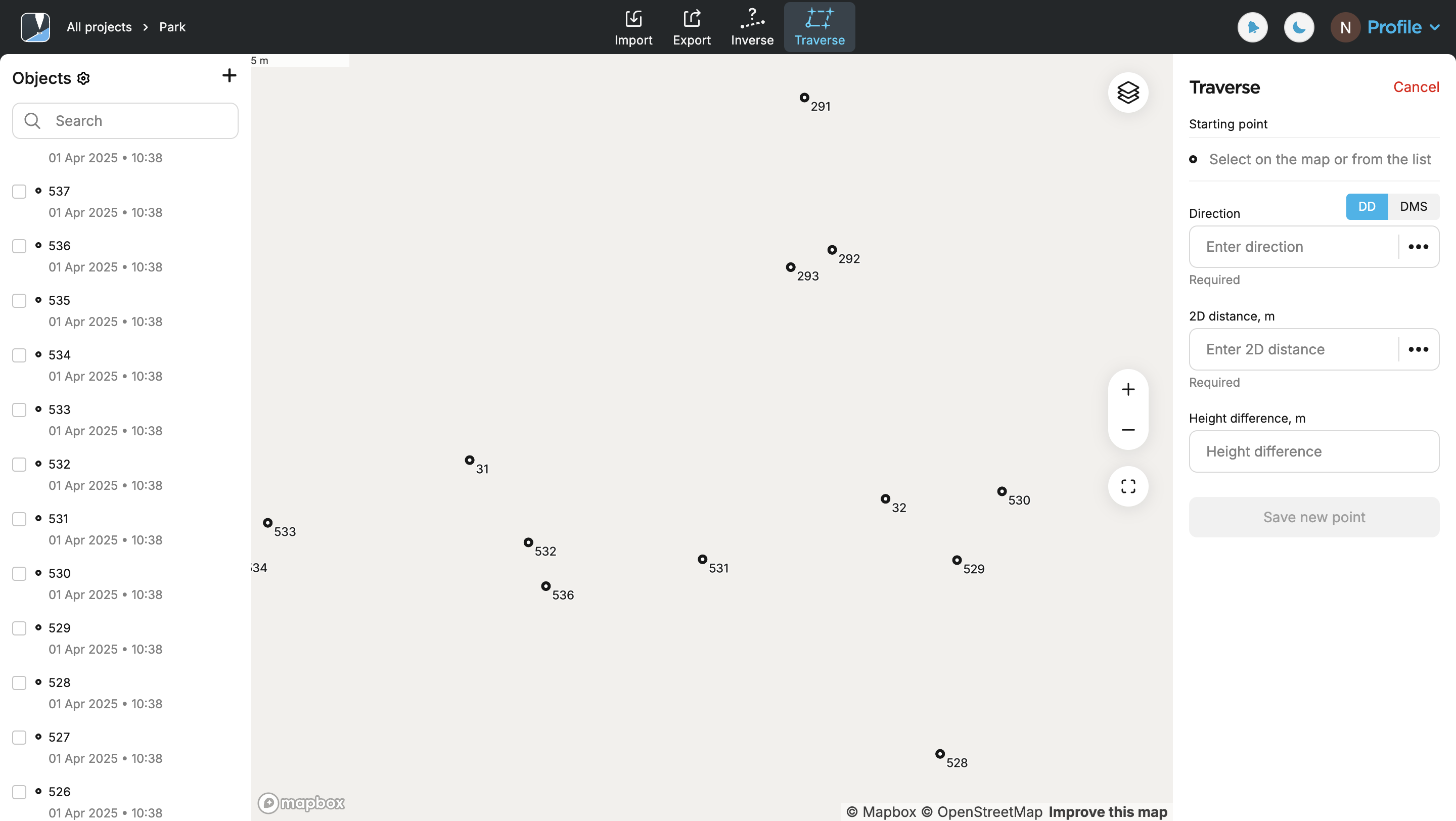
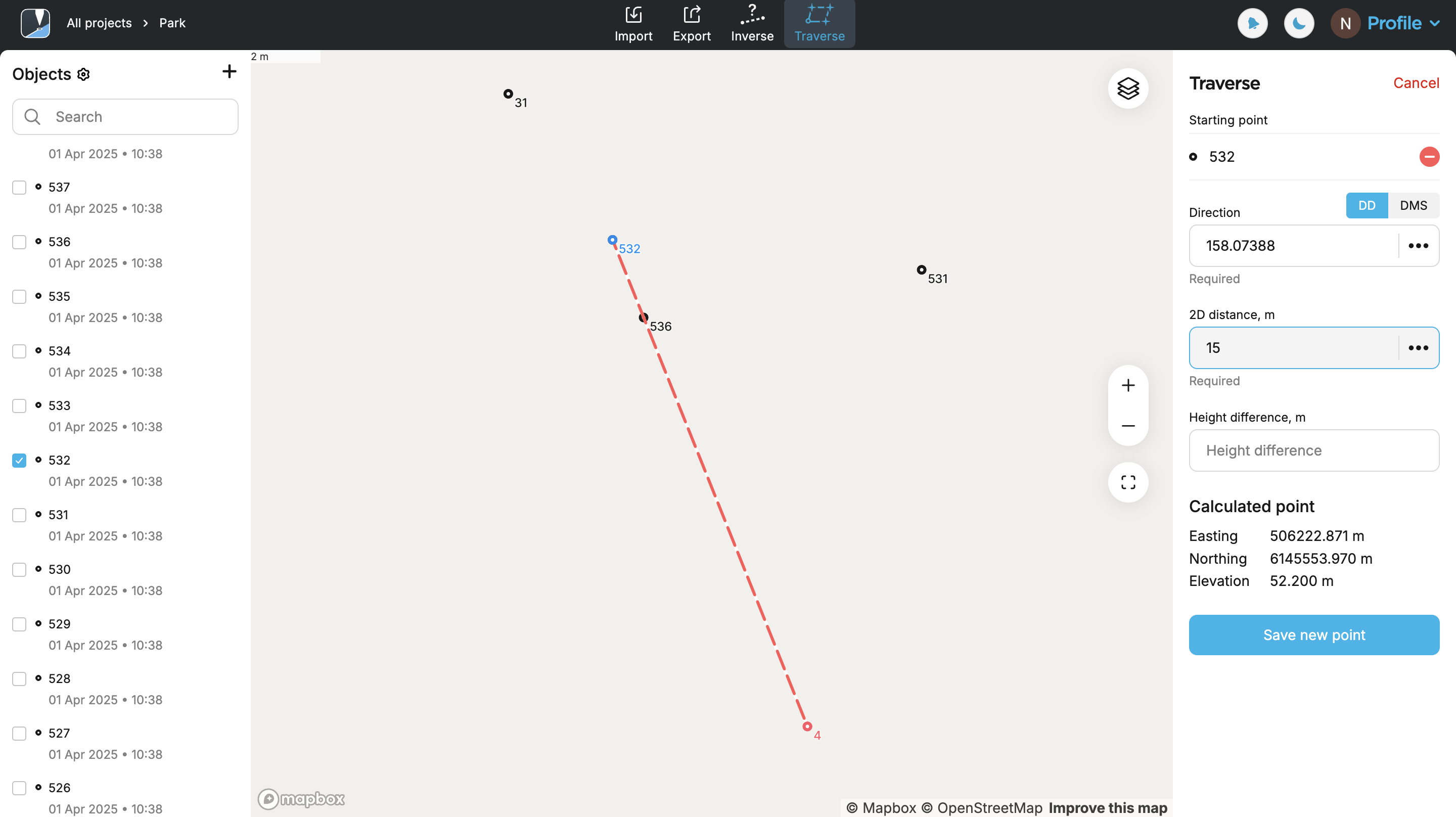
Tap Traverse at the top of the screen.
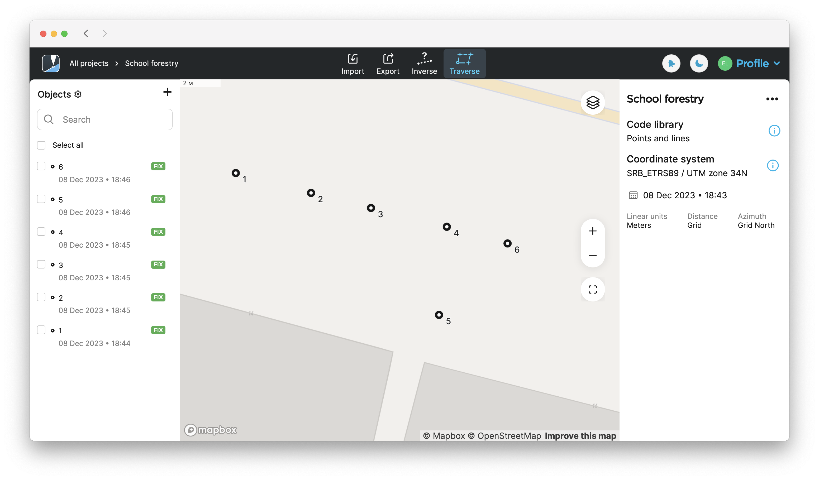
-
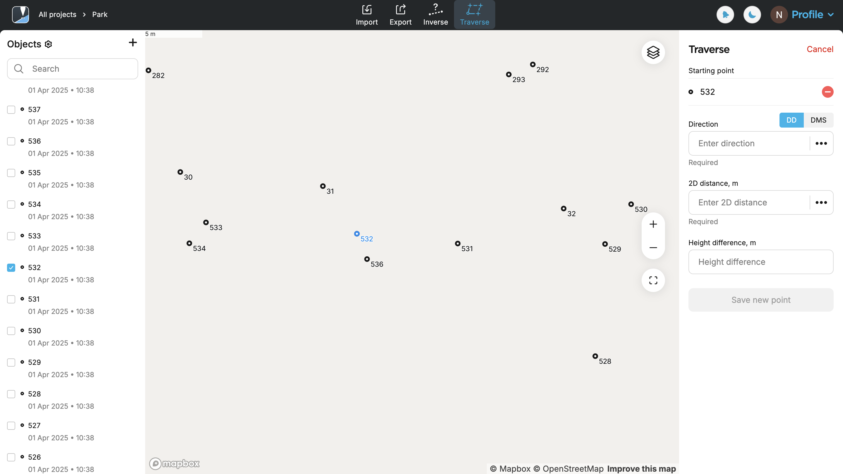
Select a starting point from the map or the list.
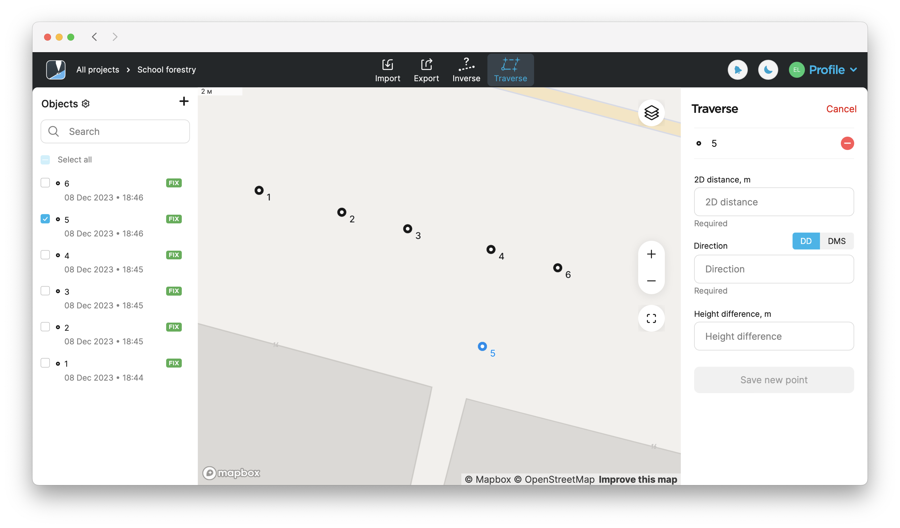
-
Enter the distance,
direction (azimuth), and height difference from this point to create a new point. Tap Save new point.Direction (azimuth) of a line AB, or from point A to B, is a horizontal angle in degrees, measured at point A clockwise between the direction to the north and the direction to point B.
noteDistance must start from 0.
Direction (azimuth)must be in the range 0-360 and can be in the DD or DMS format.Direction (azimuth) of a line AB, or from point A to B, is a horizontal angle in degrees, measured at point A clockwise between the direction to the north and the direction to point B.
To create a fast design when the initial direction is known, you can simply add the needed angle in the next calculations. For example, your first point is calculated with the
Direction (azimuth) of a line AB, or from point A to B, is a horizontal angle in degrees, measured at point A clockwise between the direction to the north and the direction to point B.
-
Enter the name, fill in the description, and assign a code for your new point.
If you select a line as the survey code for your new points, you can then use the Create line feature to join them together into a line.
-
Tap Save point. Now your new point has been saved into your project.
-
To exit the Traverse calculation mode, tap Cancel in the upper-right corner.
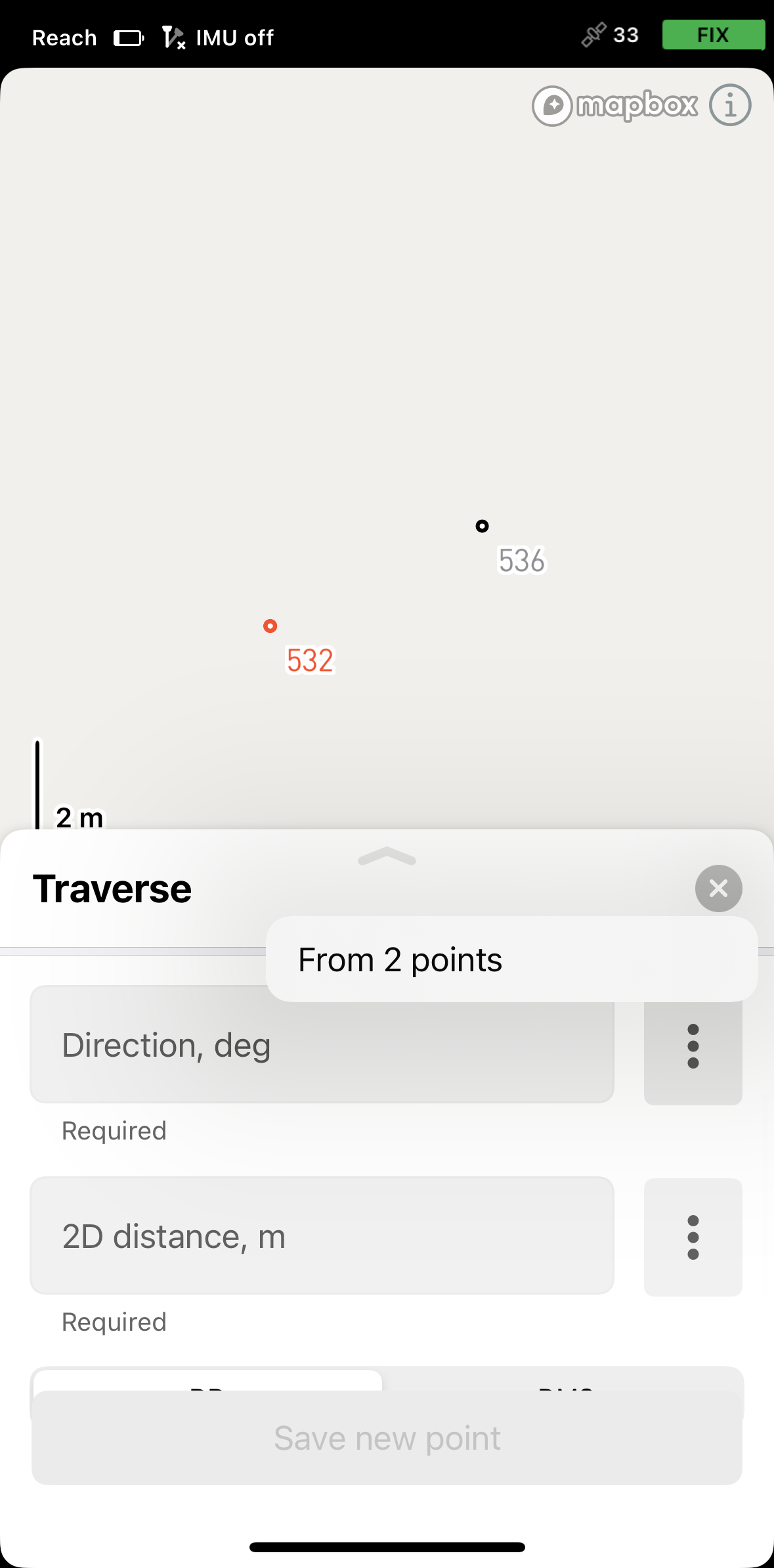
Calculating direction from two points
The Traverse tool allows you to calculate direction using two auxiliary points that are collected or added in advance and positioned on the same straight line as the calculated point. Follow the steps below:
- Emlid Flow
- Emlid Flow 360
-
Open Emlid Flow and either create a new project or access an existing one.

-
Tap Tools, then select Traverse.
-
Select the starting point. You can choose it from the map or the list.
-
For the direction, open the menu and select From two points.
-
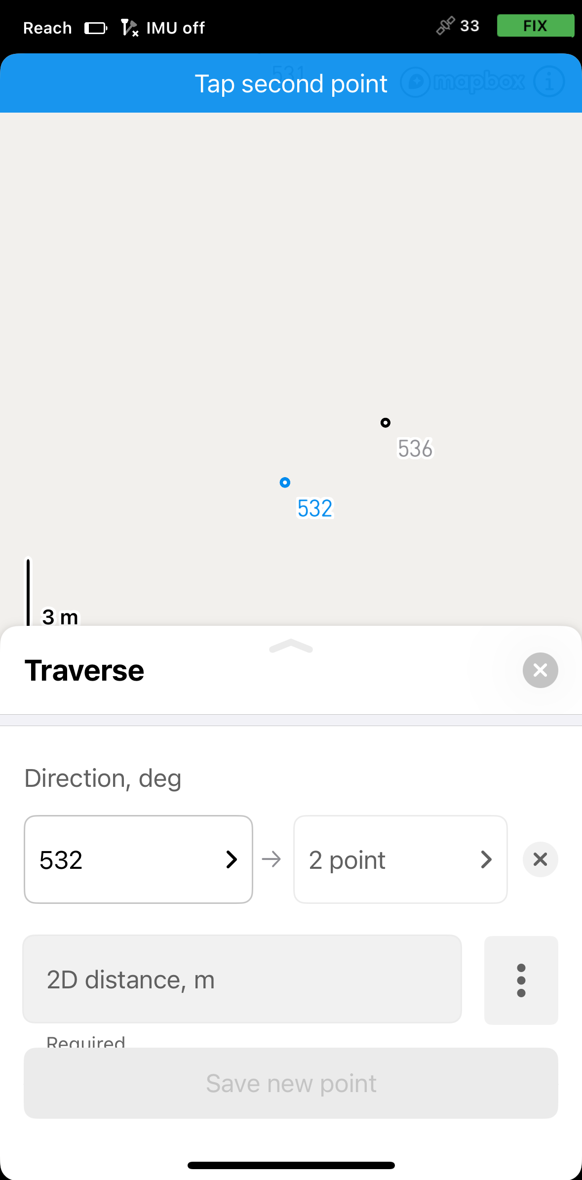
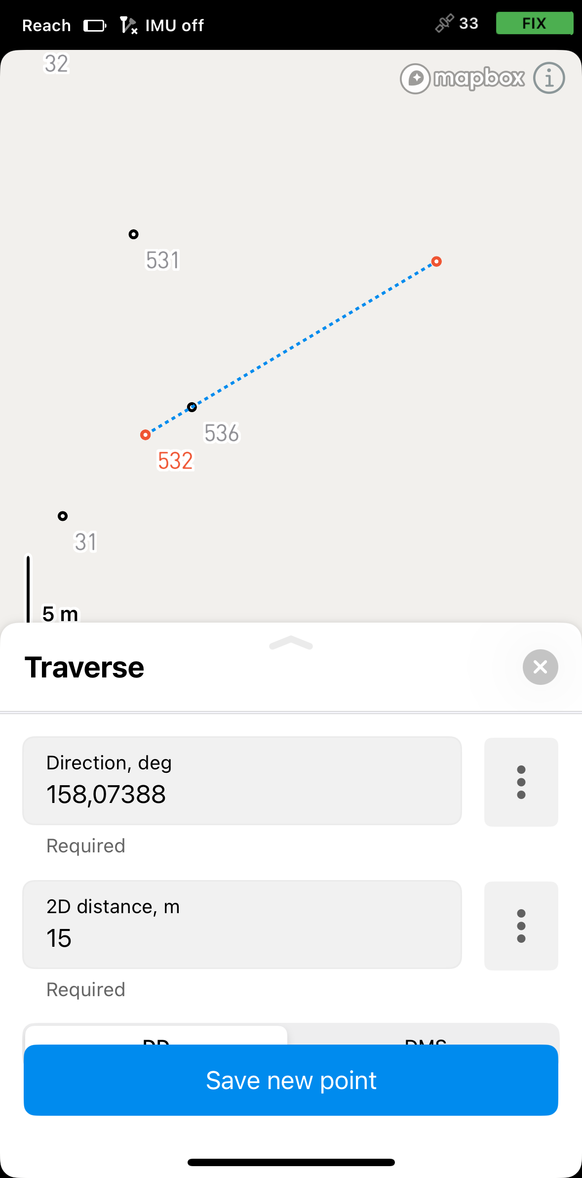
Select two auxiliary points positioned on the same line as the calculated point.
-
Specify the distance between the auxiliary points and enter the value in the corresponding field.
-
Save the new point.
-
Access Emlid Flow 360 and open a project.
-
Select Traverse at the top of the screen.
-
Select the starting point. You can choose it from the map or the list.
-
For the direction, open the menu and select From two points.
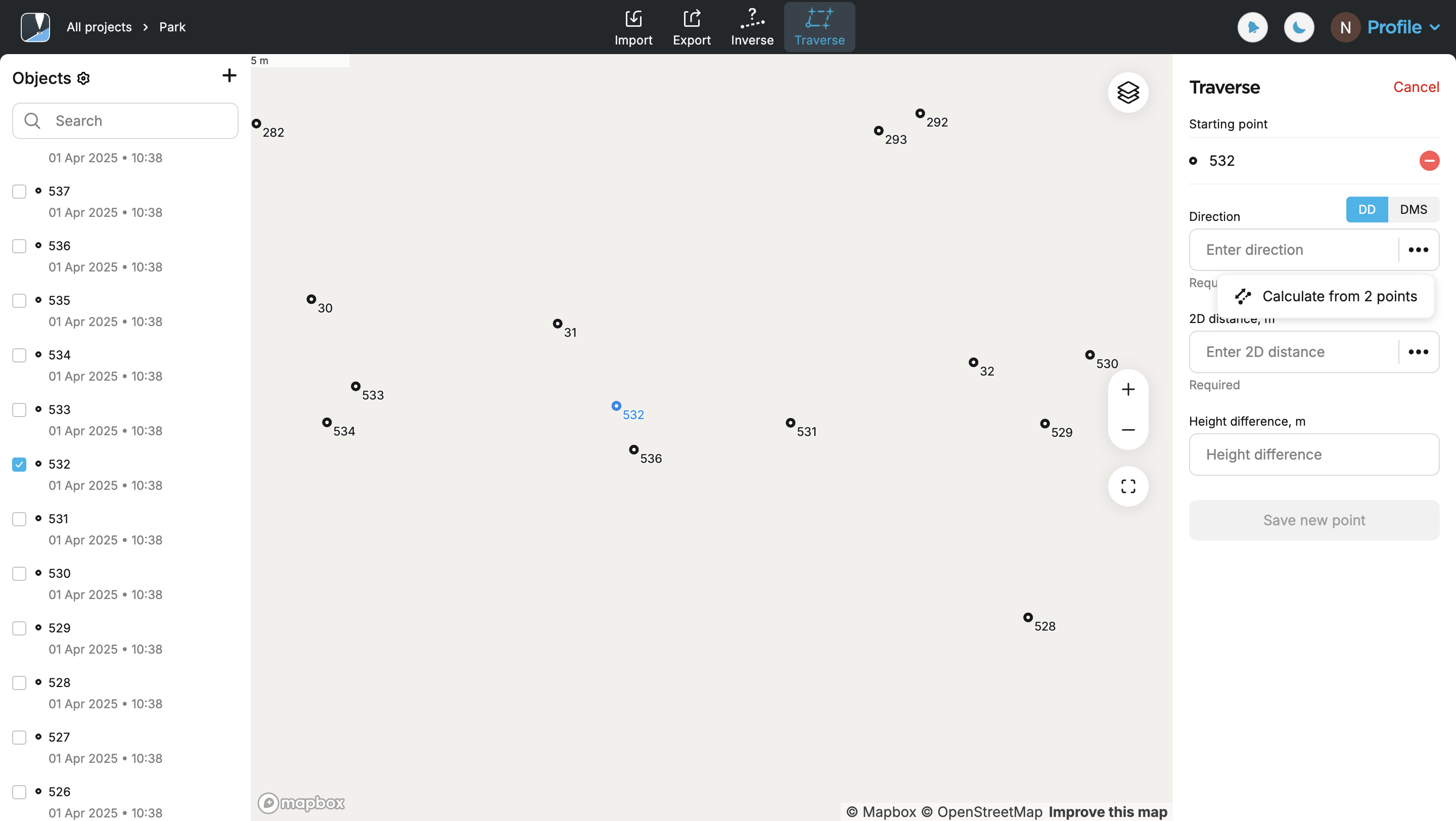
-
Select two points which must be exactly on the same line with the calculated point.
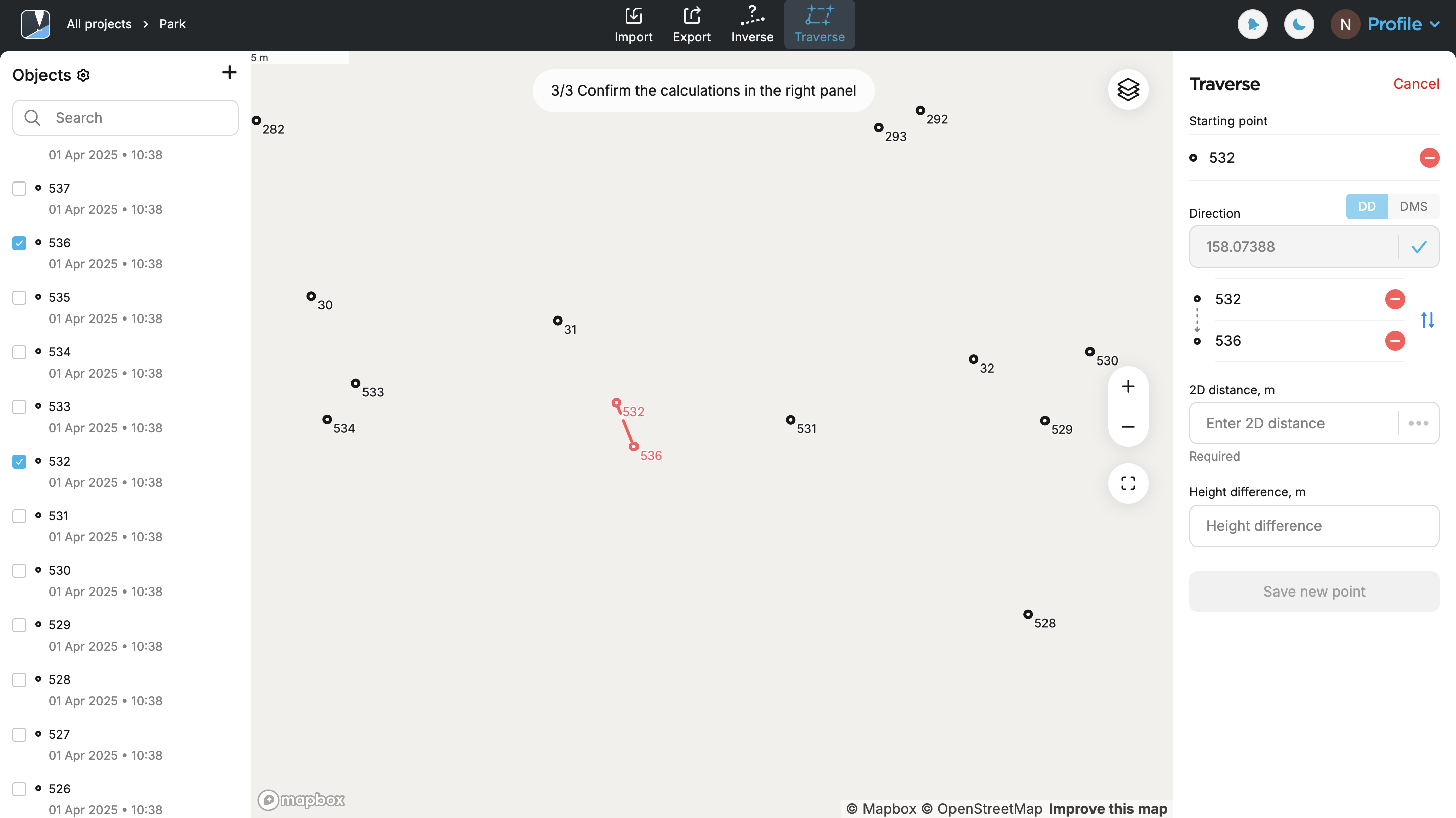
-
Confirm the calculation of the direction.
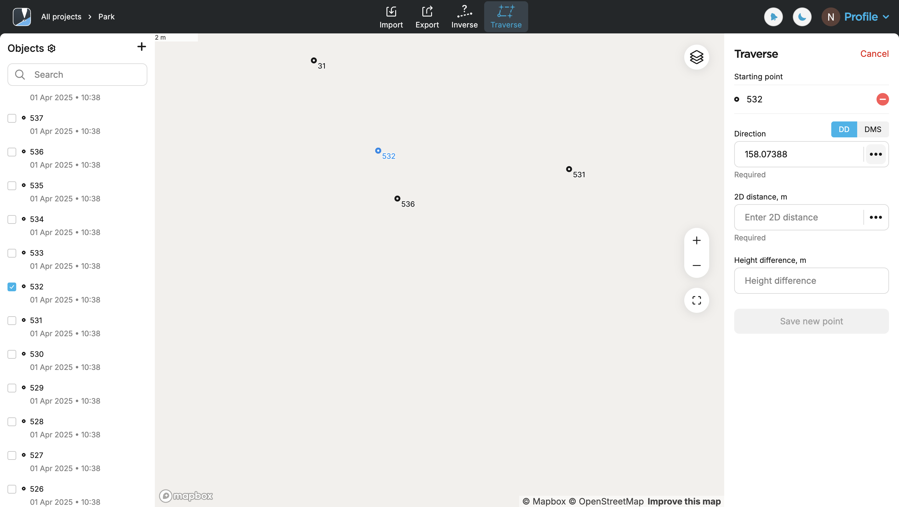
-
Specify the distance measured between the auxiliary points.
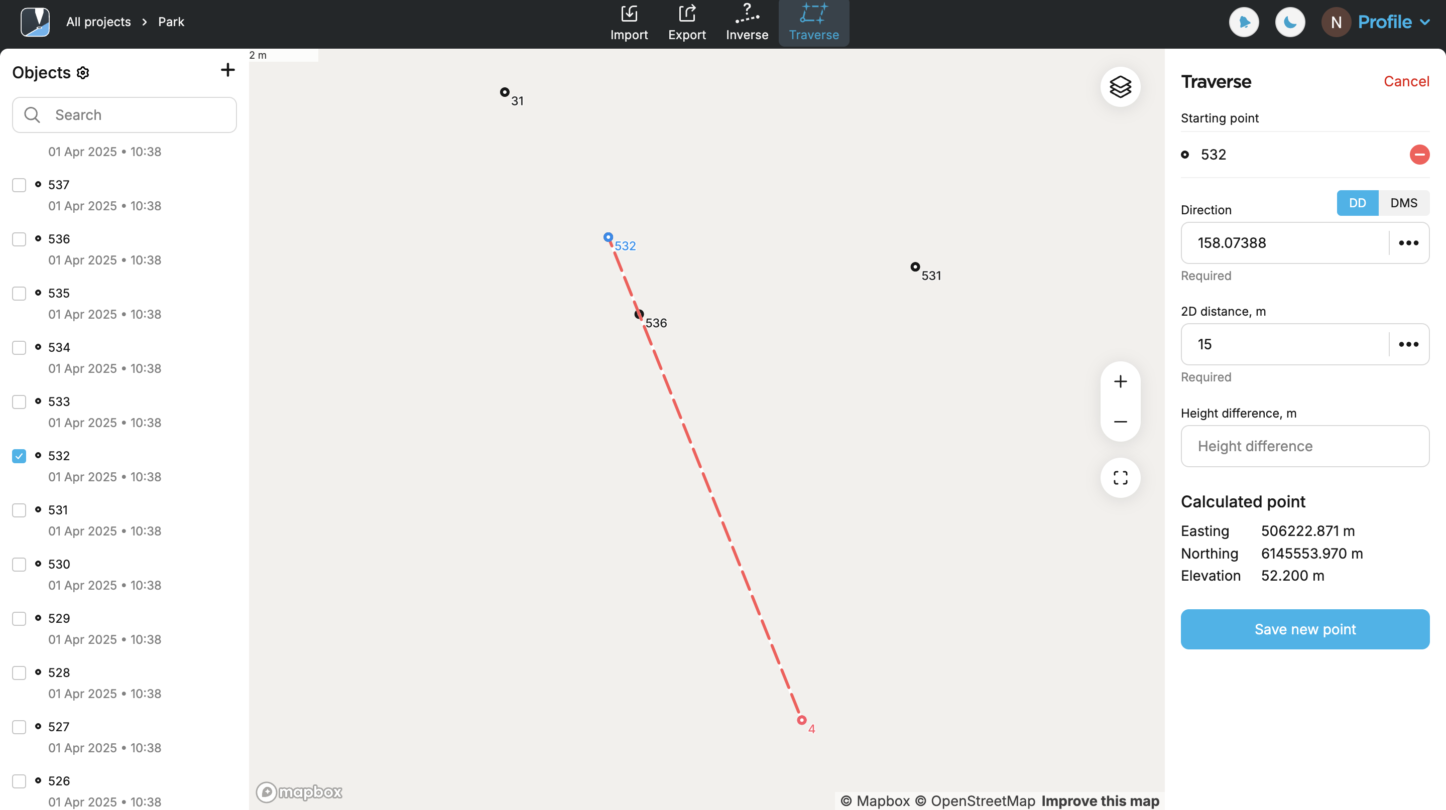
-
Save new point.
Video guide
Check out the workflow in the video below: