Calcolo inverso
Sblocca il set completo di funzionalità per rilievi topografici, di tracciamento e as-built
Questa guida spiega come utilizzare lo strumento Inverse in Emlid Flow ed Emlid Flow 360 per calcolare dati di geometria delle coordinate come
Area of an object is the total amount of space enclosed by its shape on flat surface.
Direction (azimuth) of a line AB, or from point A to B, is a horizontal angle in degrees, measured at point A clockwise between the direction to the north and the direction to point B.
Panoramica
Lo strumento Inverse in Emlid Flow ed Emlid Flow 360 consente di calcolare i dati geometrici per i punti esistenti. Lo strumento può essere d'aiuto in progetti quali la pianificazione di opere di ingegneria civile o di pubblica utilità e il monitoraggio dell'avanzamento dei lavori.
Il software calcola i seguenti valori in base al numero di punti di input:
Quando si selezionano due o più punti:
- Direzione(
Direction (azimuth) of a line AB, or from point A to B, is a horizontal angle in degrees, measured at point A clockwise between the direction to the north and the direction to point B.
Azimut Nord effettivo,True North azimuth is the angle ranging from 0 to 360 degrees measured clockwise between True North and the direction to a point of interest.
Azimut Nord griglia)Grid North azimuth is the angle measured clockwise between a line parallel to the central meridian, and the direction to a point of interest (a straight line between two points on the projection flat plane).
- Distanza inclinata(
Slope distance from point A to point B is the length of the straight line AB, measured along the slope, taking the height difference between the points into account.
Distanza su pendenza,Ground distance is the distance measured on the actual surface of the Earth, taking the mean elevation of the measured points into account.
Distanza griglia inclinata)Grid distance is the distance measured on the projection flat plane.
- Distanza 2D (Distanza dal suolo 2D,
2D Ground distance between points A and B is the length of the shortest AB line on the surface of the ellipsoid.
Distanza dalla griglia 2D)2D Grid distance between points A and B is the length of the straight line AB on a flat plane.
- Dislivello
-
Pendenza
Grade of a line is the measure of its steepness, with larger values standing for steeper slopes and 0% indicating a horizontal line.
- Delta Est(solo per i punti in un SC locale)
Delta E/N between points A and B is the difference in their coordinates along the corresponding Easting and Northing axes.
- Delta Nord(solo per i punti in un SC locale)
Delta E/N between points A and B is the difference in their coordinates along the corresponding Easting and Northing axes.
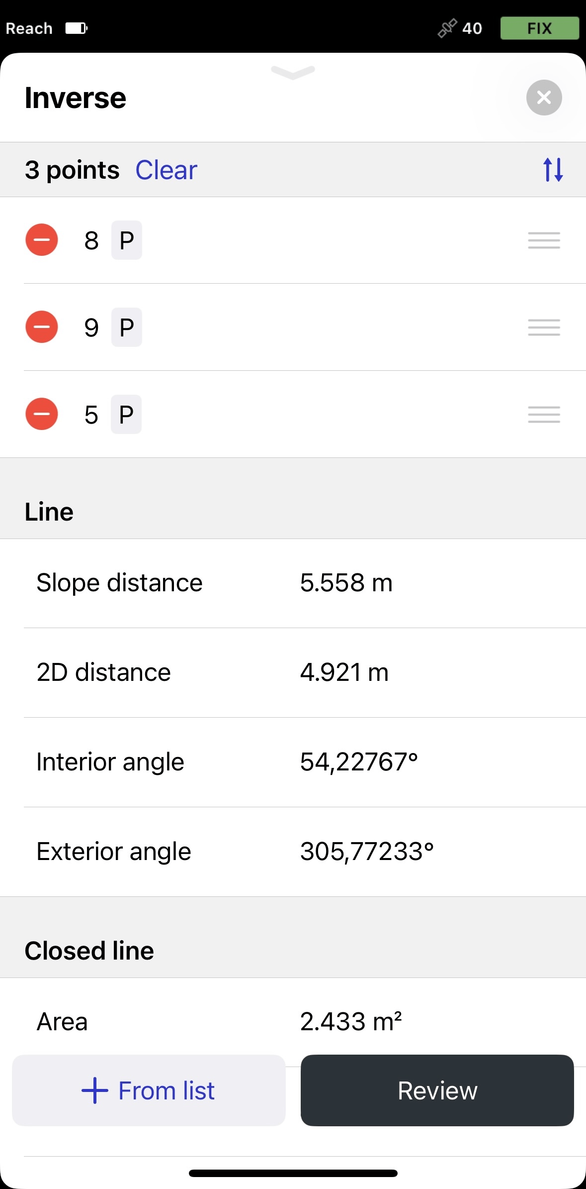
Quando si selezionano tre o più punti:
- Distanza inclinata(
Slope distance from point A to point B is the length of the straight line AB, measured along the slope, taking the height difference between the points into account.
Distanza su pendenza,Ground distance is the distance measured on the actual surface of the Earth, taking the mean elevation of the measured points into account.
Distanza griglia inclinata)Grid distance is the distance measured on the projection flat plane.
- Distanza 2D (Distanza dal suolo 2D,
2D Ground distance between points A and B is the length of the shortest AB line on the surface of the ellipsoid.
Distanza dalla griglia 2D)2D Grid distance between points A and B is the length of the straight line AB on a flat plane.
-
Area
Area of an object is the total amount of space enclosed by its shape on flat surface.
-
Perimetro inclinato
Slope perimeter of an enclosed object is the sum of slope distances of its sides with the height difference consideration.
-
Perimetro 2D
2D perimeter of an enclosed object is the sum of 2D distances of its sides without the height difference consideration.
A seconda del
Coordinate system is a coordinate-based local, regional or global system used to locate geographical entities. A spatial reference system defines a specific map projection, as well as transformations between different spatial reference systems.
| Tipo di SC | Tipo di distanza | Tipo di azimut |
|---|---|---|
| SC Globale | Distanza dal suolo Ground distance is the distance measured on the actual surface of the Earth, taking the mean elevation of the measured points into account. | Azimut Nord effettivo True North azimuth is the angle ranging from 0 to 360 degrees measured clockwise between True North and the direction to a point of interest. |
| SC Locale | Distanza dalla griglia Grid distance is the distance measured on the projection flat plane. | Azimut Nord di griglia Grid North azimuth is the angle measured clockwise between a line parallel to the central meridian, and the direction to a point of interest (a straight line between two points on the projection flat plane). |
Consultare la guida Introduzione ai sistemi di coordinate per saperne di più sui tipi di distanza e azimut nei diversi SC.
Quando si calcola l'
Area of an object is the total amount of space enclosed by its shape on flat surface.
Coordinate system is a coordinate-based local, regional or global system used to locate geographical entities. A spatial reference system defines a specific map projection, as well as transformations between different spatial reference systems.
Area of an object is the total amount of space enclosed by its shape on flat surface.

L'
Area of an object is the total amount of space enclosed by its shape on flat surface.
Coordinate system is a coordinate-based local, regional or global system used to locate geographical entities. A spatial reference system defines a specific map projection, as well as transformations between different spatial reference systems.
Flusso di lavoro
- Emlid Flow
- Emlid Flow 360
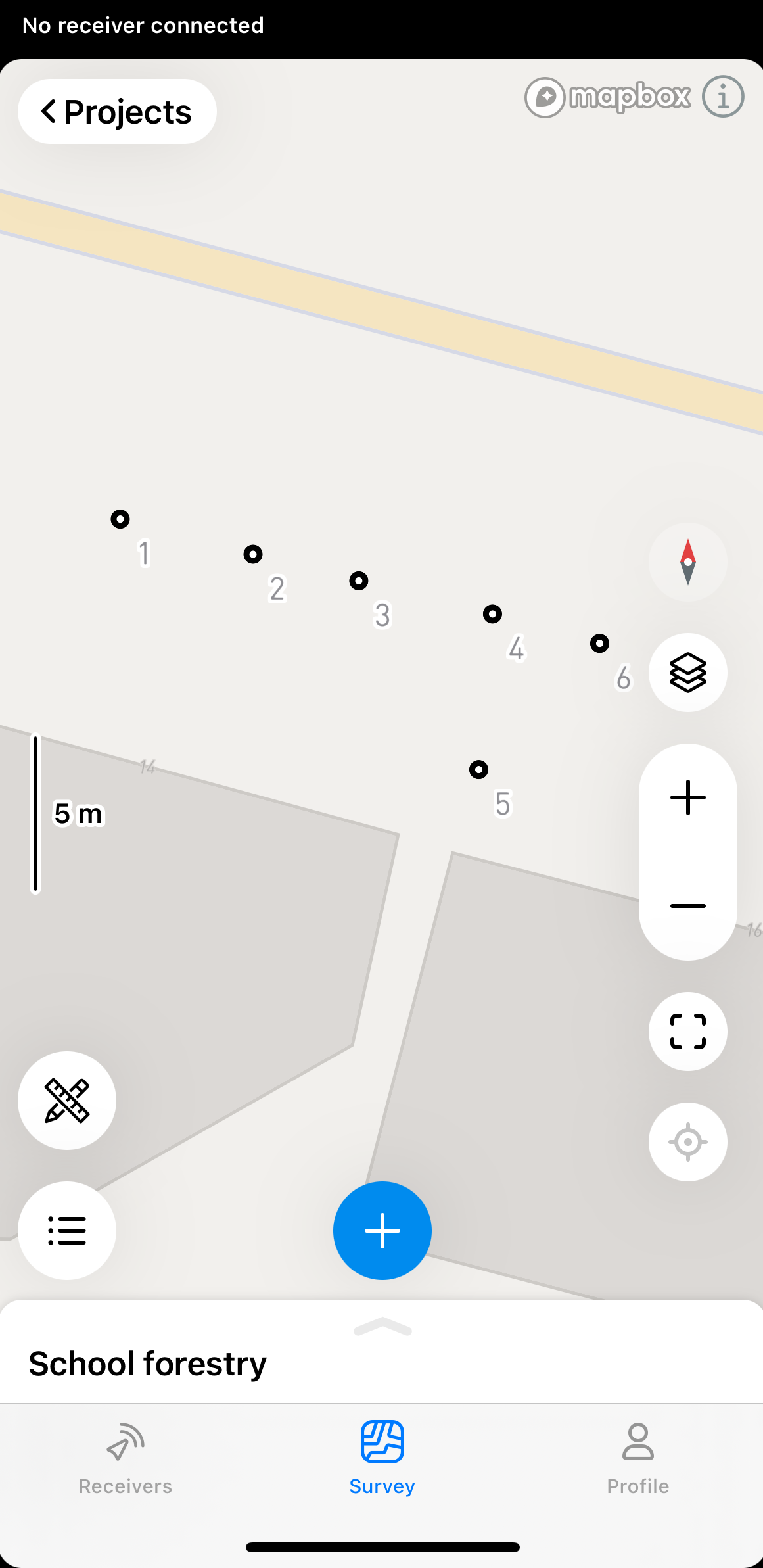
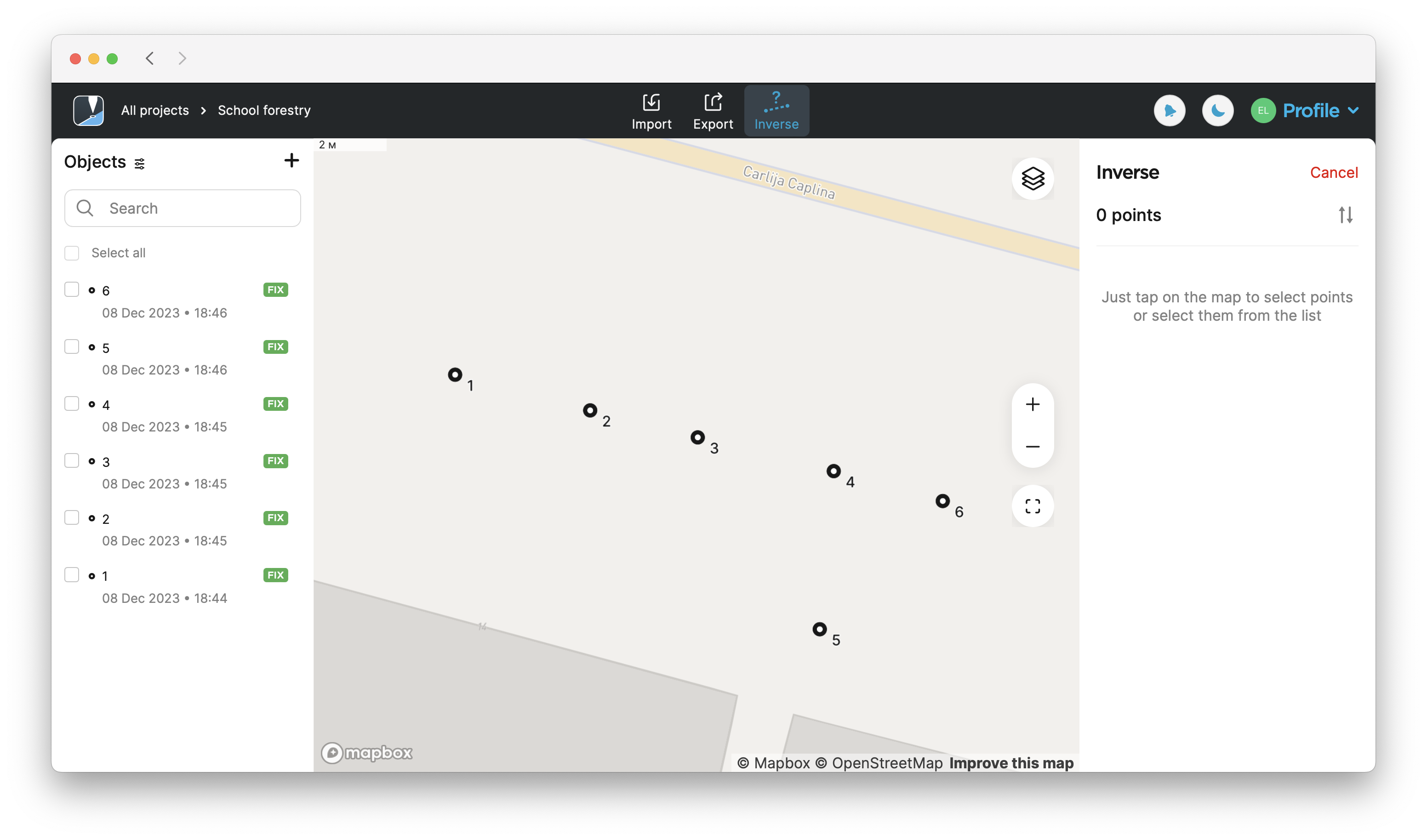
Per utilizzare lo strumento Inverse nell'app Emlid Flow, attenersi alla seguente procedura:
-
Aprire il progetto in Emlid Flow.
-
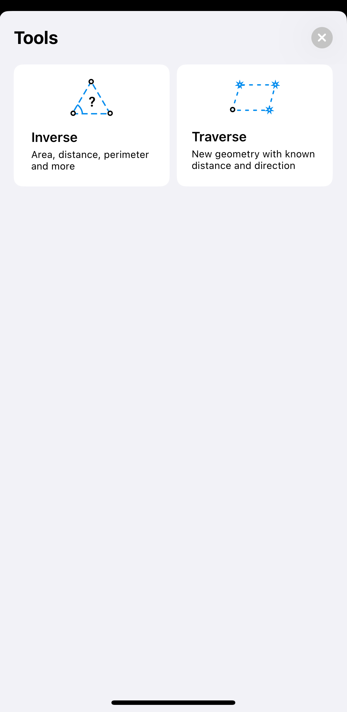
Toccare il pulsante degli strumenti nell'angolo in basso a sinistra dello schermo.
-
Toccare Inverse.
-
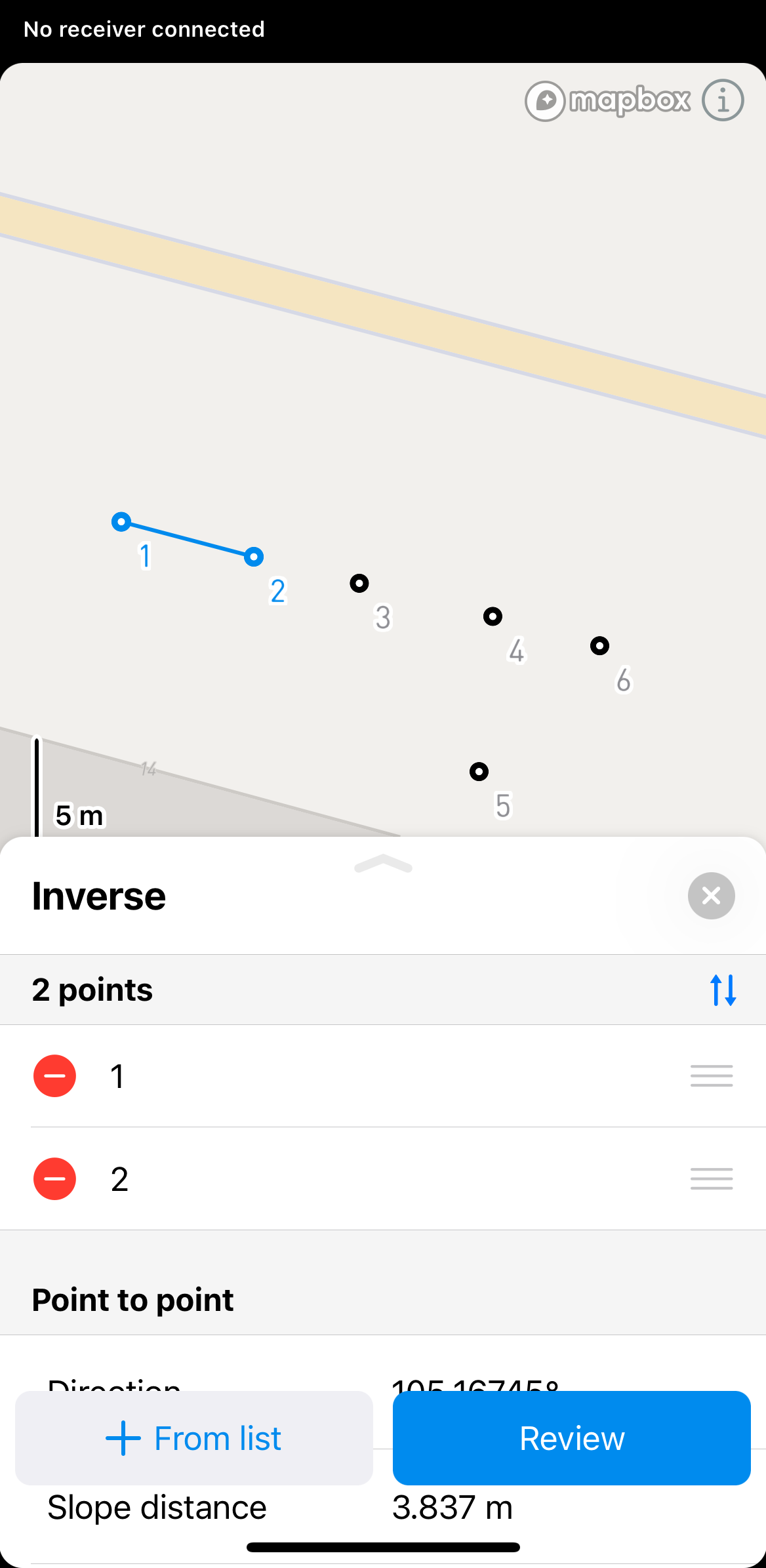
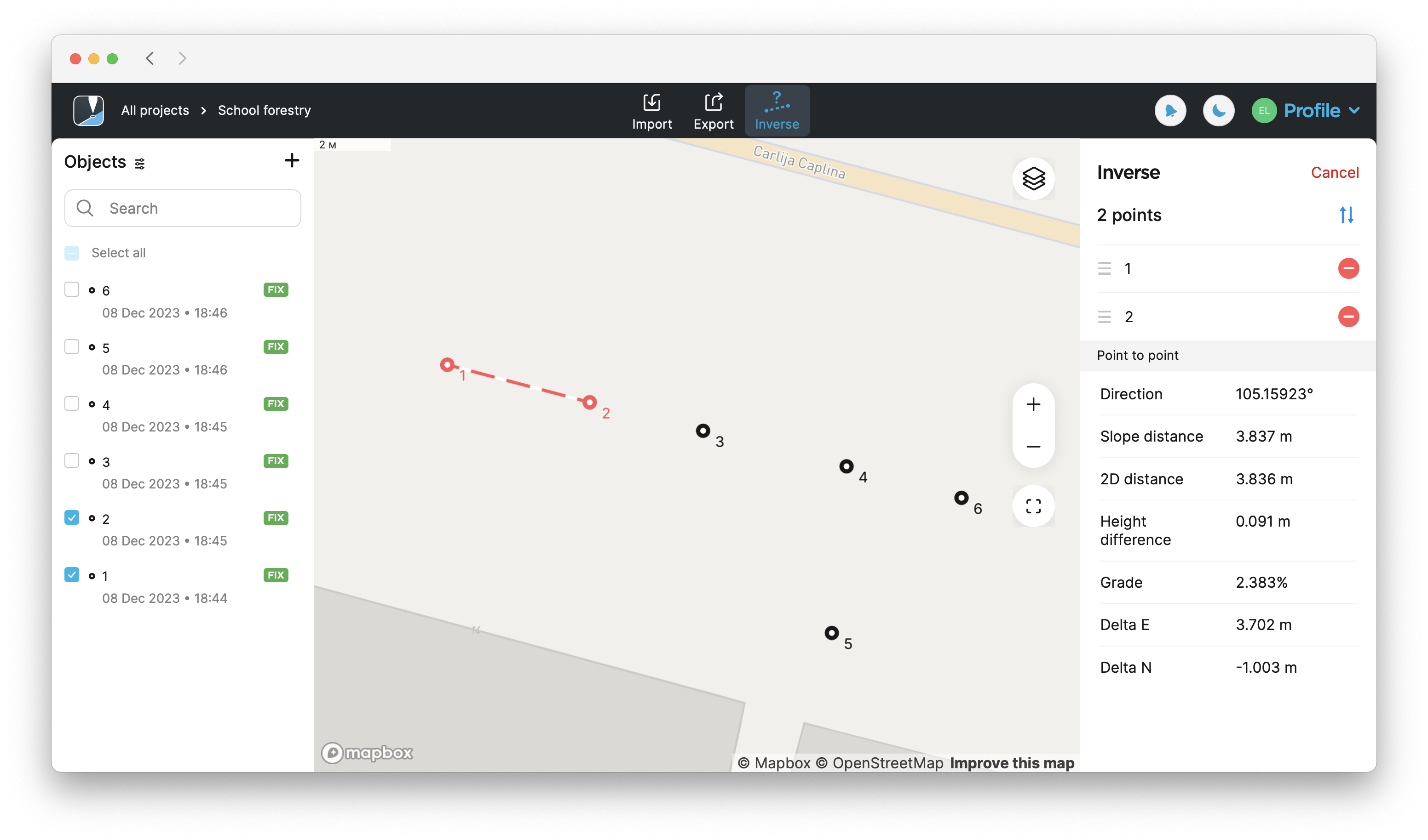
Selezionare i punti per cui si desidera calcolare l'inverso dalla mappa o dall'elenco Objects (Oggetti).
 suggerimento
In Emlid Flow ed Emlid Flow 360 è anche possibile trovare le informazioni punto-punto, linea e linea chiusa per ogni linea. Per visualizzare queste informazioni, è sufficiente toccare la linea.
-
Fare clic su Review (Rivedi) per visualizzare i risultati calcolati. Per calcolare i risultati per più di due punti, usare i pulsanti freccia per passare a un diverso set di due punti.
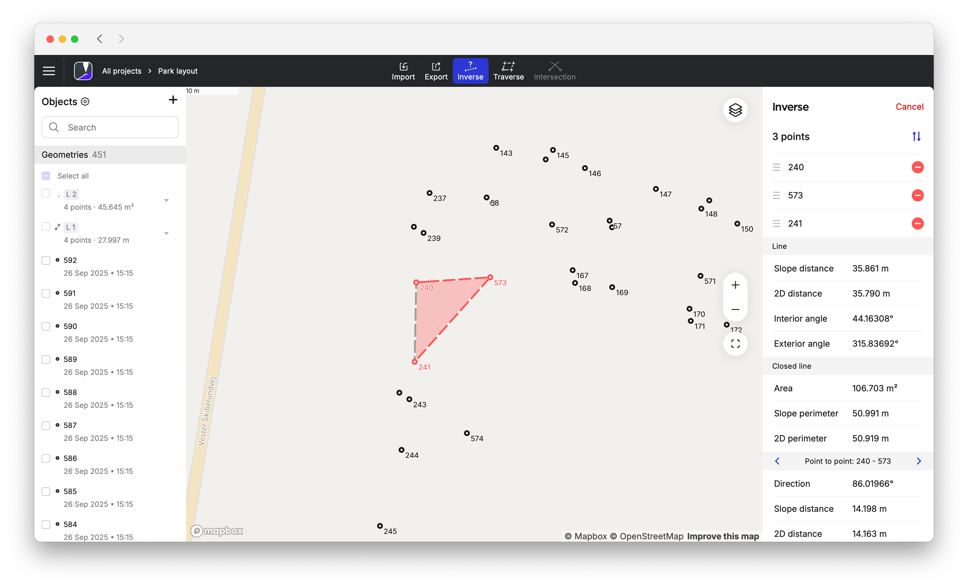
noteI risultati visualizzati saranno diversi a seconda dei punti selezionati. Se si selezionano 2 punti, vengono visualizzati i calcoli da punto a punto. Se si selezionano 3 punti, vengono visualizzati anche i calcoli relativi all'area, al perimetro inclinato, al perimetro 2D e all'angolo interno ed esterno.
 note
notePer le misurazioni geometriche è possibile utilizzare solo Closed line (Linea chiusa) e Line (Linea). Non è possibile importarli o esportarli come figure geometriche.
suggerimentoÈ possibile modificare l'ordine dei punti nella sezione Inverse trascinandoli e rilasciandoli. Per eliminare un punto, toccare il pulsante di eliminazione.
-
Per uscire dalla modalità di calcolo Inverse, toccare il pulsante di chiusura nell'angolo in alto a destra.
Per utilizzare lo strumento Inverse nell'app Emlid Flow 360, attenersi alla seguente procedura:
-
Aprire il progetto in Emlid Flow 360.
-
Toccare Inverse nella parte superiore dello schermo per calcolare i risultati.
-
Selezionare i punti per cui si desidera calcolare l'inverso dalla mappa o dall'elenco Objects (Oggetti).
 suggerimento
In Emlid Flow ed Emlid Flow 360 è anche possibile trovare le informazioni punto-punto, linea e linea chiusa per ogni linea. Per visualizzare queste informazioni, è sufficiente toccare la linea.
-
I risultati calcolati si trovano sul lato destro dello schermo. Per calcolare i risultati per più di due punti, usare i pulsanti freccia per passare a un diverso set di due punti.
noteI risultati visualizzati saranno diversi a seconda dei punti selezionati. Se si selezionano 2 punti, vengono visualizzati i calcoli da punto a punto. Se si selezionano 3 punti, vengono visualizzati anche i calcoli relativi a
area,Area of an object is the total amount of space enclosed by its shape on flat surface.
perimetro inclinato,Slope perimeter of an enclosed object is the sum of slope distances of its sides with the height difference consideration.
distanza inclinata, angolo interno ed esterno, ecc.Slope distance from point A to point B is the length of the straight line AB, measured along the slope, taking the height difference between the points into account.
notePer le misurazioni geometriche è possibile utilizzare solo Closed line (Linea chiusa) e Line (Linea). Non è possibile importarli o esportarli come figure geometriche.
 suggerimento
È possibile modificare l'ordine dei punti nella sezione Inverse trascinandoli e rilasciandoli. Per eliminare un punto, toccare il pulsante di eliminazione.
-
Per uscire dalla modalità di calcolo Inverse, toccare Cancel (Annulla) nell'angolo in alto a destra.
Guida video
Guardare il flusso di lavoro nel video qui sotto: