Integration of Reach RS2/R2+ with Mergin Maps for Android
This tutorial provides step-by-step instructions on how to integrate your Reach RS2/RS2+ with Mergin Maps for Android via Bluetooth.
Overview
Mergin Maps is a mobile app for Android devices that allows you to collect, share and publish geodata and collaborate with teams using instant sync with QGIS.
To integrate your Reach RS2/RS2+ Mergin Maps via Bluetooth, you will need the following:
- Reach RS2/RS2+
- A device on Android
- Mergin Maps mobile app installed on your Android device
- Mergin Maps account
Workflow
To integrate your Reach R2/RS2+ with Mergin Maps follow the steps below.
Configuring receiving corrections in Emlid Flow
To achieve centimeter-level accuracy when surveying with Reach RS2/RS2+, configure it to act as a rover in RTK in the following ways:
-
Set up RTK communication between 2 Reach RS2/RS2+ units over LoRa radio according to the guide about base and rover setup.
-
Configure your Reach RS2/RS2+ to receive corrections from an NTRIP service by following the steps from the Working with NTRIP service guide.
To start receiving corrections, make sure that your receiver has satellite visibility.
Setting up position streaming from Reach RS2/RS2+
To stream your Reach RS2/RS2+ position in the NMEA format to the Android device, proceed as follows:
-
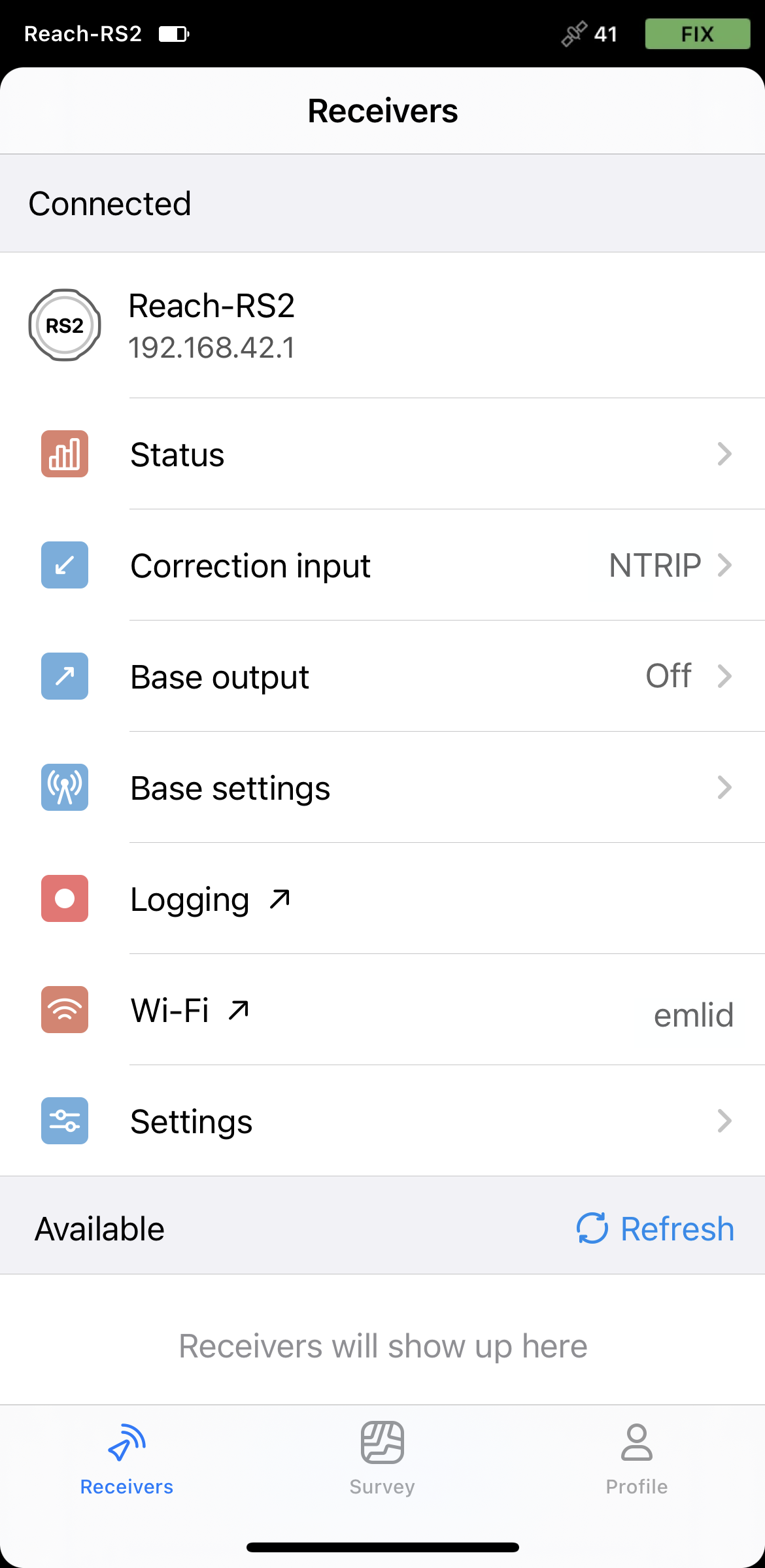
Open Emlid Flow and connect to your Reach.
-
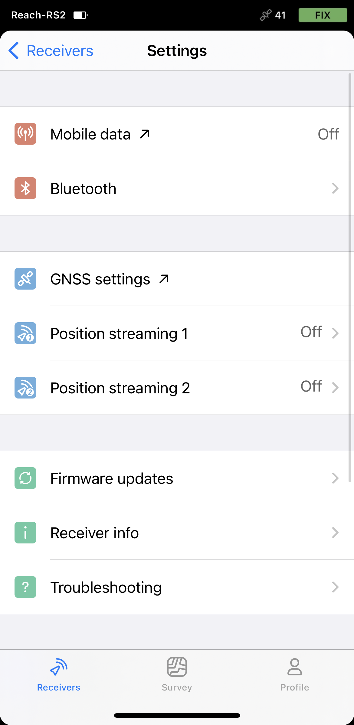
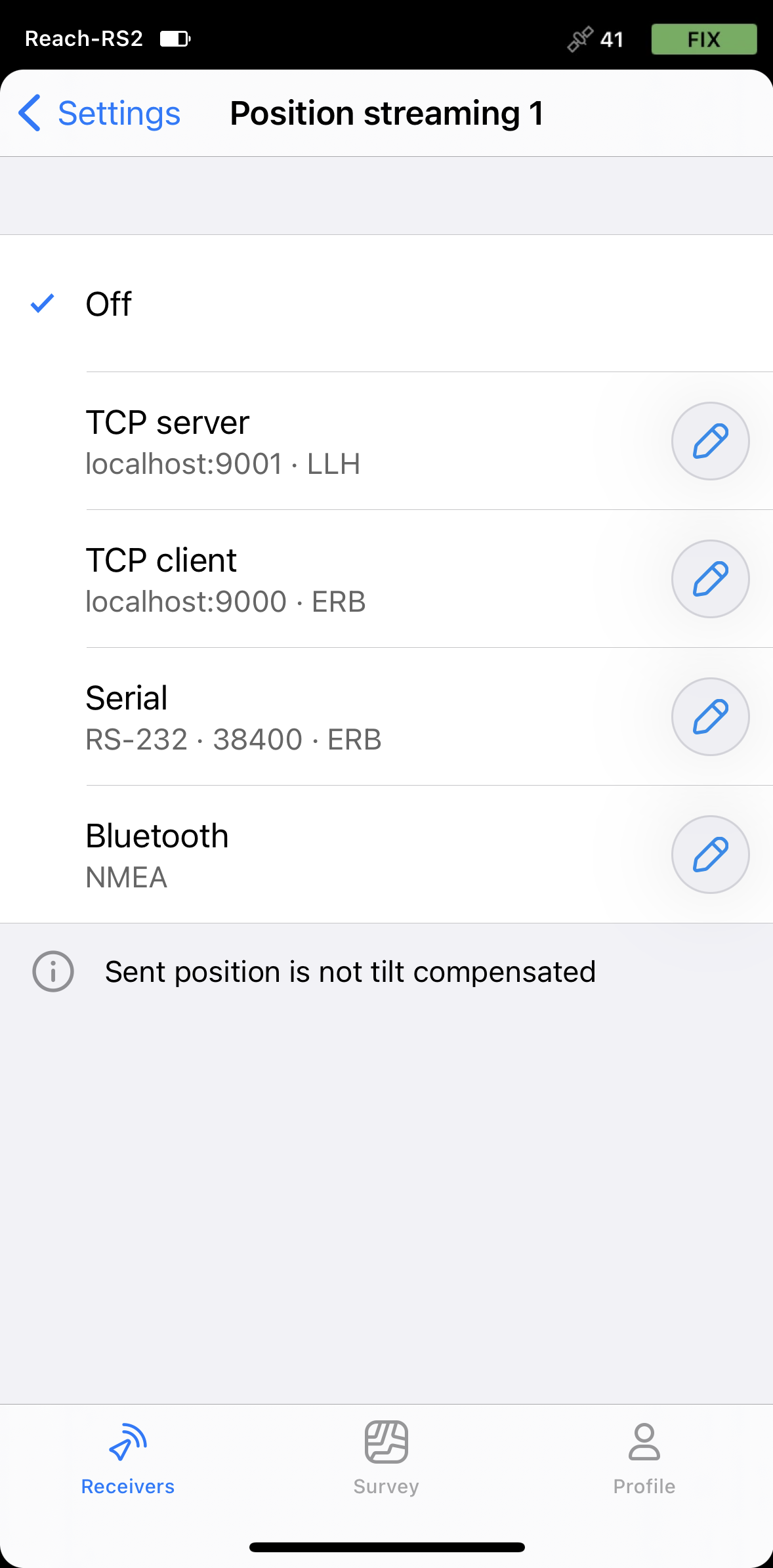
Go to Settings and tap Position streaming 1.
-
Select Bluetooth.
-
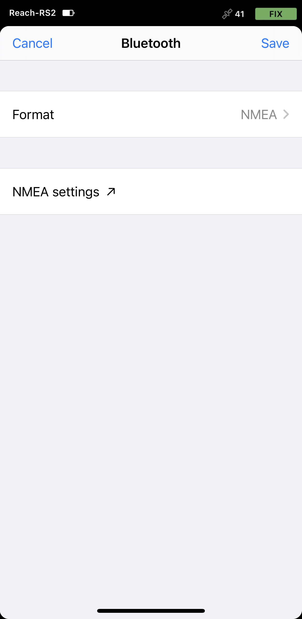
To configure position streaming, tap the Edit button in the Bluetooth cell.
-
Tap Format and choose NMEA. Save changes.
Enabling Reach RS2/RS2+ discoverability
To make your Reach RS2/RS2+ discoverable via Bluetooth, follow these steps:
-
Connect to your Reach RS2/RS2+ using Emlid Flow.
-
Go to Settings and tap Bluetooth.
-
Enable Bluetooth by tapping the Turn on Bluetooth button.
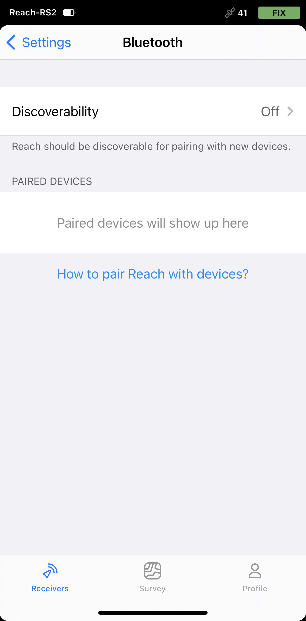
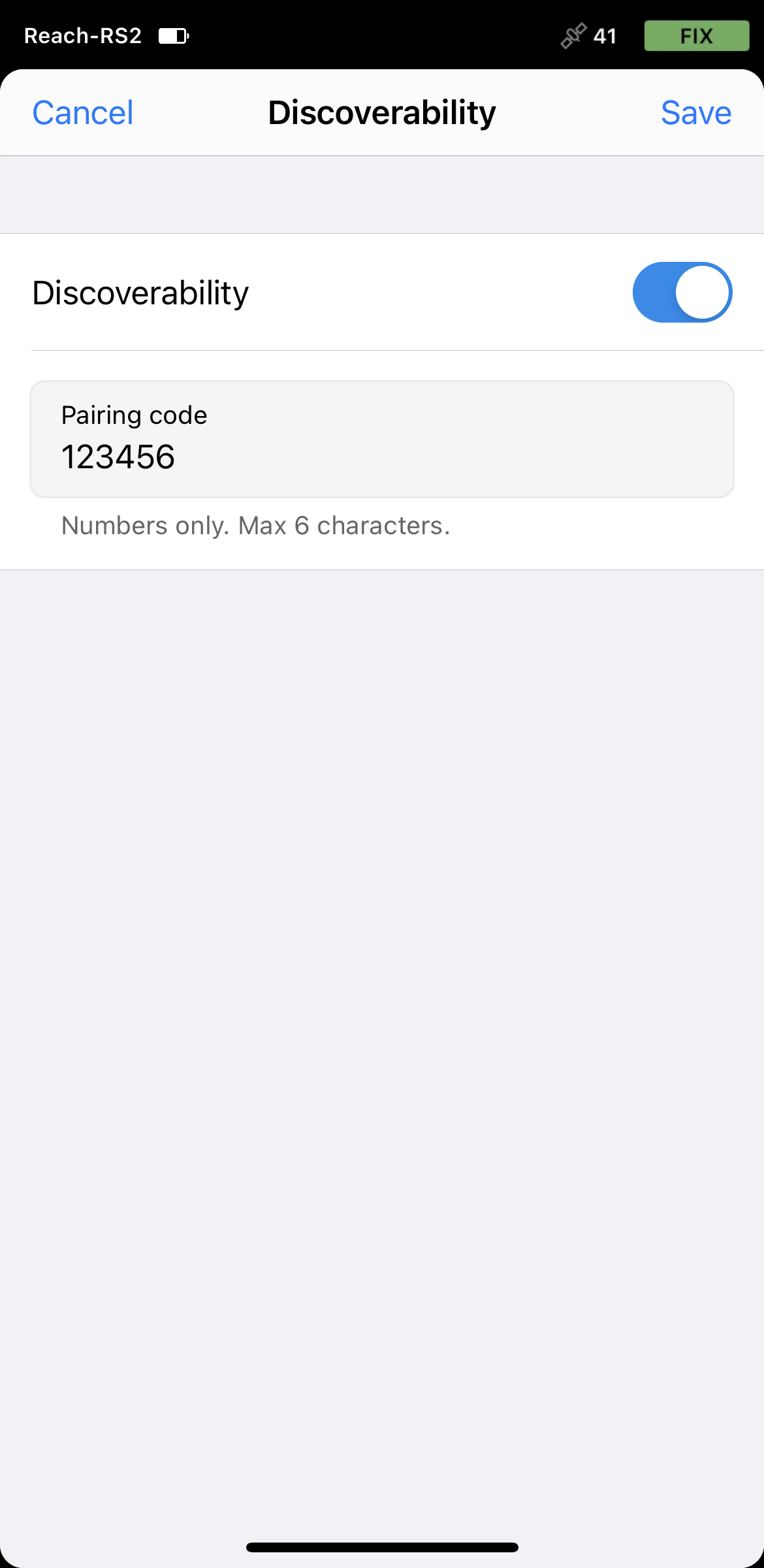
-
Tap Discoverability and turn it on. Tap Save to apply changes.
Pairing Reach with Android device
To pair your Reach RS2/RS2+ with the Android device, do the following:
-
Navigate to the Bluetooth configuration screen on your Android device and enable Bluetooth.
-
Wait for your Reach to be listed as an available device.
tipKeep Reach within a few meters from the device.
-
Tap the name of your Reach in the list of available devices on the Android device.
noteIf your device requires a PIN code, enter 123456.
-
Pair Reach with the Android device.
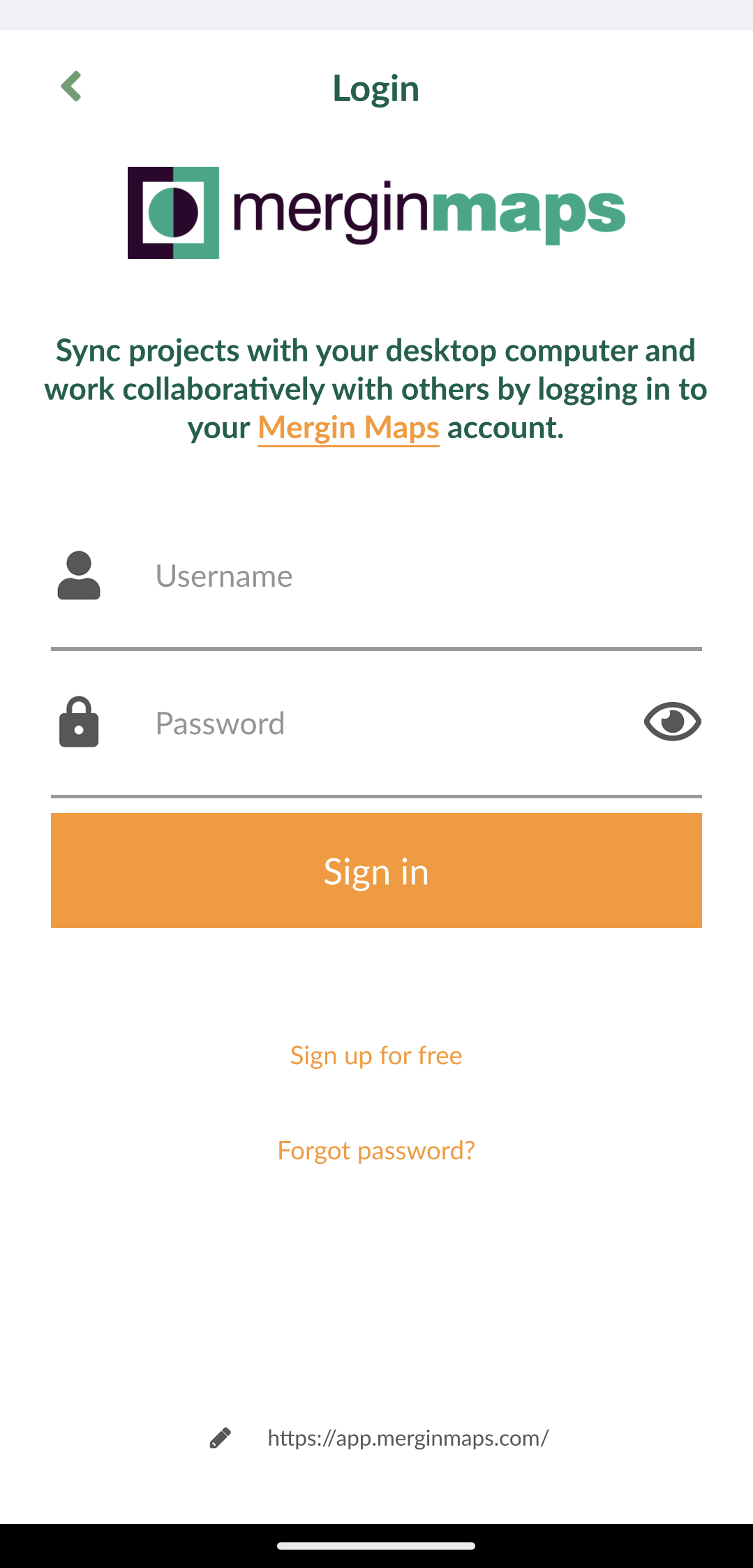
Configuring communication between Mergin Maps and Reach RX
-
Open the Mergin Maps app and create an account if you don’t have it yet to access the app.
-
Open or create a new project.
-
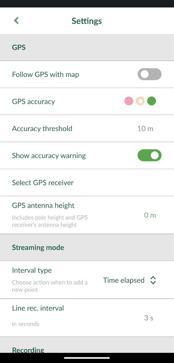
On the opened screen in the lower right corner, tap More and Settings.
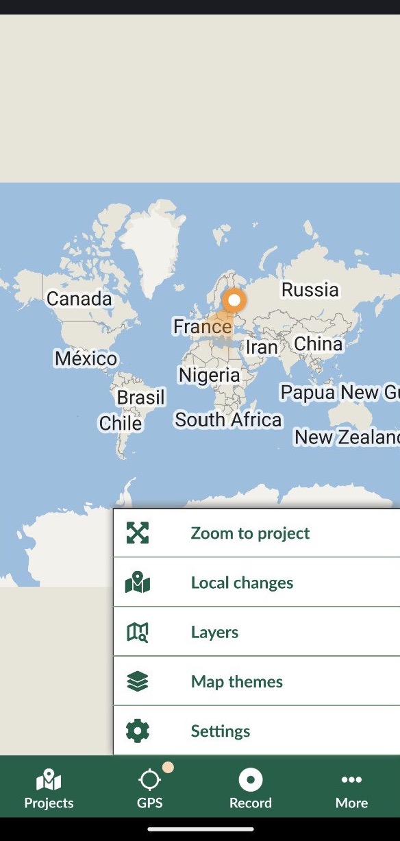
-
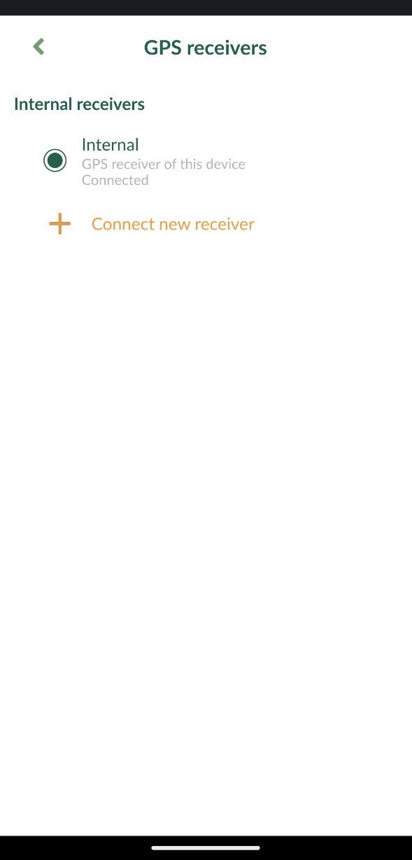
In Settings, tap Select GPS receiver.
-
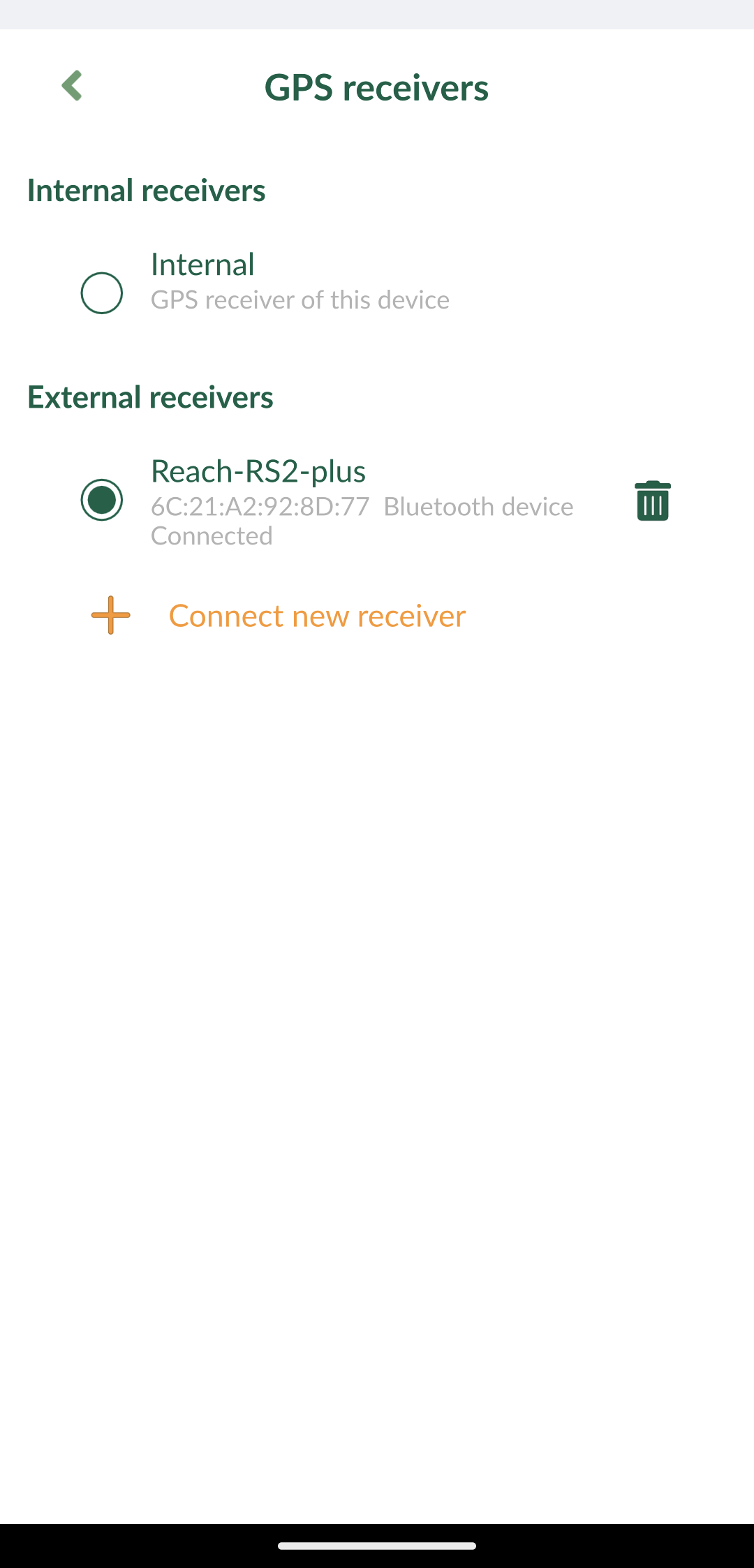
Tap Connect new receivers.
-
Choose your GPS receiver from the list of Bluetooth devices and wait until it's connected.
-
Go back to Settings and set the antenna height. For Reach RS2/RS2+, the antenna height is the distance from the mark on the ground to the center point on the Reach’s bottom, antenna reference point (ARP), plus the height of the receiver to the antenna phase center (APC), antenna height offset. The antenna height offset equals to 134 mm.
-
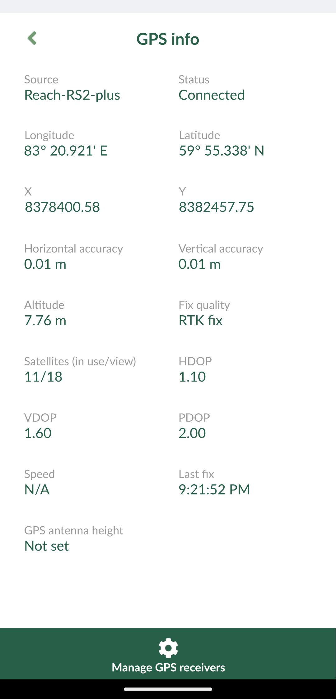
Go to the GPS tab and check the RTK status and accuracy on the map. To check the detailed GPS info, tap the tab one more time.
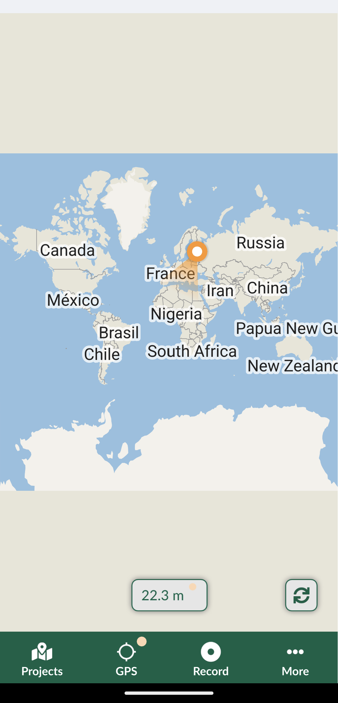
Now you are ready to start collecting data!