Getting Reach coordinates on Android devices via Bluetooth
This guide describes how to stream position in the NMEA format from Reach RX to third-party data collection and GIS apps on Android devices.
Overview
Mock location feature on Android devices allows using an external GNSS receiver as if it was a device’s built-in GPS receiver. This way, you can stream position in the NMEA format from Reach RX to GIS apps on Android devices.
Below are some survey and GIS apps that can be used with Reach RX:
- Mobile Topographer Pro
- PointMan
- Mapit GIS
- LandStar
- Autocad360
- QField
In most cases, you can configure a correction stream from an NTRIP service in the Emlid Flow app and transmit the corrected position to a third-party GIS or data collection application on Android. If the third-party app does not allow adding an external GNSS receiver and only accepts the phone’s internal location, refer to the Configuring mock location on Android device using Lefebure NTRIP Client section below. It explains how to integrate using the Lefebure NTRIP Client app to provide corrected positioning data.
To output a centimeter-precise position, Reach RX should be in RTK mode. You can do the following:
-
Use an NTRIP service as a source of positioning corrections for Reach rover.
Reach RX uses Bluetooth and streams its position in the NMEA format by default. You only need to pair it with your Android device.
Pairing Android device
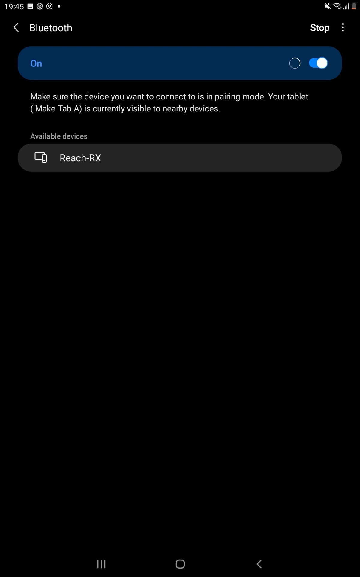
To pair your Reach RX with an Android device, follow the steps below:
-
Navigate to the Bluetooth configuration screen on your Android device and enable Bluetooth.
-
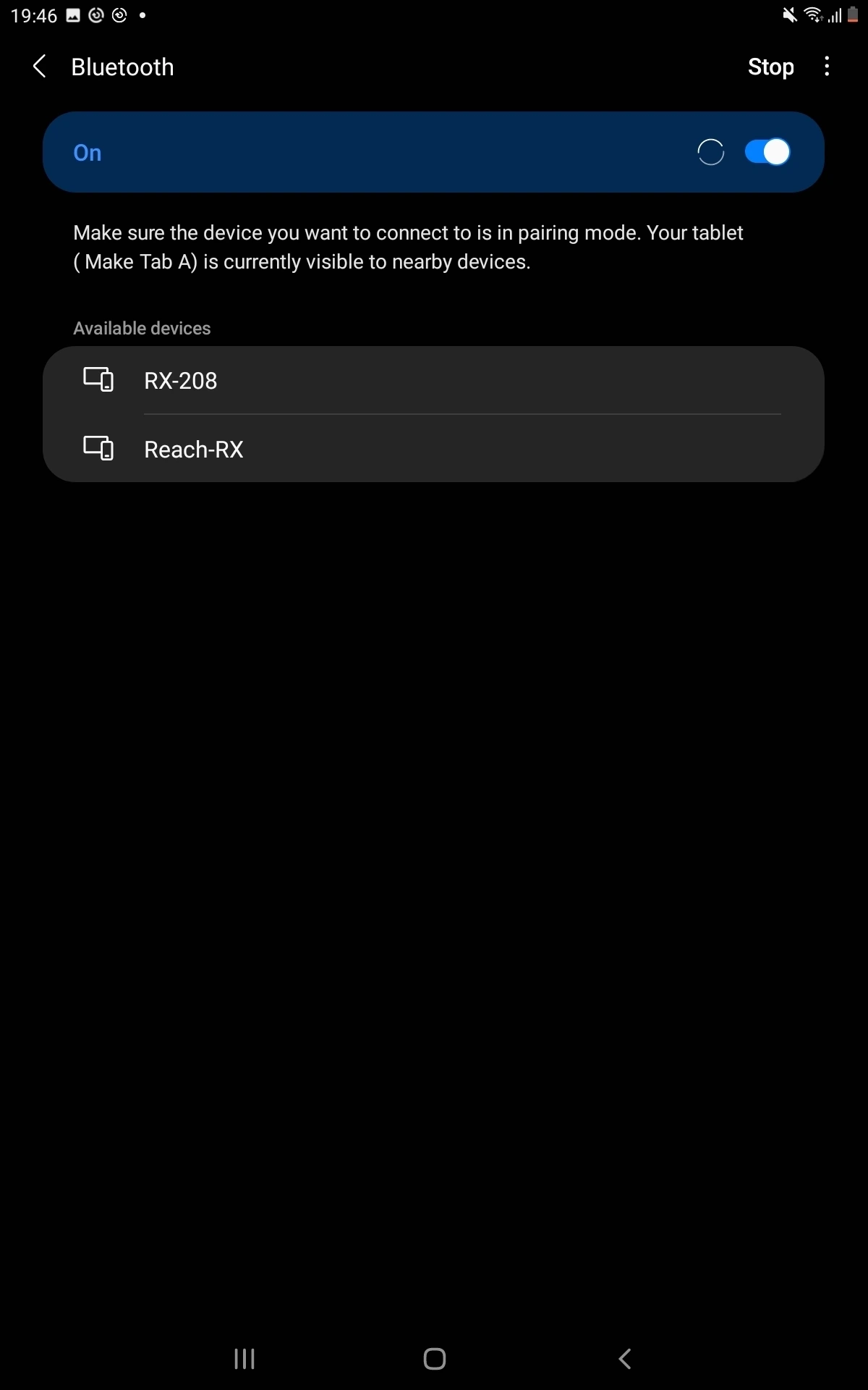
Wait for your Reach RX to be listed as an available device.
tipKeep Reach within a few meters from the device.
-
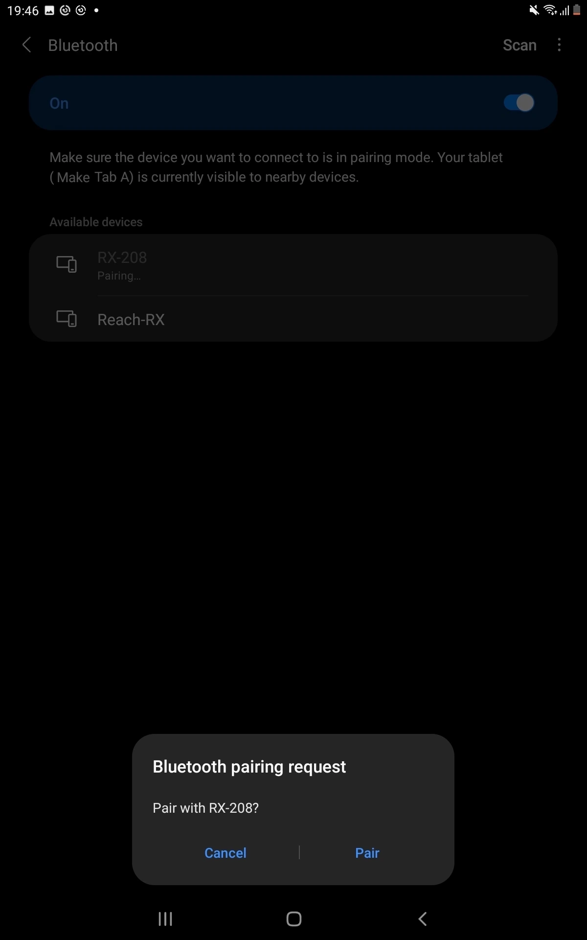
Tap the name of your Reach in the list of available devices on the Android device.
noteIf your device requires a PIN code, enter 123456.
-
Pair Reach with the Android device.
Now you can start receiving the precise position in your third-party data collection or GIS app. If your app does not support external GNSS receivers and relies only on the phone’s internal GPS for location data, you can integrate using Lefebure NTRIP client app. Follow the steps in the section below.
Configuring mock location on Android device using Lefebure NTRIP Client
Follow the steps in this section only if your third-party application does not support external GNSS receivers and relies only on the phone’s internal GPS for location data.
Lefebure NTRIP Client allows the data collection and GIS apps on Android devices to use precise coordinates from Reach. Besides being an NTRIP client, it allows inputting NMEA data via Bluetooth and substituting your device's built-in GPS receiver with an external location provider.
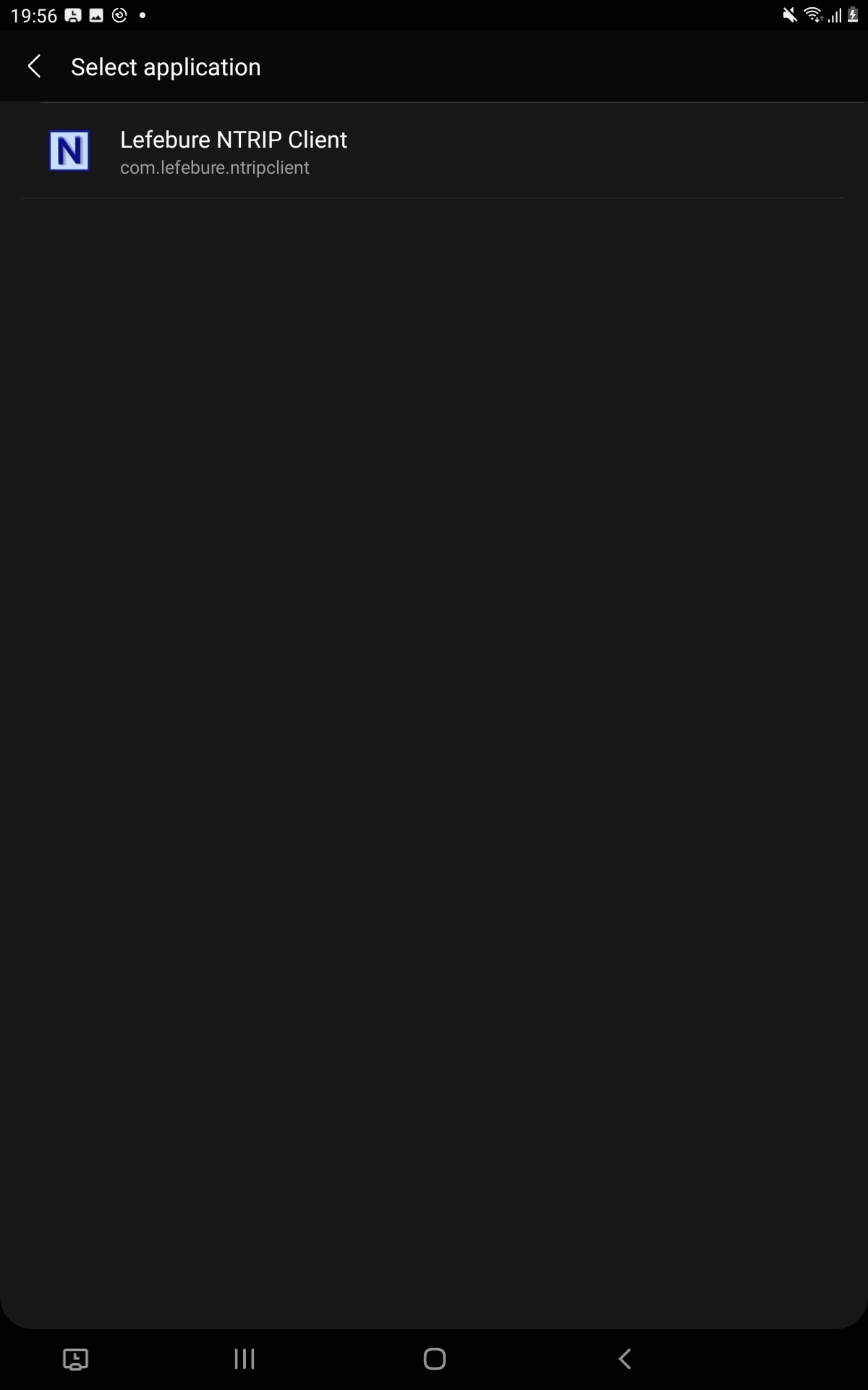
To configure the mock location on the Android device, follow the steps below:
-
Download and install the Lefebure NTRIP Client app on your Android device.
-
Open Developer Options on your Android device.
tipTo learn more about accessing Developer Options on your device, check your Android device’s instructions.
cautionIt is recommended to switch off the power-saving mode on your device, as it may limit background data usage for the Lefebure NTRIP client app.
-
In the Select mock location app field, choose Lefebure NTRIP Client.
-
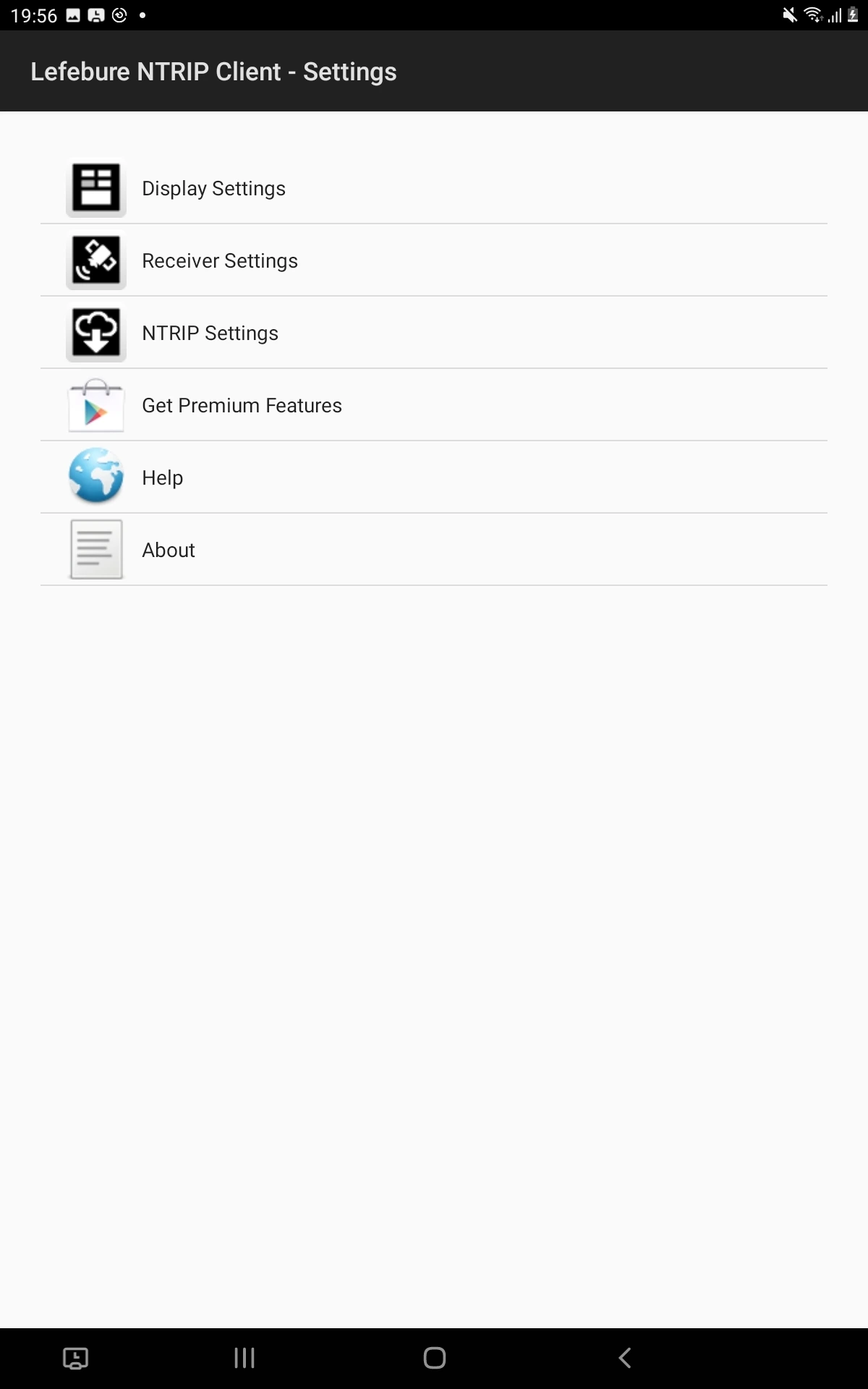
Launch the Lefebure NTRIP Client app and tap the Settings icon.
-
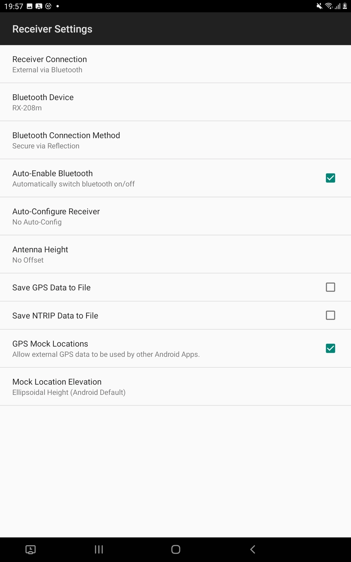
Go to Receiver Settings. Configure the following:
- Receiver Connection: External via Bluetooth.
- Bluetooth device: Reach, your device is paired with.
- Bluetooth Connection Method: Secure via Reflection.
- Enable GPS Mock Locations.
-
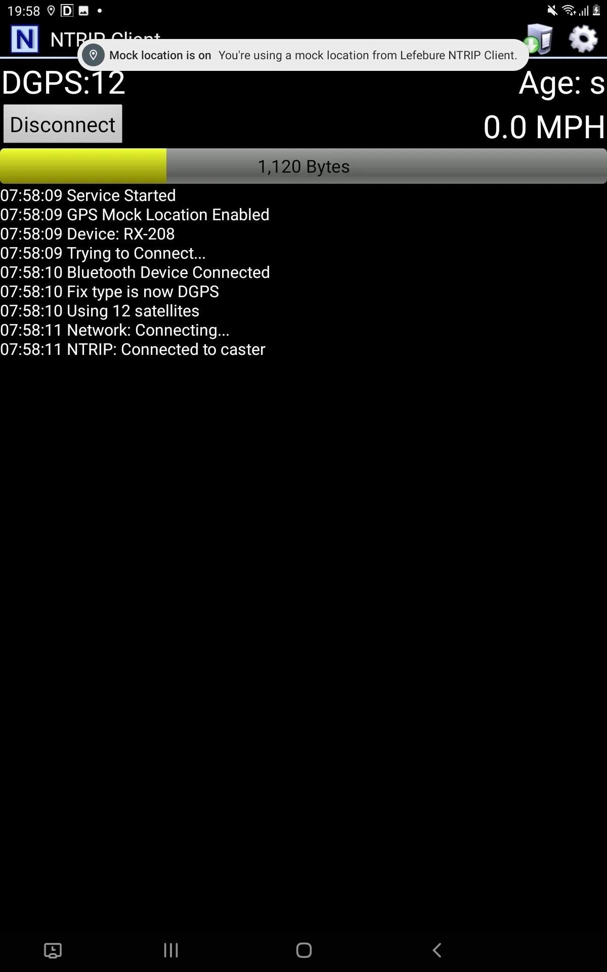
Go back to the main screen and tap the Connect button.
-
Check that you’re receiving corrections.
If you want to configure your Reach RX to receive corrections from an NTRIP service in the Lefebure NTRIP Client app, follow the steps below:
-
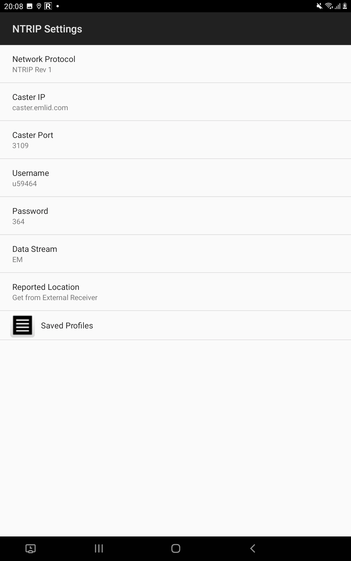
In Lefebure NTRIP Client, go to NTRIP Settings and fill in the information from your NTRIP provider.
-
Save settings.
-
Go back to the main screen and tap the Connect button.
-
Check that you’re receiving corrections.
tipCheck the log messages to make sure that corrections are coming and information about satellites is updated.
From this moment, all data collection and GIS apps that use location services installed on your device will automatically have access to the positional data streamed from Reach.