Getting Reach coordinates on Android via BT
This guide describes how to get precise coordinates from Reach on an Android device over Bluetooth.
Overview
Some of the survey and GIS apps for Android used with Reach:
- Mobile Topographer Pro
- PointMan
- ESRI ArcGIS Collector
- Mapit GIS
- LandStar
- Autocad360
- QField
In most cases, you can configure a correction stream from an NTRIP service in the Emlid Flow app and transmit the corrected position to a third-party GIS or data collection application. If the third-party app does not allow adding an external GNSS receiver and only accepts the phone’s internal location, refer to the section below. It explains how to integrate using the Lefebure NTRIP Client app to provide corrected positioning data.
To output a centimeter accurate position, Reach should be in RTK mode. You can do the following:
-
Set up RTK communication between two Reach RS2/RS2+ units over LoRa radio following this guide.
-
Use NTRIP service as a source of positioning corrections for Reach rover this guide.
Pairing Reach with Android device�
To pair Reach with your Android device, follow the steps below:
Access Reach rover using Emlid Flow
- Bluetooth connection
- Hotspot connection
-
Enable Bluetooth on your smartphone or tablet.
-
Open Emlid Flow. When prompted, tap Configure access and allow location permissions. This is required for full receiver functionality.
Reach prioritizes the current connection when using BLE, regardless of type:
- If Reach is connected via Bluetooth Classic to third-party software, disconnect it before using BLE in Emlid Flow.
- If another device is connected to Reach, disconnect it before reconnecting using BLE in Emlid Flow.
After granting permissions, your receiver will appear in the list. The app will connect to it automatically.
-
Go to Wi-Fi settings on your device.
-
Connect to Reach hotspot. It appears as reach:XX:XX.
-
Enter password emlidreach.
-
Open Emlid Flow and connect to your Reach.
-
Go to Settings and tap Bluetooth.
-
Enable Bluetooth by tapping the Turn on Bluetooth button.
-
Tap Discoverability and turn on the Discoverability option. Tap Save to apply changes.
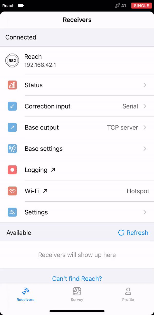
Reach name is displayed just above its MAC. In this guide, we used the unit named as Reach.
For more information on connecting to your Reach device, refer to the Connecting to Reach guide. A Bluetooth connection is the recommended method.
Access Android device
-
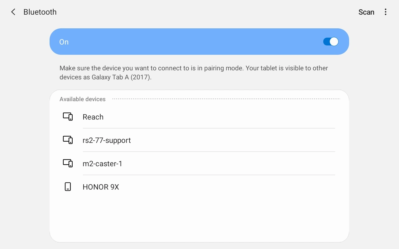
Navigate to the Bluetooth configuration screen. Activate the Bluetooth connection.
-
Wait for Reach to be listed as an available device.
tipKeep Reach within a few meters from your Android device.
-
Tap the name of your Reach in the list of available devices on the Android device.
-
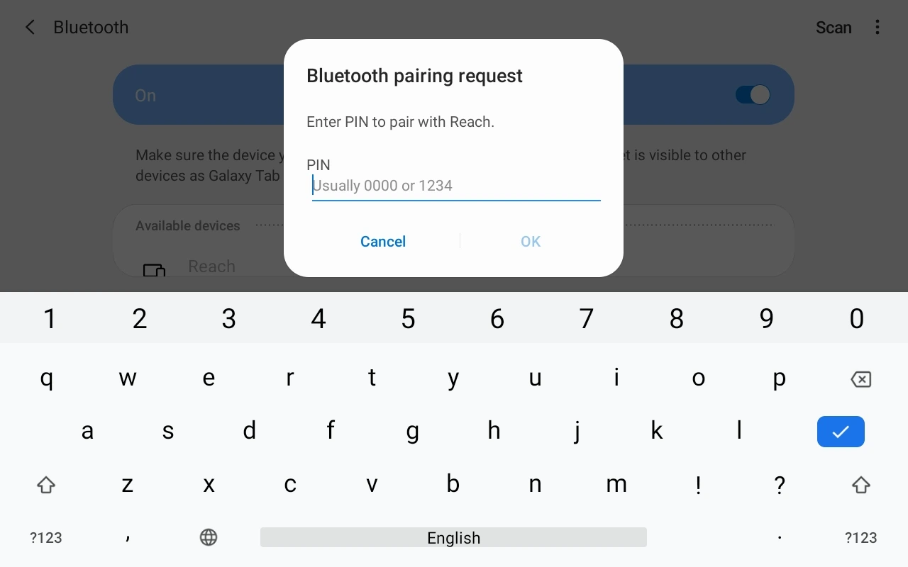
You should receive a pairing request from Reach.
-
Enter the PIN code of your Reach unit and confirm it.
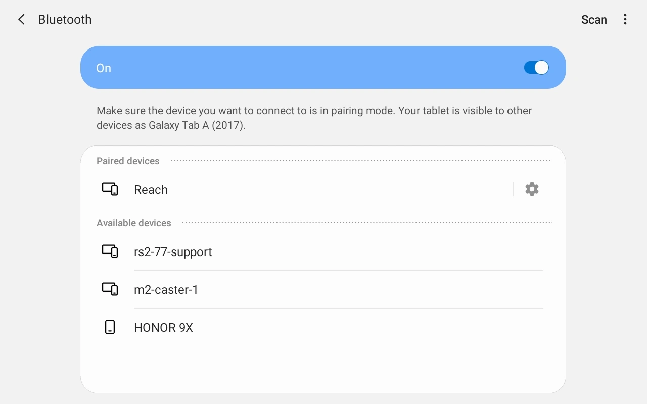
Reach and Android device are now paired.
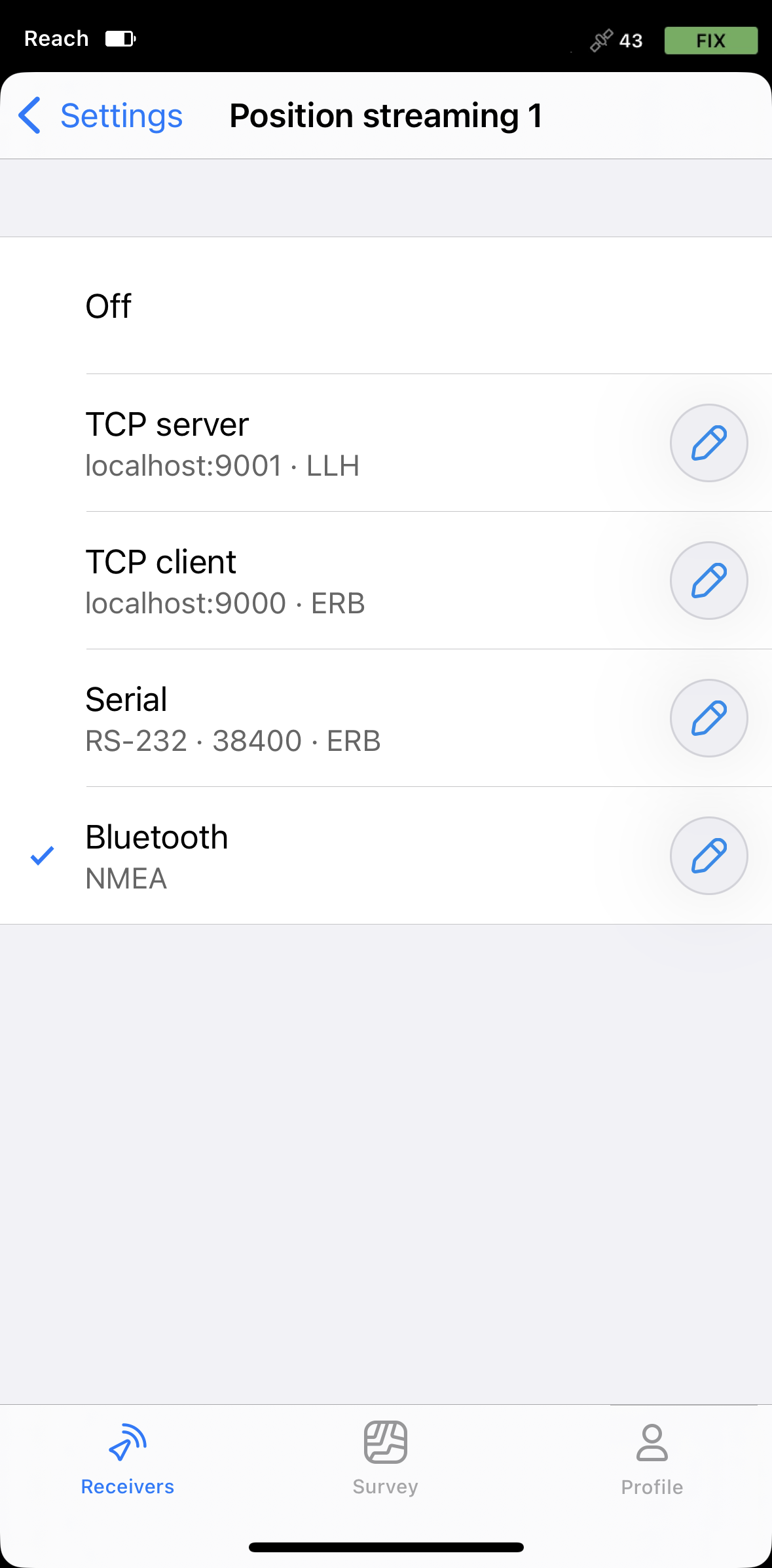
Stream position from Reach to Android
-
In Emlid Flow, go to Settings.
-
Tap Position streaming 1 and select Bluetooth.
-
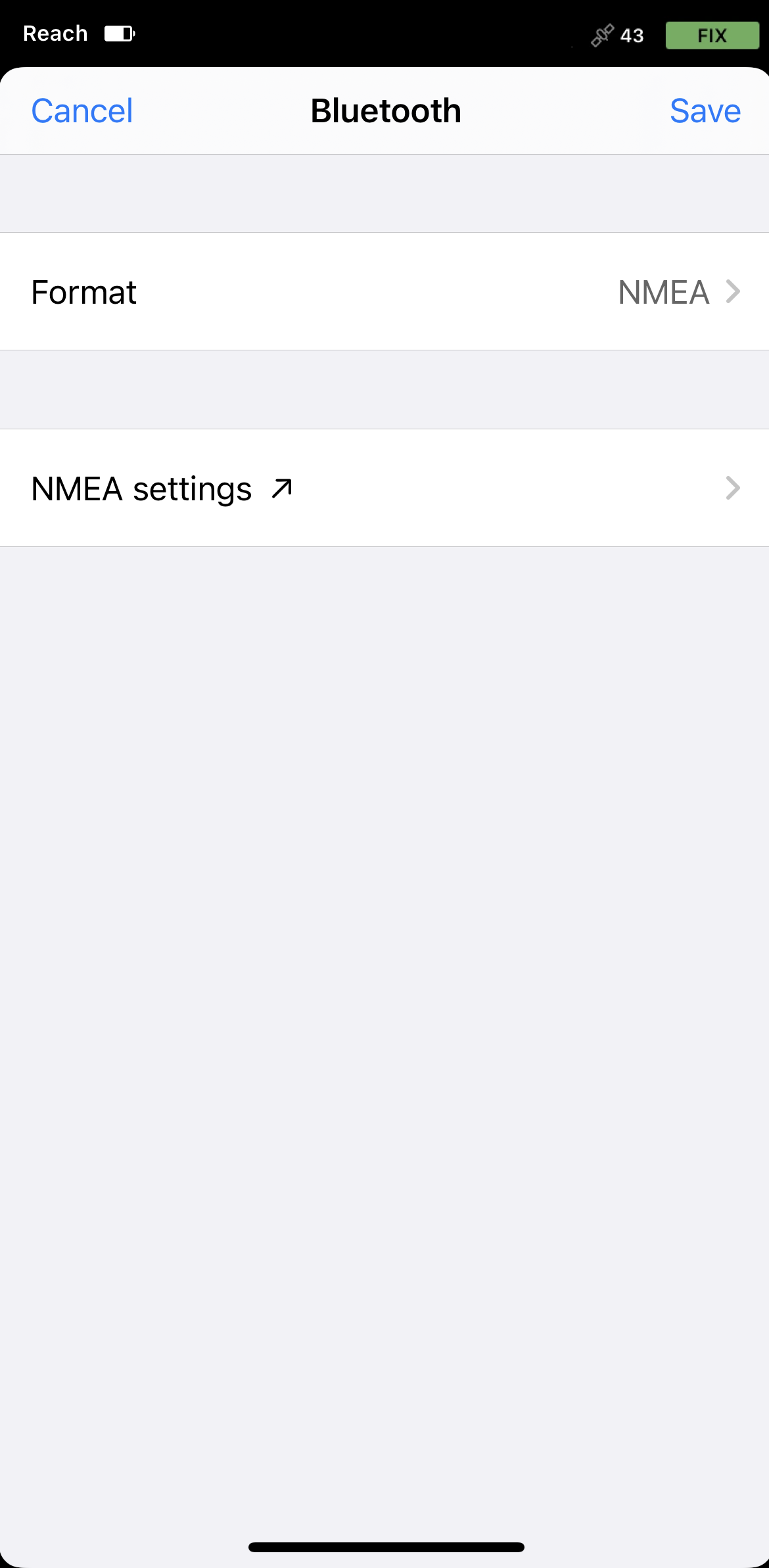
To configure position streaming, tap the Edit button in the Bluetooth cell.
noteWhen connected to your Reach via Bluetooth, Emlid Flow will prompt you to connect to the Reach hotspot to access the streaming configuration settings.
-
Tap Format and choose NMEA.

-
Apply necessary changes.
Now you can start receiving the corrected position in a third-party GIS or data collection application.
Use Android mock location
Follow the steps in this section only if your third-party application does not support external GNSS receivers and relies only on the phone’s internal GPS for location data.
We provide a guide on how to use Reach with Lefebure NTRIP Client.
Besides being an NTRIP Client, this app also allows NMEA data input via Bluetooth and supports Android feature called mock location. This feature allows substituting your device's built-in GPS receiver with an external location provider.
Lefebure NTRIP Client allows the survey and GIS apps on the Android device to use accurate coordinates from Reach.
-
Install the app Lefebure NTRIP Client in your Android device.
-
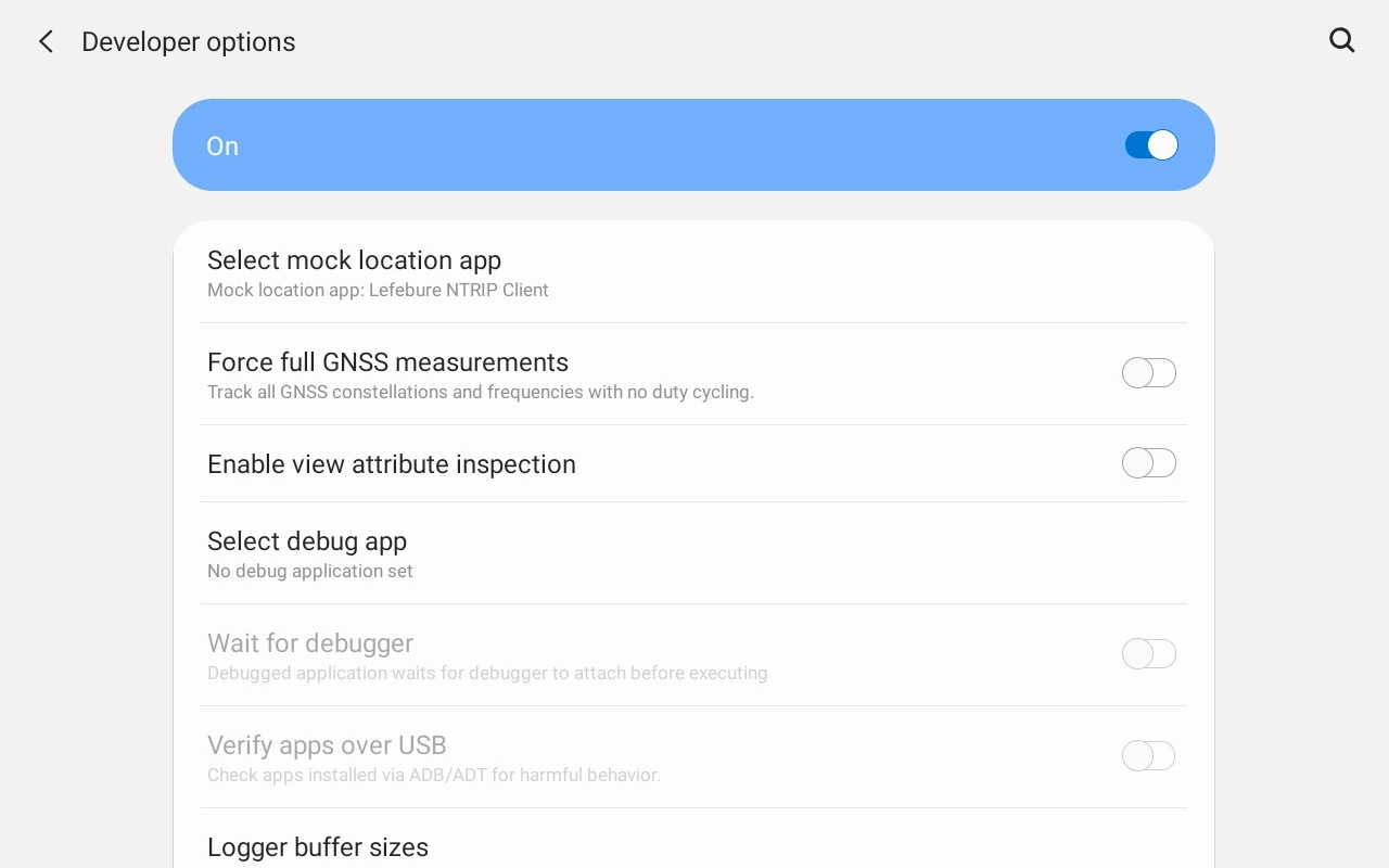
Open Developer Options on your Android device and choose Lefebure NTRIP Client in the Select mock location app field.
noteIt is recommended to switch off the power-saving mode on your phone as it may limit background data usage for the Lefebure NTRIP client app.
-
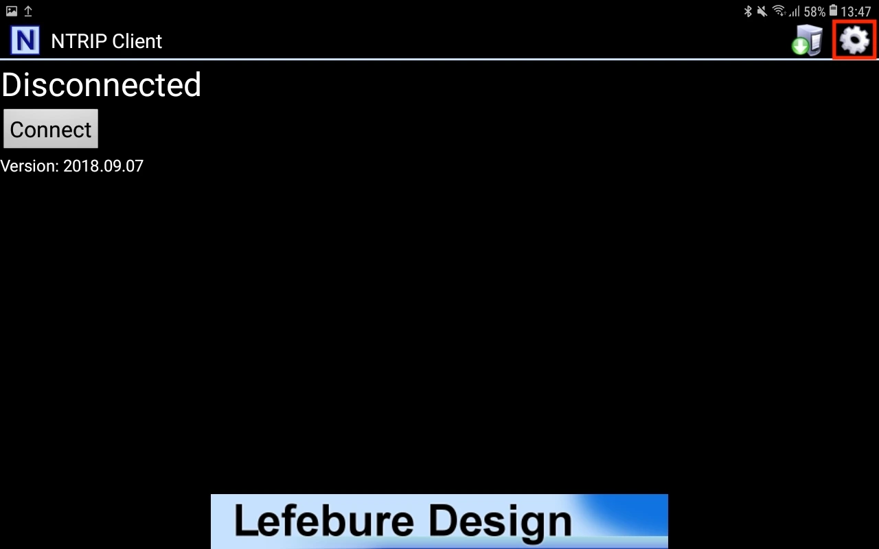
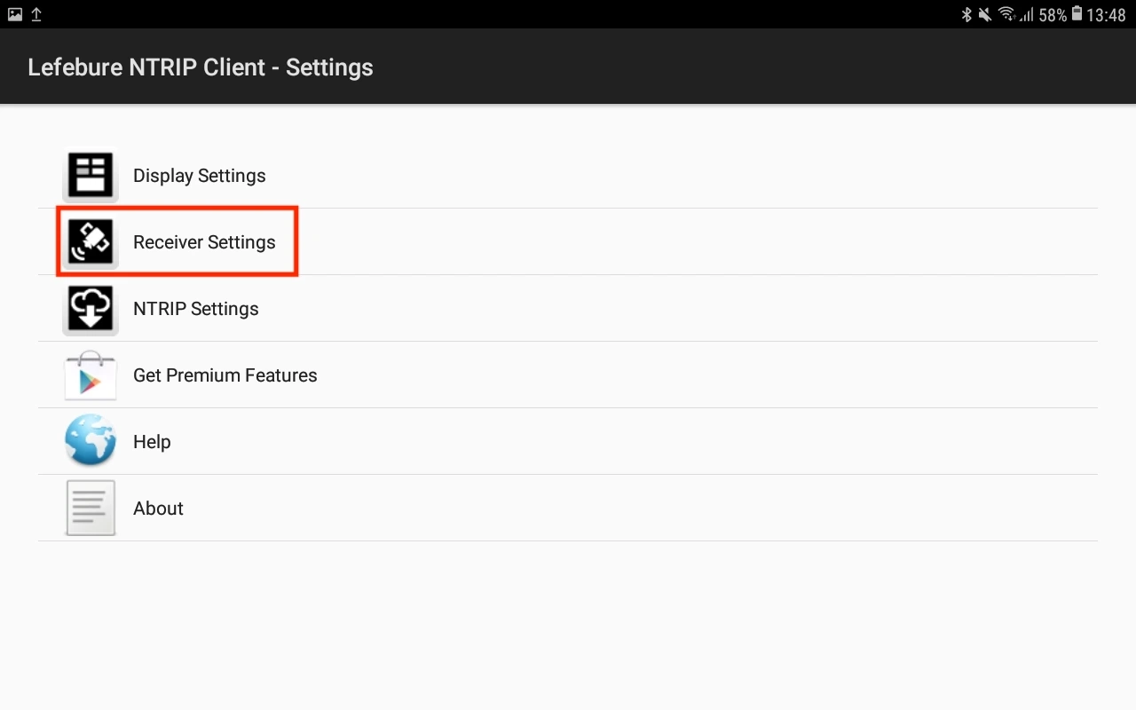
Launch the Lefebure NTRIP Client app and tap on the settings icon (gear in the upper right corner).
-
Go to the Receiver Settings.
-
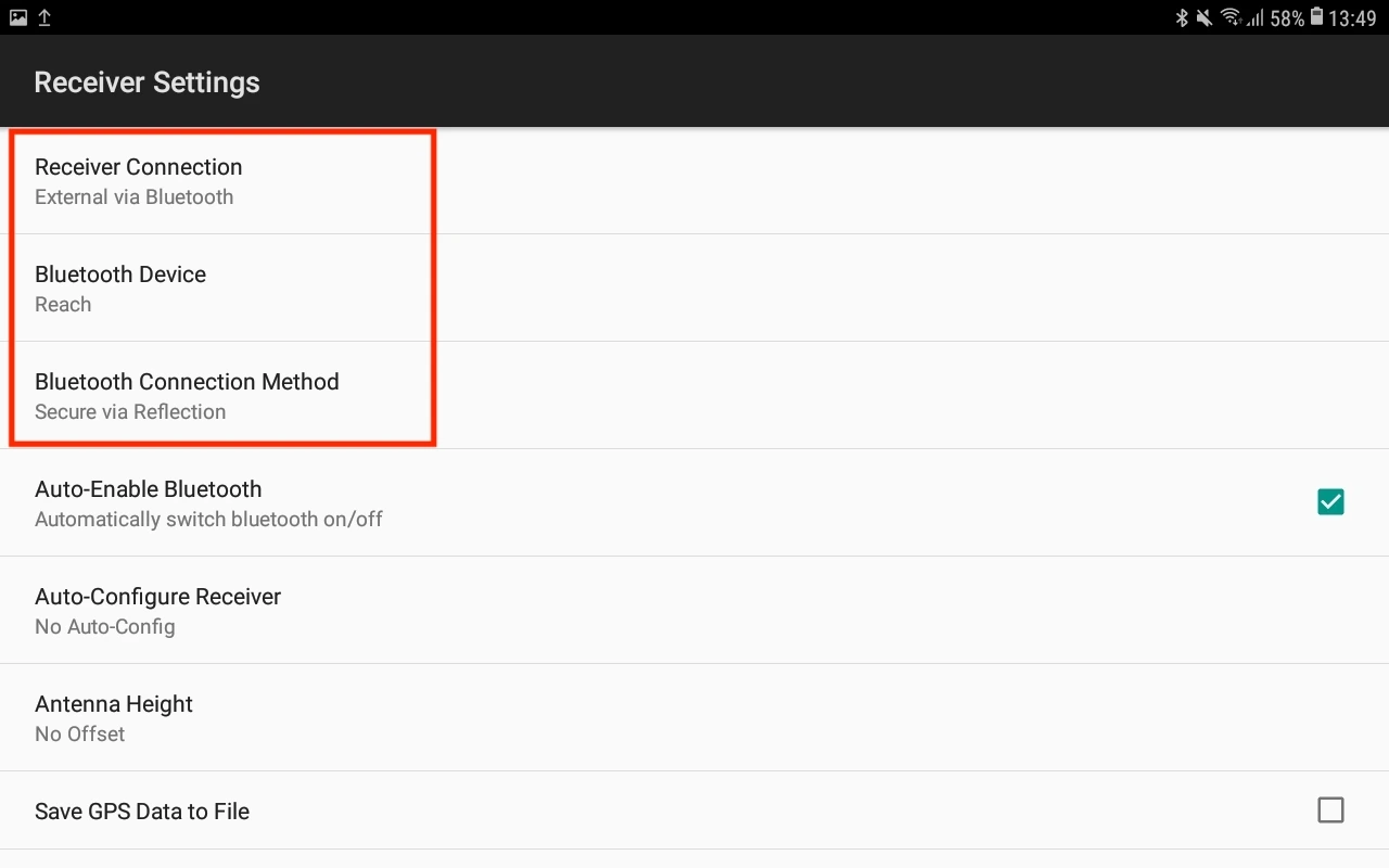
Adjust the following options as specified below:
- Set Receiver Connection to External via Bluetooth.
- Change Bluetooth device to Reach you are paired with.
- Change Bluetooth Connection Method to Secure via Reflection.
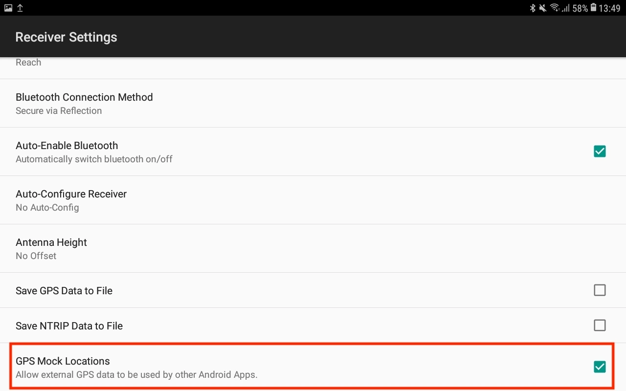
- Enable the GPS Mock Locations option.
-
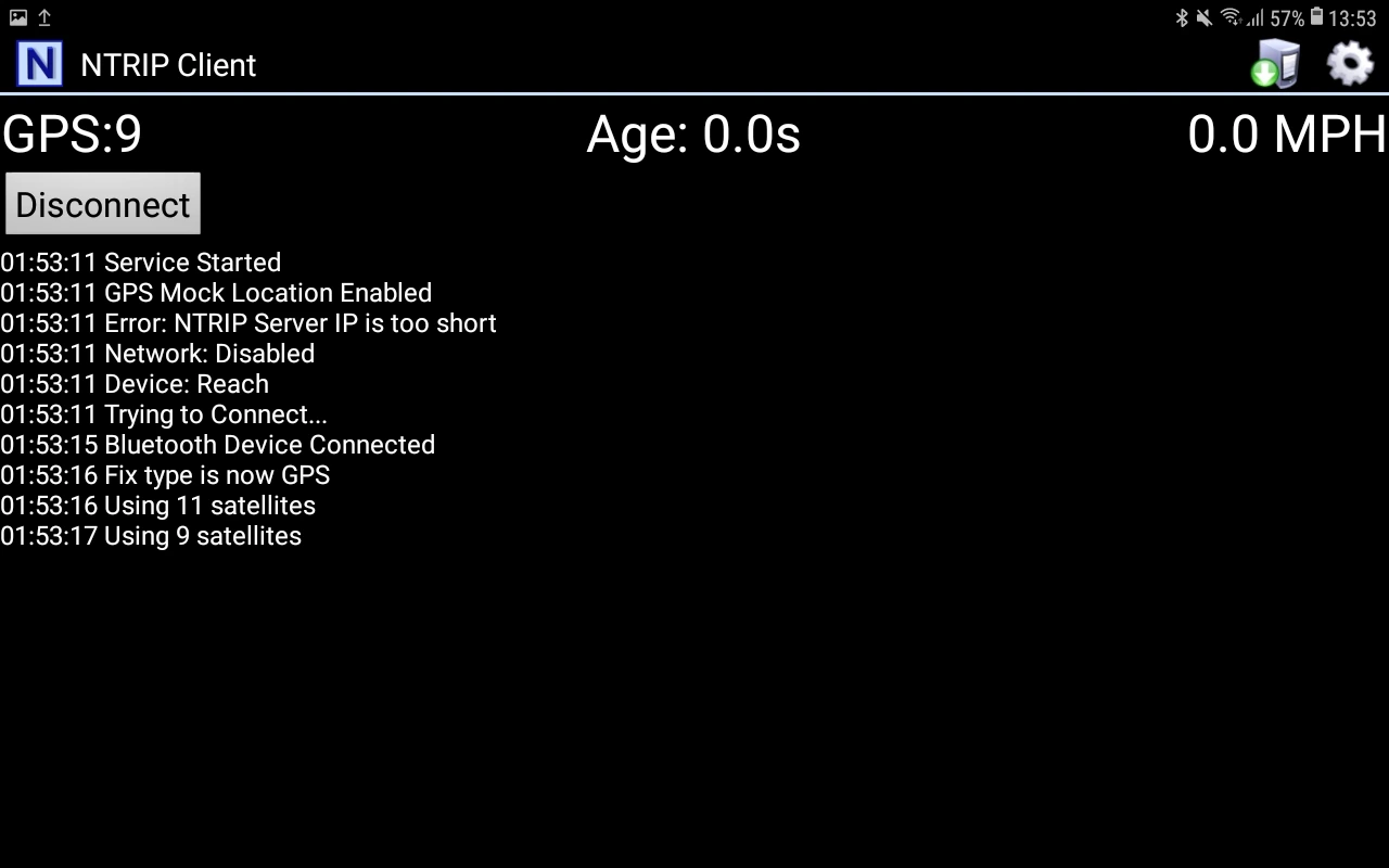
Go back to the main screen and tap the Connect button.
tipCheck the log messages to confirm the Bluetooth connection got established and the information about satellites is updated.
From this moment on, all apps on the Android device that use location services will automatically have access to the positional data streamed from Reach. You can just open a survey or GIS app you want to use and start surveying.
Tapping the Disconnect button in the Lefebure NTRIP Client will revert back to the Android built-in GNSS.