Setting up base position manually
This guide explains how to use the Manual coordinates entry method in the Emlid Flow app to set up base over a known point.
Overview
The Manual coordinates entry method in the Emlid Flow app allows you to enter the position of your base when you have a point with known coordinates in DD or DMS LLH format. In this case, the positions measured with the rover will be precise and accurate in the selected coordinate system to the centimeter level.
To learn more about the accuracy for RTK and PPK measurements, read our Simple Intro to Accuracy and Precision article.
Workflow
Placing base in field
To place your base station in the field, follow the recommendations below.
Clear sky view without any obstacles
Reach base needs to have a clear sky view 30 degrees above the horizon. There should be no obstacles that could block the view like buildings, trees, cars, humans, laptops, etc.
Take a look at 2 pictures below. The left picture demonstrates desirable conditions for Reach location. The right one is an example of poor surrounding conditions such as the reduced view of the sky, possible obstructions or vegetation nearby.
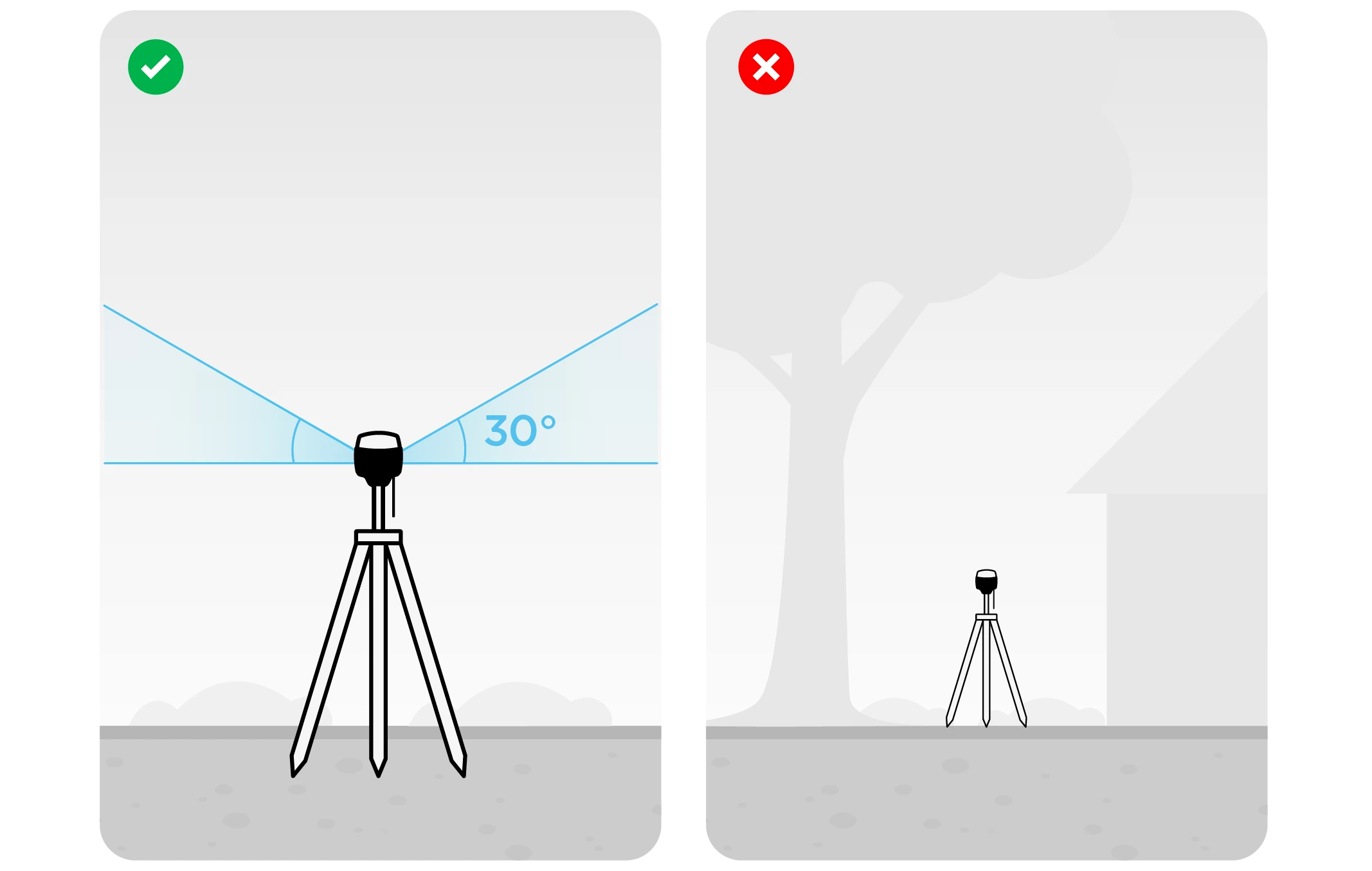
Examples of recommended environments for Reach placement:
- field
- top of the hill
- rooftop
Examples of poor environments for Reach placement:
- indoors
- urban area
- forestry area
No electronics nearby
Electronic devices may produce RF noise that could affect the reception of the GNSS signal. Keep all electronics as far as possible from Reach.
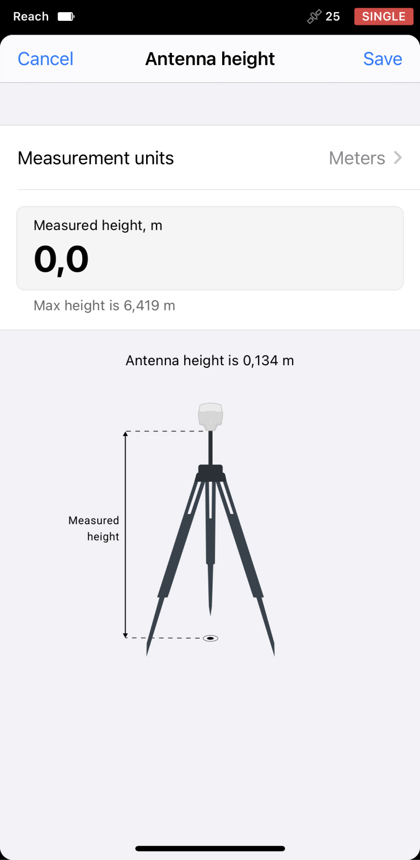
Measuring antenna height offset
When placing your Reach in the field, make sure your Reach device is placed precisely above the marked point on the tripod and leveled. When you are setting up base coordinates manually, you need to measure the antenna height offset. Follow the steps below:
-
Measure the distance from the mark to the bottom of your Reach (h in Figure 1).
-
Specify the measured distance in Emlid Flow. It will automatically calculate the antenna height.
tipFor Reach RS2/RS2+, the antenna height is the distance from the mark on the ground to the center point on the Reach’s bottom (h in Figure 1), antenna reference point (ARP), plus the height of the receiver to the antenna phase center (APC), antenna height offset. Emlid Flow automatically adds the antenna height offset, which is 134 mm.
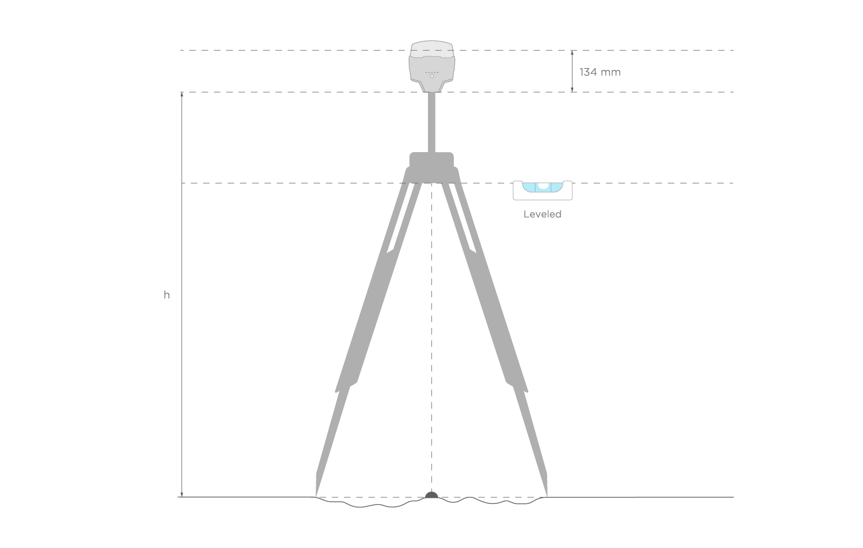 Figure 2. Antenna height
When you placed Reach over the mark and measured the antenna height, you are ready to set up the base position in the Emlid Flow app.
Setting up base’s coordinates in Emlid Flow
To set up your base using the Manual coordinates entry method in Emlid Flow, follow the steps below:
-
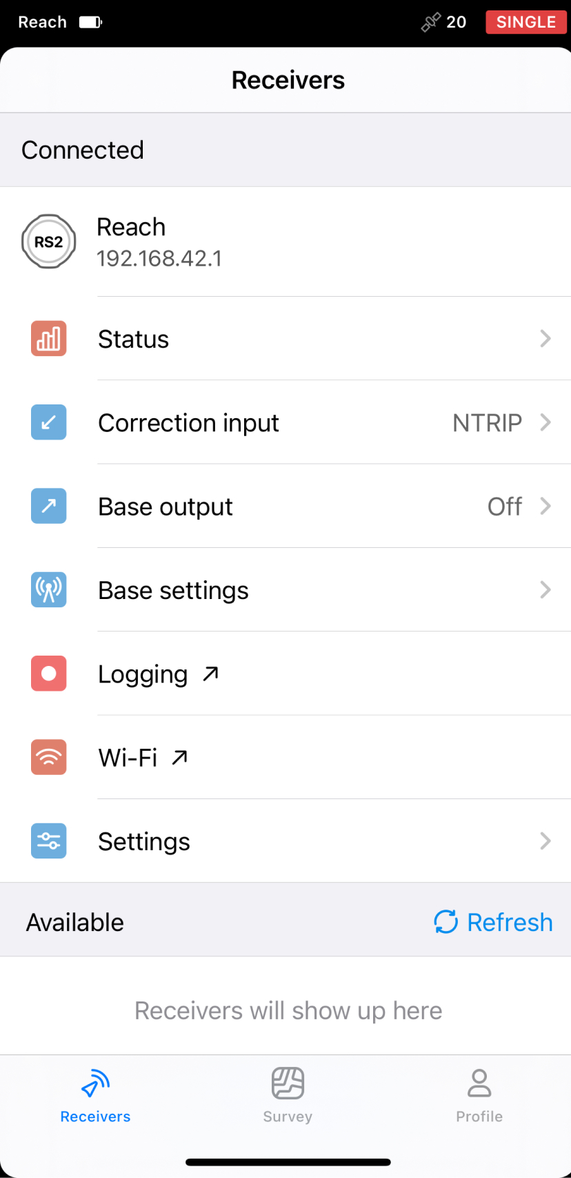
Open the Emlid Flow app and connect to your Reach.
-
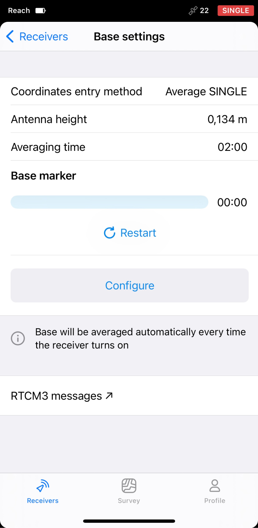
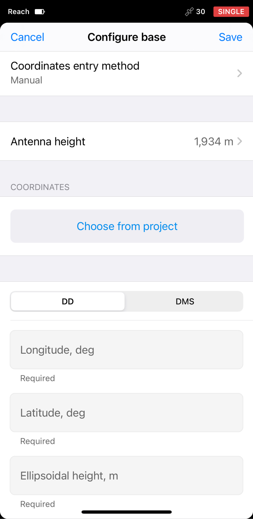
Go to Base settings of your Reach and tap Configure.
-
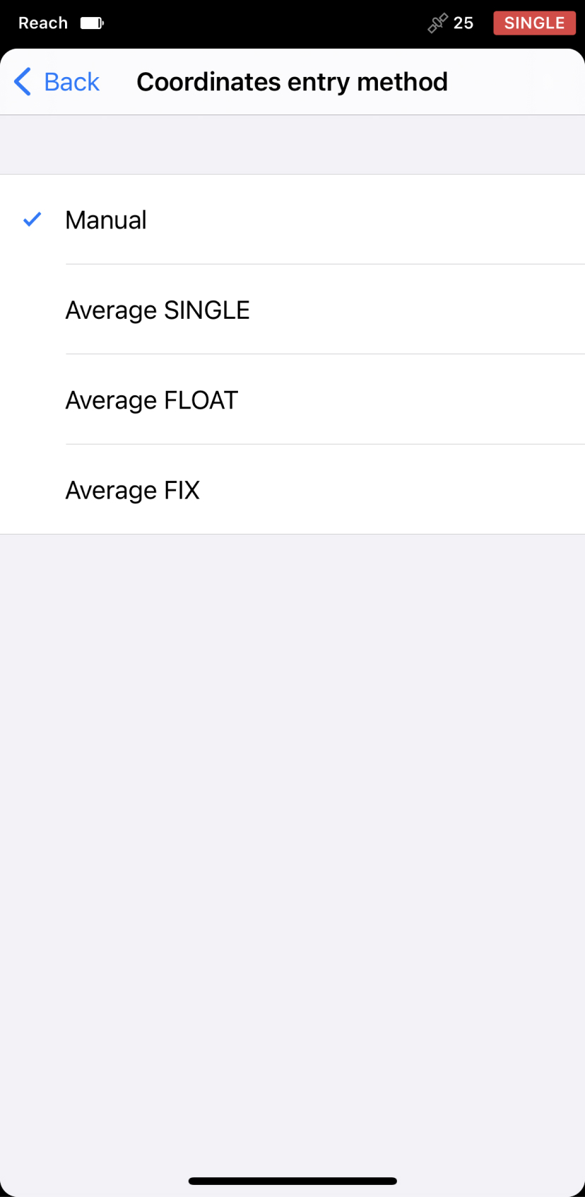
Tap Coordinates entry method and select Manual from the menu.
-
Tap Antenna height to set the antenna height and save it.
-
Enter the geographic coordinates of your point in DD or DMS format, or import a point from your Emlid project by tapping Choose from project.
tipIf your known point has local coordinates, add it to your Emlid project and use the point picker option to set it as a base’s coordinates. Emlid Flow will convert this coordinates into geographic ones.
 tip
tipTo correct the coordinates of a manually created or imported point in Emlid Flow, choose the point on the map or in the objects list, tap the three-dot menu, and select Duplicate and edit. Edit the coordinates and tap Save.
-
Once you’ve set the coordinates of the point, tap Save in the upper right corner.
The coordinates of your base are now set, and you are ready to proceed with creating a project on your rover.
After setting up coordinate system for your project on the rover, make sure to specify the same datum as on the base while configuring rover's coordinate system in the survey project.