Set up coordinate system from library
We recommend setting up the projects indoors before the survey as some
Coordinate system is a coordinate-based local, regional or global system used to locate geographical entities. A spatial reference system defines a specific map projection, as well as transformations between different spatial reference systems.
This guide shows how to set up a
Coordinate system is a coordinate-based local, regional or global system used to locate geographical entities. A spatial reference system defines a specific map projection, as well as transformations between different spatial reference systems.
Overview
You can only configure the
Coordinate system is a coordinate-based local, regional or global system used to locate geographical entities. A spatial reference system defines a specific map projection, as well as transformations between different spatial reference systems.
Emlid Flow and Emlid Flow 360 contain a library of ready-to-use local
Coordinate system is a coordinate-based local, regional or global system used to locate geographical entities. A spatial reference system defines a specific map projection, as well as transformations between different spatial reference systems.
Coordinate system is a coordinate-based local, regional or global system used to locate geographical entities. A spatial reference system defines a specific map projection, as well as transformations between different spatial reference systems.
- Argentina
- Australia
- Austria
- Balearic Islands
- Belgium
- Brazil
- Bulgaria
- Canada
- Canary Islands
- Chile
- China - Hong Kong
- Colombia
- Croatia
- Czech Republic
- Denmark
- Estonia
- Finland
- France
- French Polynesia
- Georgia
- Germany
- Greece
- Guatemala
- Hungary
- Iceland
- India
- Ireland
- Israel
- Italy
- Japan
- Latvia
- Lithuania
- Mexico
- Netherlands
- New Caledonia
- New Zealand
- Norway
- Papua New Guinea
- Philippines
- Poland
- Portugal
- Romania
- Serbia
- Slovakia
- Slovenia
- South Africa
- South Korea
- Spain
- Sweden
- Switzerland
- Thailand
- USA
- United Kingdom
If you can't find your country or region in the list, contact us at support@emlid.com.
To show you all the steps, we will walk you through the example of configuring a
Coordinate system is a coordinate-based local, regional or global system used to locate geographical entities. A spatial reference system defines a specific map projection, as well as transformations between different spatial reference systems.
Workflow
Setting up coordinate system
- Emlid Flow
- Emlid Flow 360
While creating a project, follow the steps below:
-
On the New project screen, tap Coordinate system.
-
Search the required coordinate system by its name, country, or code.
We enter Switzerland and pick
CH1903 / LV03.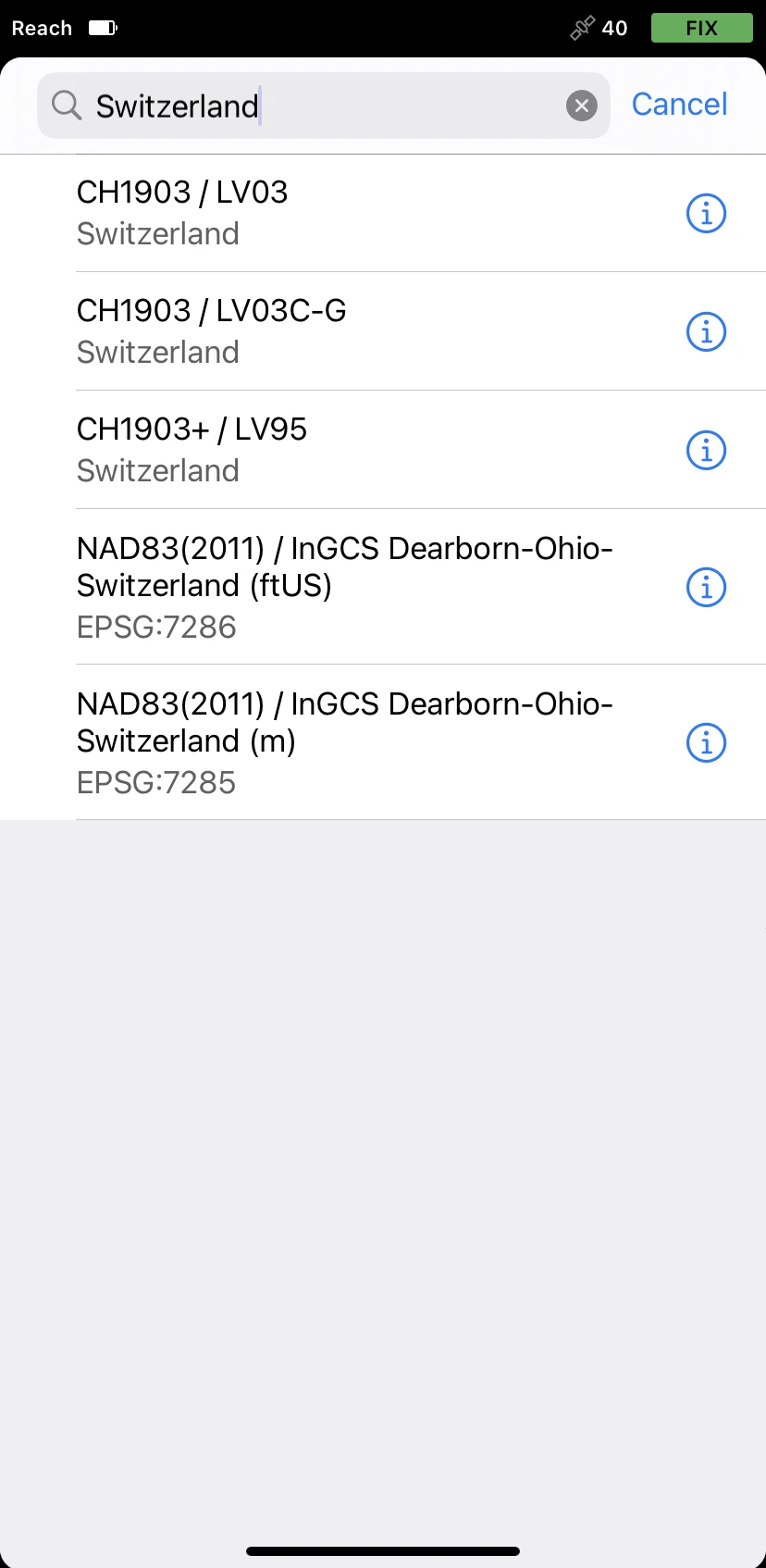
tipTo learn more about the suggested coordinate system, tap the info icon next to the system. Depending on the chosen coordinate system, the screen can contain the following information:
- Datum and its reference ellipsoid with parameters
- Global datumand its reference ellipsoid with parameters
Global datum is an ellipsoidal coordinate reference system that is used by the receiver to measure coordinates before any transformations are applied.
- Projection type and its parameters
- Transformation type and its parameters
-
Once you’ve selected the coordinate system, go to the Vertical datum section. The app will show you available vertical datums and corresponding geoids. Choose the one you need.
We select
LHN95 height.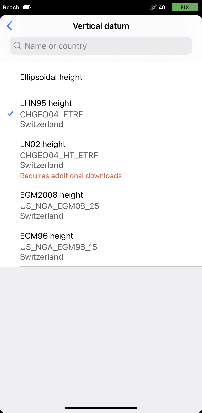
While creating a project, follow the steps below:
-
On the New project screen, click the Coordinate system cell.
-
Click Choose from the library.
-
Search the required coordinate system by its name, country, or code.
We enter Switzerland and select
CH1903 / LV03.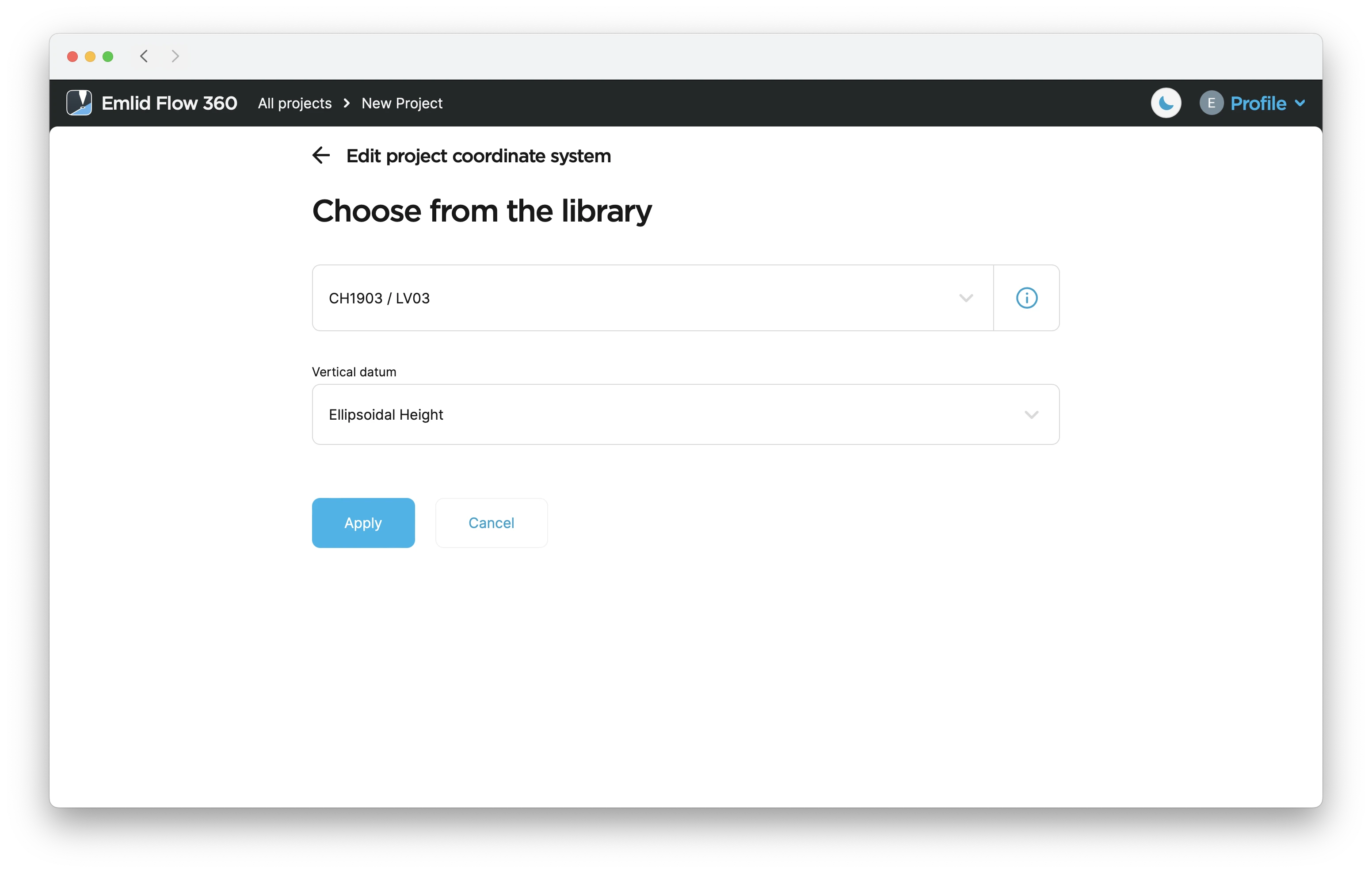
tipTo learn more about the suggested coordinate system, click the info icon next to the system name. Depending on the chosen coordinate system, the screen can contain the following information:
- Datum and its reference ellipsoid with parameters
- Global datum and its reference ellipsoid with parameters
- Projection type and its parameters
- Transformation type and its parameters
-
Click the Vertical datum cell. The app will show you available vertical datums. Choose the one you need and click Apply.
We select
LHN95 height.
Make sure that the coordinate system of your project and the base or
The Networked Transport of RTCM via Internet Protocol or NTRIP network is an alternative source of corrections. NTRIP allows your rover to accept corrections over the Internet with no need for the second local receiver acting as a base. A reference station collects data, then sends it to NTRIP caster, where it is retransmitted through the Internet port to the client rover connected via a particular port and authorized.
You can continue creating the project for survey.
Editing coordinate system
- Emlid Flow 360
In Emlid Flow 360, you can change a coordinate system for your project. Follow the steps below:
-
Open the project in Emlid Flow 360.
-
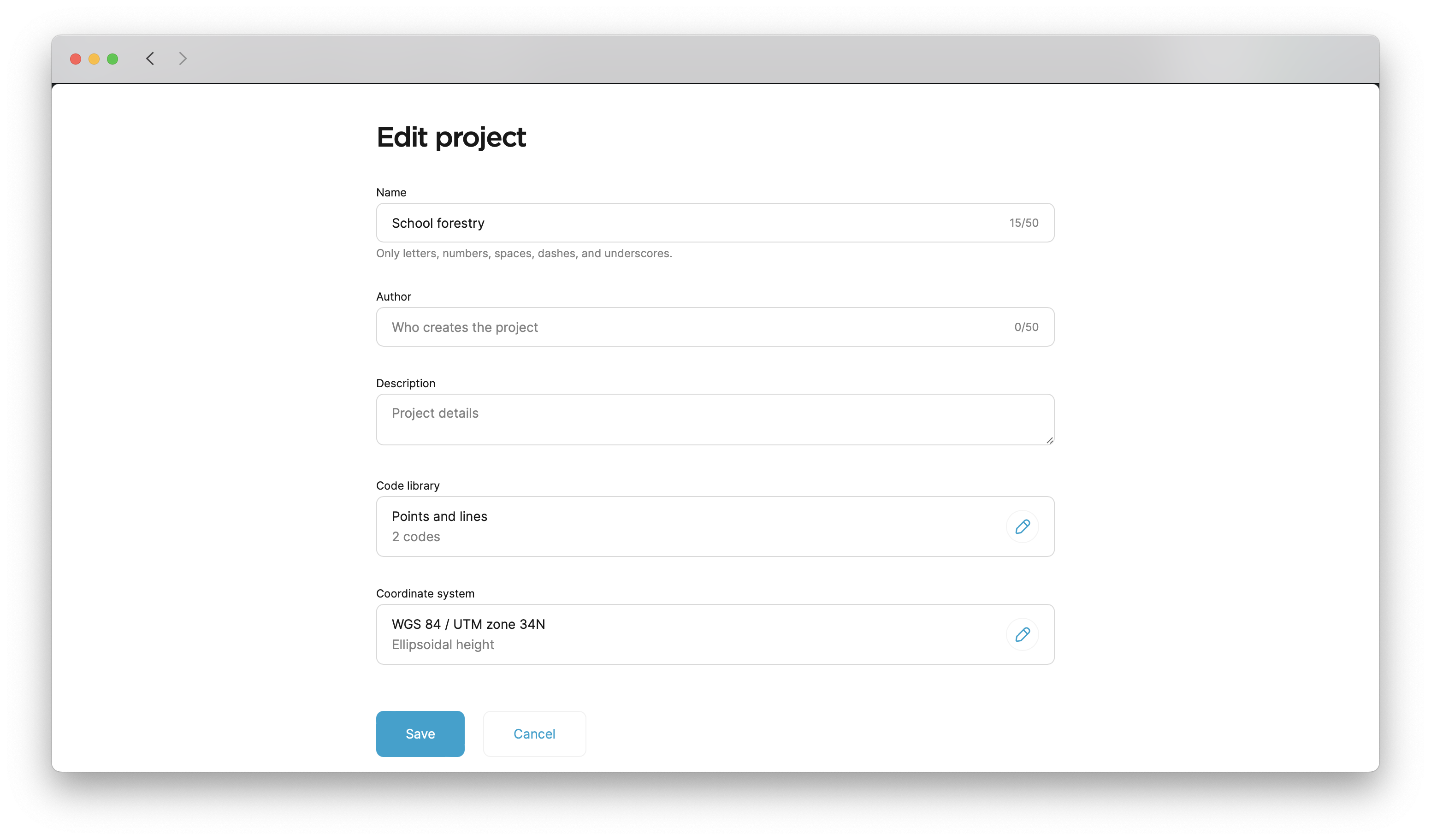
Tap the three-dot button in the upper-right corner, then tap Edit info.
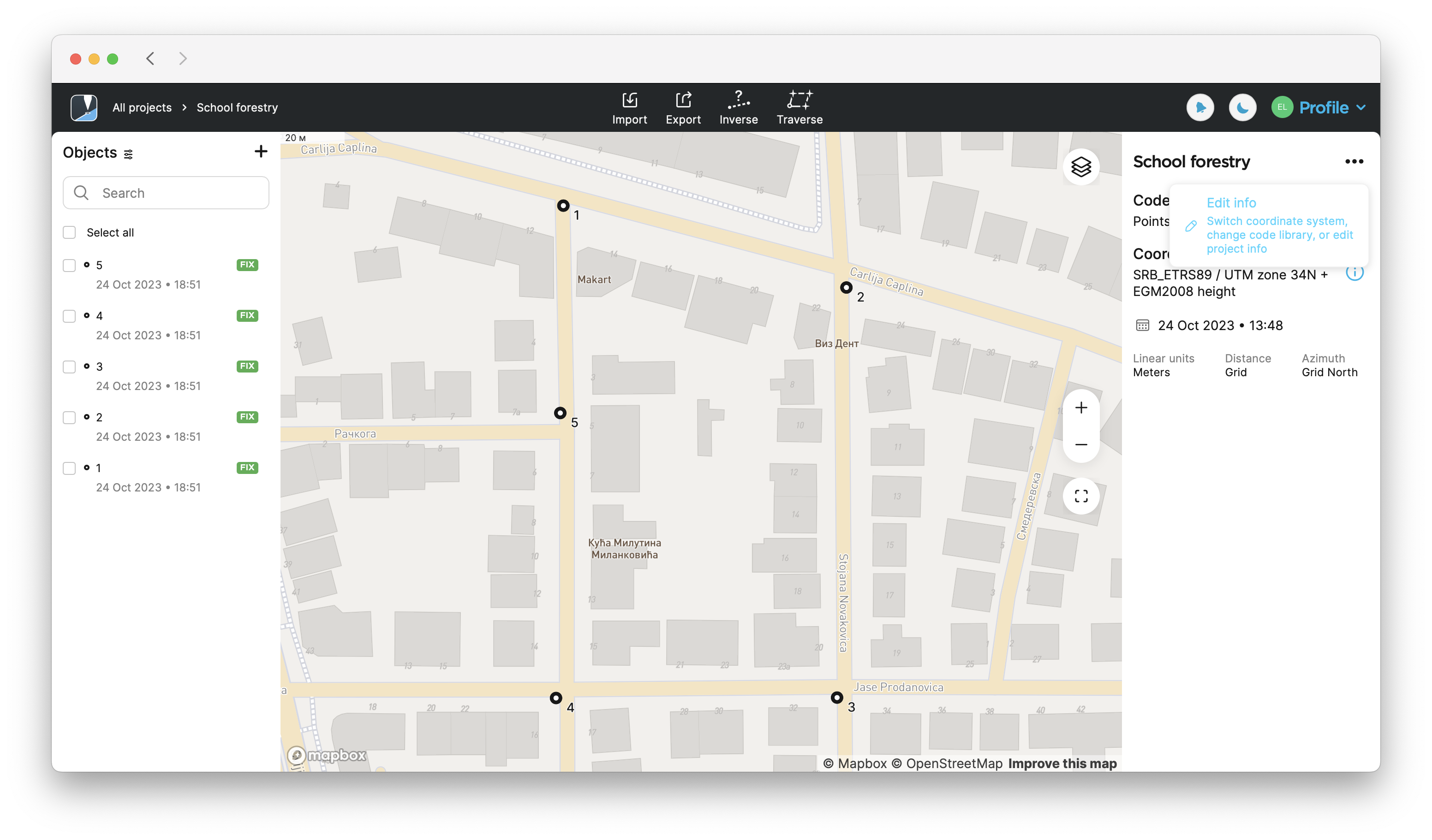
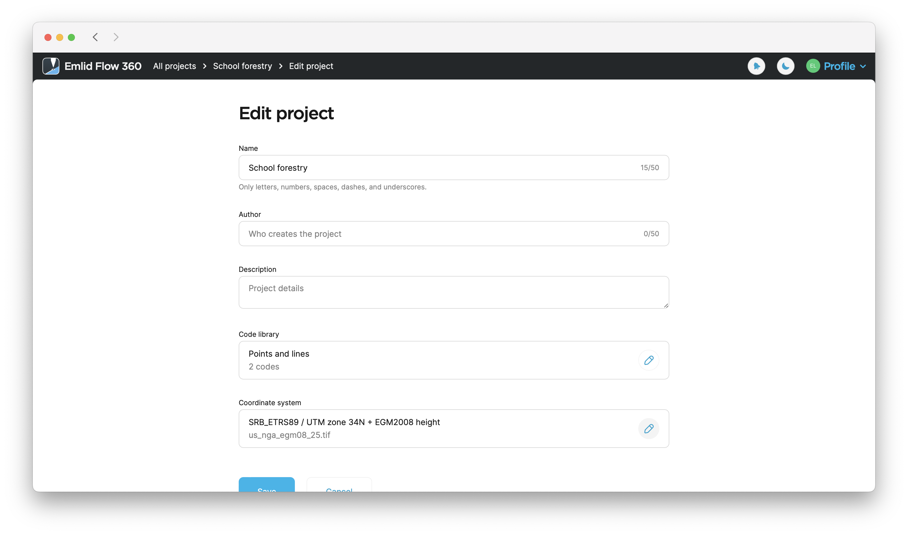
-
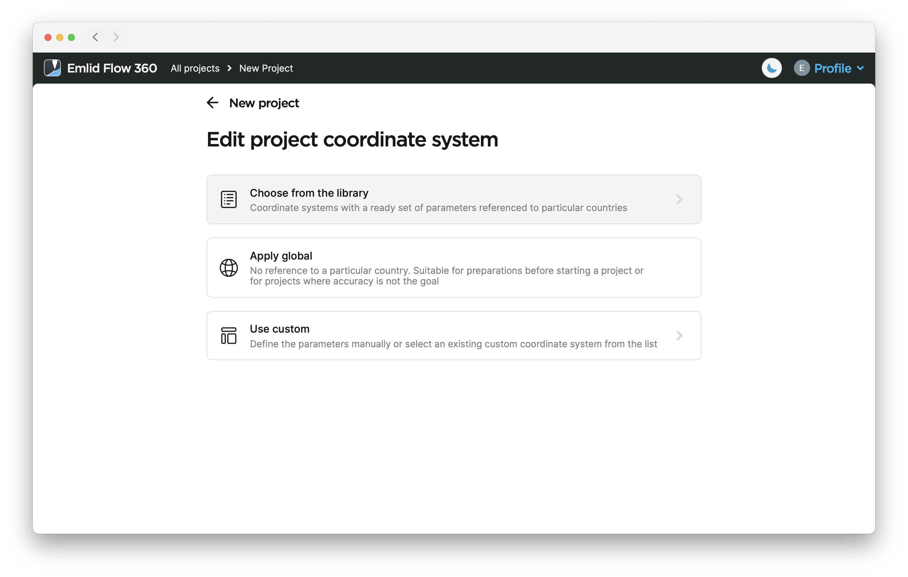
Tap the Edit button in the Coordinate system section.
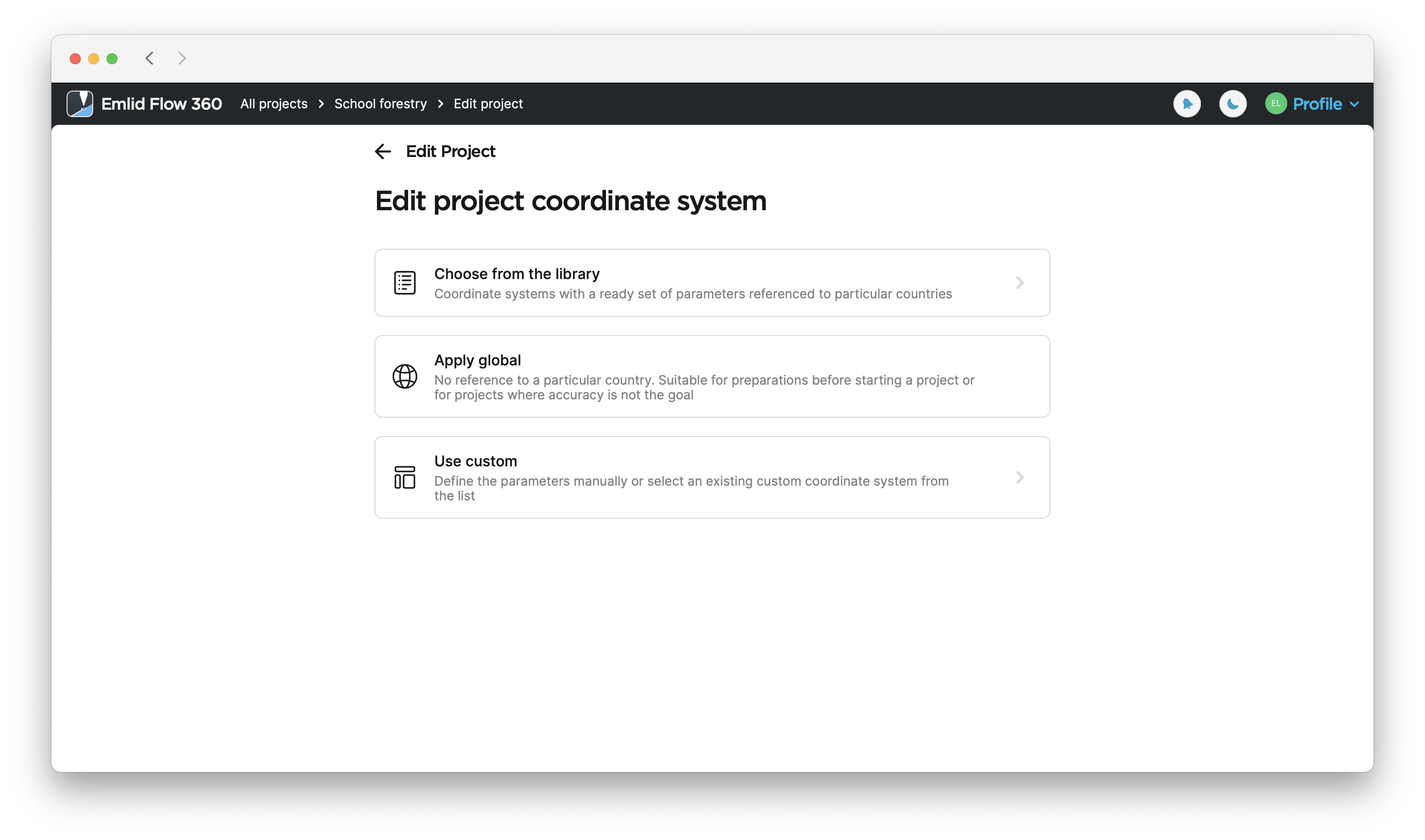
-
Select a suitable option to set a new CS.
-
After you’ve selected the new CS, tap Save to apply the changes.