Integration with ArcGIS Field Maps for Android
This tutorial provides step-by-step instructions on how to integrate your Reach RS2/RS2+ with ArcGIS Field Maps using a device on Android or WSA (Windows Subsystem for Android) via Bluetooth.
Overview
ArcGIS Field Maps is a mobile app that allows you to collect data in the field, view and edit maps, and share information with team members in real time.
To integrate your Reach RS2/RS2+ with ArcGIS Field Maps via Bluetooth, you will need the following:
- Reach RS2/RS2+
- A device on Android or WSA (Windows Subsystem for Android)
- ArcGIS Field Maps mobile app installed on your Android device
- ArcGIS account
Workflow
To integrate your Reach R2/RS2+ with ArcGIS Field Maps follow the steps below.
Configuring receiving corrections in Emlid Flow
To achieve centimeter-level accuracy when surveying with Reach RS2/RS2+, configure it to act as a rover in RTK in the following ways:
-
Set up RTK communication between 2 Reach RS2/RS2+ units over LoRa radio according to the guide about base and rover setup.
-
Configure your Reach RS2/RS2+ to receive corrections from an NTRIP service by following the steps from the Working with NTRIP service guide.
To start receiving corrections, make sure that your receiver has satellite visibility.
Enabling Reach RS2/RS2+ discoverability
To make your Reach RS2/RS2+ discoverable via Bluetooth, follow these steps:
-
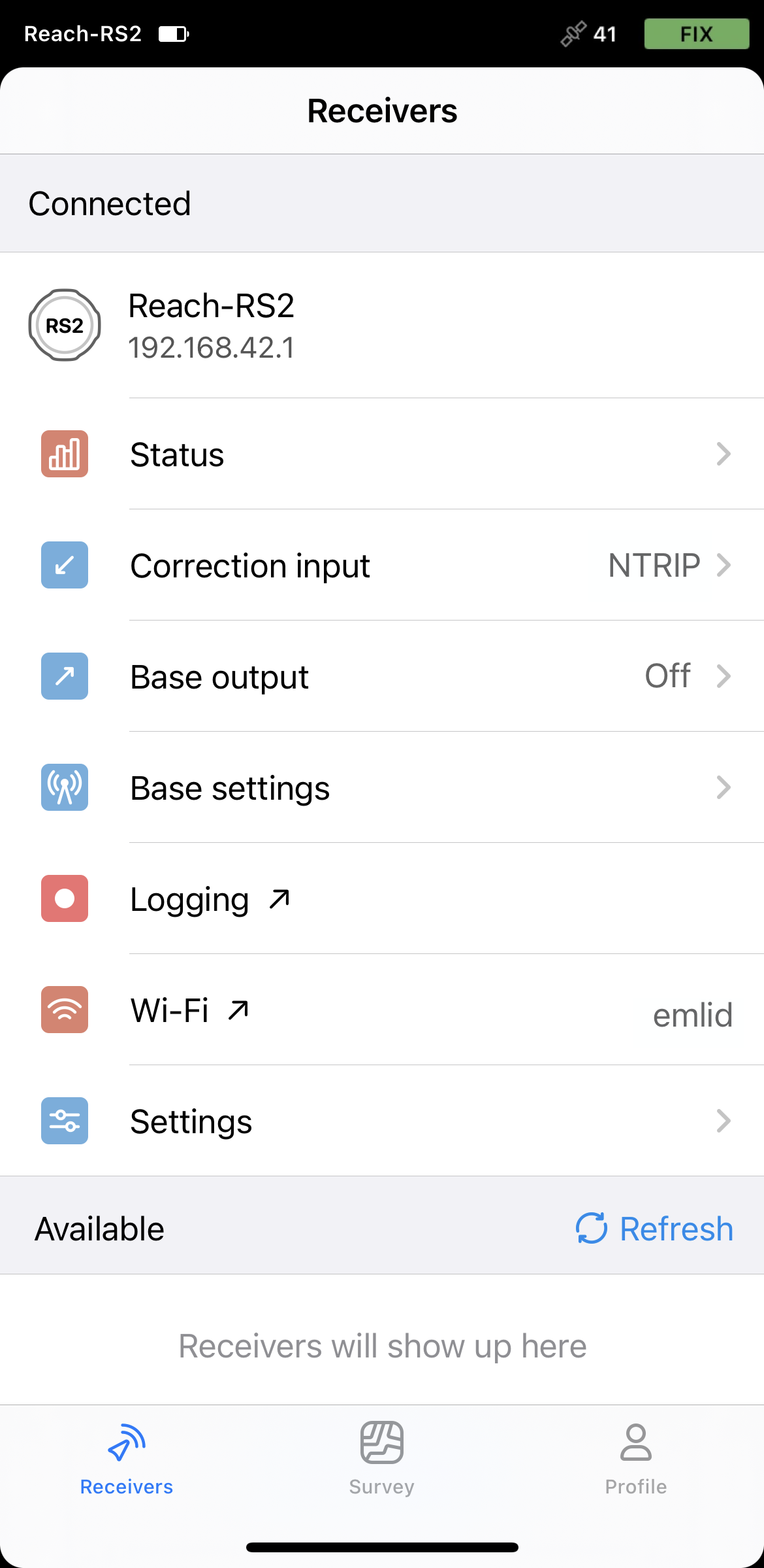
Connect to your Reach RS2/RS2+ using Emlid Flow.
-
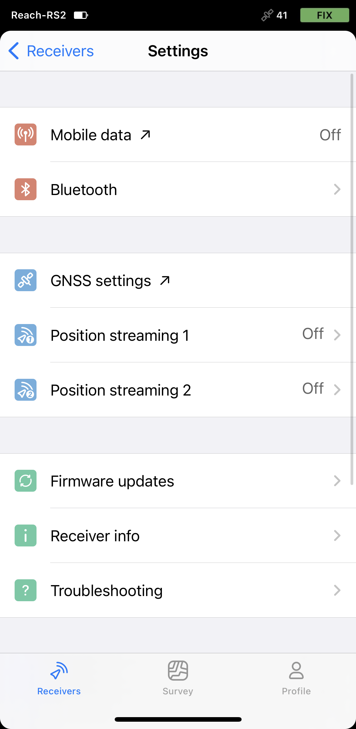
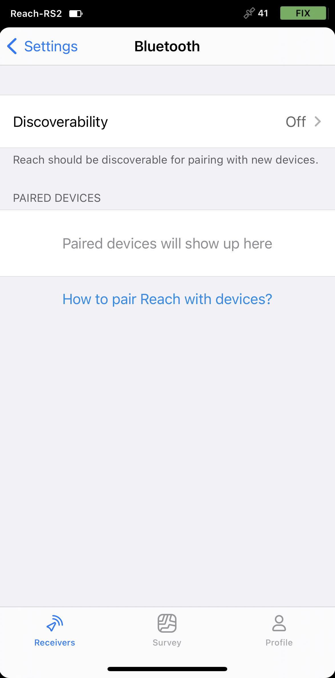
Go to Settings and tap Bluetooth.
-
Enable Bluetooth by tapping the Turn on Bluetooth button.
-
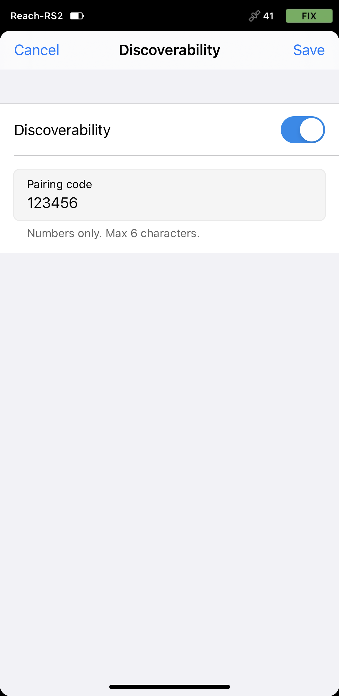
Tap Discoverability and turn it on. Tap Save to apply changes.
Pairing Reach with Android device
To pair your Reach RS2/RS2+ with the Android device, do the following:
-
Navigate to the Bluetooth configuration screen on your Android device and enable Bluetooth.
-
Wait for your Reach to be listed as an available device.
tipKeep Reach within a few meters from the device.
-
Tap the name of your Reach in the list of available devices on the Android device.
noteIf your device requires a PIN code, enter 123456.
-
Pair Reach with the Android device.
Setting up position streaming from Reach RS/RS2+
To stream your Reach RS2/RS2+ position in the NMEA format to the Android device, proceed as follows:
-
Open Emlid Flow and connect to your Reach.
-
Go to Settings and tap Position streaming 1.
-
Select Bluetooth.
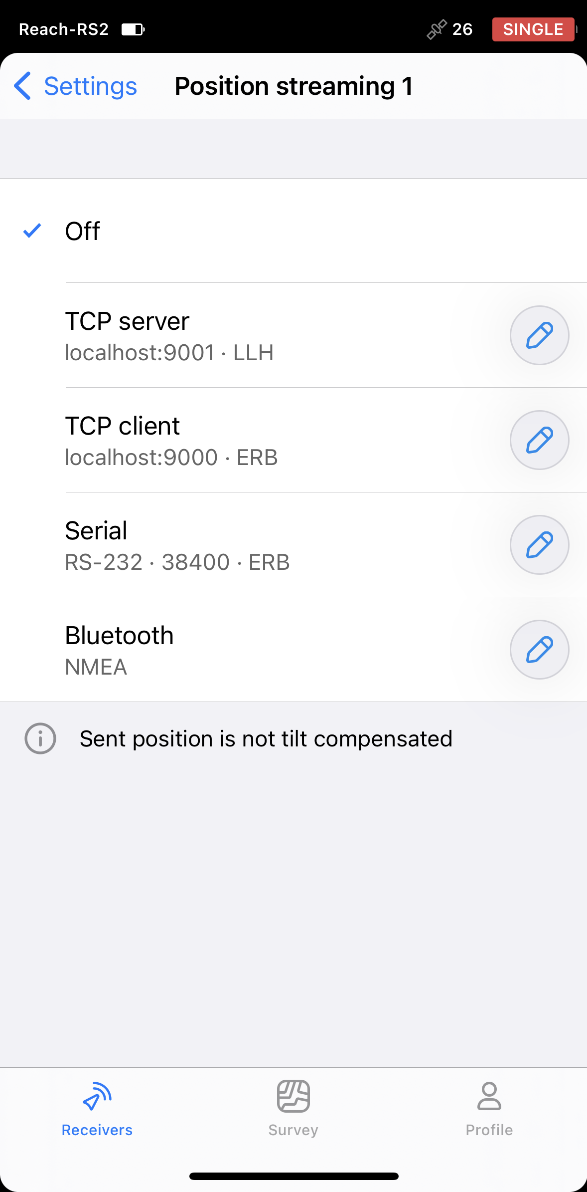
-
To configure position streaming, tap the Edit button in the Bluetooth cell.
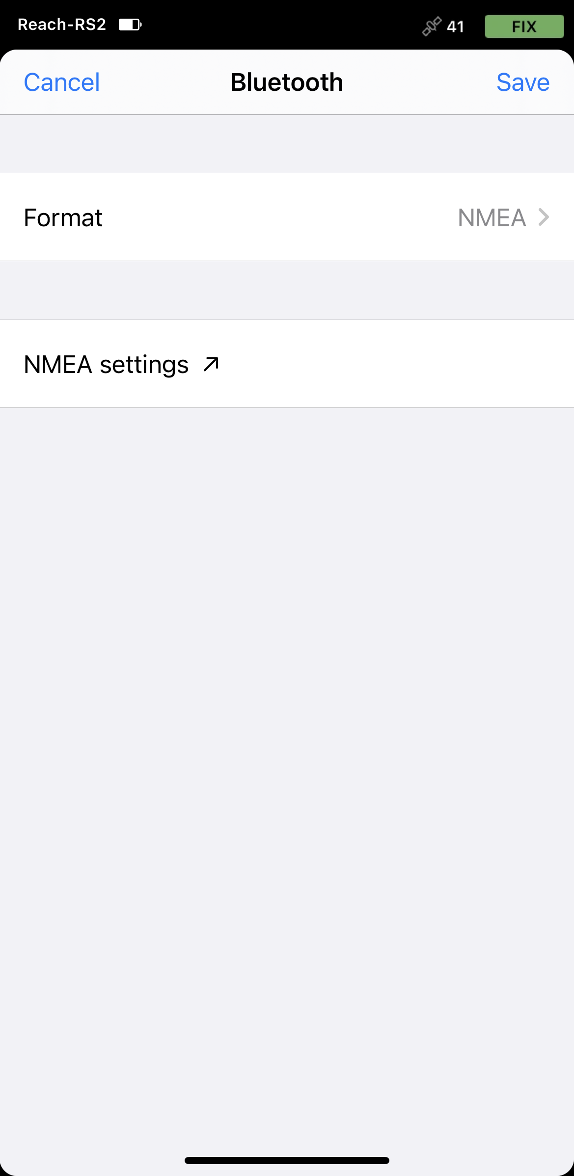
-
Tap Format and choose NMEA. Save changes.
Configuring communication between ArcGIS Field Maps and Reach RS2/RS2+
-
Open the ArcGIS Field Maps app.
-
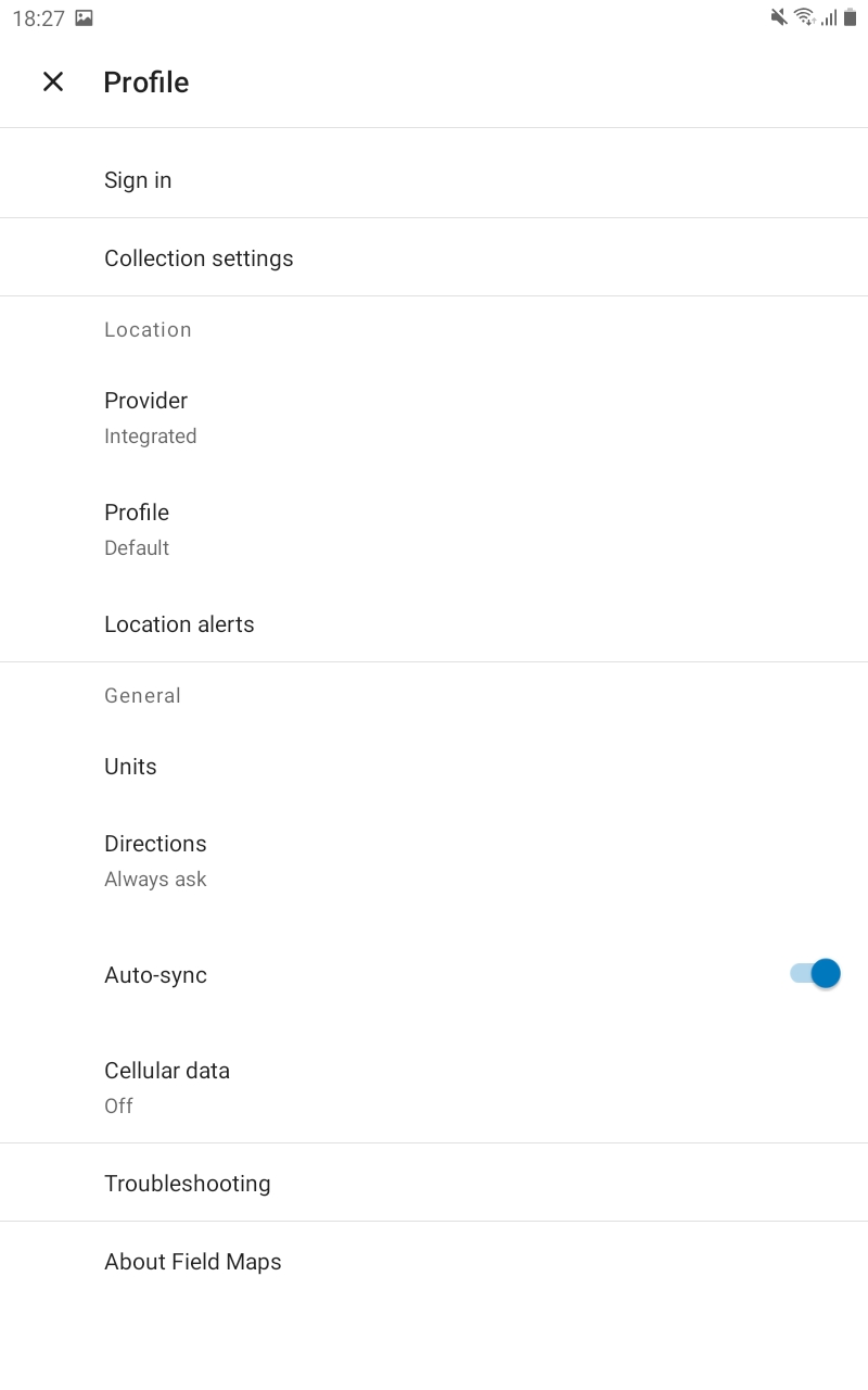
Tap the Profile icon in the upper-right corner to open the settings.
-
Tap Provider in the Location section.
-
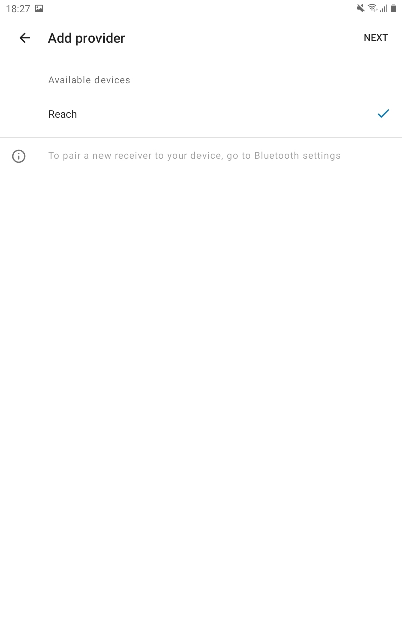
Tap the Plus button to add a provider.
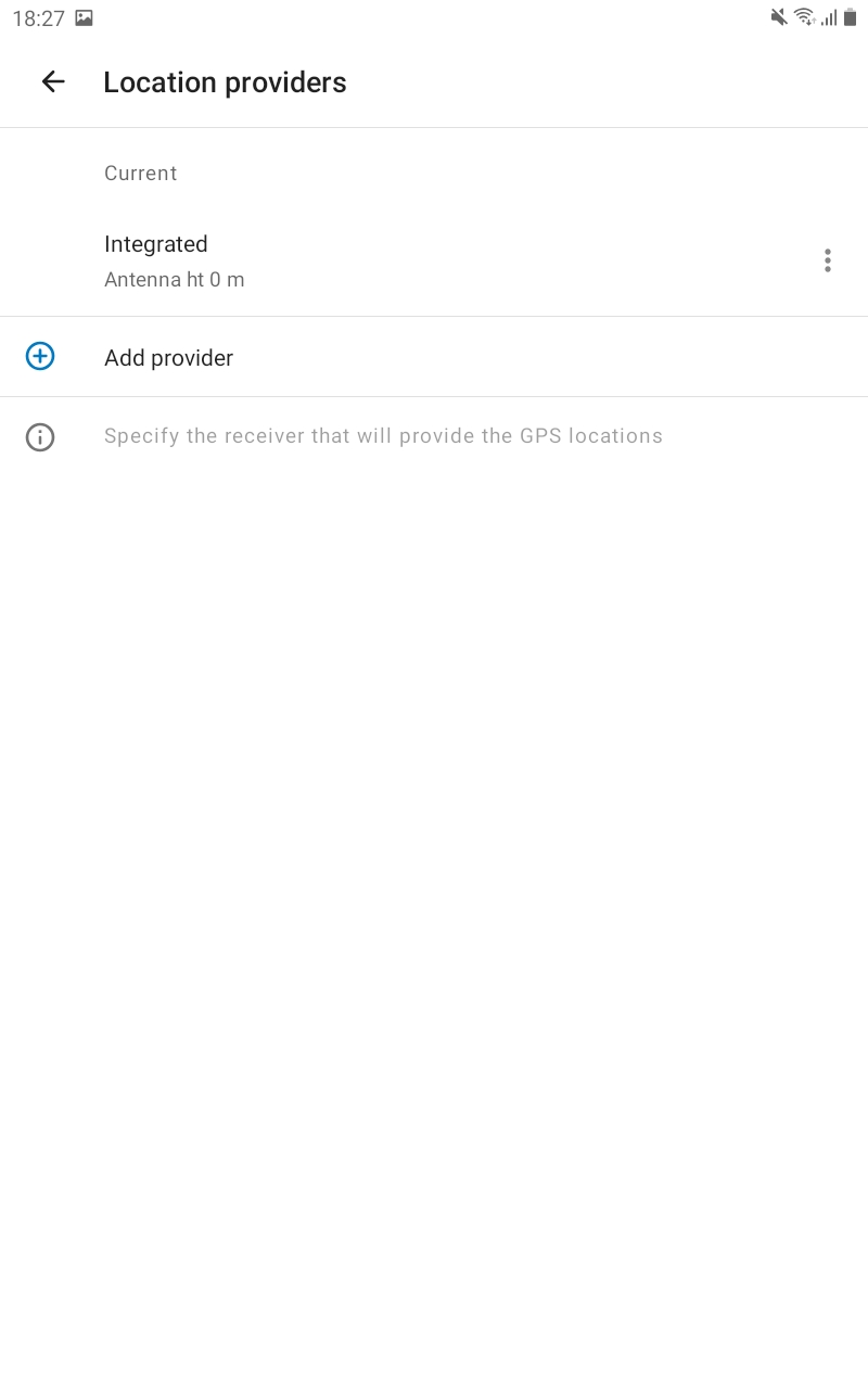
-
Select your Reach in the list of available devices. Tap NEXT.
-
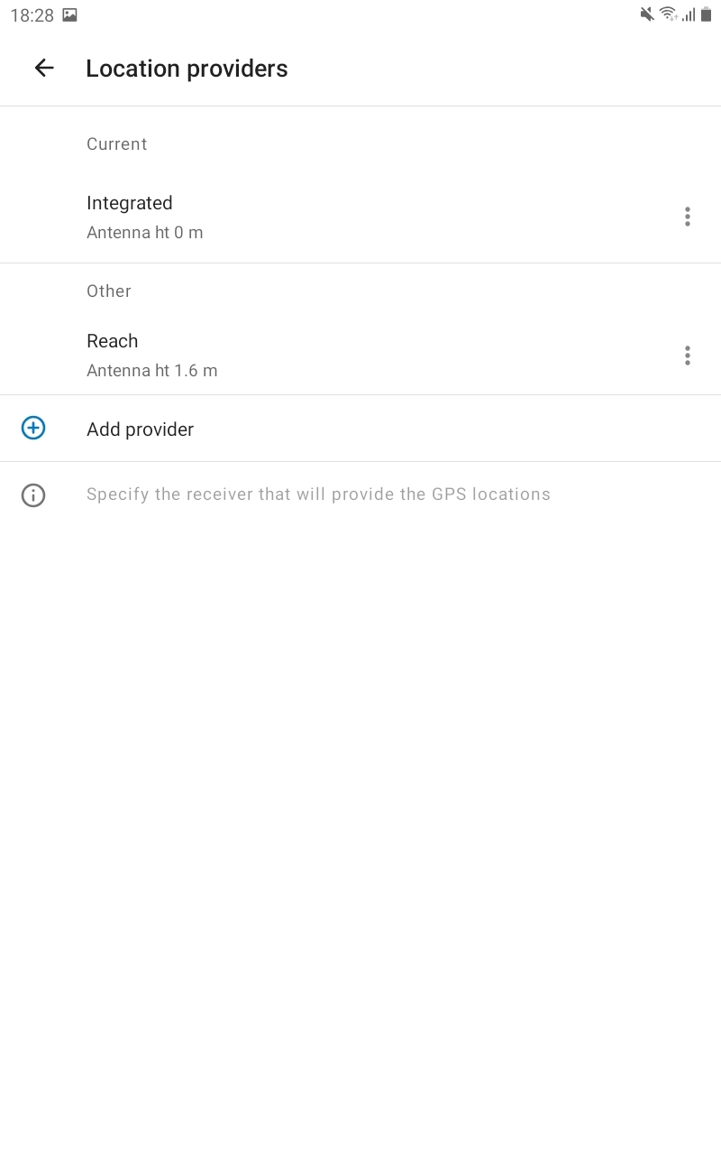
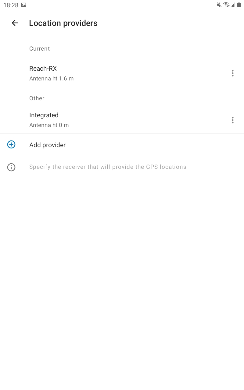
Set the Antenna height, tap DONE.
-
Tap Current, set the antenna height. Click on your Reach in the Other section. This Reach will be set as a current one.
-
Tap the back arrow to come back to your Profile settings.
You are now ready to proceed with the measurement of the GNSS data!