Calculate intersection
Unlock the full set of features for topo, set-out, and as-built surveys
This guide describes how to use the Intersection tool in Emlid Flow and Emlid Flow 360 to compute new points.
Overview
The Intersection tool in Emlid Flow and Emlid Flow 360 allows you to compute new points based on intersections of the existing reference points using distances, directions, or a combination of both. This functionality is useful for solving various geometry tasks, including:
- Working with paper plans that lack coordinate data,
- Recovering missing or incomplete field data,
- Calculating positions for inaccessible or obstructed locations.
Workflow
Follow the steps below to apply the tool and explore each available method in detail:
- Emlid Flow
- Emlid Flow 360
-
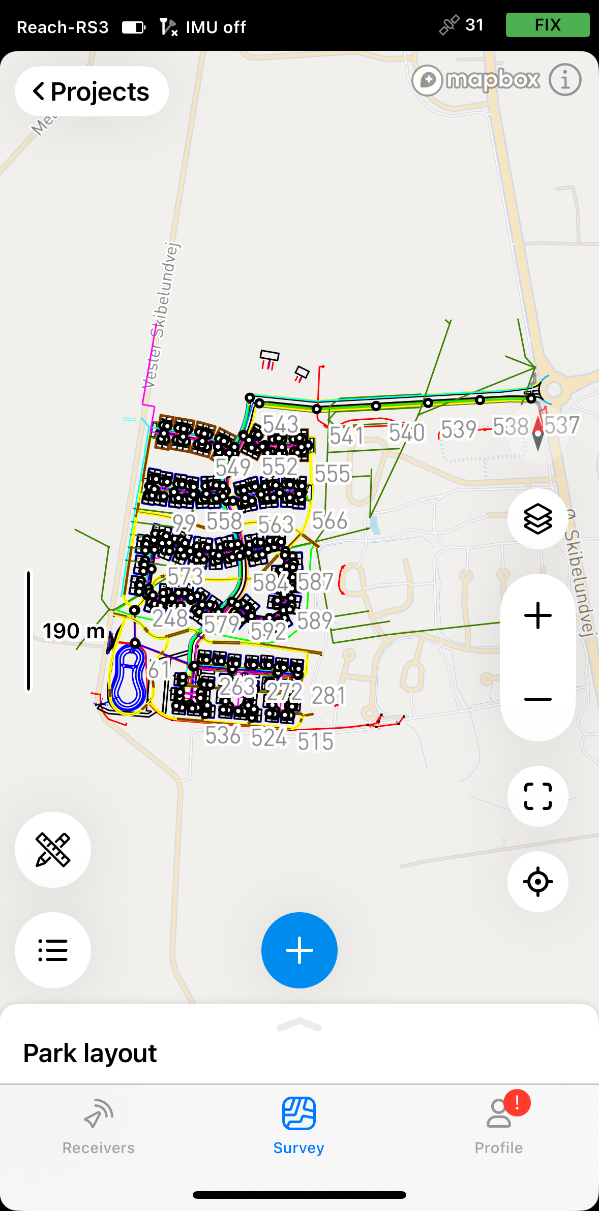
Open the project in Emlid Flow.
-
Tap the tools button at the bottom left corner of the screen.

-
Tap Intersection.
-
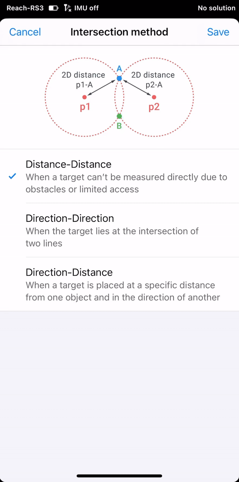
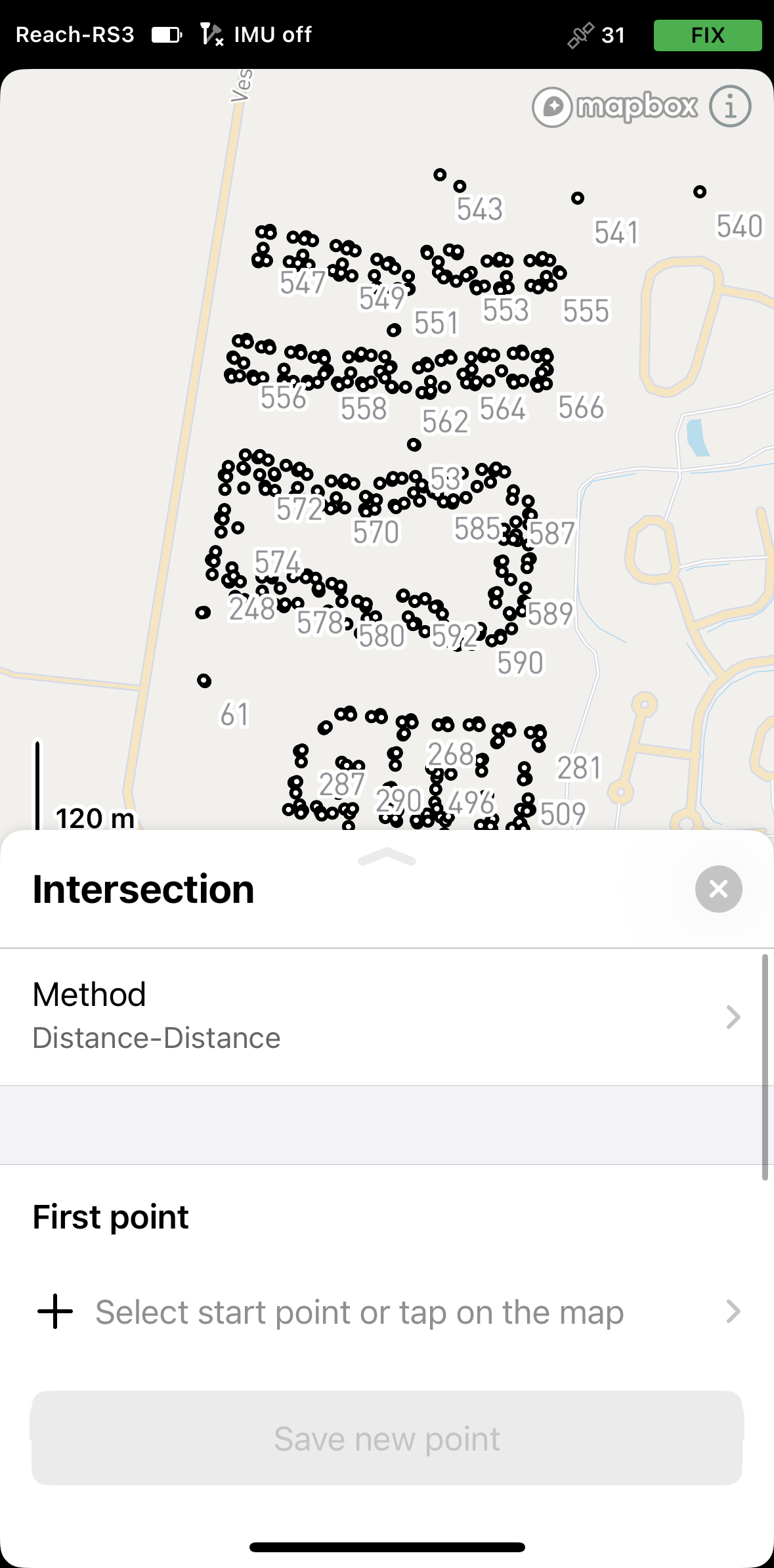
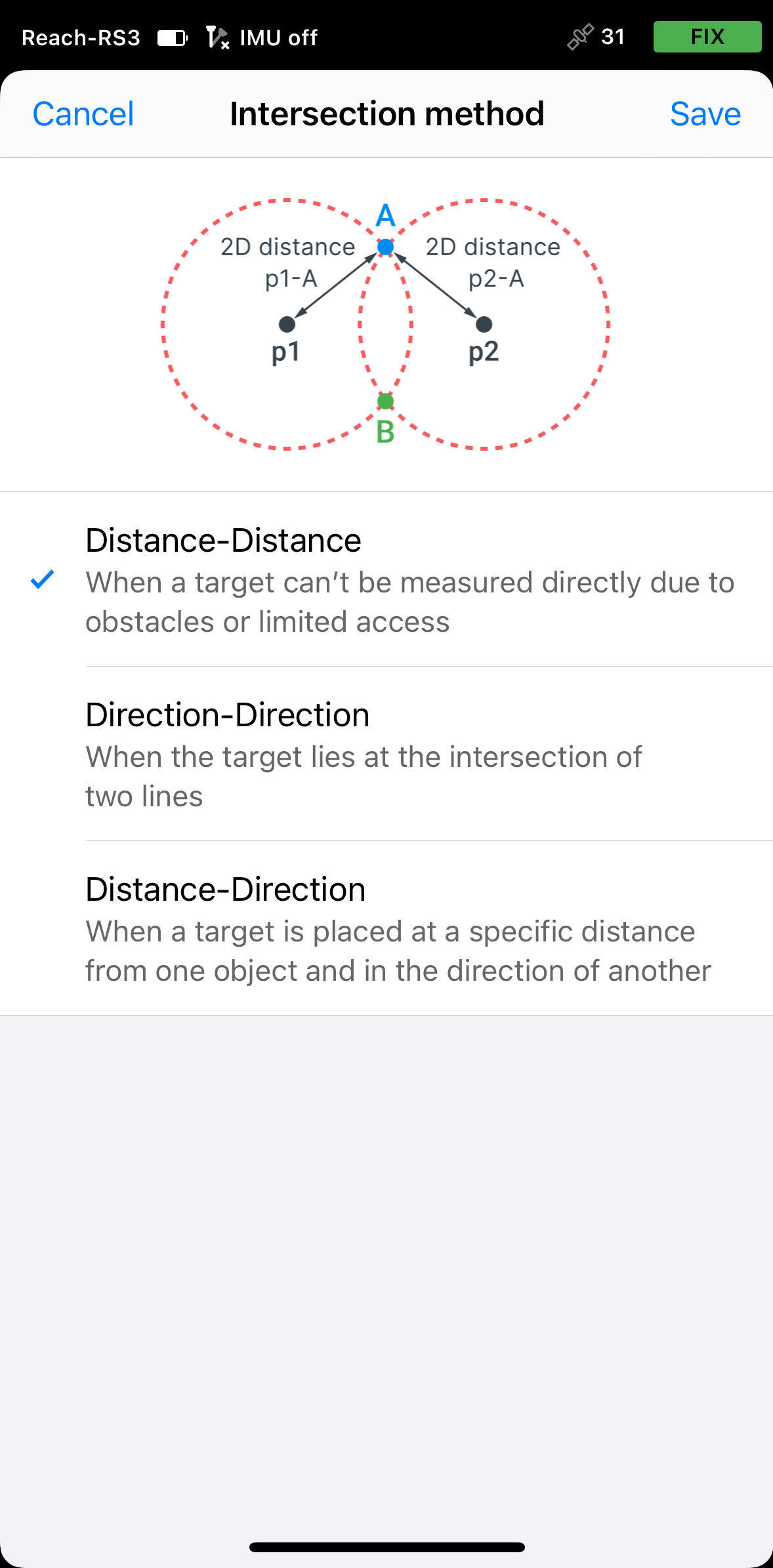
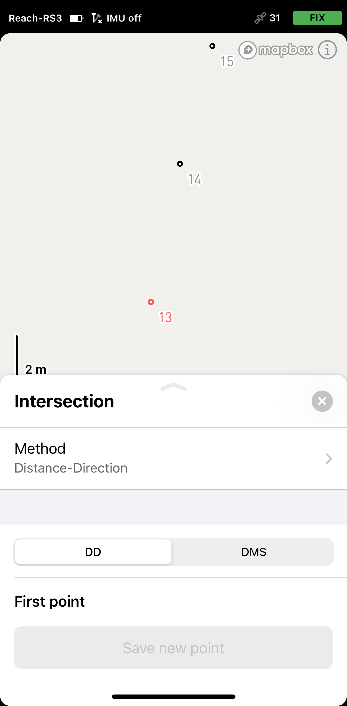
Tap Method and select the required calculation type. By default, the tool uses the Distance–Distance method.
Depending on the selected calculation method, follow the steps below.
-
Open the project in Emlid Flow 360.
-
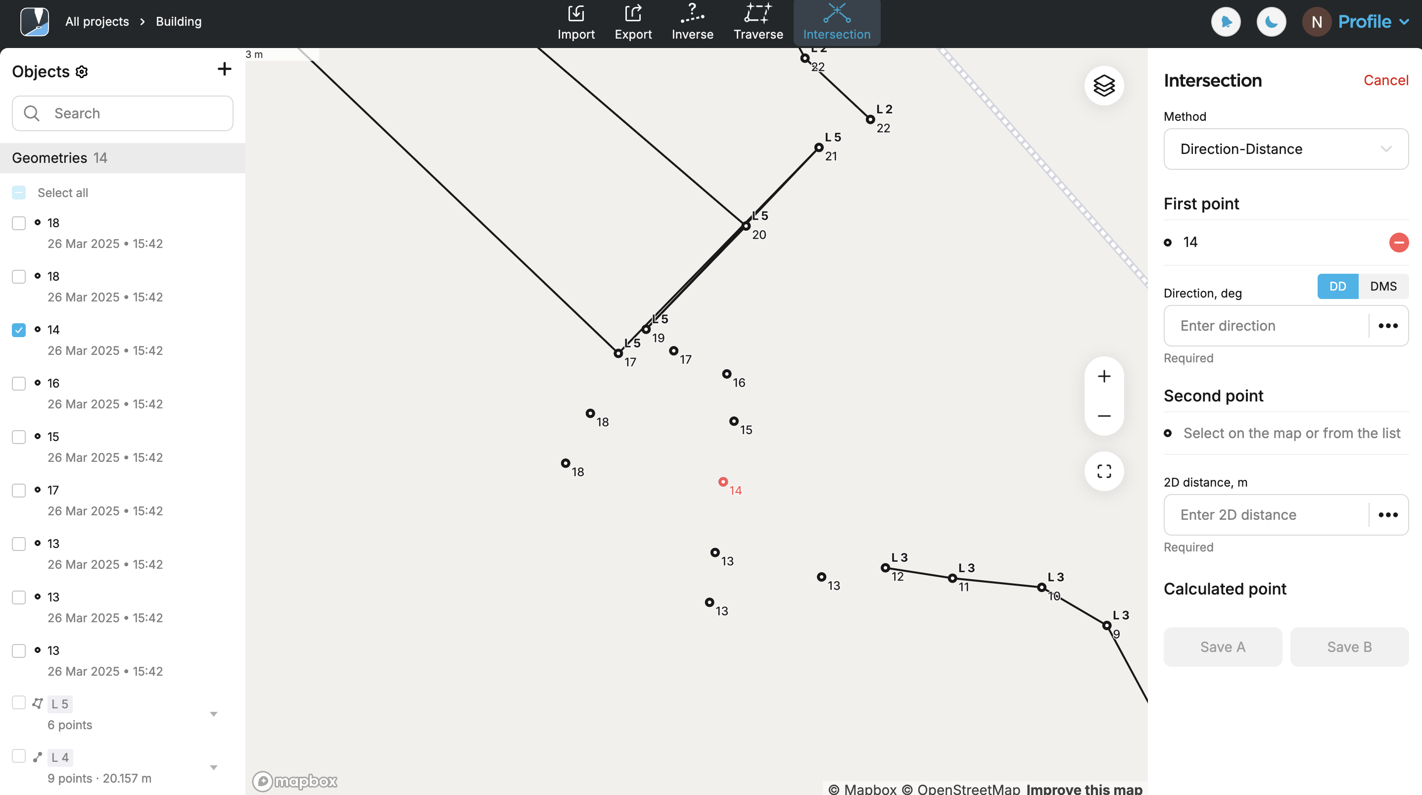
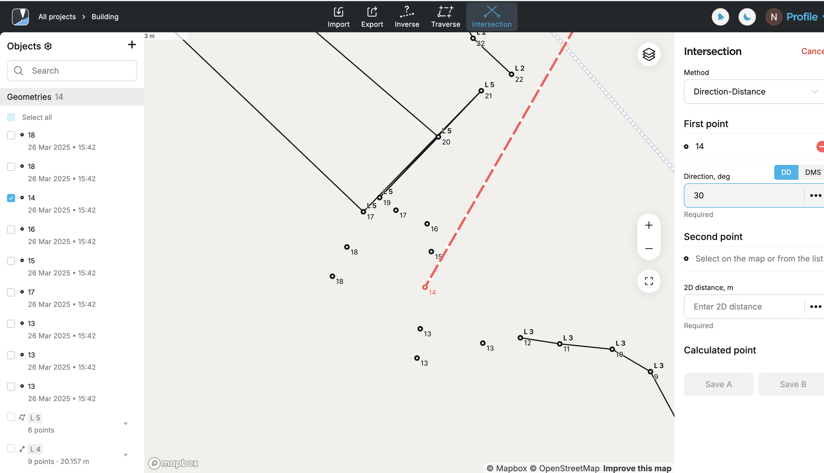
Click the Intersection button in the tools panel at the top of the screen.
-
Click Method and select the required calculation type. By default, the tool uses the Distance–Distance method.

Applying Distance-Distance method
Use the Distance–Distance method to define a new point based on its distance from two known reference points. The app generates two circles—each centered on a reference point with a radius equal to the entered distance. The intersection of these circles produces one or two possible locations. Select the appropriate one based on the site context.
There are specific cases based on the entered distance values where no intersection can be calculated:
- If the distance between the two reference points is greater than the sum of the entered distances.
- If the distance between the two reference points is less than the absolute difference of the two entered distances, i.e one circle is completely inside the other.
The apps apply 2D grid distance.
- Emlid Flow
- Emlid Flow 360
-
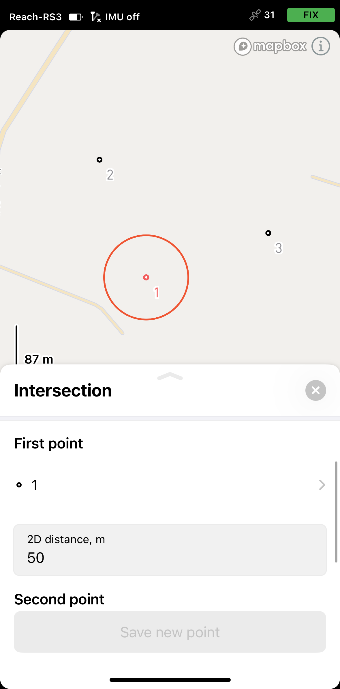
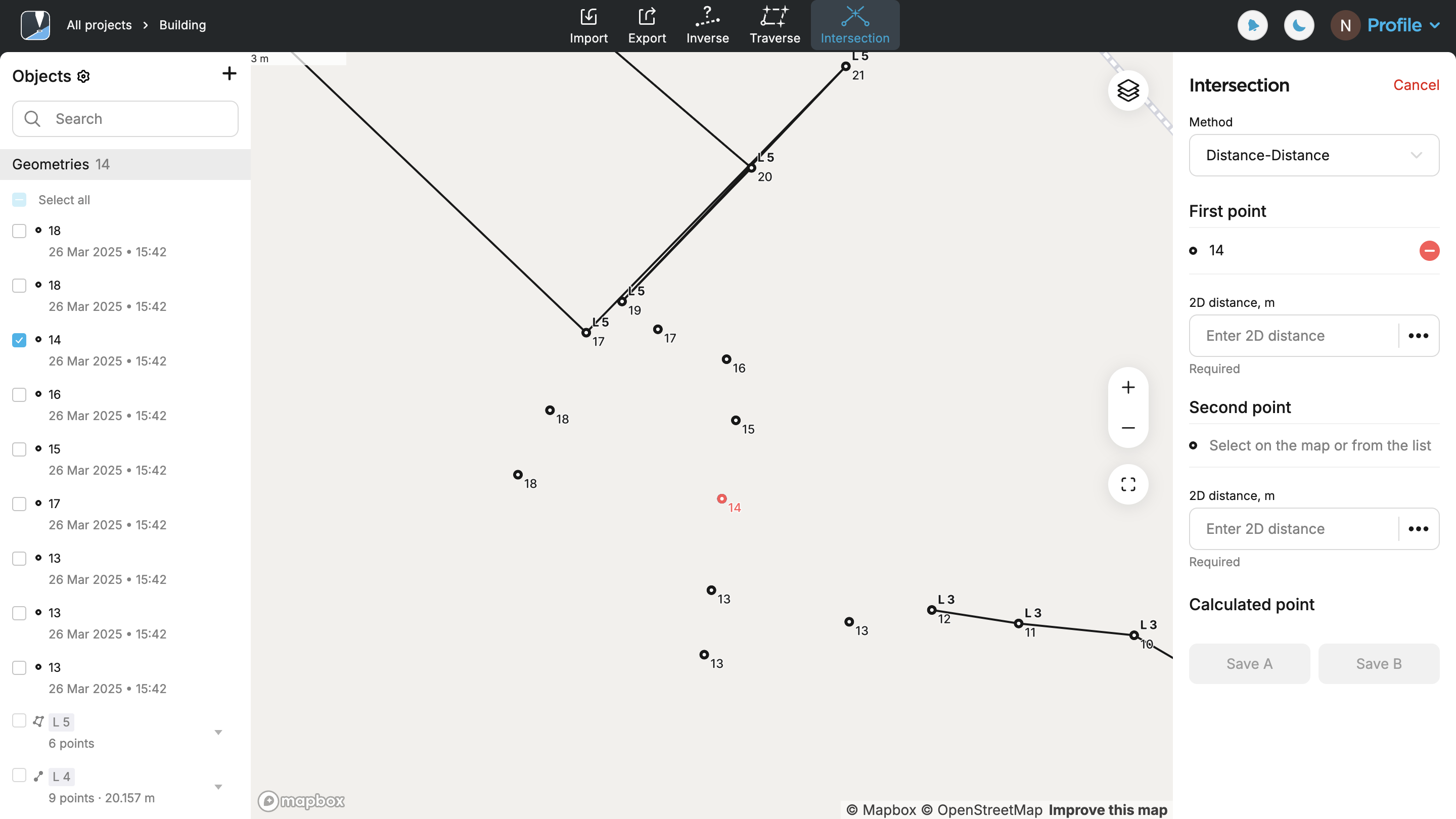
Select the first point on the map or from the list. It will be displayed in red.

-
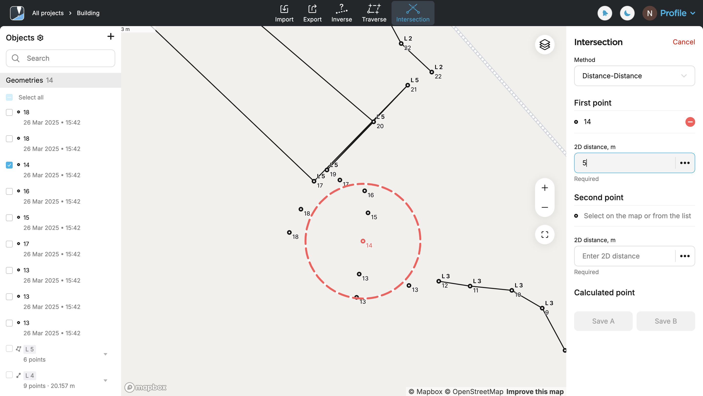
Specify the distance. You’ll see a red circle, the radius of which corresponds to the specified distance.
-
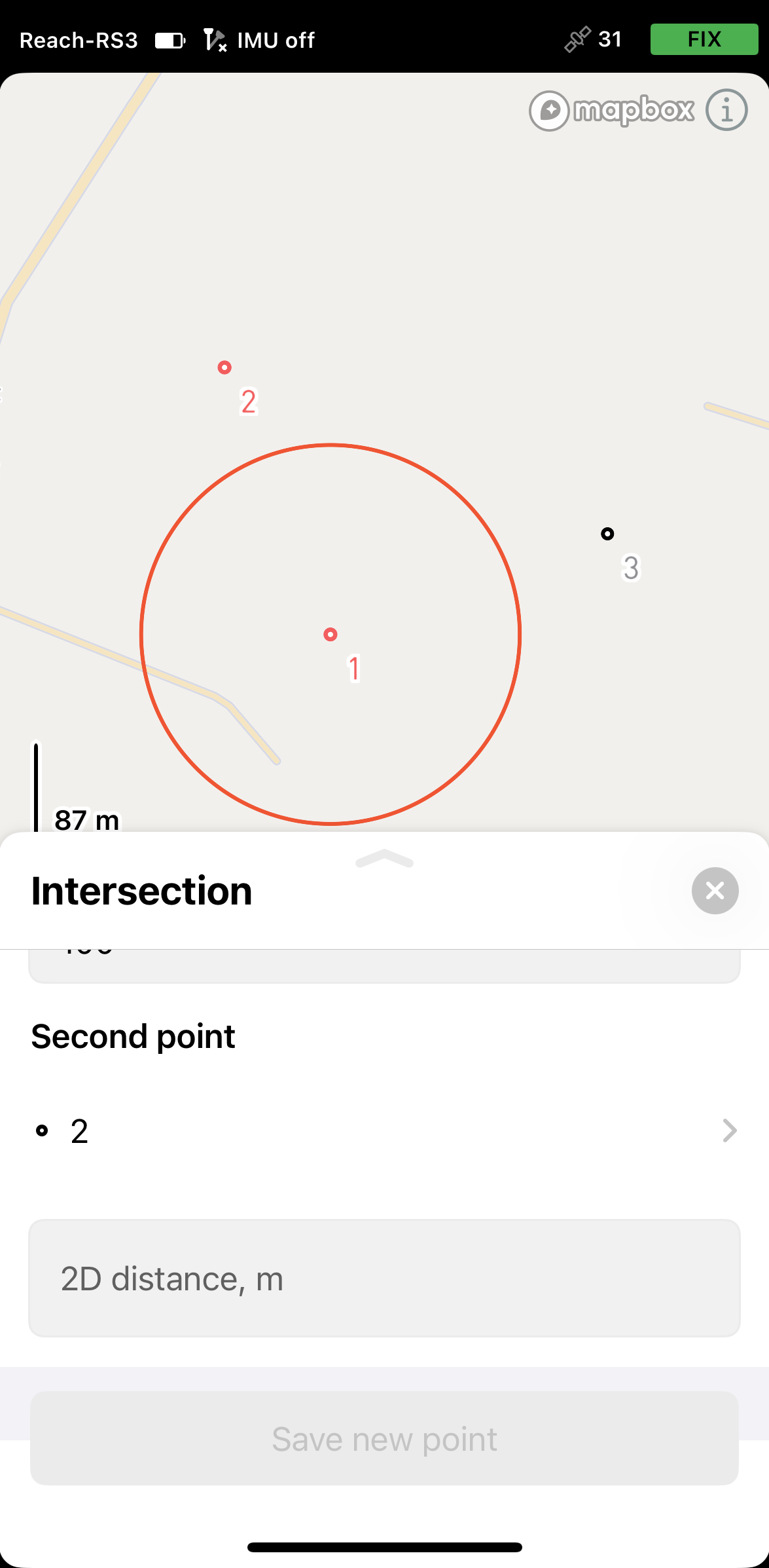
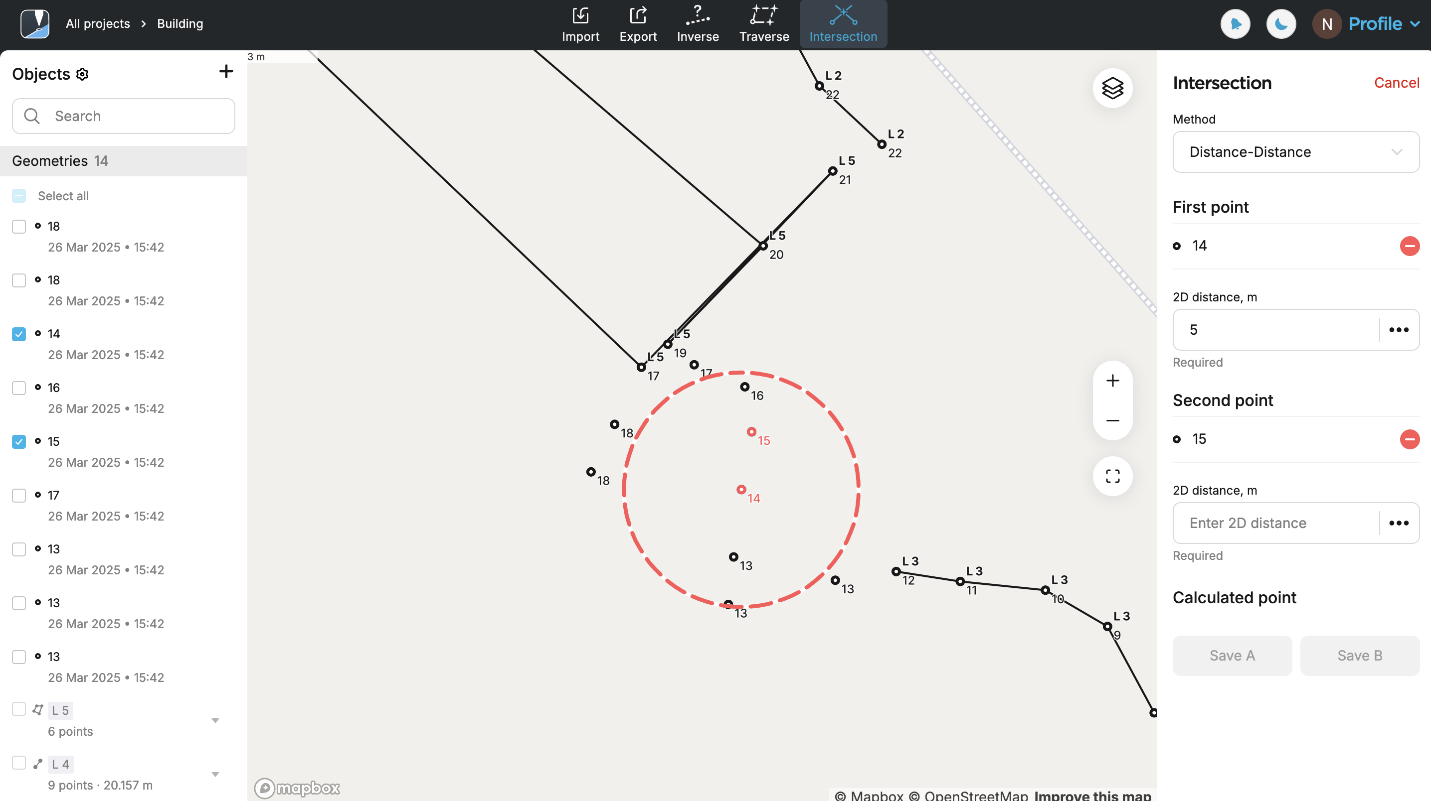
Select the second point on the map or from the list. It will be displayed in red.
-
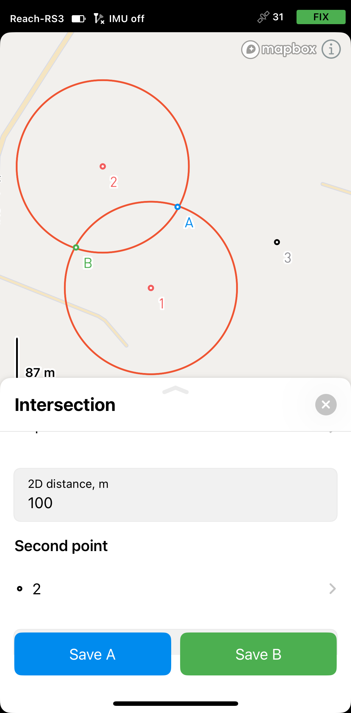
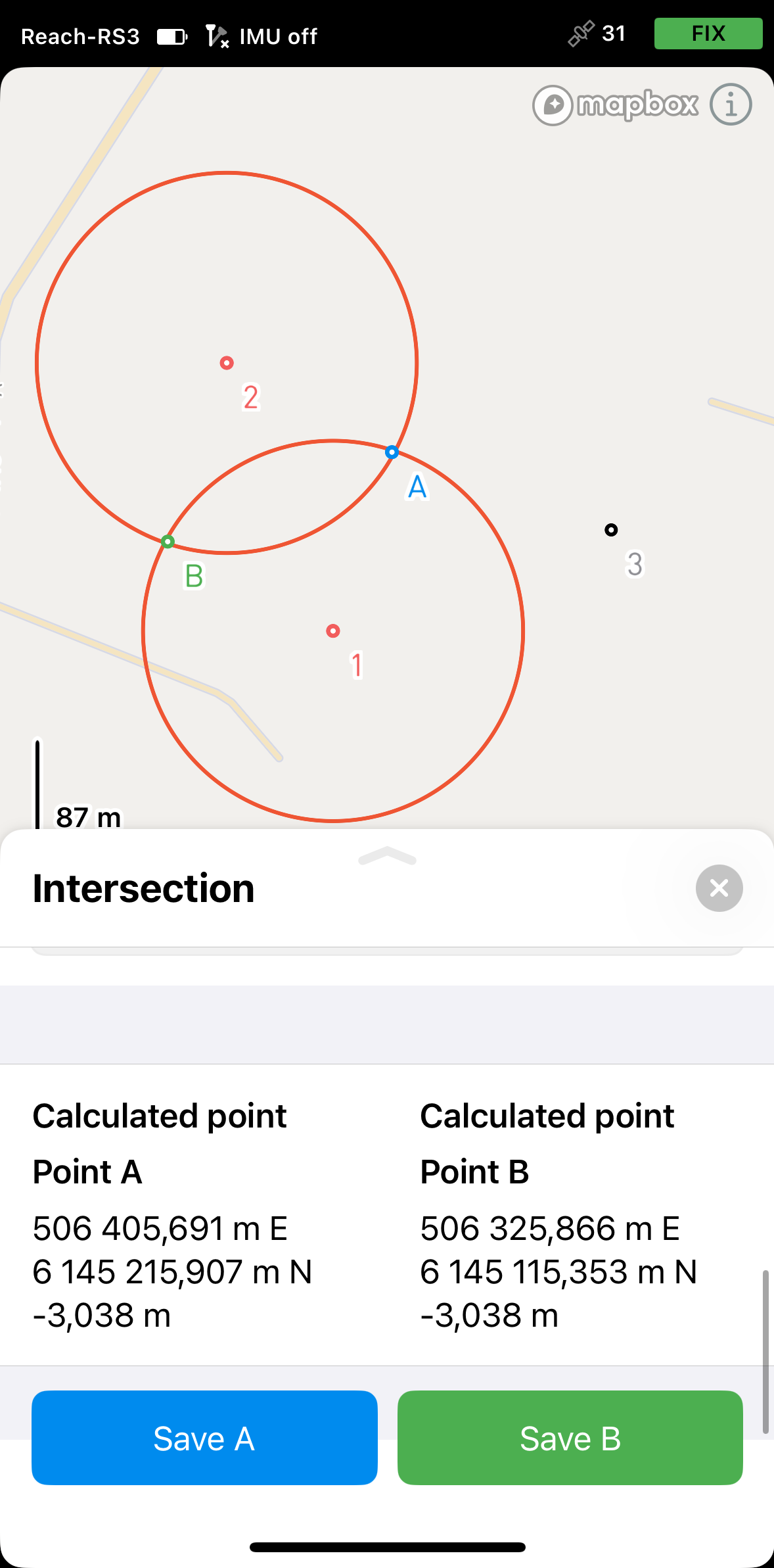
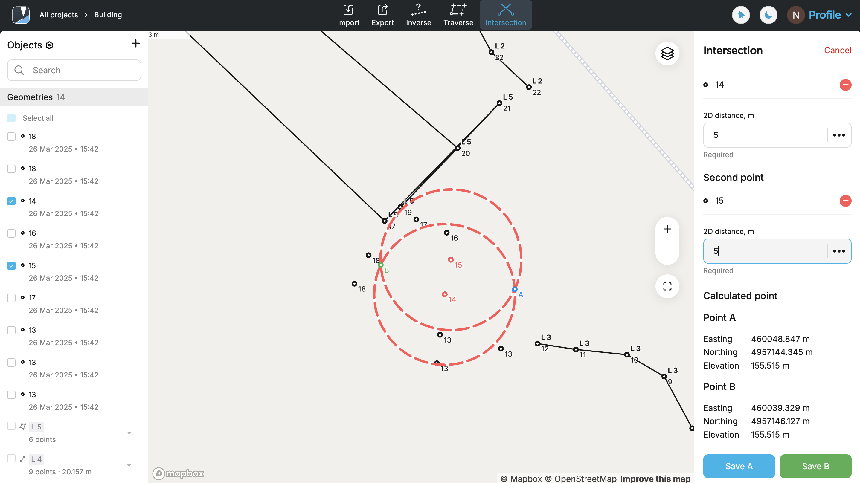
Specify the distance. You’ll see the second circle, the radius of which corresponds to the specified distance. The app will simultaneously display the intersection of the two circles, resulting in two possible point locations named A and B. It will provide the coordinates for both options—select and save the one your project requires.
-
Select the first point on the map or from the list. It will be displayed in red.
-
Specify the distance. You’ll see a red circle, the radius of which corresponds to the specified distance.
-
Select the second point on the map or from the list. It will be displayed in red.
-
Specify the distance. You’ll see the second circle, the radius of which corresponds to the specified distance. The app will simultaneously display the intersection of the two circles, resulting in two possible point locations named A and B. It will provide the coordinates for both options—select and save the one your project requires. Save the required point.
Applying Direction-Direction method
Use the Direction-Direction method to calculate the intersection point of two directional lines (azimuths) originating from known reference points. The app visualizes each direction as a ray and determines their point of intersection.
There are specific cases based on the entered direction values where no intersection can be calculated:
- This method may not return a result if the input directions are parallel.
- If the rays intersect at a very shallow angle, the computed point may be less reliable due to sensitivity to input errors.
Follow the steps below:
- Emlid Flow
- Emlid Flow 360
-
Select the direction format. You can choose between decimal degrees (DD) and degrees–minutes–seconds (DMS).
-
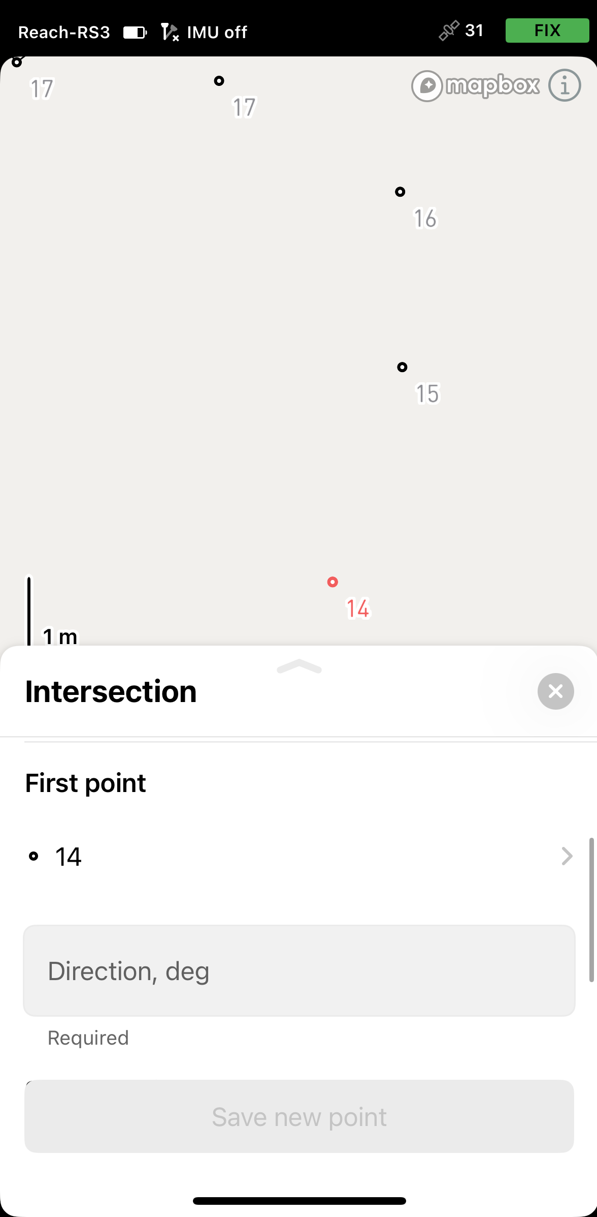
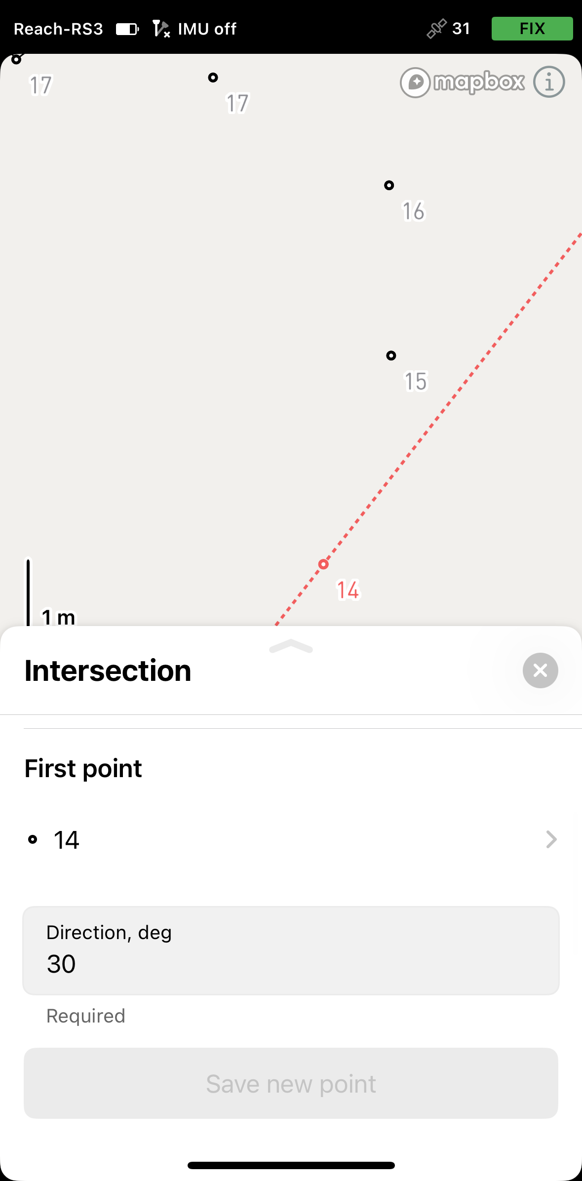
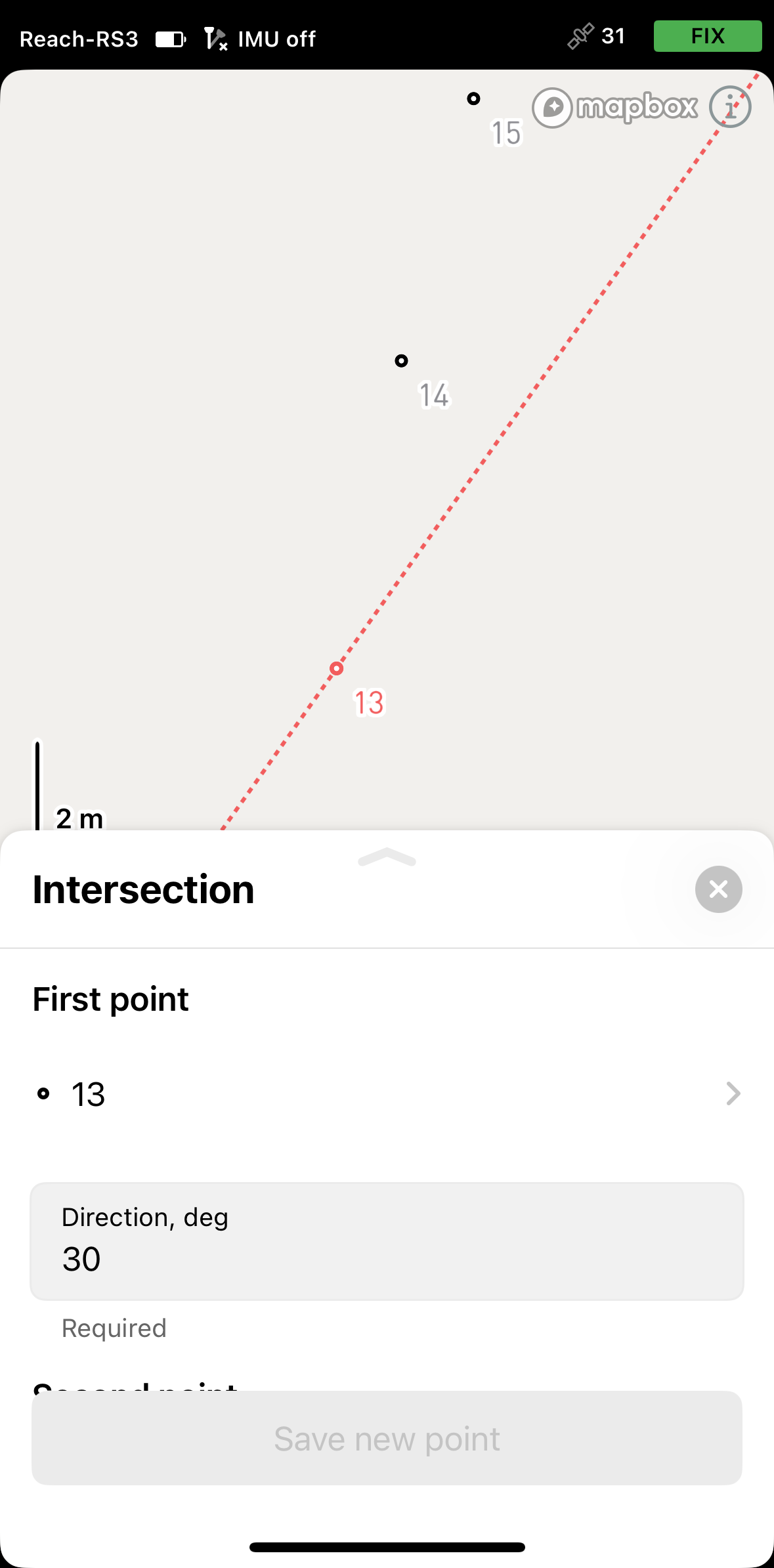
Select the first point on the map or from the list. It will be displayed in red.
-
Specify the direction. A red line will appear on the map, aligned with the specified azimuth.
-
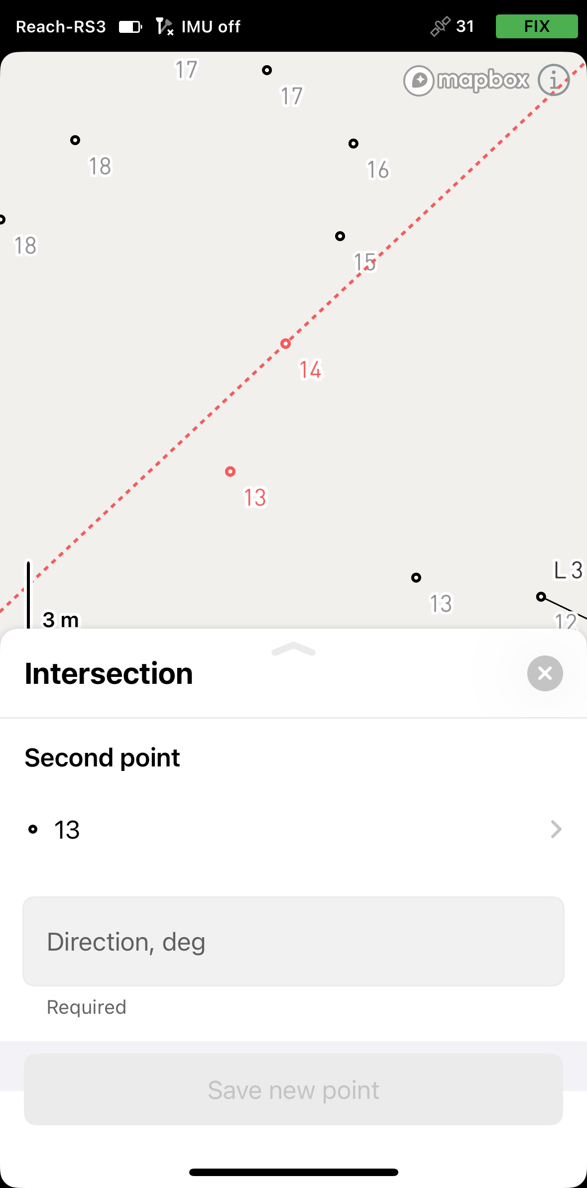
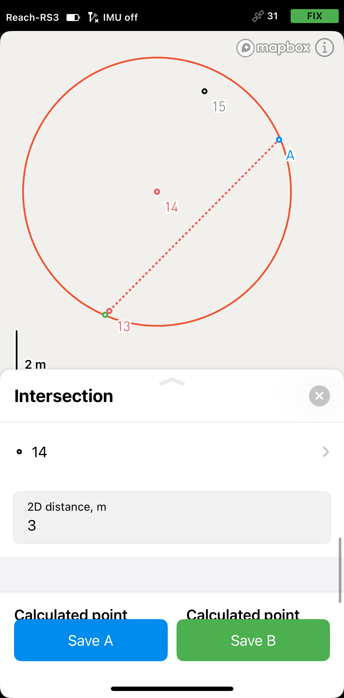
Select the second point on the map or from the list. It will be displayed in red.
-
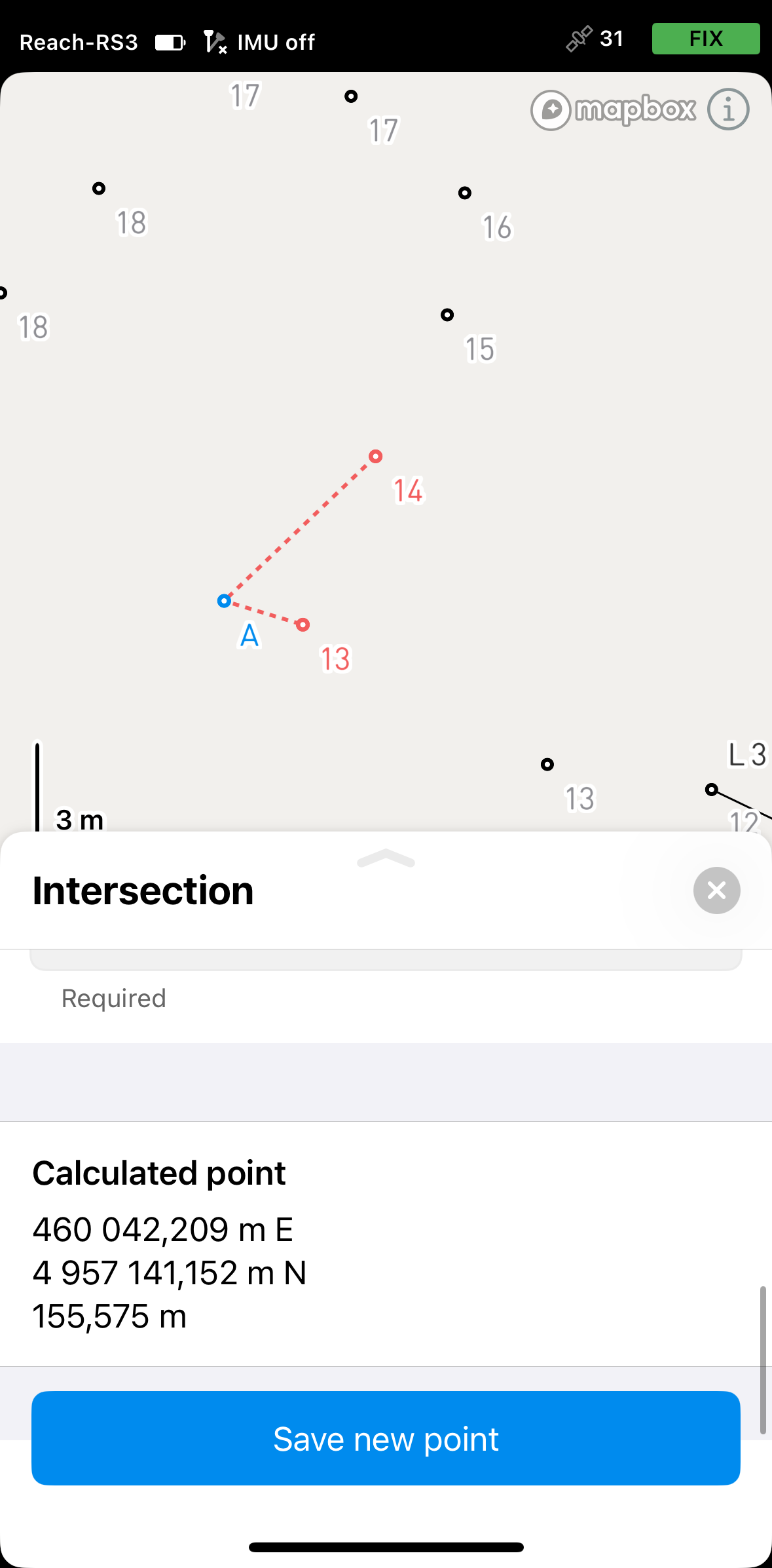
Specify the direction. A second red line will appear on the map, aligned with the entered azimuth. The intersection of the two directional lines, each originating from a known reference point, will define a new point. The app will display its coordinates. Save the point.
-
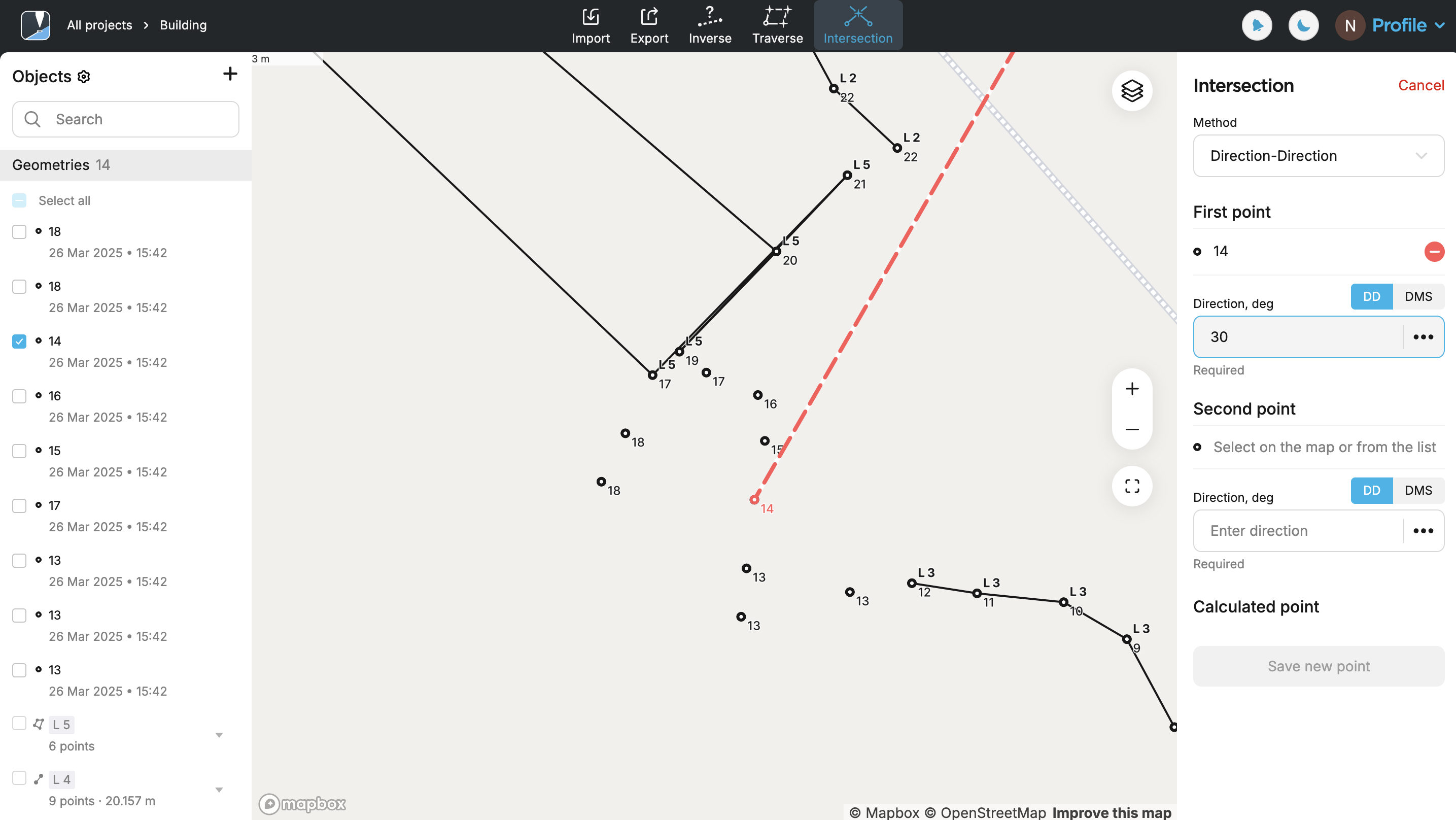
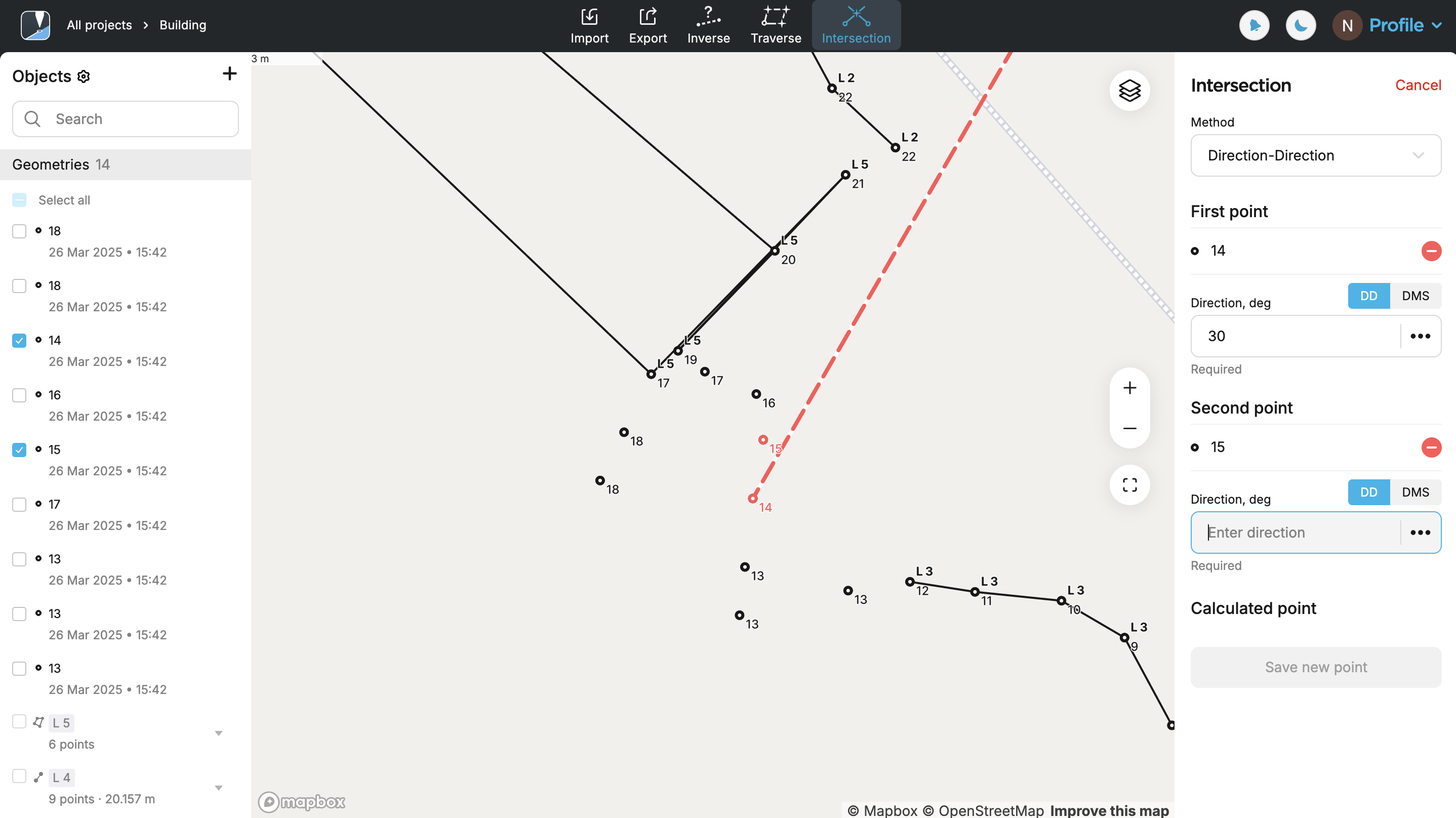
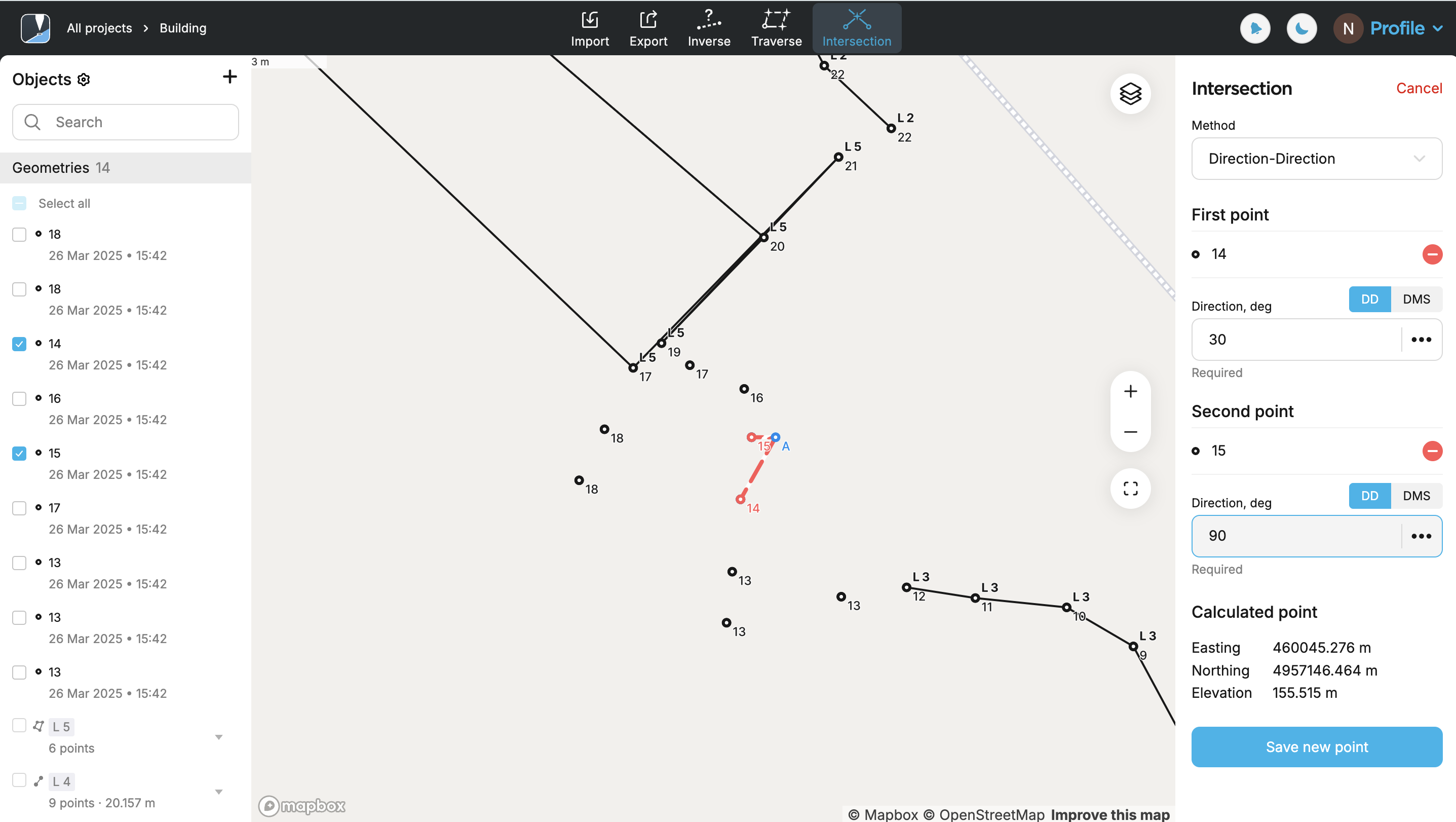
Select the direction format. You can choose between decimal degrees (DD) and degrees–minutes–seconds (DMS).
-
Select the first point on the map or from the list. It will be displayed in red.

-
Specify the direction. A red line will appear on the map, aligned with the specified azimuth.
-
Select the second point on the map or from the list. It will be displayed in red.
-
Specify the direction. A second red line will appear on the map, aligned with the entered azimuth. The intersection of the two directional lines, each originating from a known reference point, will define a new point. The app will display its coordinates. Save the point.
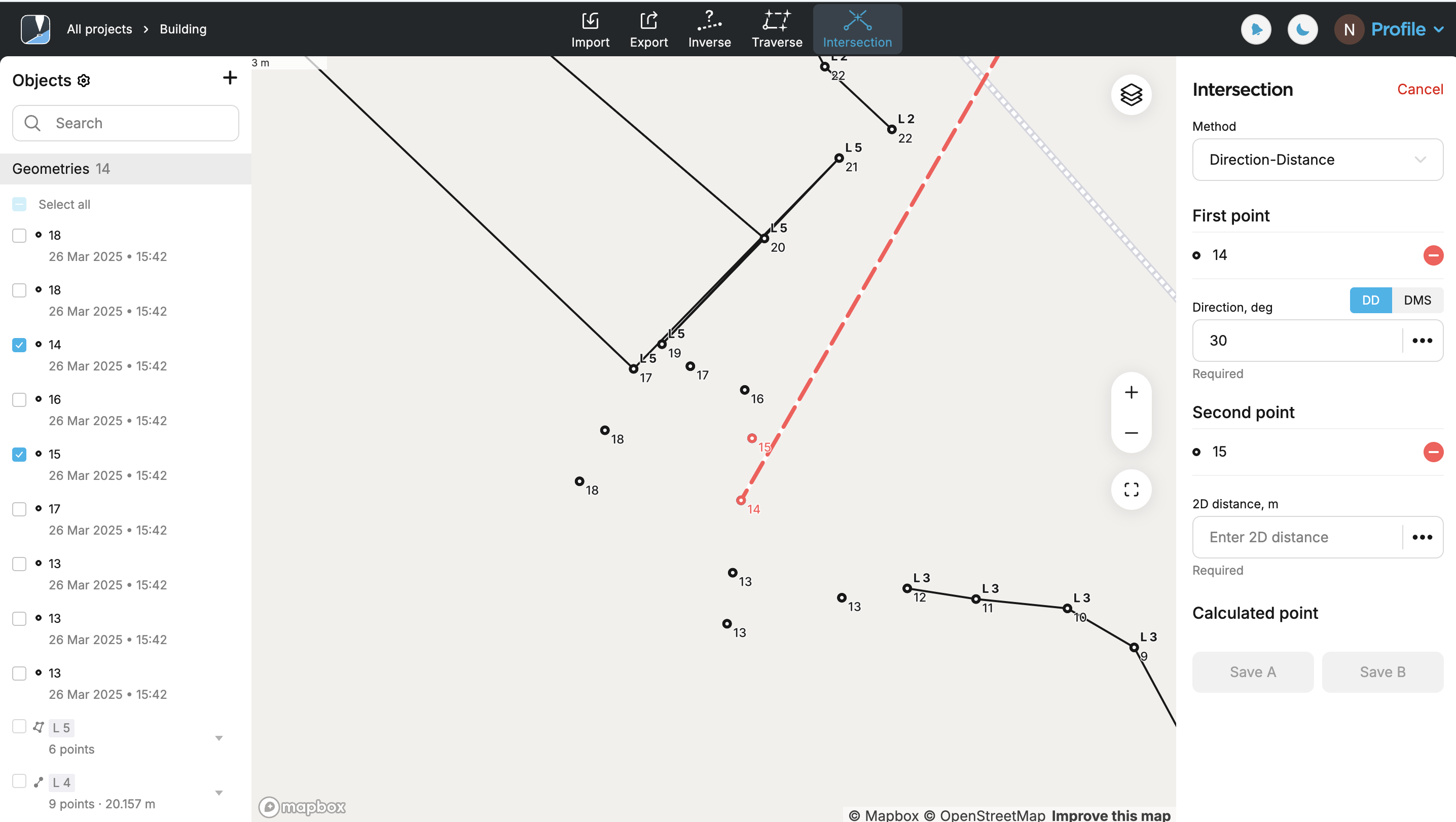
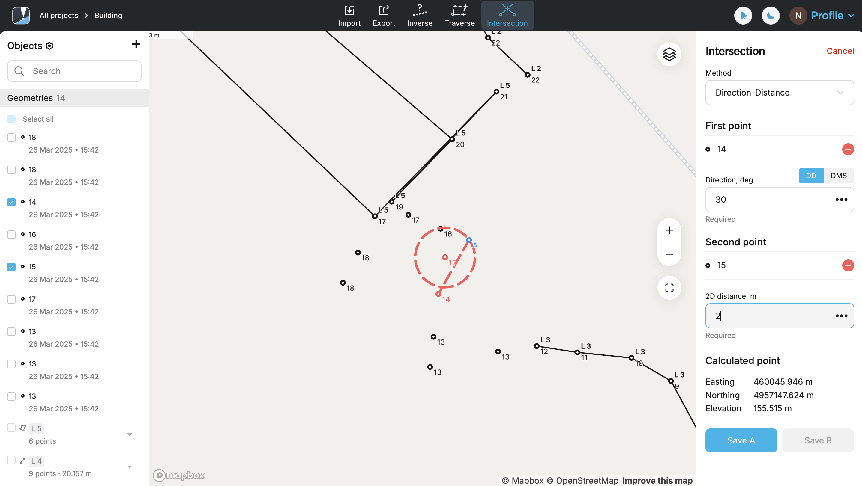
Applying Distance-Direction method
Use the Distance-Direction method method to calculate a new point based on a known distance from one reference point and a direction (azimuth) from another. The app draws a circle centered on the distance point and a ray from the direction point. Their intersection results in one or two possible locations—select the required one.
There are specific cases based on the entered distance and direction values where no intersection can be calculated:
- If the ray and the circle do not intersect, e.g., the ray is directed away from the circle.
Follow the steps below:
- Emlid Flow
- Emlid Flow 360
-
Select the direction format. You can choose between decimal degrees (DD) and degrees–minutes–seconds (DMS).
-
Select the first point on the map or from the list. It will be displayed in red.
-
Specify the direction. A red line will appear on the map, aligned with the specified azimuth.
-
Select the second point on the map or from the list. It will be displayed in red.
-
Specify the distance. The app will display a circle centered on the distance point, with a radius equal to the entered value, along with a ray extending from the direction point. The intersection of these two elements produces two possible locations—select the required one. Tap Save.
Now you can continue working with the Intersection tool or switch to the other tool.
-
Select the direction format. You can choose between decimal degrees (DD) and degrees–minutes–seconds (DMS).
-
Select the first point on the map or from the list. It will be displayed in red.
-
Specify the direction. A red line will appear on the map, aligned with the specified azimuth.
-
Select the second point on the map or from the list. It will be displayed in red.
-
Specify the distance. The app will display a circle centered on the distance point, with a radius equal to the entered value, along with a ray extending from the direction point. The intersection of these two elements produces two possible locations—select the required one. Click Save.
Now you can continue working with the Intersection tool or switch to the other tool.