Calcular inverso
Mejora tu experiencia topográfica con herramientas de codificación, trazado de líneas, mapas de fondo, localización, inversión y travesía.
Esta guía explica cómo utilizar la herramienta Inverso de Emlid Flow y Emlid Flow 360 para calcular datos geométricos de coordenadas como el área, la distancia, el acimut, etc. para puntos conocidos.
Resumen
La herramienta Inverso de Emlid Flow y Emlid Flow 360 permite calcular los datos geométricos de los puntos existentes. La herramienta puede ayudarle en proyectos como la planificación de obras de ingeniería civil o de servicios públicos, y el seguimiento del progreso de la construcción.
El software calcula los siguientes valores en función del número de puntos de entrada:
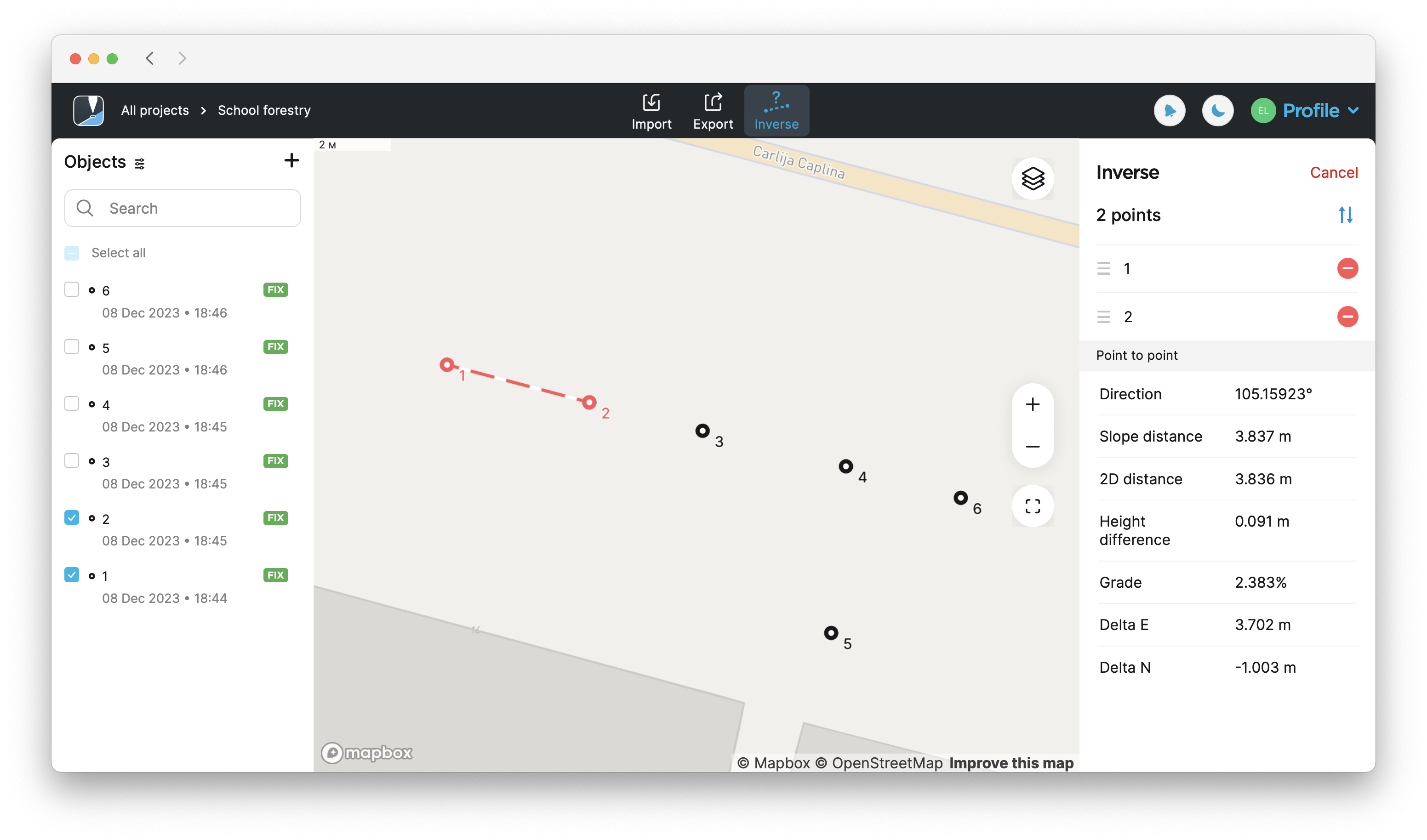
Cuando seleccione dos puntos o más:
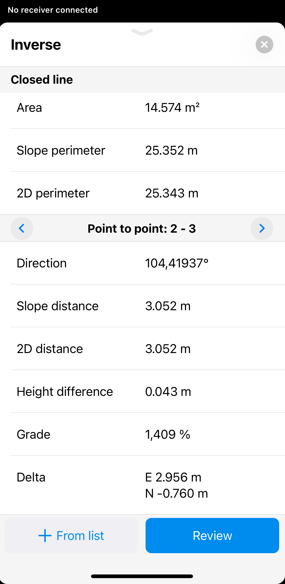
- Dirección (Acimut norte real, Acimut de la cuadrícula norte)
- Distancia de la pendiente (Distancia al suelo de la pendiente, Distancia de cuadrícula de la pendiente)
- Distancia 2D (Distancia al suelo 2D, Distancia a la cuadrícula 2D)
- Diferencia de altura
- Grado
- Delta East (for points in a local CS only)
- Delta norte (solo para puntos en un SC local)
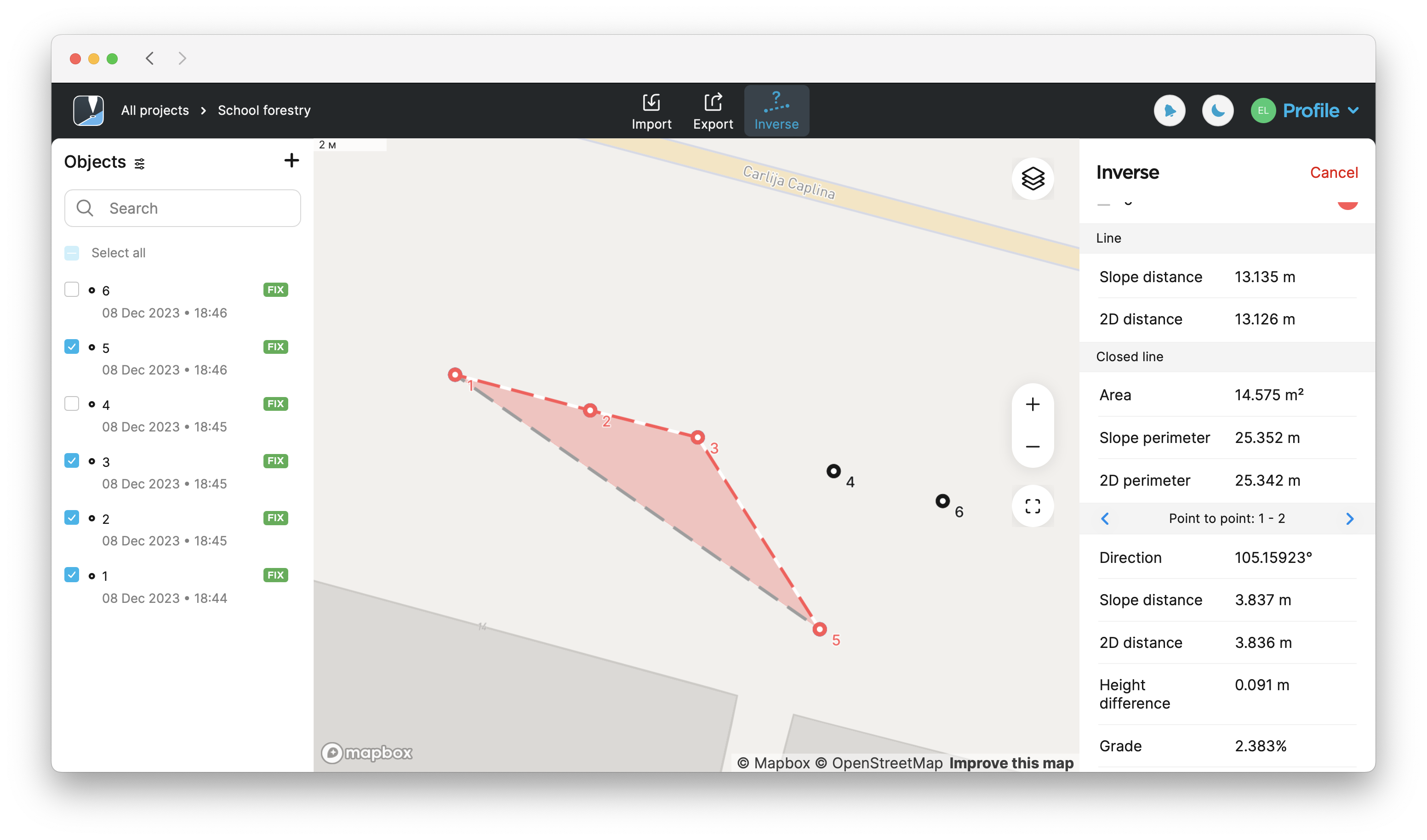
Cuando seleccione tres puntos o más:
- Distancia de la pendiente (Distancia al suelo de la pendiente, Distancia de cuadrícula de la pendiente)
- Distancia 2D (Distancia al suelo 2D, Distancia a la cuadrícula 2D)
- Área
- Perímetro de pendiente
- Perímetro 2D
Según el sistema de coordenadas (SC) de tu proyecto, se utilizan diferentes tipos de distancia y acimut en los cálculos:
| Tipo de SC | Tipo de distancia | Tipo de acimut |
|---|---|---|
| SC global | Distancia al suelo | Acimut norte verdadero |
| SC local | Distancia de cuadrícula | Acimut de la cuadrícula norte |
Consulte nuestra guía Introducción a los sistemas de coordenadas para obtener más información sobre los tipos de distancia y acimut en diferentes CS.
Cuando se calcula el área en un sistema de coordenadas local, el software aplica una variación de la fórmula de Shoelace, que realiza una aproximación del área utilizando trapezoides:

El área en un sistema de coordenadas global se puede calcular para el elipsoide (en la superficie del elipsoide) o el suelo (en la elevación media del suelo). Utilizamos el método descrito en la sección 6 de Algoritmos para geodésicos de C. F. F. Karney (2013).
Flujo de trabajo
- Emlid Flow
- Emlid Flow 360
Para aplicar la herramienta de inversión en la aplicación Emlid Flow, siga estos pasos:
-
Abra el proyecto en Emlid Flow.
-
Pulsa el botón Herramientas situado en la esquina inferior izquierda de la pantalla.
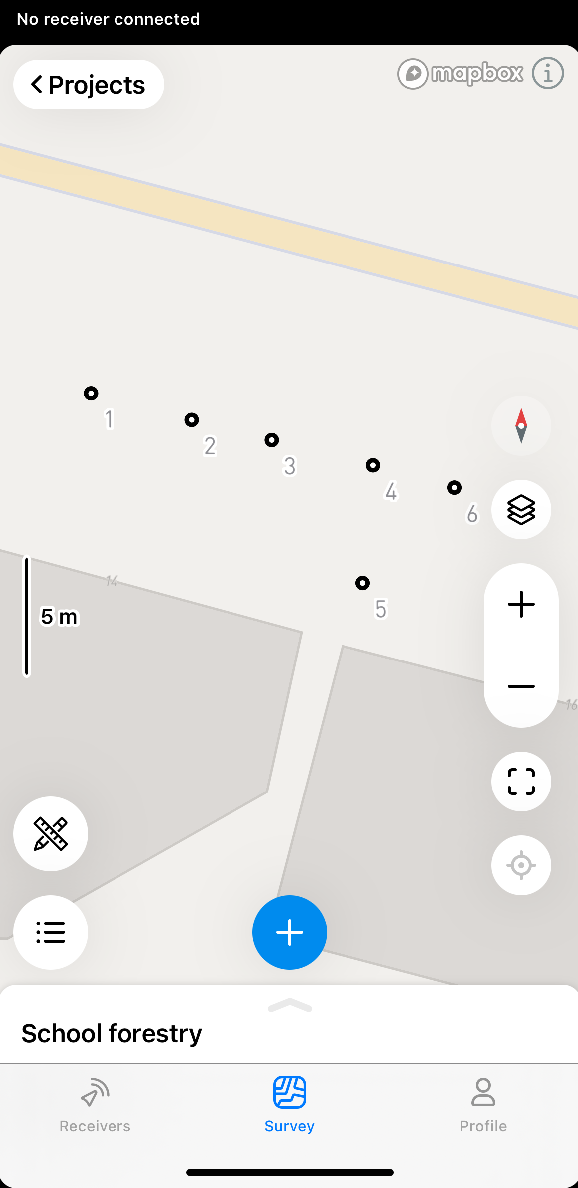
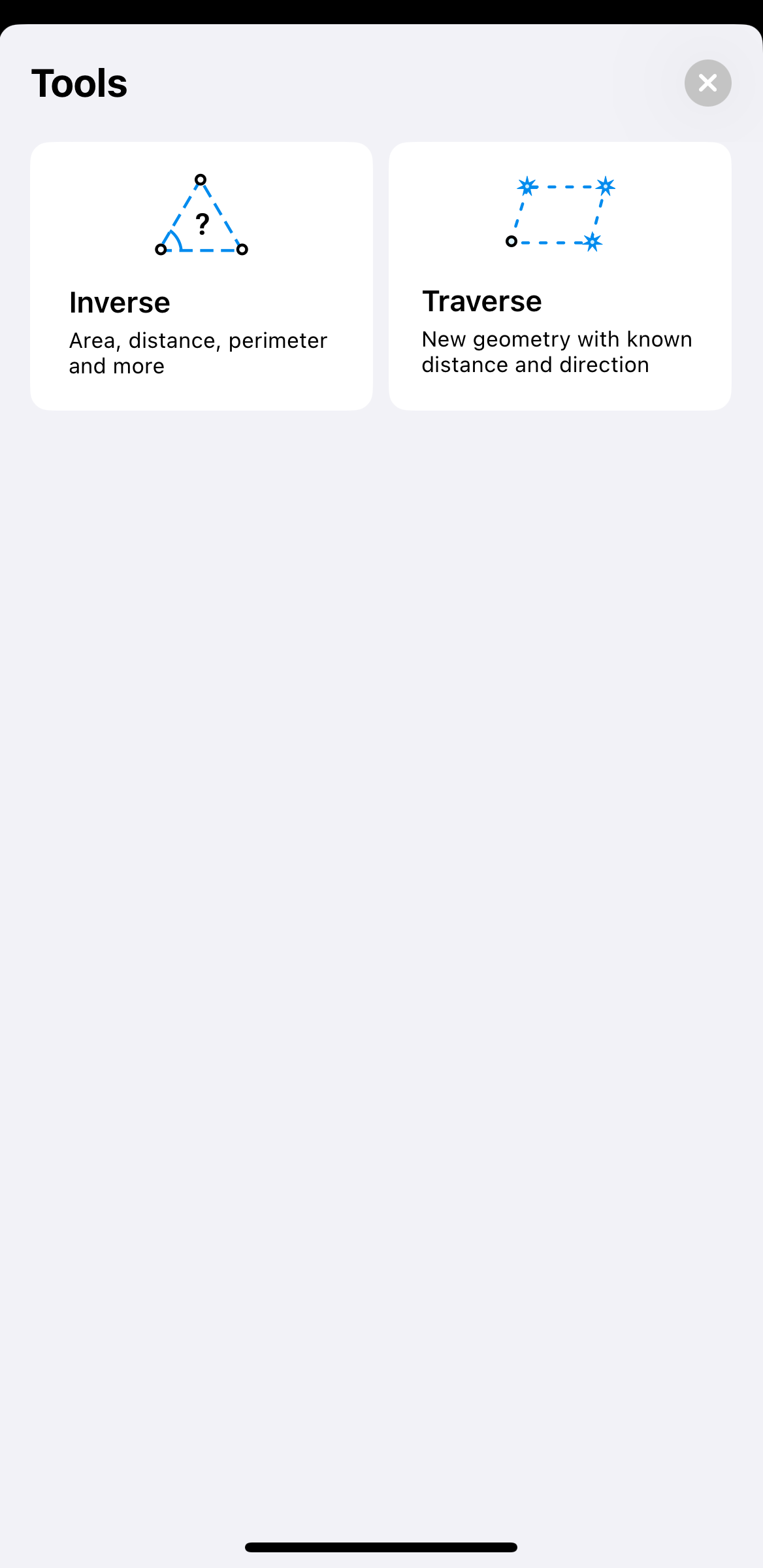
- Pulsa Inverse (Inverso).
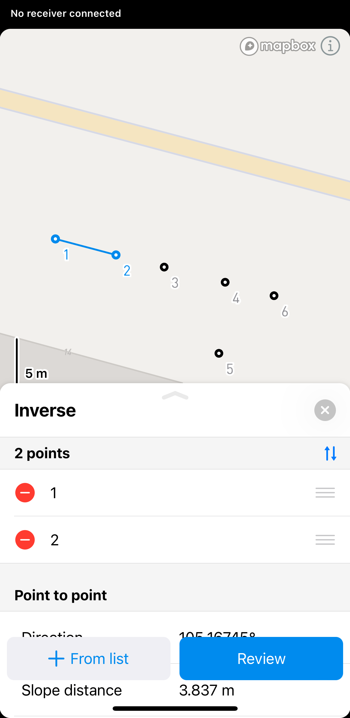
- Seleccione en el mapa o en la lista de objetos los puntos para los que desea calcular la inversa.
En Emlid Flow y Emlid Flow 360 también puede encontrar la información de punto a punto, línea y línea cerrada de cada línea. Para ver esta información, pulse sobre la línea.
-
Haz clic en Review (Revisar) para ver los resultados calculados. Para calcular los resultados de más de dos puntos, utilice los botones de flecha para cambiar a otro conjunto de dos puntos.
noteLos resultados mostrados serán diferentes en función de los puntos seleccionados. Si selecciona 2 puntos, verá los cálculos punto a punto. Si selecciona 3 puntos, también verá los cálculos sobre el área, el perímetro de la pendiente, etc.
Solo puede utilizar Línea y Línea cerrada para mediciones geométricas. No es posible importarlas ni exportarlas como figuras geométricas.
Puede cambiar el orden de los puntos en la sección Inverso arrastrándolos y soltándolos. Para eliminar un punto, pulse el botón Eliminar.
- Para salir del modo de cálculo de inversión, pulsa el botón de cierre situado en la esquina superior derecha.
Para aplicar la herramienta Inverso en la aplicación Emlid Flow 360, siga estos pasos:
-
Abra el proyecto en Emlid Flow 360.
-
Pulse Inverso en la parte superior de la pantalla para calcular los resultados.
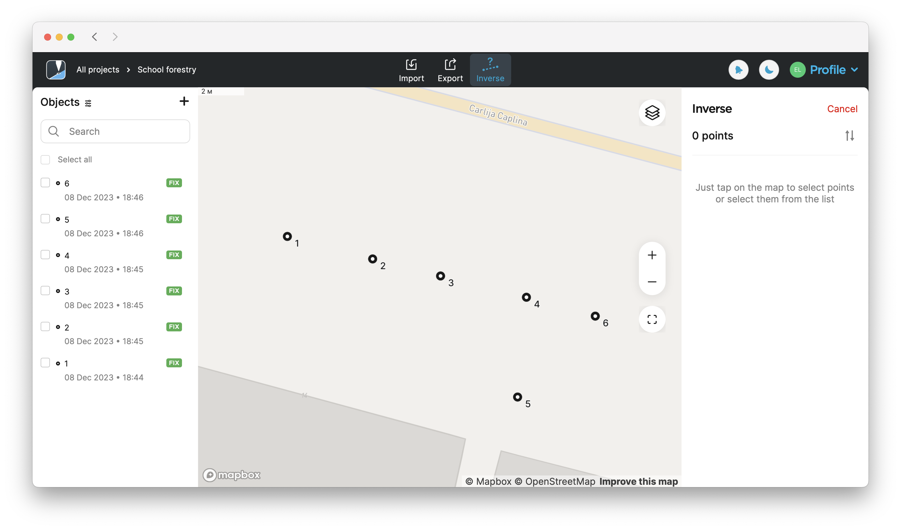
- Seleccione en el mapa o en la lista de objetos los puntos para los que desea calcular la inversa.
En Emlid Flow y Emlid Flow 360 también puede encontrar la información de punto a punto, línea y línea cerrada de cada línea. Para ver esta información, pulse sobre la línea.
-
Encuentre los resultados calculados en la parte derecha de la pantalla. Para calcular los resultados de más de dos puntos, utilice los botones de flecha para cambiar a otro conjunto de dos puntos.
noteLos resultados mostrados serán diferentes en función de los puntos seleccionados. Si selecciona 2 puntos, verá los cálculos punto a punto. Si seleccionas tres puntos, también verás los cálculos sobre el área, el perímetro de la pendiente, etc.
noteSolo puede utilizar Línea y Línea cerrada para mediciones geométricas. No es posible importarlas ni exportarlas como figuras geométricas.
Puede cambiar el orden de los puntos en la sección Inverso arrastrándolos y soltándolos. Para eliminar un punto, pulse el botón Eliminar.
- Para salir del modo de cálculo Inverso, pulse Cancel (Cancelar) en la esquina superior derecha.
Videoguía
Echa un vistazo al flujo de trabajo en el siguiente vídeo: