How PPP works
With the Precise Point Positioning (PPP) technique, you may accurately determine the coordinates of a static point anywhere in the world without real-time corrections or a base station nearby.
Overview
A standalone receiver finds out its position relying on the data obtained from satellites only. Along with raw data, it gets navigation messages with satellite clock offset, the ionospheric and tropospheric corrections, etc. Using the information about these offsets, the receiver may calculate its position with a several-meter level accuracy. If there were no navigation data, the accuracy would be much worse.
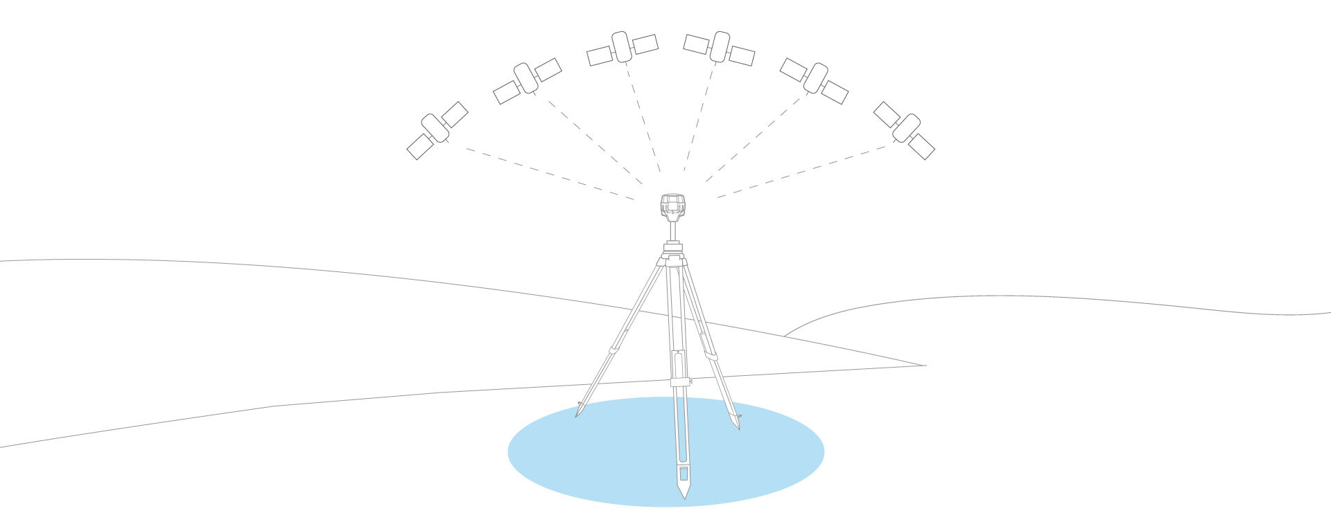
In RTK and PPK, these offsets might be eliminated since both the base and the rover operate in quite similar conditions. Compared with these two methods, PPP allows the single receiver to achieve a high-level accuracy without the use of corrections from the base station. To calculate the coordinates, PPP uses the same data that is provided by the navigation message generated from a network of global reference stations. Thereby, the single receiver might determine its position with a centimeter-level accuracy using only its own raw data, precise ephemerides, and clock offsets provided by a PPP service.
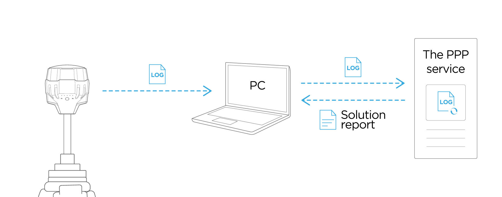
With the PPP technique, it is possible to determine the base position with absolute accuracy for further RTK and PPK surveys anywhere around the world. The PPP technique doesn't require an additional receiver and the presence of an internet connection during the survey. As to the requirements, most of the PPP services are capable of working with GPS and GLONASS satellites only.
| Feature | PPP | PPK | RTK |
|---|---|---|---|
| Real-time corrections required | No | No | Yes |
| Base station required | No | Yes | Yes |
| Internet during surveying required | No | Yes | Yes, but not necessary when radio is used |
| Logging required | Yes | Yes | No, but can be used as backup data |
| Possible accuracy | Cm | Cm | Cm |
| Corrections | Offsite | Offsite | Onsite |
| Baseline | No | Up to 100 km | Up to 60 km |
PPP services overview
There are several PPP services available:
- Brazilian IBGE-PPP service, mainly used in South America region, is capable of working with both single-band and multi-band Reach receivers.
- Canadian NRCan CSRS-PPP service can process both single-frequency and multi-frequency logs.