IBGE-PPP—Online service for post-processing GNSS data
This guide explains how to get the precise coordinates of a standalone receiver using the IBGE-PPP service.
Overview
IBGE-PPP is a free online GNSS data processing service provided by Instituto Brasileiro de Geografia e Estatística (Brazilian Institute of Geography and Statistics). The service is based on the CSRS-PPP software provided by NRCan. It uses single or dual-frequency GPS and GLONASS data for solution computation and supports both Static and Kinematic modes.
Static computation is accomplished with a receiver sitting on one point. As the result of Static mode, you will get the absolutely determined position of this point.
Kinematic mode allows surveying with a moving receiver and provides a path as the solution.
Depending on the accuracy level and time that is required to get the solution, the IBGE-PPP service can calculate the solution using 3 types of orbits: Ultra-Rapid, Rapid and Final. These orbits’ parameters vary depending on the territory of the survey.
If you conduct a survey on the territory of Brazil, IBGE-PPP will use the following orbits in the solution computation:
| Orbit type | When the orbit is ready for use | Accuracy |
|---|---|---|
| ULTRA-RAPID | 1.5-2.5 hours after the end of the survey | ~15 cm |
| RAPID | 12-36 hours after the end of the survey | ~5 cm |
| FINAL | 11-17 days after the end of the survey | ~2 cm |
If you conduct a survey outside of Brazil, IBGE-PPP will use the following orbits in the solution computation:
Outside of Brazil, IBGE-PPP uses only GPS satellites in solution computation.
| Orbit type | When the orbit is ready for use | Accuracy |
|---|---|---|
| RAPID | 17-41 hours after the end of the survey | ~2.5 cm |
| FINAL | 12-20 days after the end of the survey | ~2.5 cm |
You can learn more about the IBGE-PPP service on their official site.
Workflow
This guide will show you how to process raw data recorded in the Static mode.
Placing the base
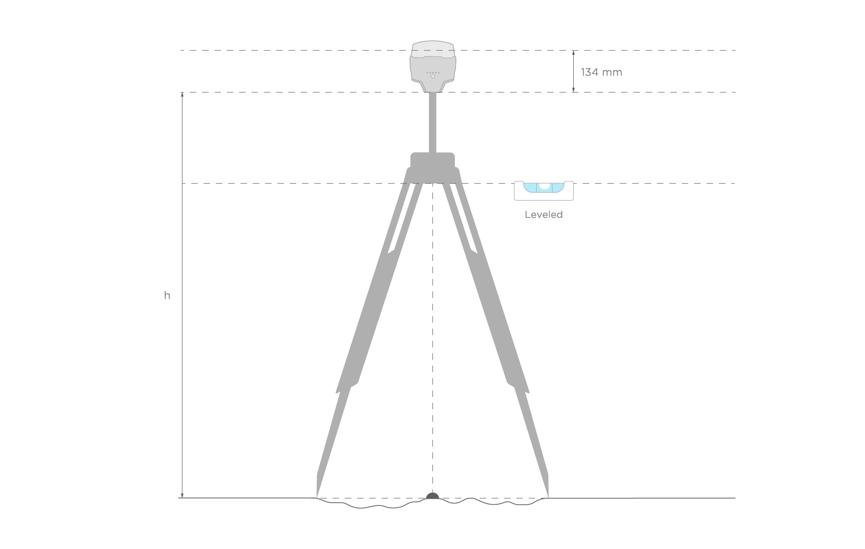
Place your Reach precisely above the marked point on the tripod and level it. You can learn more about placing Reach in the Placing the base tutorial.
Recording RINEX logs on Reach
To record logs for IBGE-PPP, perform the following steps:
-
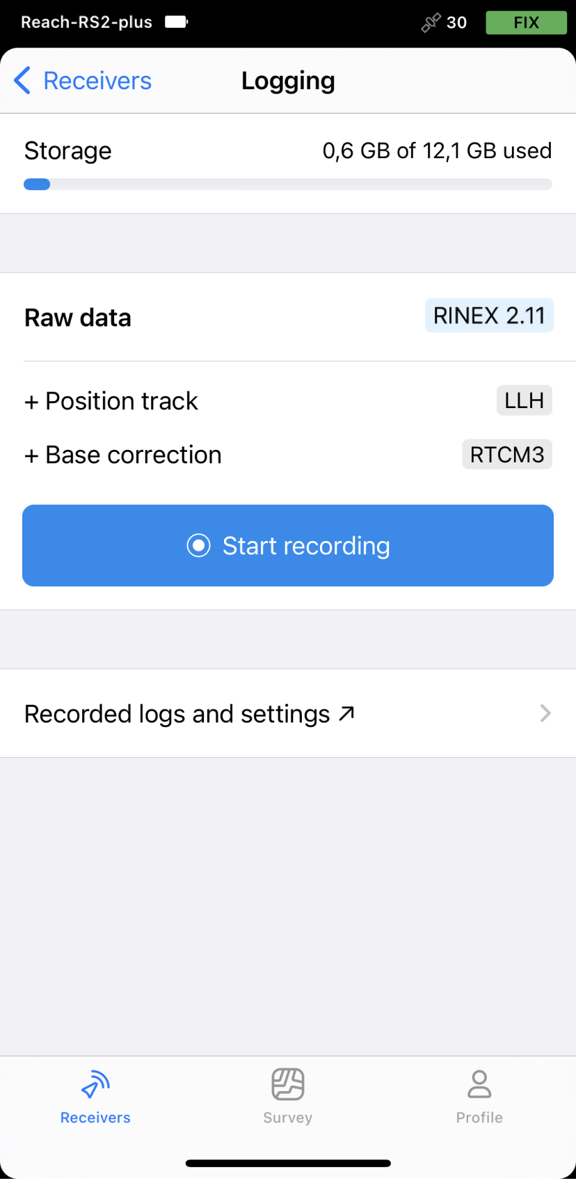
Open Emlid Flow and connect to your Reach.
-
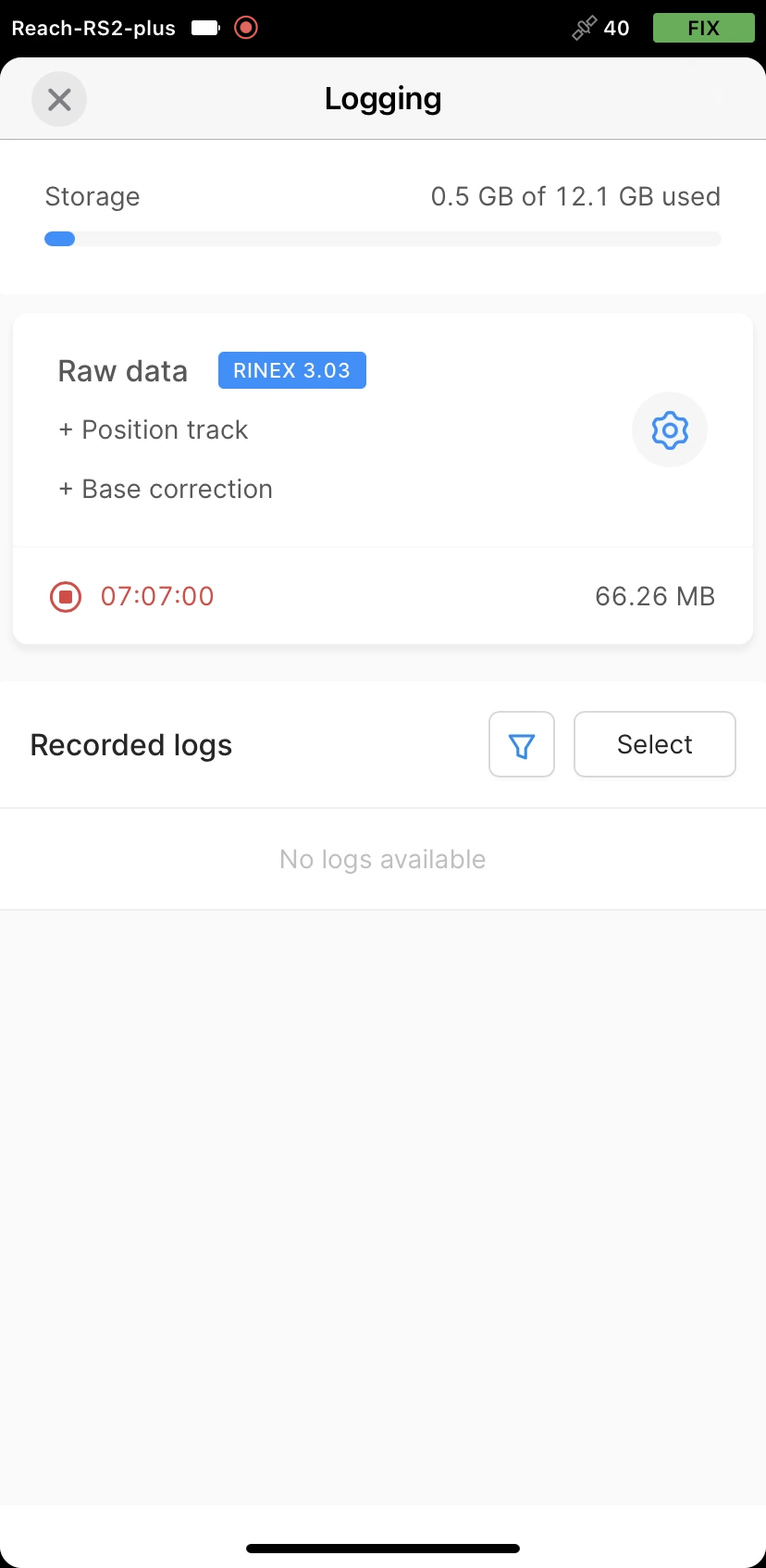
Go to the Logging screen.
-
Tap the Recorded logs and settings button.
-
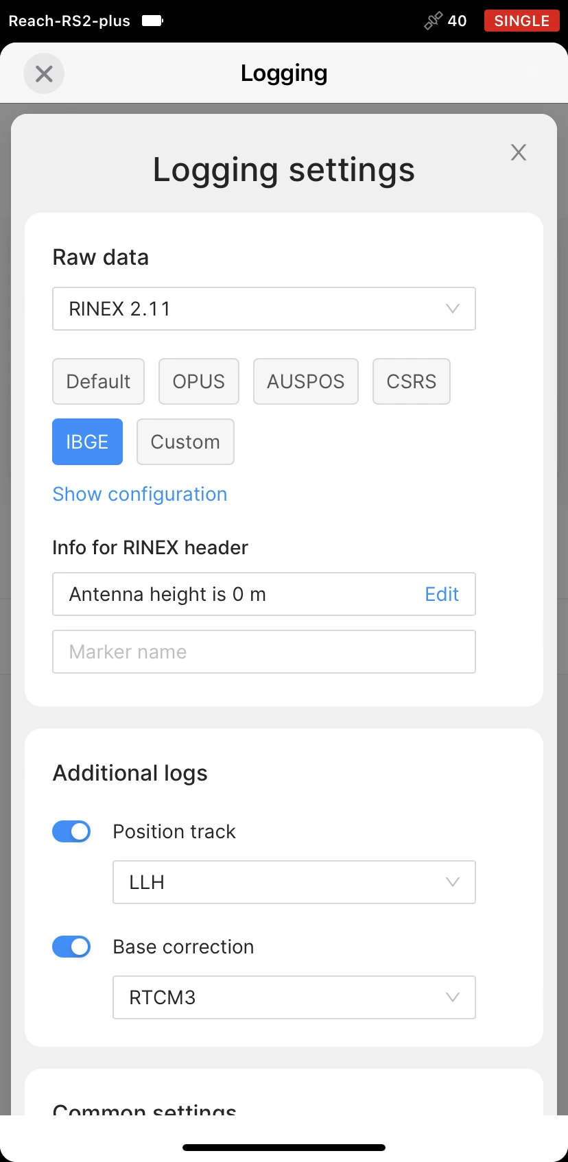
To configure logging, tap the Settings button.
-
Select the IBGE preset.
-
Choose the required RINEX format in the Raw data section.
IBGE-PPP accepts files in the RINEX format only of version 2.11 or older.
While recording in the RINEX format, you can log the UBX file as a backup. UBX file can be used to adjust RINEX file settings in the Converter tool in Emlid Studio. You can enable logging in the UBX format in the logging settings in Emlid Flow.
-
Tap Show configuration and enter the measured height to the bottom of the receiver in the corresponding field.
-
Fill in the point's name in the Marker name field.
-
Tap Apply.
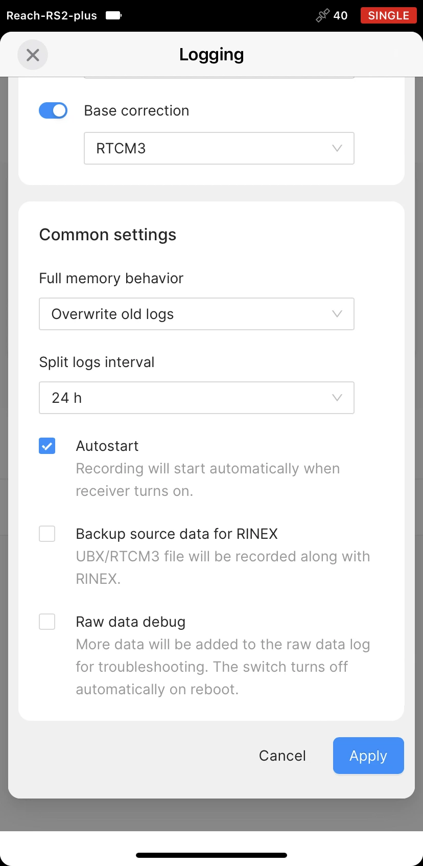
You can start recording automatically when your receiver is turned on. Check the corresponding field on the Raw data settings screen.
- Enable log recording by tapping the Start recording button. The red recording icon will appear in the status bar.
For IBGE-PPP, there is no minimum required time for an observation session. However, we recommend recording data not less than 4 hours to get the best accuracy.
- To finish recording logs, tap the End recording button.
Wait for data processing to finish.
You may log the data for up to 24 hours, depending on the accuracy required.
Once you finish the survey, don't forget to turn off raw data recording in the logging settings.
Downloading logs
After you finish raw data logging, you need to download RINEX data from Reach to your mobile device.
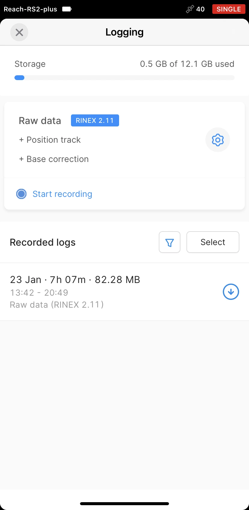
- Go to the Recorded logs section at the bottom of the Logging screen.
You can also find information on the logs size and recording date and time here.
-
To export the file, tap the Download button.
-
Save your log depending on the device you use.
If you do not need your logs anymore, you can delete them using the Edit button.
Submitting data to IBGE service
Once the logs are downloaded, export them to your PC in a preferred way and submit the data to NRCan CSRS-PPP for processing.
-
Go to IBGE-PPP submission page.
-
In Selecione o Modo de Processamento (Select Processing Mode), choose Estático (Static).
-
In the Selecione um arquivo RINEX (Select a RINEX file) field, click the Choose file button and browse for the observation file (.**O).
-
Choose EML_REACH_RS2 NONE in the Tipo de Antena (Antenna Type) dropdown menu.
For Reach RS2+, choose EML_REACH_RS2+ NONE.
-
Enter the pole height in the Altura da antena (Antenna height) field and apply changes by checking the A altura da antena somente será alterada se esta caixa estiver marcada (The antenna height will only change if this box is checked) checkbox.
-
In the E-mail válido do usuário (User’s valid email) field, enter your email address to get the results.
-
Click the Processar (Process) button. IBGE-PPP will process your file.
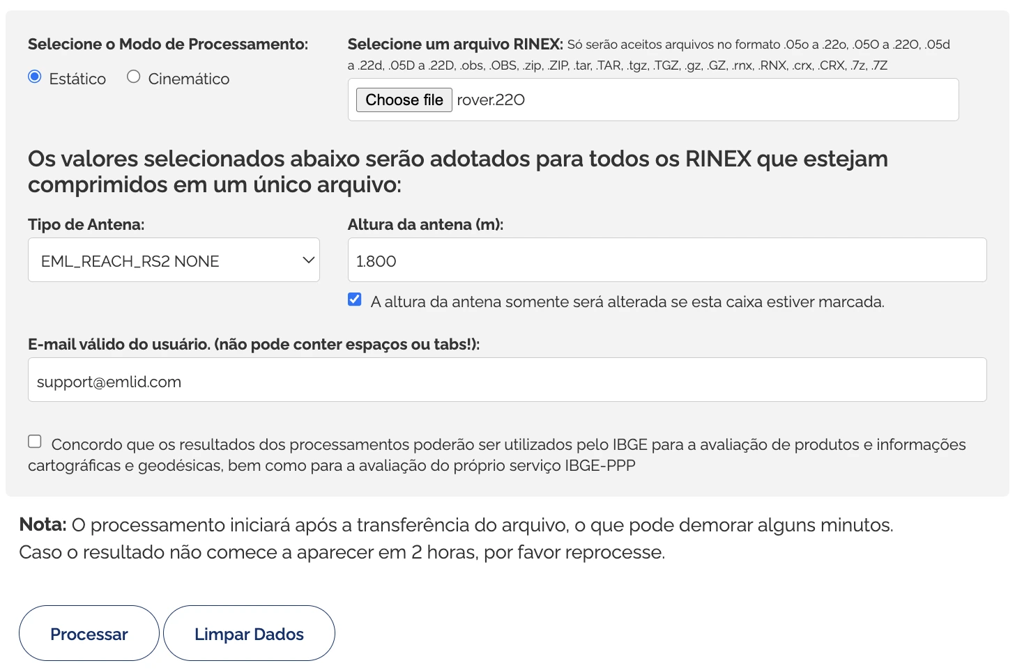
- To download the results, click the Download dos resultados (Download the results) button in the Resultado do processamento (Result of processing) section. IBGE-PPP will also send the file with the solution to your email address.
After you get the solution file, you can continue working with the coordinates of a point you observed.
Setting up obtained base coordinates in Emlid Flow
If you want to use the obtained coordinates as a base position, you can enter the base coordinates in Emlid Flow.
-
Open Emlid Flow and connect to the Reach you want to use as a base.
-
On the Receivers screen, tap Base settings.
-
Tap the Configure button.
-
Set the Coordinates entry method to Manual.
-
Enter the coordinates and specify the antenna height.
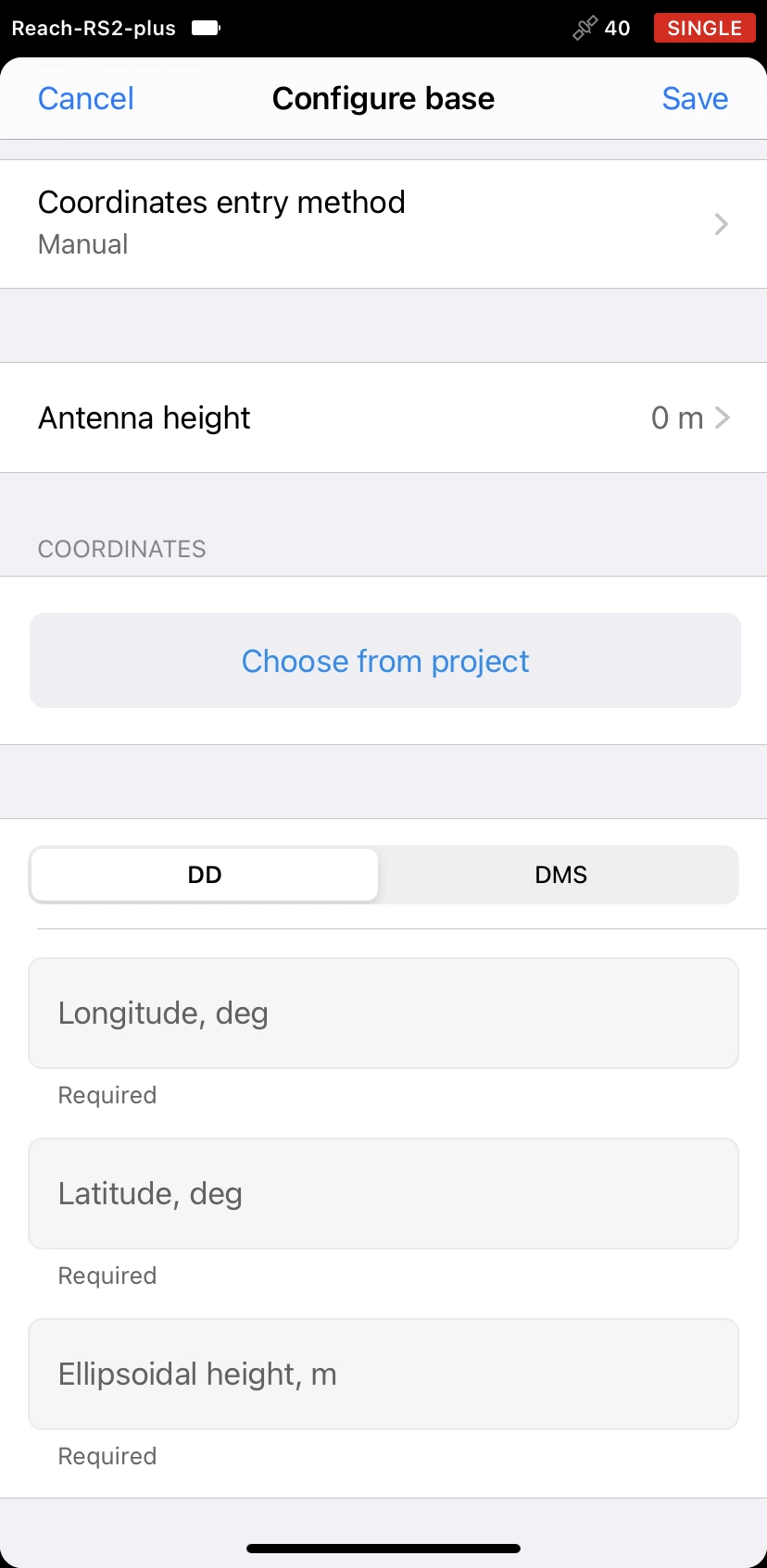
- Tap Save.
After setting up the base position, you can continue working in RTK or PPK.