Switching map types
Upgrade your surveying experience with coding, linework, background maps, and localization
This guide explains how to switch the map type between vector and satellite using Emlid Flow or Emlid Flow 360 for a better context of the survey site while working with the project.
Overview
In Emlid Flow and Emlid Flow 360, there are 2 map types: vector and satellite. A vector map is a schematic representation of the surveying site. A satellite map is a set of satellite photos tied to real-world objects.
Switching map types
To switch between map types, follow the steps below:
- Emlid Flow
- Emlid Flow 360
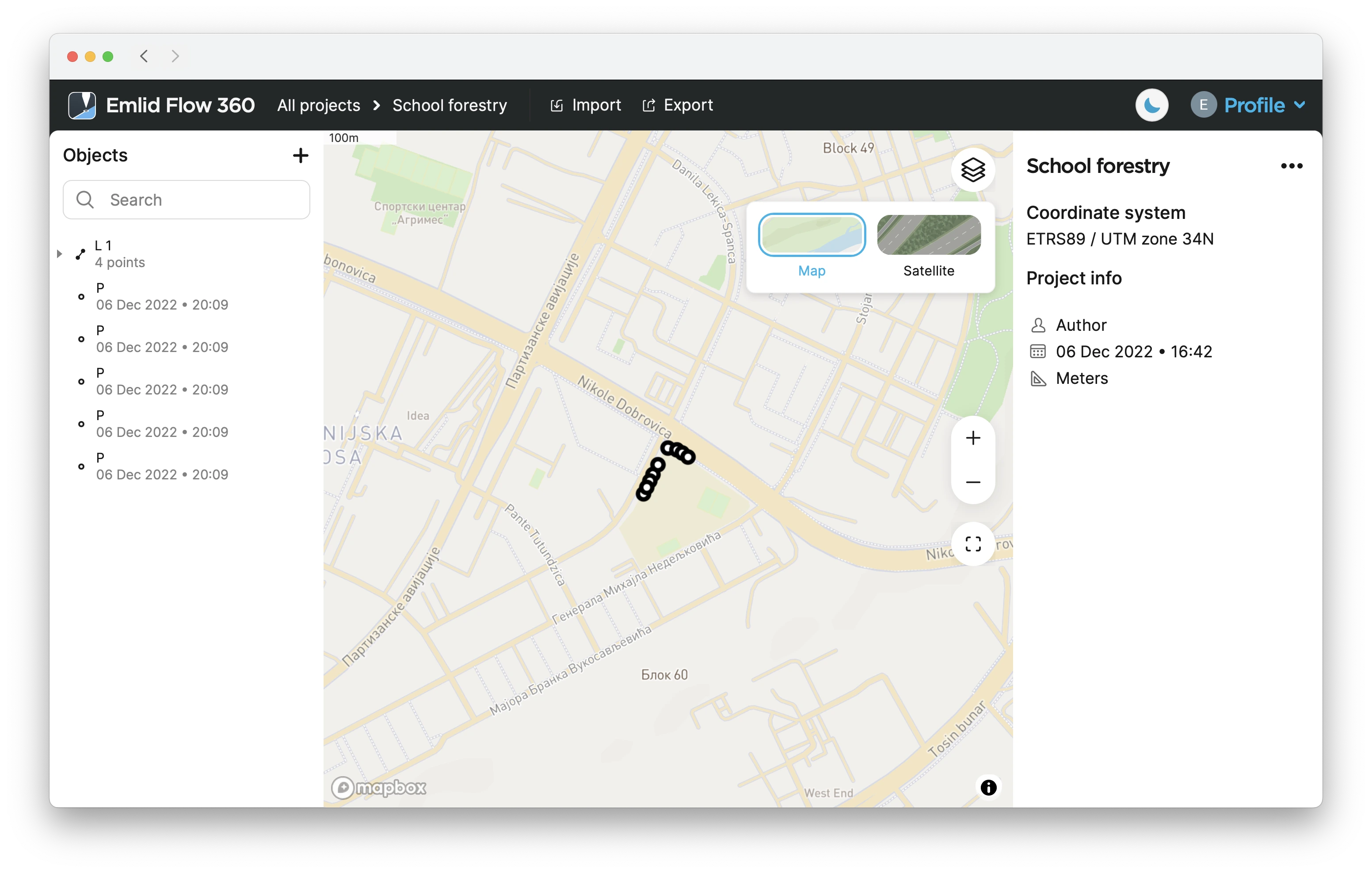
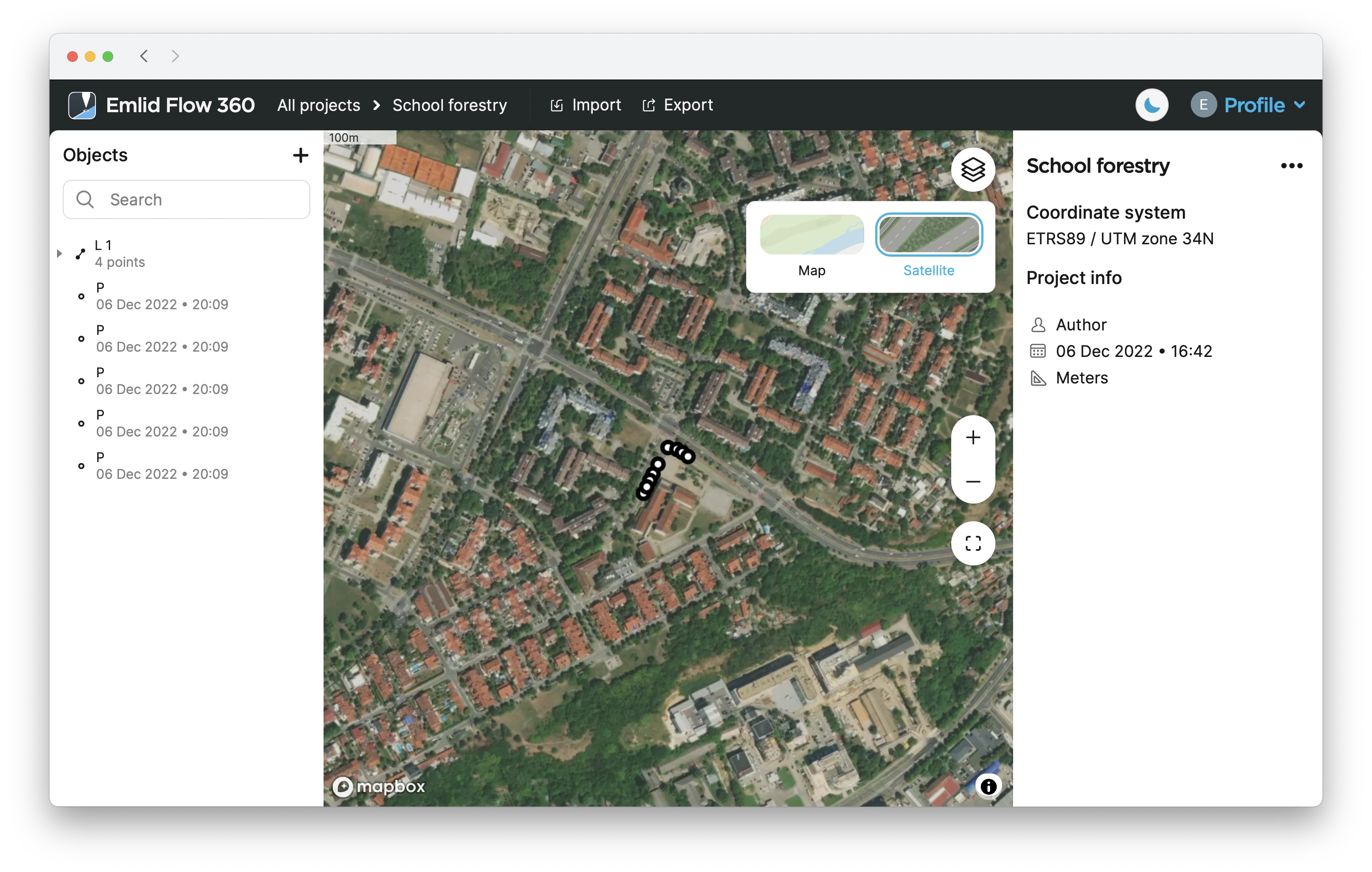
On the Project view screen, tap the Map type button in the top right corner. The map type will change to Satellite.
To change the map type to vector, tap on the Map type button once more.
-
On the Project view screen, click the Layers button. You will see the Map type menu.
-
Select the preferred map type.
Now you can continue to collect or stake out data.